
The Highway 50 landslide monitoring system uses data acquisition systems and radio telemetry developed by the USGS Volcano Hazards Program to operate in remote, hazardous sites with limited power. In many landslides, infiltration of rainfall or rapid snowmelt increases groundwater pressures. These elevated pressures can, in turn, trigger landslide movement.
Real-time Data
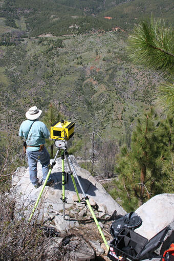
The U.S. Geological Survey, in cooperation with the Eldorado National Forest, has installed monitoring instruments on the Cleveland Corral landslide that has the potential to affect Highway 50. Data from these instruments are used to detect changes in local conditions including
Sensors are sampled every second and data are transmitted from the landslide to a USGS computer every 5 minutes.
Project Background
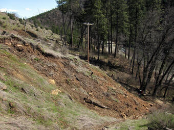
During January 1997, several large landslides closed Highway 50 between Placerville and South Lake Tahoe, California. The photograph below shows the catastrophic Mill Creek landslide that closed Highway 50 for 4 weeks. A number of other landslides are episodically active in this corridor during wet years.
The Highway 50 landslide monitoring system uses data acquisition systems and radio telemetry developed by the USGS Volcano Hazards Program to operate in remote, hazardous sites with limited power. In many landslides, infiltration of rainfall or rapid snowmelt increases groundwater pressures. These elevated pressures can, in turn, trigger landslide movement.
Below are other science projects associated with this project.

U.S. Highway 50, California - Current Landslide Status

U.S. Highway 50, California - Yearly Information

U.S. Highway 50, California - Report
The Highway 50 landslide monitoring system uses data acquisition systems and radio telemetry developed by the USGS Volcano Hazards Program to operate in remote, hazardous sites with limited power. In many landslides, infiltration of rainfall or rapid snowmelt increases groundwater pressures. These elevated pressures can, in turn, trigger landslide movement.
Real-time Data
The U.S. Geological Survey, in cooperation with the Eldorado National Forest, has installed monitoring instruments on the Cleveland Corral landslide that has the potential to affect Highway 50. Data from these instruments are used to detect changes in local conditions including
Sensors are sampled every second and data are transmitted from the landslide to a USGS computer every 5 minutes.
Project Background
During January 1997, several large landslides closed Highway 50 between Placerville and South Lake Tahoe, California. The photograph below shows the catastrophic Mill Creek landslide that closed Highway 50 for 4 weeks. A number of other landslides are episodically active in this corridor during wet years.
The Highway 50 landslide monitoring system uses data acquisition systems and radio telemetry developed by the USGS Volcano Hazards Program to operate in remote, hazardous sites with limited power. In many landslides, infiltration of rainfall or rapid snowmelt increases groundwater pressures. These elevated pressures can, in turn, trigger landslide movement.
Below are other science projects associated with this project.