
ShakeOut 2022: Earthquake Awareness Enables Community Preparedness
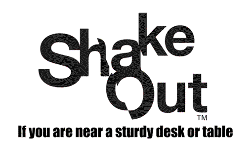
Get ready to shake it like it’s real! ShakeOut 2022: Drop (or Lock), Cover, and Hold On!
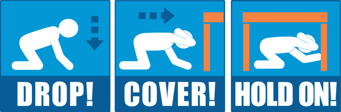
Drop, Cover, and Hold On!
Nearly half of Americans are exposed to potentially damaging earthquakes where they work and live. Still, others will be at risk when traveling. It’s a good idea for everyone, everywhere to know how to protect themselves during an earthquake.
Be prepared and join millions of people participating in Great ShakeOut Earthquake Drills worldwide on October 20th. During the drill, participants practice “Drop, Cover, and Hold On!” and other recommended safety actions to take during an earthquake. There are even resources for people with disabilities available at the Earthquake Country Alliance Accessibility site.

Shake It Like It’s Real
Mark your calendar and register to participate so that you know how to protect yourself, those you love, and your community. Families, schools, businesses, and organizations can all sign up and get involved. There are many ways to participate, and a variety of resources and tips are provided online. This includes pre-made flyers, drill broadcast recordings, drill manuals, and more.
What’s Your Exposure to Earthquake Shaking?
To learn about your exposure to ground shaking from an earthquake near you, check out the USGS National Seismic Hazard Maps. These maps reflect the best and most current understanding of where future earthquakes are likely occur, how often they tend to occur and how hard the ground will likely shake as a result.
What to Do During the Drill
Most people will synchronize their ShakeOut drills at 10:20 a.m. local time on October 20, but organizers can hold drills at other times or on other days, if necessary. If you are indoors, you should “Drop, Cover, and Hold On!” Drop where you are onto your hands and knees, then crawl for cover under a nearby sturdy desk or table and hold on to it securely.
If you are not near a desk or table, crawl against an interior wall, then protect your head and neck with your arms. Avoid exterior walls, windows, hanging objects, mirrors, tall furniture, large appliances, and kitchen cabinets filled with heavy objects or glass.
During the drill, look around, see what objects could fall during a potential earthquake, and ensure to secure or move those items after the drill. If you happen to be outdoors in a real earthquake, move to a clear and open area if you can do so.
Avoid power lines, trees, signs, buildings, vehicles, and items that can fall on you. If you are driving, pull over to the side of the road and set the parking brake. Do not shelter under bridges, overpasses, power lines, or traffic signs. Make sure to remain inside the vehicle until the shaking has stopped.


USGS Science in ShakeOut
The USGS develops earthquake scenarios that help shape preparedness exercises like the Great ShakeOut. USGS earthquake research helps emergency managers understand where earthquakes occur, as well as provides valuable information about potential damages and losses.
The original ShakeOut was based on a comprehensive analysis of a major earthquake in southern California known as “The ShakeOut Scenario.” That project, completed in 2008, was led by the USGS and many partners as a demonstration of how science can be applied to reduce risks related to natural hazards. The concept and organization of a public drill came out of the collaboration between the USGS, the Southern California Earthquake Center, and others including the Earthquake Country Alliance.
The success of the original 2008 ShakeOut drill in Southern California inspired other states and countries to want to participate. The third Thursday of October each year is now International ShakeOut Day, with more countries joining each year. ShakeOut’s growth is coordinated by the Southern California Earthquake Center (which also manages many ShakeOut websites globally) with the support of agencies and partners across the nation, including the USGS, the Federal Emergency Management Agency, the National Science Foundation, the Central U.S. Earthquake Consortium, and several others.
ShakeAlert® – Earthquake Early Warning
In 1989, one of the most destructive earthquake disasters in U.S. history – the Loma Prieta Earthquake – would lead to the development of new tools for earthquake preparedness. The magnitude 6.9 quake struck October 17 in the southern portion of the San Francisco Bay Area near Santa Cruz and was responsible for the deaths of 63 people and more than 3,500 injuries. That event also marks the beginning of many years of intense work developing and testing what would ultimately become the USGS-managed ShakeAlert Earthquake Early Warning System.
The backbone of the ShakeAlert System is based on a widespread network of seismometers. This robust seismic network has grown over the years as numerous regional seismic networks were established by several research institutions and universities, including the California Institute of Technology; University of California, Berkeley; University of Oregon; and University of Washington.
The ShakeAlert System uses cutting-edge technology to detect significant seismic motion and rapidly estimate the location, magnitude, and extent of ground shaking. USGS-licensed technical partners use this data to deliver ShakeAlert-powered alerts to people seconds before major shaking arrives.
After all, a few seconds of warning enable people to take protective action, especially if they have received advanced training.
ShakeAlert-powered alerts can be programmed into emergency systems, automatically triggering actions that can reduce response times, injury, and even death. For example, fire station doors can be programmed to open to prevent jamming, or heavy equipment can be set to automatically stop or park in safe positions. Additionally, other utilities, hospitals, transportation systems, and educational institutions continue to explore new applications for the ShakeAlert System.
Although it started in California, the ShakeAlert System has now expanded across the entire West Coast. By rolling out earthquake early warning in Washington and Oregon, ShakeAlert now serves over 50 million people.
Each year the effectiveness of earthquake early warning gets better as seismic networks grow and detection algorithms improve.
Want to set up your phone to receive ShakeAlert-powered alerts? Learn more here.
Learn More
The USGS provides rapid alerts of potential impacts from an earthquake through its Prompt Assessment of Global Earthquakes for Response (PAGER) system. Sign up to receive earthquake notices through the USGS Earthquake Notification Service. If you feel an earthquake, report your experience on the USGS “Did You Feel It?” website.
Learn how to prepare at home using the 7 Steps to Earthquake Safety from the guidebook “Staying Safe Where the Earth Shakes,” which is available in several languages.