
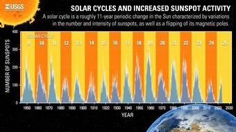
Every 11 years the Sun's magnetic field flips. This period is referred to as a solar cycle. As we approach the peak of Solar Cycle 25, activity on the Sun’s surface will increase, including more solar flares, sunspots, and coronal mass ejections.
What a Solar Superstorm Could Mean for the US
New USGS research shows how intense solar activity and large geomagnetic storms could impact much of the country
New USGS research shows how intense solar activity and large geomagnetic storms could impact much of the country
By Communications and Publishing
December 10, 2025
If a geomagnetic storm as large as the famed “Carrington Event” of 1859 were to occur today, it could adversely affect telecommunications and electric power transmission systems across the U.S., especially in the Midwest and the East Coast.
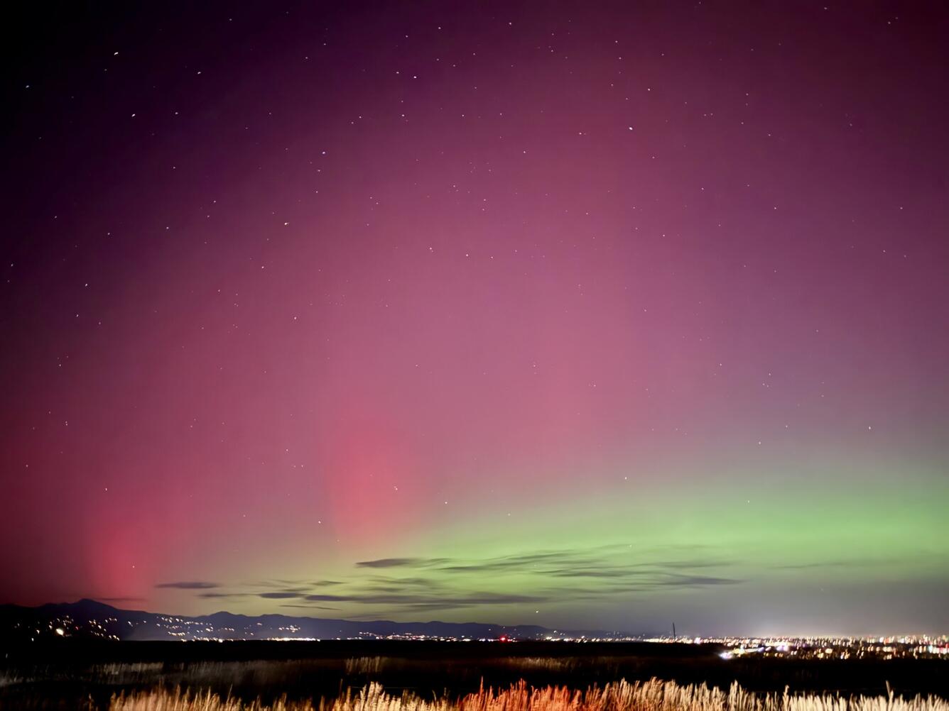
Vibrant Lights, Minor Disruptions
On November 11, 2025, people across the United States looked up in awe. The northern lights, usually reserved for places like Canada and Alaska, were instead visible as far south as Alabama and Florida. The vibrant display of auroras was caused by a strong geomagnetic storm, the result of a burst of solar activity that sent charged particles racing toward Earth hours earlier.
The geostorm caused only minor disruptions, such as a 30-minute blackout of high-frequency radio transmissions across Europe, Africa, and Asia, as well as delaying the launch of NASA’s ESCAPADE satellite. However, it did serve as a reminder that the Sun is still currently in an active phase, and with that comes an increased potential for “space weather” events that can affect the technologies on Earth that we rely on every day.
Media
Sources/Usage: Public Domain. View Media Details
Understanding Geomagnetic Storms
Media
Sources/Usage: Public Domain. View Media Details
The Sun follows an approximately 11-year cycle of magnetic activity. As it passes through the peak of Solar Cycle 25 and enters the early declining phase of the cycle, increased activity continues to produce more sunspots, solar flares, and coronal mass ejections. These solar eruptions can send massive waves of energy into space. If one of these eruptions is directed toward Earth, it can disturb our planet’s magnetic field and trigger a geomagnetic storm. Other recent notable events occurred in May 2024, January 2025, and June 2025.
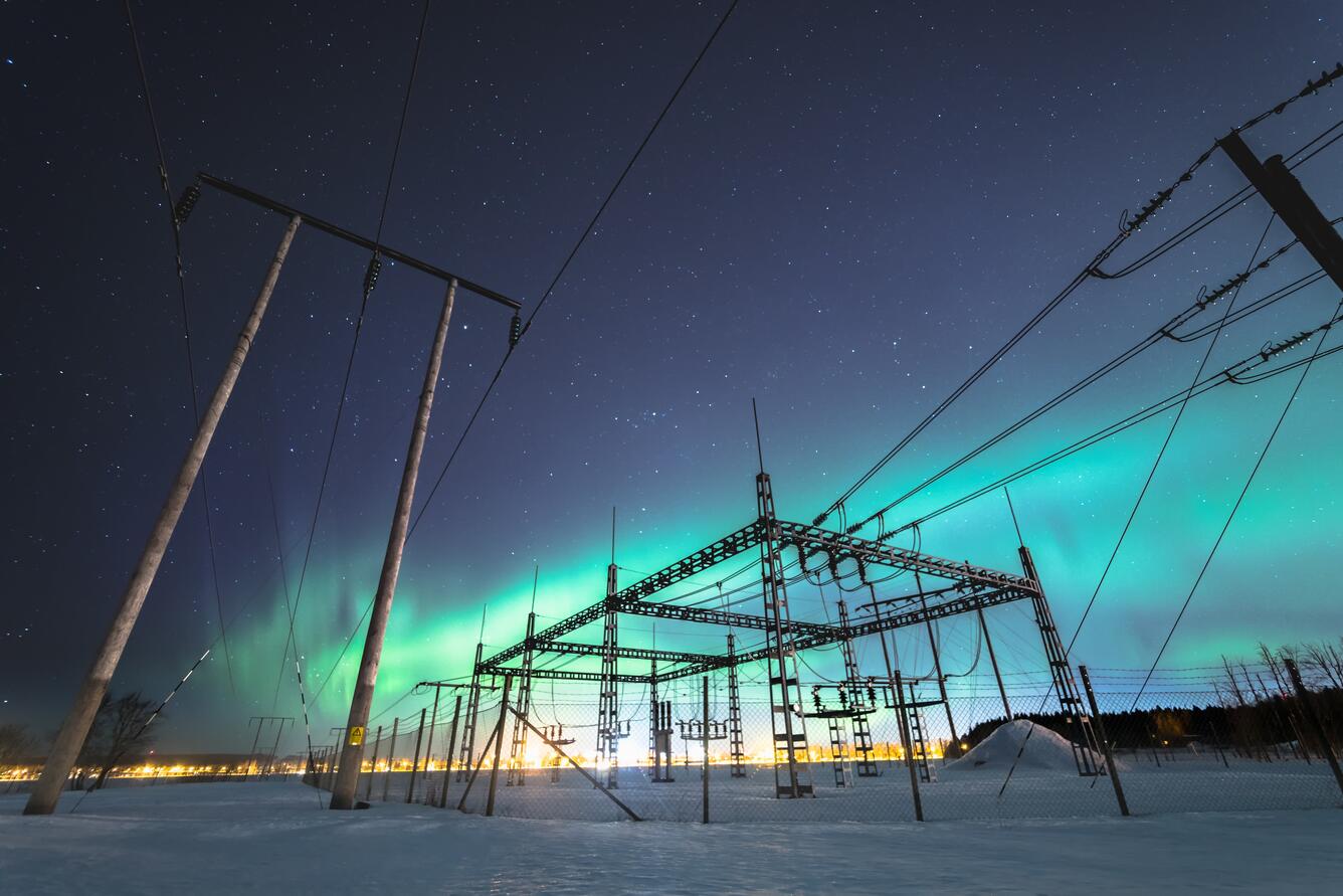
Although these geostorms have occurred throughout history, their potential impacts to modern society have grown as our dependence on technology has increased. Today, geomagnetic storms can interfere with satellite operations, disrupt GPS and radio communications, and in more extreme cases, adversely affect electric-power transmission systems and lead to widespread blackouts.
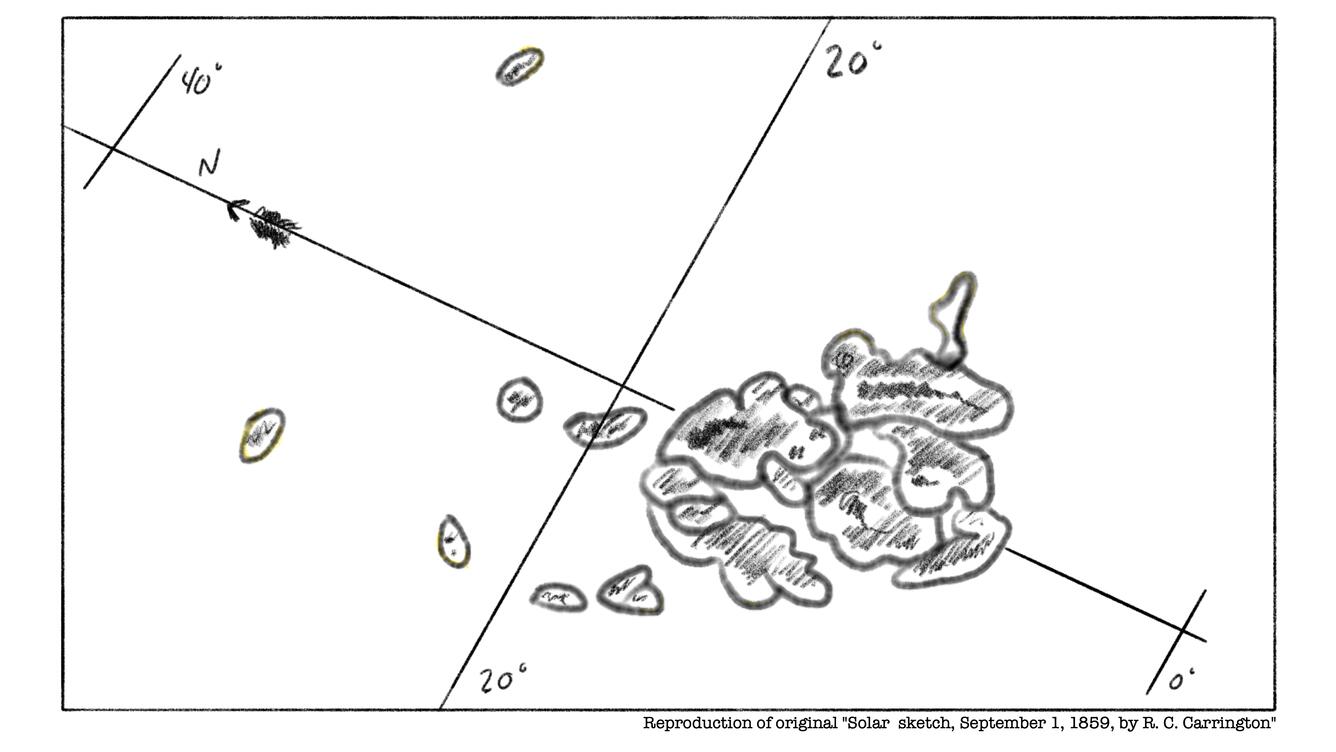
A Historical Benchmark: The Carrington Event
A Historical Benchmark: The Carrington Event
One of the most well-known examples of an extreme geomagnetic storm is the “Carrington Event” of 1859. Named after British astronomer Richard Carrington, who observed the solar flare that preceded it, the geostorm caused widespread disruption to telegraph systems, which were the backbone of global communication at the time. Operators reported sparks, fires, and electric shocks.
If an event of that magnitude occurred today, the consequences could be far more significant. Modern infrastructure, including satellites, navigation systems, and electrical grids, is far more powerful, complex, and interconnected than it was in the 19th century. One failure could have a cascading effect across many of these networks. Automated electronic functions could falter. Blackouts could affect not just neighborhoods, but entire regions. Flights at multiple airports could be delayed or cancelled. And although these disruptions may only last for a few seconds, in a worst-case scenario, they could go on for days or weeks.
Sources/Usage: Public Domain. View Media Details
New USGS Research Maps the Modern Risk
To better understand ground-level magnetic-storm hazards, USGS scientists developed a new map of geoelectric fields such as those that would be generated in the Earth by a Carrington-scale storm.
Geoelectric fields are natural electric currents that flow underground when solar storms disturb Earth’s magnetic field. These currents vary depending on the local geology and can be stronger in some regions than others.
Using decades of geomagnetic data and Earth conductivity measurements from across the country, the study found that the Eastern and Midwestern U.S. would be most affected. The bedrock beneath these regions, which include many of the nation’s largest population centers and critical infrastructure, is more exposed to charged geoelectric fields that can interfere with electric-power systems.
In some areas, expected magnetic field strengths would be enough to stress or damage high-voltage transformers and potentially lead to massive power outages.
“This work demonstrates that an intense magnetic storm could be far more hazardous than what the electric power transmission industry is prepared for,” said Jeffrey J. Love, USGS geophysicist and advisor for geomagnetic research. “These large storms are 100-year-type events, so although rare, they are still potentially consequential.”
Media
Sources/Usage: Some content may have restrictions. View Media Details
Monitoring and Mitigating the Risk
USGS plays a key role in monitoring and understanding space weather. Through a network of ground-based magnetic observatories, USGS provides real-time data on geomagnetic activity. These data support national and international efforts to forecast and respond to space weather events.
In addition to monitoring, USGS conducts magnetotelluric surveys to understand how Earth’s subsurface geology influences the strength of geoelectric fields. This information helps utilities and emergency planners assess where infrastructure may be most vulnerable and prioritize mitigation strategies.
Looking Ahead
As Solar Cycle 25 unfolds, more geomagnetic storms and their impressive auroras will continue. Most will be mild, but the potential for a major event remains. The November auroras were a dazzling reminder of Earth’s connection to the Sun, but they also highlight the importance of preparedness.
With tools like the new geoelectric hazard map, USGS is helping the nation better understand and mitigate the hazards of space weather. By combining long-term monitoring, scientific modeling, and public outreach, we are working to ensure that when the Sun sends its next big storm, the U.S. will be ready.
More Information
Geoelectric Hazard Map Viewer
Geoelectric Hazard Map Viewer
USGS Magnetic Observatory Network
USGS Magnetic Observatory Network
Carrington Event Background
Carrington Event Background
Related

5 Geomagnetic Storms that Reshaped Society
Every 11 years the Sun's magnetic field flips. This period is referred to as a solar cycle. As we approach the peak of Solar Cycle 25, activity on the Sun’s surface will increase, including more solar flares, sunspots, and coronal mass ejections.
Related
5 Geomagnetic Storms that Reshaped Society
Every 11 years the Sun's magnetic field flips. This period is referred to as a solar cycle. As we approach the peak of Solar Cycle 25, activity on the Sun’s surface will increase, including more solar flares, sunspots, and coronal mass ejections.
Every 11 years the Sun's magnetic field flips. This period is referred to as a solar cycle. As we approach the peak of Solar Cycle 25, activity on the Sun’s surface will increase, including more solar flares, sunspots, and coronal mass ejections.