Rocks in unusual positions hold secrets to northeastern U.S. earthquakes
USGS scientists are studying precariously balanced rocks, or rocks that seem on the brink of falling over (but haven’t yet), to estimate the strongest earthquake shaking to rattle parts of New York and northern Vermont.
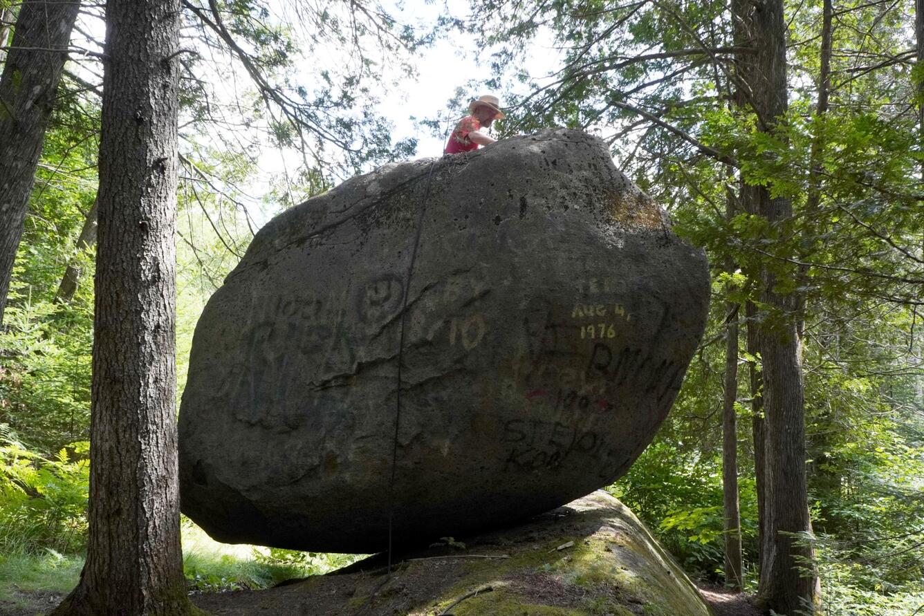
A quick internet search for “precariously balanced rocks” will result in amazing photos of perched boulders in majestic landscapes around the world. As their name suggests, these fragile geologic features seem likely to be easily toppled from a strong force, like shaking from an earthquake.
In fact, their precariousness, or how unstable they are, can tell us about the maximum strength of earthquake shaking the rock could have experienced in its current form and position. If we know how long the rock has been perched and have an estimate of the shaking it would take to topple the rock, then we know something about the strongest earthquakes that could have occurred in that region during the time that the rock has been precariously balanced.
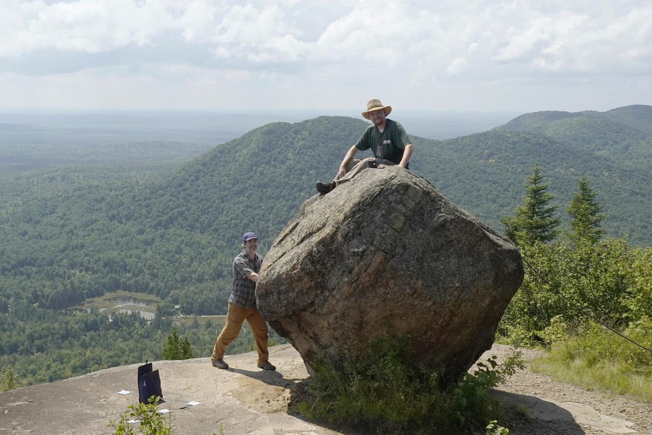
Three USGS scientists recently traveled to northern Vermont and the Adirondack region of New York to study some of these rocks, and successfully resisted the urge to attempt toppling them.

“These are glacial erratics, which almost certainly were set in place by the continental ice sheet about 19,000 to 14,000 years ago.” said Thomas Pratt, a Research Geophysicist with the USGS. “The rocks were carried to their current location by the south-moving ice sheet and then gently set down in precarious positions as the ice gradually melted.”
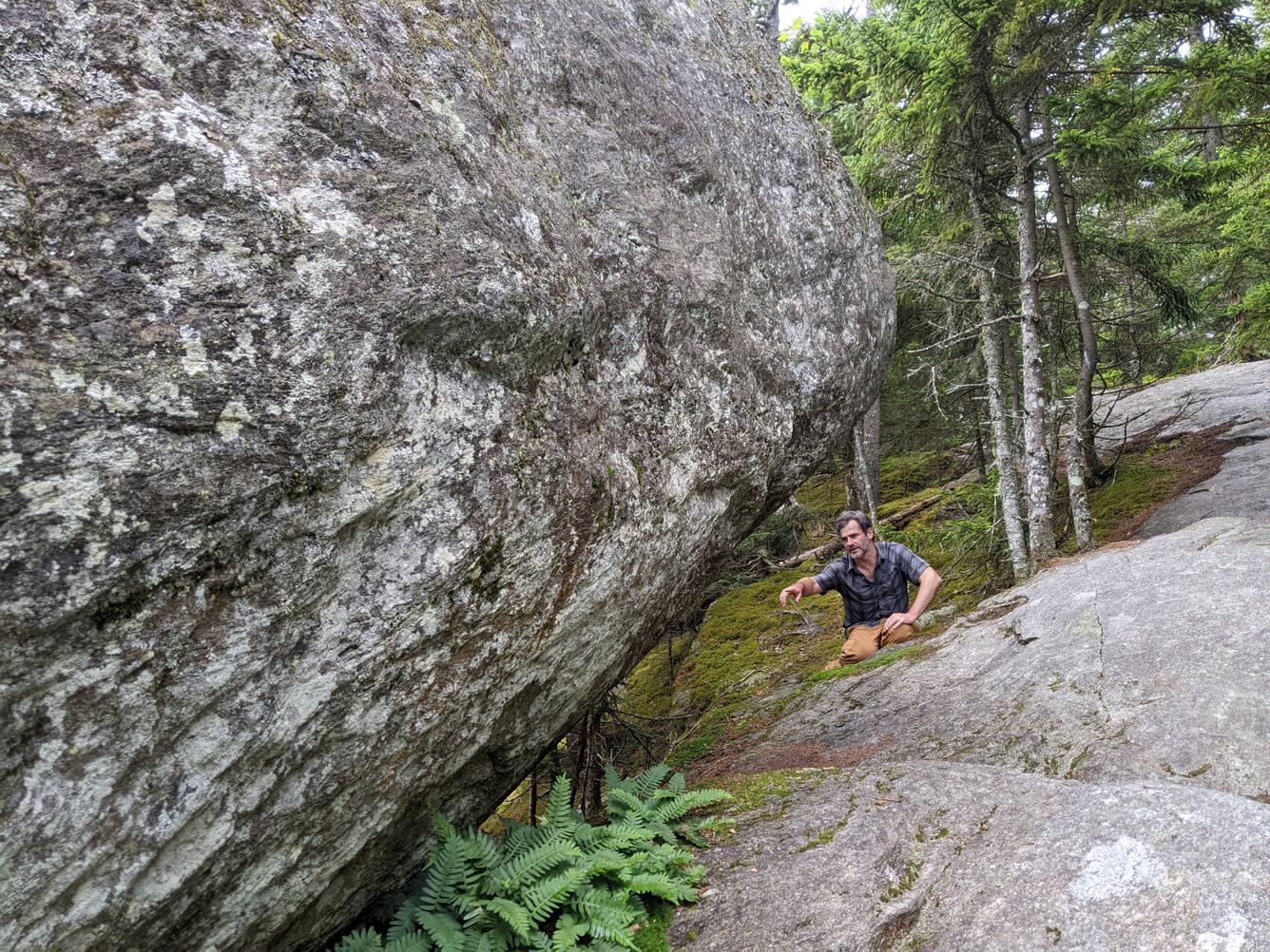
The group used a portable lidar imaging system and camera to collect images that will be used to produce detailed 3-dimensional models of the rocks. They can use these models to compute the locations of the centers of mass of the balanced rocks relative to the edges on which they might move, and then estimate the strength of ground shaking that it would take to knock the rocks off their perches. Similarly minded researchers have tested this method by placing rocks on large shake tables that simulate ground movements and increasing the strength of shaking until the rocks were knocked over.
The researchers also placed seismometers on the precariously balanced rocks and nearby bedrock to measure how the rocks respond to ambient ground motions. In addition, they gave the rocks gentle pushes to measure the rocks’ movements, such as the direction of rocking and how long the rocks wobble after being pushed.
The trio first had to get to the rocks, which are often at the tops of mountains that required steep uphill hikes of several miles with heavy gear (cameras, lidar, seismometers) in their backpacks, in one case bushwhacking through the woods without a trail. “It’s great field work in a scenic area to look at some amazing rocks!” said Noah Lindberg, a USGS geophysicist. “My job doesn’t usually involve this much hiking, so this is a fun change of pace!”
The Adirondack mountains have a relatively high seismic hazard risk compared to the rest of the northeastern U.S. because of their proximity to the St. Lawrence valley seismic zone in southern Canada, which has produced significant earthquakes in recorded history. The Adirondacks are also the site of past earthquakes, such as the magnitude 5 AuSable earthquake in 2002.
“By studying these rocks, we hope to estimate the magnitudes of the largest earthquakes that could have occurred in the region in the past 15,000 years. This knowledge will provide one more piece of evidence to help place upper limits on the potential ground motions encapsulated in the National Seismic Hazard Model,” said Devin McPhillips, a Geologist with the Earthquake Hazards Program.
Although a number of researchers have conducted studies like these in the western U.S. and other areas of the world, few have studied balanced rocks the eastern U.S. in part because of the difficulty of finding suitable rocks among the trees in the woodlands that cover most of the region. To find the more elusive eastern precariously balanced rocks, the scientists were helped by a group of intrepid hikers who have published books describing interesting rock formations in the northeastern U.S.
This outing was the first of several planned trips to look at precariously balanced rocks throughout the northeastern U.S. Stay tuned for updates on these studies by following @USGS_Quakes on Twitter and Instagram and read on for a more visual story about how the scientists studied the rocks.