
USGS, AmericaView Connection Proves Valuable with Hurricane Florence
In the days of Hurricane Florence, when the winds blew, the rains fell, the ocean surged, and the rivers overflowed, the U.S Geological Survey (USGS) and its partners moved quickly to make a difference in people’s lives.

One important way they did that was through their remote sensing ties to a global consortium called the International Charter “Space and Major Disasters.” Comprised of 17 participating space agencies and 34 contributing satellites from around the world, the Charter makes remotely sensed information and products available at no cost during emergencies to monitor events on the ground and to support response efforts.
The USGS with its Landsat satellites is a valuable member of that Charter. As such, with Florence bearing down on the Carolinas, the Federal Emergency Management Agency (FEMA) asked if the USGS would activate the Charter on its behalf. That way FEMA could access pre- and post-storm imagery to better assess where flooding and storm damage would be playing out during the monstrous storm, while also directing valuable information to emergency responders.
That access included Very High Resolution (VHR) imagery from Digital Globe commercial satellites that the USGS is able to task and obtain through the National Geospatial Intelligence Agency’s EnhancedView contract. Combining the moderate resolution of Landsat and the higher resolution commercial data allows users the capability to obtain a full view of the damage extents, ranging from 30 meters all the way down to 30-centimeter ground resolution.
In these kinds of catastrophic events, the USGS as the authorized user of the Charter for the United States puts a Project Manager in place to access and coordinate the flow of available satellite data. For Hurricane Florence, the USGS called on an old hand at this—Brent Yantis, director of a NASA research program at the University of Louisiana at Lafayette called the Regional Application Center.
Yantis has a long history in emergency response, through his center’s work and as a member of the national AmericaView consortium. AmericaView, a 501(c)(3) non-profit, has 39 state members and is largely funded by the USGS National Land Imaging program to promote remote sensing. Many AmericaView Principal Investigators like Yantis have volunteered and trained as Charter project managers, and support Charter activations and requests for support by local emergency response agencies.
USGS-funded AmericaView Supports Disaster Activations
Having established a geospatial operations center for the state of Louisiana, Yantis has contracted with the Louisiana Army National Guard for 20 years now to assist with their responses during disasters. He was part of three Charter activations in 2016 when flooding struck Louisiana and Texas in March, May, and August of that year. And during Hurricane Katrina in 2005, Yantis’ conference room at the University of Louisiana at Lafayette became the center-point for work and activations during that storm.
Related

USGS and Partner Efforts to Monitor High River Flow During Summer, 2018 and Potential Effects of Hurricane Florence on the Chesapeake Bay Watershed
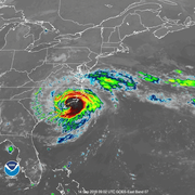
Hurricane Florence 2018
Related
USGS and Partner Efforts to Monitor High River Flow During Summer, 2018 and Potential Effects of Hurricane Florence on the Chesapeake Bay Watershed