



US Topo Cartographic Specifications - Elevation
US Topo cartographic specifications including feature symbology and labels for elevation generated contours.
Elevation Feature Types
Table of Contents
Contours
CONTOURS
Depression Index
Subtype of Contours
- FType: Not applicable
- FCode: 10105
- Feature Description: A line with hashes drawn on a topographic map to indicate a depression, with the hashes pointing towards the lower point. A depression index contour is a thick, bold line, to indicate every fifth contour line.
- Feature Geometry: Linear
Graphic Depiction
Media

Sources/Usage: Public Domain. View Media Details
- Point Graphic Depiction: Not applicable
- Linear Graphic Depiction:
- Symbol: Depression Index
- Symbol Description: A brown hash line on top of a brown solid line.
- Polygon Graphic Depiction: Not applicable
Line Symbology Specifications
- Layer 1 (Hash Line):
- Size: 1.44 pt
- Color (R,G,B): 145,88,40
- Transparency: 0%
- Layer 2 (Solid Line):
- Size: 0.504 pt
- Color (R,G,B): 166,116,66
- Transparency: 0%
Annotation
Media
Sources/Usage: Public Domain. View Media Details
- Annotation Graphic Depiction:
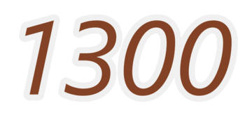
- Annotation: Index - Annotation
- Annotation Description: Brown italic text with a light gray halo.
- Font Style: Segoe UI, Italic
- Font Size: 6.00 pt
- Font Color (R,G,B): 131,66,37
- Font Halo Size: 0.70 pt
- Font Halo Color (R,G,B): 240,240,240
- Placement Properties: Regular placement straight and centered on line.
Depression Intermediate
Subtype of Contours
- FType: Not applicable
- FCode: 10104
- Feature Description: A line with hashes drawn on a topographic map to indicate a depression, with the hashes pointing towards the lower point. A depression intermediate contour is a thinner line between each index contour, drawn at the contour interval.
- Feature Geometry: Linear
Graphic Depiction
Media

Sources/Usage: Public Domain. View Media Details
- Point Graphic Depiction: Not applicable
- Linear Graphic Depiction:
- Symbol: Depression Intermediate
- Symbol Description: A brown hash line on top of a brown solid line.
- Polygon Graphic Depiction: Not applicable
Line Symbology Specifications
- Layer 1 (Hash Line):
- Size: 1.44 pt
- Color (R,G,B): 179,134,89
- Transparency: 0%
- Layer 2 (Solid Line):
- Size: 0.216 pt
- Color (R,G,B): 179,134,89
- Transparency: 0%
Annotation
- Annotation: Not applicable
Depression Supplemental
Subtype of Contours
- FType: Not applicable
- FCode: 10106
- Feature Description: A line with hashes drawn on a topographic map to indicate a depression, with the hashes pointing towards the lower point. A depression supplemental contour is drawn between any two depression contour lines to visualize small features that otherwise would not be depicted by the set contour interval of the map.
- Feature Geometry: Linear
Graphic Depiction
Media

Sources/Usage: Public Domain. View Media Details
- Point Graphic Depiction: Not applicable
- Linear Graphic Depiction:
- Symbol: Depression Supplemental
- Symbol Description: A brown hash line on top of a brown solid line.
- Polygon Graphic Depiction: Not applicable
Line Symbology Specifications
- Layer 1 (Hash Line):
- Size: 1.44 pt
- Color (R,G,B): 207,164,142
- Transparency: 0%
- Layer 2 (Solid Line):
- Size: 0.36 pt
- Color (R,G,B): 207,164,142
- Transparency: 0%
Annotation
- Annotation: Not applicable
Index
Subtype of Contours
- FType: Not applicable
- FCode: 10102
- Feature Description: A line drawn on a topographic map to indicate ground elevation. An index contour is a thick, bold line, to indicate every fifth contour line and is labeled with the elevation.
- Feature Geometry: Linear
Graphic Depiction
Media

Sources/Usage: Public Domain. View Media Details
- Point Graphic Depiction: Not applicable
- Linear Graphic Depiction:
- Symbol: Index
- Symbol Description: Solid brown line.
- Polygon Graphic Depiction: Not applicable
Line Symbology Specifications
- Layer 1 (Solid Line):
- Size: 0.504 pt
- Color (R,G,B): 145,88,40
- Transparency: 0%
Annotation
Media
Sources/Usage: Public Domain. View Media Details
- Annotation Graphic Depiction:
- Annotation: Index - Annotation
- Annotation Description: Brown italic text with a light gray halo.
- Font Style: Segoe UI, Italic
- Font Size: 6.00 pt
- Font Color (R,G,B): 131,66,37
- Font Halo Size: 0.70 pt
- Font Halo Color (R,G,B): 240,240,240
- Placement Properties: Regular placement straight and centered on line.
Intermediate
Subtype of Contours
- FType: Not applicable
- FCode: 10101
- Feature Description: A line drawn on a topographic map to indicate ground elevation. An intermediate contour is a thinner line between each index contour, drawn at the contour interval.
- Feature Geometry: Linear
Graphic Depiction
Media

Sources/Usage: Public Domain. View Media Details
- Point Graphic Depiction: Not applicable
- Linear Graphic Depiction:
- Symbol: Intermediate
- Symbol Description: Solid brown line.
- Polygon Graphic Depiction: Not applicable
Line Symbology Specifications
- Layer 1 (Solid Line):
- Size: 0.216 pt
- Color (R,G,B): 179,134,89
- Transparency: 0%
Annotation
- Annotation: Not applicable
Supplemental
Subtype of Contours
- FType: Not applicable
- FCode: 10103
- Feature Description: A line drawn on a topographic map to indicate ground elevation. A supplemental contour is drawn between any two contour lines to visualize small features that otherwise would not be depicted by the set contour interval of the map.
- Feature Geometry: Linear
Graphic Depiction
Media

Sources/Usage: Public Domain. View Media Details
- Point Graphic Depiction: Not applicable
- Linear Graphic Depiction:
- Symbol: Supplemental
- Symbol Description: Solid brown line.
- Polygon Graphic Depiction: Not applicable
Line Symbology Specifications
- Layer 1 (Solid Line):
- Size: 0.36 pt
- Color (R,G,B): 207,164,142
- Transparency: 0%
Annotation
- Annotation: Not applicable
Related Information
Related Information
-
US Topo Cartographic Specifications US Topo Cartographic Specifications
This page and associated links define the U.S. Geological Survey (USGS) digital topographic map (US Topo) cartographic specifications including feature symbology and annotation. The specifications are organized by data sets and themes listed below.
US Topo Cartographic Specifications - Version History US Topo Cartographic Specifications - Version History
This page highlights version history and details the refinements made to the published US Topo Cartographic Specifications.
US Topo Cartographic Specifications - Elevation US Topo Cartographic Specifications - Elevation
US Topo cartographic specifications including feature symbology and labels for elevation generated contours.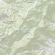
US Topo Cartographic Specifications - Geographic Names US Topo Cartographic Specifications - Geographic Names
US Topo cartographic specifications including feature symbology and annotation for Geographic Names Landforms.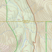
US Topo Cartographic Specifications - Government Units US Topo Cartographic Specifications - Government Units
US Topo cartographic specifications including feature symbology and labels for Government Units (Boundaries) including County or Equivalent, Designated Areas, Federally Managed Lands, International, Military, Native American Area, Public Land Survey System (PLSS), and State.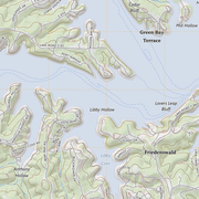
US Topo Cartographic Specifications - Hydrography US Topo Cartographic Specifications - Hydrography
US Topo cartographic specifications for Hydrography including NHDArea, NHDFlowline, NHDLine, NHDPoint, NHDWaterbody, and National Wetland Inventory (NWI).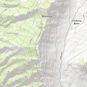
US Topo Cartographic Specifications - Land Cover US Topo Cartographic Specifications - Land Cover
US Topo cartographic specifications including feature symbology and annotation for Land Cover including Woodland.
US Topo Cartographic Specifications - Structures US Topo Cartographic Specifications - Structures
US Topo cartographic specifications including feature symbology and labels for Structures including Emergency / Medical, Pipeline, Public Services, and Recreation.
US Topo Cartographic Specifications - Transportation US Topo Cartographic Specifications - Transportation
US Topo cartographic specifications including feature symbology and annotation for Transportation including Airport, Rail, Route, and Trail.