



US Topo Cartographic Specifications - Government Units
US Topo cartographic specifications including feature symbology and labels for Government Units (Boundaries) including County or Equivalent, Designated Areas, Federally Managed Lands, International, Military, Native American Area, Public Land Survey System (PLSS), and State.
Government Units Feature Type
Table of Contents
County or Equivalent
- Borough
- City and Borough
- County
- District
- Independent City
- Island
- Judicial Division
- Municipality
- Municipio
- Other County Equivalent
- Parish
Designated Areas
Federally Managed Lands
- Bureau of Land Management (BLM) (Alaska only)
- Forest (Forest Service)
- Grassland (Forest Service)
- National Monument
- Park (National Park)
- Wildlife
- Wilderness
International
Military
Native American Area
Public Land Survey System (PLSS)
State
*Note: Throughout this page there are boundary features that have symbology for large and small areas. Esri’s default Shape_Area is calculated to the North American Datum of 1983 (NAD 83) or to the World Geodetic System of 1984 (WGS 84). For large area boundaries Shape_Area is greater than 0.000001 and for small areas Shape_Area is less than or equal to 0.000001. All US Topo maps are projected to the Universal Transverse Mercator (UTM) projection and coordinate system and thus a generalized squared areas cannot be defined.
COUNTY OR EQUIVALENT
Borough
Subtype of County or Equivalent
- FType: Not applicable
- FCode: 61201
- Feature Description: A legally established geographic entity in Alaska, which the Census Bureau treats as statistically equivalent to a county in other states.
- Feature Geometry: Polygon
Graphic Depiction

- Point Graphic Depiction: Not applicable
- Linear Graphic Depiction: Not applicable
- Polygon Graphic Depiction:
- Symbol: Borough
- Symbol Description: Dashed, gray line on top of a thicker, solid yellow line.
Polygon Symbology Specifications
- Layer 1 (Stroke - Dash/Gap Pattern: 9·3·5·3·9·0):
- Size: 0.72 pt
- Color (R,G,B): 0,0,0
- Transparency: 0%
- Layer 2 (Solid Stroke):
- Size: 3.0024 pt
- Color (R,G,B): 240,225,135
- Transparency: 0%
Annotation

- Annotation Graphic Depiction:
- Annotation: Borough - Annotation
- Annotation Description: Black uppercase text with a yellow halo.
- Font Style: Charis SIL
- Font Size: 7.00 pt
- Font Color (R,G,B): 0,0,0
- Font Halo Size: 1.00 pt
- Font Halo Color (R,G,B): 255,250,177
- Placement Properties: Positioned along polygon boundary
City and Borough
Subtype of County or Equivalent
- FType: Not applicable
- FCode: 61210
- Feature Description: A legally established geographic entity in Alaska (Juneau, Sitka and Yakutat), which the U.S. Census Bureau treats as the statistical equivalent of a county in other states.
- Feature Geometry: Polygon
Graphic Depiction
- Point Graphic Depiction: Not applicable
- Linear Graphic Depiction: Not applicable
- Polygon Graphic Depiction:
- Symbol: City and Borough
- Symbol Description: Dashed, gray line on top of a thicker, solid yellow line.
Polygon Symbology Specifications
- Layer 1 (Stroke - Dash/Gap Pattern: 9·3·5·3·9·0):
- Size: 0.72 pt
- Color (R,G,B): 0,0,0
- Transparency: 0%
- Layer 2 (Solid Stroke):
- Size: 3.0024 pt
- Color (R,G,B): 240,225,135
- Transparency: 0%
Annotation
- Annotation Graphic Depiction:
- Annotation: City and Borough - Annotation
- Annotation Description: Black uppercase text with a yellow halo.
- Font Style: Charis SIL
- Font Size: 7.00 pt
- Font Color (R,G,B): 0,0,0
- Font Halo Size: 1.00 pt
- Font Halo Color (R,G,B): 255,250,177
- Placement Properties: Positioned along polygon boundary
County
Subtype of County or Equivalent
- FType: Not applicable
- FCode: 61200
- Feature Description: The primary division of a state or state equivalent area.
- Feature Geometry: Polygon
Graphic Depiction
- Point Graphic Depiction: Not applicable
- Linear Graphic Depiction: Not applicable
- Polygon Graphic Depiction:
- Symbol: County
- Symbol Description: Dashed, gray line on top of a thicker, solid yellow line.
Polygon Symbology Specifications
- Layer 1 (Stroke - Dash/Gap Pattern: 9·3·5·3·9·0):
- Size: 0.72 pt
- Color (R,G,B): 0,0,0
- Transparency: 0%
- Layer 2 (Solid Stroke):
- Size: 3.0024 pt
- Color (R,G,B): 240,225,135
- Transparency: 0%
Annotation
- Annotation Graphic Depiction:
- Annotation: County - Annotation
- Annotation Description: Black uppercase text with a yellow halo.
- Font Style: Charis SIL
- Font Size: 7.00 pt
- Font Color (R,G,B): 0,0,0
- Font Halo Size: 1.00 pt
- Font Halo Color (R,G,B): 255,250,177
- Placement Properties: Positioned along polygon boundary
District
Subtype of County or Equivalent
- FType: Not applicable
- FCode: 61202
- Feature Description: A legal county equivalent in American Samoa.
- Feature Geometry: Polygon
Graphic Depiction
- Point Graphic Depiction: Not applicable
- Linear Graphic Depiction: Not applicable
- Polygon Graphic Depiction:
- Symbol: District
- Symbol Description: Dashed, gray line on top of a thicker, solid yellow line.
Polygon Symbology Specifications
- Layer 1 (Stroke - Dash/Gap Pattern: 9·3·5·3·9·0):
- Size: 0.72 pt
- Color (R,G,B): 0,0,0
- Transparency: 0%
- Layer 2 (Solid Stroke):
- Size: 3.0024 pt
- Color (R,G,B): 240,225,135
- Transparency: 0%
Annotation
- Annotation Graphic Depiction:
- Annotation: District - Annotation
- Annotation Description: Black uppercase text with a yellow halo.
- Font Style: Charis SIL
- Font Size: 7.00 pt
- Font Color (R,G,B): 0,0,0
- Font Halo Size: 1.00 pt
- Font Halo Color (R,G,B): 255,250,177
- Placement Properties: Positioned along polygon boundary
Independent City
Subtype of County or Equivalent
- FType: Not applicable
- FCode: 61203
- Feature Description: A legal county equivalent in Maryland, Missouri, Nevada and Virginia.
- Feature Geometry: Polygon
Graphic Depiction
- Point Graphic Depiction: Not applicable
- Linear Graphic Depiction: Not applicable
- Polygon Graphic Depiction:
- Symbol: Independent City
- Symbol Description: Dashed, gray line on top of a thicker, solid yellow line.
Polygon Symbology Specifications
- Layer 1 (Stroke - Dash/Gap Pattern: 9·3·5·3·9·0):
- Size: 0.72 pt
- Color (R,G,B): 0,0,0
- Transparency: 0%
- Layer 2 (Solid Stroke):
- Size: 3.0024 pt
- Color (R,G,B): 240,225,135
- Transparency: 0%
Annotation
- Annotation Graphic Depiction:
- Annotation: Independent City - Annotation
- Annotation Description: Black uppercase text with a yellow halo.
- Font Style: Charis SIL
- Font Size: 7.00 pt
- Font Color (R,G,B): 0,0,0
- Font Halo Size: 1.00 pt
- Font Halo Color (R,G,B): 255,250,177
- Placement Properties: Positioned along polygon boundary
Island
Subtype of County or Equivalent
- FType: Not applicable
- FCode: 61204
- Feature Description: A legal county equivalent in the U.S. Virgin Islands.
- Feature Geometry: Polygon
Graphic Depiction
- Point Graphic Depiction: Not applicable
- Linear Graphic Depiction: Not applicable
- Polygon Graphic Depiction:
- Symbol: Island
- Symbol Description: Dashed, gray line on top of a thicker, solid yellow line.
Polygon Symbology Specifications
- Layer 1 (Stroke - Dash/Gap Pattern: 9·3·5·3·9·0):
- Size: 0.72 pt
- Color (R,G,B): 0,0,0
- Transparency: 0%
- Layer 2 (Solid Stroke):
- Size: 3.0024 pt
- Color (R,G,B): 240,225,135
- Transparency: 0%
Annotation
- Annotation Graphic Depiction:
- Annotation: Island - Annotation
- Annotation Description: Black uppercase text with a yellow halo.
- Font Style: Charis SIL
- Font Size: 7.00 pt
- Font Color (R,G,B): 0,0,0
- Font Halo Size: 1.00 pt
- Font Halo Color (R,G,B): 255,250,177
- Placement Properties: Positioned along polygon boundary
Judicial Division
Subtype of County or Equivalent
- FType: Not applicable
- FCode: 61205
- Feature Description: A geographic area established by a judicial governmental authority for establishing the jurisdiction for trying cases involving the government and the administration of justice.
- Feature Geometry: Polygon
Graphic Depiction
- Point Graphic Depiction: Not applicable
- Linear Graphic Depiction: Not applicable
- Polygon Graphic Depiction:
- Symbol: Judicial Division
- Symbol Description: Dashed, gray line on top of a thicker, solid yellow line.
Polygon Symbology Specifications
- Layer 1 (Stroke - Dash/Gap Pattern: 9·3·5·3·9·0):
- Size: 0.72 pt
- Color (R,G,B): 0,0,0
- Transparency: 0%
- Layer 2 (Solid Stroke):
- Size: 3.0024 pt
- Color (R,G,B): 240,225,135
- Transparency: 0%
Annotation
- Annotation Graphic Depiction:
- Annotation: Judicial Division - Annotation
- Annotation Description: Black uppercase text with a yellow halo.
- Font Style: Charis SIL
- Font Size: 7.00 pt
- Font Color (R,G,B): 0,0,0
- Font Halo Size: 1.00 pt
- Font Halo Color (R,G,B): 255,250,177
- Placement Properties: Positioned along polygon boundary
Municipality
Subtype of County or Equivalent
- FType: Not applicable
- FCode: 61206
- Feature Description: A legal county equivalent in Alaska (Anchorage) and in the Commonwealth of the Northern Mariana Islands.
- Feature Geometry: Polygon
Graphic Depiction
- Point Graphic Depiction: Not applicable
- Linear Graphic Depiction: Not applicable
- Polygon Graphic Depiction:
- Symbol: Municipality
- Symbol Description: Dashed, gray line on top of a thicker, solid yellow line.
Polygon Symbology Specifications
- Layer 1 (Stroke - Dash/Gap Pattern: 9·3·5·3·9·0):
- Size: 0.72 pt
- Color (R,G,B): 0,0,0
- Transparency: 0%
- Layer 2 (Solid Stroke):
- Size: 3.0024 pt
- Color (R,G,B): 240,225,135
- Transparency: 0%
Annotation
- Annotation Graphic Depiction:
- Annotation: Municipality - Annotation
- Annotation Description: Black uppercase text with a yellow halo.
- Font Style: Charis SIL
- Font Size: 7.00 pt
- Font Color (R,G,B): 0,0,0
- Font Halo Size: 1.00 pt
- Font Halo Color (R,G,B): 255,250,177
- Placement Properties: Positioned along polygon boundary
Municipio
Subtype of County or Equivalent
- FType: Not applicable
- FCode: 61207
- Feature Description: A legal county equivalent in Puerto Rico.
- Feature Geometry: Polygon
Graphic Depiction
- Point Graphic Depiction: Not applicable
- Linear Graphic Depiction: Not applicable
- Polygon Graphic Depiction:
- Symbol: Municipio
- Symbol Description: Dashed, gray line on top of a thicker, solid yellow line.
Polygon Symbology Specifications
- Layer 1 (Stroke - Dash/Gap Pattern: 9·3·5·3·9·0):
- Size: 0.72 pt
- Color (R,G,B): 0,0,0
- Transparency: 0%
- Layer 2 (Solid Stroke):
- Size: 3.0024 pt
- Color (R,G,B): 240,225,135
- Transparency: 0%
Annotation
- Annotation Graphic Depiction:
- Annotation: Municipio - Annotation
- Annotation Description: Black uppercase text with a yellow halo.
- Font Style: Charis SIL
- Font Size: 7.00 pt
- Font Color (R,G,B): 0,0,0
- Font Halo Size: 1.00 pt
- Font Halo Color (R,G,B): 255,250,177
- Placement Properties: Positioned along polygon boundary
Other County Equivalent
Subtype of County or Equivalent
- FType: Not applicable
- FCode: 61299
- Feature Description: Any other established geographic entity that is equivalent to a county.
- Feature Geometry: Polygon
Graphic Depiction
- Point Graphic Depiction: Not applicable
- Linear Graphic Depiction: Not applicable
- Polygon Graphic Depiction:
- Symbol: Other County Equivalent
- Symbol Description: Dashed, gray line on top of a thicker, solid yellow line.
Polygon Symbology Specifications
- Layer 1 (Stroke - Dash/Gap Pattern: 9·3·5·3·9·0):
- Size: 0.72 pt
- Color (R,G,B): 0,0,0
- Transparency: 0%
- Layer 2 (Solid Stroke):
- Size: 3.0024 pt
- Color (R,G,B): 240,225,135
- Transparency: 0%
Annotation
- Annotation Graphic Depiction:
- Annotation: Other County Equivalent - Annotation
- Annotation Description: Black uppercase text with a yellow halo.
- Font Style: Charis SIL
- Font Size: 7.00 pt
- Font Color (R,G,B): 0,0,0
- Font Halo Size: 1.00 pt
- Font Halo Color (R,G,B): 255,250,177
- Placement Properties: Positioned along polygon boundary
Parish
Subtype of County or Equivalent
- FType: Not applicable
- FCode: 61208
- Feature Description: A legal county equivalent in Louisiana.
- Feature Geometry: Polygon
Graphic Depiction
- Point Graphic Depiction: Not applicable
- Linear Graphic Depiction: Not applicable
- Polygon Graphic Depiction:
- Symbol: Parish
- Symbol Description: Dashed, gray line on top of a thicker, solid yellow line.
Polygon Symbology Specifications
- Layer 1 (Stroke - Dash/Gap Pattern: 9·3·5·3·9·0):
- Size: 0.72 pt
- Color (R,G,B): 0,0,0
- Transparency: 0%
- Layer 2 (Solid Stroke):
- Size: 3.0024 pt
- Color (R,G,B): 240,225,135
- Transparency: 0%
Annotation
- Annotation Graphic Depiction:
- Annotation: Parish - Annotation
- Annotation Description: Black uppercase text with a yellow halo.
- Font Style: Charis SIL
- Font Size: 7.00 pt
- Font Color (R,G,B): 0,0,0
- Font Halo Size: 1.00 pt
- Font Halo Color (R,G,B): 255,250,177
- Placement Properties: Positioned along polygon boundary
DESIGNATED AREAS
Wild and Scenic Rivers
Subtype of Designated Areas
- FType: Not applicable
- FCode: Not applicable
- Feature Description: River corridors of each Wild and Scenic River designated by Congress or the Secretary of the Interior for the United States and Puerto Rico.
- Feature Geometry: Polygon
Graphic Depiction
- Point Graphic Depiction: Not applicable
- Linear Graphic Depiction: Not applicable
- Polygon Graphic Depiction:
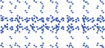
- Symbol: Wild and Scenic Rivers
- Symbol Description: Multipart, blue dot pattern
Polygon Symbology Specifications
- Layer 1 (0 -25m: Fill):
- Size: 8.00 pt
- Color (R,G,B): 24,74,255
- Transparency: 0%
- Layer 2 (0 -25m: Fill):
- Size: 6.00 pt
- Color (R,G,B): 24,74,255
- Transparency: 0%
- Layer 3 (0 -25m: Fill):
- Size: 5.00 pt
- Color (R,G,B): 24,74,255
- Transparency: 0%
- Layer 4 (0-25m: Fill):
- Size: 5.00 pt
- Color (R,G,B): 24,74,255
- Transparency: 0%
- Layer 5 (26m -100m: Fill):
- Size: 9.00 pt
- Color (R,G,B): 24,74,255
- Transparency: 0%
- Layer 6 (26m -100m: Fill):
- Size: 9.00 pt
- Color (R,G,B): 24,74,255
- Transparency: 0%
- Layer 7 (26m -100m: Fill):
- Size: 8.00 pt
- Color (R,G,B): 45,108,215
- Transparency: 0%
Annotation

- Annotation Graphic Depiction:
- Annotation: Wild and Scenic Rivers - Annotation
- Annotation Description: Blue uppercase text with a light gray halo.
- Font Style: Charis SIL, Bold
- Font Size: 9.00 pt
- Font Color (R,G,B): 101,137,191
- Font Halo Size: 0.80 pt
- Font Halo Color (R,G,B): 240,240,240
- Placement Properties: Horizontal and offset from polygon
FEDERALLY MANAGED LANDS
Bureau of Land Management (BLM) (Alaska only)
Subtype of Federally Managed Lands
- FType: Not applicable
- FCode: 67400
- Feature Description: United States federal land managed by the Bureau of Land Management.
- Feature Geometry: Polygon
Graphic Depiction


- Point Graphic Depiction: Not applicable
- Linear Graphic Depiction: Not applicable
- Polygon Graphic Depiction:
- Symbol, large area greater than 0.000001*: Bureau of Land Management (BLM) (Alaska only)
- Symbol Description, large area: Solid, dark gray outline with a light green band on the interior of the polygon area.
- Symbol, secondary symbol, small area less than or equal to 0.000001*: Bureau of Land Management (BLM) (Alaska only)
- Symbol Description, small area: Solid, dark gray outline with a light green fill on the interior of the polygon area.
Polygon Symbology Specifications
- Layer 1 (Large Area - Solid Stroke)
- Size: 0.70 pt
- Color (R,G,B): 77,77,77
- Transparency: 0%
- Layer 2 (Large Area - Solid Stroke)
- Size: 3.50 pt
- Color (R,G,B): 161,217,155
- Transparency: 0%
- Layer 1 (Small Area - Solid Stroke)
- Size: 0.70 pt
- Color (R,G,B): 77,77,77
- Transparency: 0%
- Layer 2 (Small Area - Solid Fill)
- Size: Not applicable
- Color (R,G,B): 161,217,155
- Transparency: 30%
Annotation

- Annotation Graphic Depiction:
- Annotation: Bureau of Land Management (Alaska only) - Annotation
- Annotation Description: Uppercase, green text with a light gray halo.
- Font Style: Charis SIL, Bold
- Font Size: 10.00 pt
- Font Color (R,G,B): 67,138,56
- Font Halo Size: 1.00 pt
- Font Halo Color (R,G,B): 240,240,240
- Placement Properties: Regular placement horizontal within the polygon.
Forest (Forest Service)
Subtype of Federally Managed Lands
- FType: Forest
- FCode: 67100
- Feature Description: Area primarily for the management of forest resources.
- Feature Geometry: Polygon
Graphic Depiction
- Point Graphic Depiction: Not applicable
- Linear Graphic Depiction: Not applicable
- Polygon Graphic Depiction:
- Symbol, large area greater than 0.000001*: Forest (Forest Service)
- Symbol Description, large area: Solid, dark gray outline with a light green band on the interior of the polygon area.
- Symbol, secondary symbol, small area less than or equal to 0.000001*: Forest (Forest Service)
- Symbol Description, small area: Solid, dark gray outline with a light green fill on the interior of the polygon area.
Polygon Symbology Specifications
- Layer 1 (Large Area - Solid Stroke)
- Size: 0.70 pt
- Color (R,G,B): 77,77,77
- Transparency: 0%
- Layer 2 (Large Area - Solid Stroke)
- Size: 3.50 pt
- Color (R,G,B): 161,217,155
- Transparency: 0%
- Layer 1 (Small Area - Solid Stroke)
- Size: 0.70 pt
- Color (R,G,B): 77,77,77
- Transparency: 0%
- Layer 2 (Small Area - Solid Fill)
- Size: Not applicable
- Color (R,G,B): 161,217,155
- Transparency: 30%
Annotation
- Annotation Graphic Depiction:
- Annotation: Forest (Forest Service) - Annotation
- Annotation Description: Uppercase, green text with a light gray halo.
- Font Style: Charis SIL, Bold
- Font Size: 10.00 pt
- Font Color (R,G,B): 67,138,56
- Font Halo Size: 1.00 pt
- Font Halo Color (R,G,B): 240,240,240
- Placement Properties: Regular placement horizontal within the polygon.
Grassland (Forest Service)
Subtype of Federally Managed Lands
- FType: Grassland
- FCode: 67200
- Feature Description: Area primarily for the management of native grasses.
- Feature Geometry: Polygon
Graphic Depiction
- Point Graphic Depiction: Not applicable
- Linear Graphic Depiction: Not applicable
- Polygon Graphic Depiction:
- Symbol, large area greater than 0.000001*: Grassland (Forest Service)
- Symbol Description, large area: Solid, dark gray outline with a light green band on the interior of the polygon area.
- Symbol, secondary symbol, small area less than or equal to 0.000001*: Grassland (Forest Service)
- Symbol Description, small area: Solid, dark gray outline with a light green fill on the interior of the polygon area.
Polygon Symbology Specifications
- Layer 1 (Large Area - Solid Stroke)
- Size: 0.70 pt
- Color (R,G,B): 77,77,77
- Transparency: 0%
- Layer 2 (Large Area - Solid Stroke)
- Size: 3.50 pt
- Color (R,G,B): 161,217,155
- Transparency: 0%
- Layer 1 (Small Area - Solid Stroke)
- Size: 0.70 pt
- Color (R,G,B): 77,77,77
- Transparency: 0%
- Layer 2 (Small Area - Solid Fill)
- Size: Not applicable
- Color (R,G,B): 161,217,155
- Transparency: 30%
Annotation
- Annotation Graphic Depiction:
- Annotation: Grassland (Forest Service) - Annotation
- Annotation Description: Uppercase, green text with a light gray halo.
- Font Style: Charis SIL, Bold
- Font Size: 10.00 pt
- Font Color (R,G,B): 67,138,56
- Font Halo Size: 1.00 pt
- Font Halo Color (R,G,B): 240,240,240
- Placement Properties: Regular placement horizontal within the polygon.
National Monument
Subtype of Federally Managed Lands
- FType: Park
- FCode: 67400
- Feature Description: Subset of the Park feature class. Area for public recreation and preservation of a cultural or natural resource. (Generic examples include: Battlefield, Battlefield Park, Battlefield Site, Historical Park, Lakeshore, Memorial, Military Park, Monument, Park, Parkway, Recreation Area, Seashore).
- Feature Geometry: Polygon
Graphic Depiction
- Point Graphic Depiction: Not applicable
- Linear Graphic Depiction: Not applicable
- Polygon Graphic Depiction:
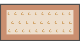
- Symbol, large area greater than 0.000001*: National Monument
- Symbol Description, large area: Solid, gray outline with a dark brown band on the interior of the polygon area with two fills—light brown solid fill and a shape marker fill.
- Symbol, secondary symbol, small area less than or equal to 0.000001*: National Monument
- Symbol Description, small area: Solid, dark gray outline with a light brown fill on the interior of the polygon area.
Polygon Symbology Specifications
- Layer 1 (Large Area - Solid Stroke):
- Size: 0.70 pt
- Color (R,G,B): 77,77,77
- Transparency: 0%
- Layer 2 (Large Area - Solid Stroke):
- Size: 3.50 pt
- Color (R,G,B): 202,143,112
- Transparency: 0%
- Layer 3 (Large Area - Shape Marker - Fill):
- Size: 8.00 pt
- Color (R,G,B): 209,164,106
- Transparency: 0%
- Layer 4 (Large Area - Shape Marker - Fill):
- Size: 8.00 pt
- Color (R,G,B): 209,164,106
- Transparency: 0%
- Layer 5 (Large Area - Solid Fill):
- Size: Not applicable
- Color (R,G,B): 237,222,204
- Transparency: 60%
- Layer 1 (Small Area - Solid Stroke):
- Size: 0.70 pt
- Color (R,G,B): 77,77,77
- Transparency: 0%
- Layer 2 (Small Area - Solid Fill):
- Size: Not applicable
- Color (R,G,B): 237,222,204
- Transparency: 60%
Annotation

- Annotation Graphic Depiction:
- Annotation: National Monument - Annotation
- Annotation Description: Uppercase, brown text with a white halo.
- Font Style: Charis SIL, Bold
- Font Size: 10.00 pt
- Font Color (R,G,B): 112,77,58
- Font Halo Size: 1.00 pt
- Font Halo Color (R,G,B): 255,255,255
- Placement Properties: Regular placement horizontal within the polygon.
Park (National Park)
Subtype of Federally Managed Lands
- FType: Park
- FCode: 67400
- Feature Description: Area for public recreation and preservation of a cultural or natural resource. (Generic examples include: Battlefield, Battlefield Park, Battlefield Site, Historical Park, Lakeshore, Memorial, Military Park, Monument, Park, Parkway, Recreation Area, Seashore).
- Feature Geometry: Polygon
Graphic Depiction
- Point Graphic Depiction: Not applicable
- Linear Graphic Depiction: Not applicable
- Polygon Graphic Depiction:
- Symbol, large area greater than 0.000001*: Park (National Park)
- Symbol Description, large area: Solid, dark gray outline with a light green band on the interior of the polygon area.
- Symbol, secondary symbol, small area less than or equal to 0.000001*: Park (National Park)
- Symbol Description, small area: Solid, dark gray outline with a light green fill on the interior of the polygon area.
Polygon Symbology Specifications
- Layer 1 (Large Area - Solid Stroke)
- Size: 0.70 pt
- Color (R,G,B): 77,77,77
- Transparency: 0%
- Layer 2 (Large Area - Solid Stroke)
- Size: 3.50 pt
- Color (R,G,B): 161,217,155
- Transparency: 0%
- Layer 1 (Small Area - Solid Stroke)
- Size: 0.70 pt
- Color (R,G,B): 77,77,77
- Transparency: 0%
- Layer 2 (Small Area - Solid Fill)
- Size: Not applicable
- Color (R,G,B): 161,217,155
- Transparency: 30%
Annotation
- Annotation Graphic Depiction:
- Annotation: Park (National Park) - Annotation
- Annotation Description: Uppercase, green text with a light gray halo.
- Font Style: Charis SIL, Bold
- Font Size: 10.00 pt
- Font Color (R,G,B): 67,138,56
- Font Halo Size: 1.00 pt
- Font Halo Color (R,G,B): 240,240,240
- Placement Properties: Regular placement horizontal within the polygon.
Wildlife
Subtype of Federally Managed Lands
- FType: Wildlife
- FCode: 67600
- Feature Description: Area primarily for wildlife management or preservation; includes the following areas: conservation, game, hunting/fishing, preserve, or other "wildlife" designation. (Generic examples include: Animal Farm, Aquatic Preserve, Conservation Area, Estuarine Sanctuary, U.S. Fish and Wildlife Area, Game Land, Game Management Area, Game Preserve, Game Refuge, Hunting and Fishing Area, National Park, Natural Area, Natural Area Reserve, Wild Horse Range, Wildlife Area, Wildlife Management Area, Wildlife Preserve, Wildlife Range, Wildlife Refuge, Wildlife Research Center, Wildlife Reserve, Wildlife Sanctuary.)
- Feature Geometry: Polygon
Graphic Depiction
- Point Graphic Depiction: Not applicable
- Linear Graphic Depiction: Not applicable
- Polygon Graphic Depiction:
- Symbol, large area greater than 0.000001*: Wildlife
- Symbol Description, large area: Solid, dark gray outline with a light green band on the interior of the polygon area.
- Symbol, secondary symbol, small area less than or equal to 0.000001*: Wildlife
- Symbol Description, small area: Solid, dark gray outline with a light green fill on the interior of the polygon area.
Polygon Symbology Specifications
- Layer 1 (Large Area - Solid Stroke)
- Size: 0.70 pt
- Color (R,G,B): 77,77,77
- Transparency: 0%
- Layer 2 (Large Area - Solid Stroke)
- Size: 3.50 pt
- Color (R,G,B): 161,217,155
- Transparency: 0%
- Layer 1 (Small Area - Solid Stroke)
- Size: 0.70 pt
- Color (R,G,B): 77,77,77
- Transparency: 0%
- Layer 2 (Small Area - Solid Fill)
- Size: Not applicable
- Color (R,G,B): 161,217,155
- Transparency: 30%
Annotation
- Annotation Graphic Depiction:
- Annotation: Wildlife
- Annotation Description: Uppercase, green text with a light gray halo.
- Font Style: Charis SIL, Bold
- Font Size: 10.00 pt
- Font Color (R,G,B): 67,138,56
- Font Halo Size: 1.00 pt
- Font Halo Color (R,G,B): 240,240,240
- Placement Properties: Regular placement horizontal within the polygon.
Wilderness
Subtype of Federally Managed Lands
- FType: Wilderness
- FCode: 67500
- Feature Description: Area virtually unsettled and uncultivated (natural); includes areas designated by an administrative group as wilderness, primitive, wild and scenic, or similar designation (Generic examples include: Riverway, Scenic Riverway, Scenic Waterway, Wild and Scenic)
- Feature Geometry: Polygon
Graphic Depiction
- Point Graphic Depiction: Not applicable
- Linear Graphic Depiction: Not applicable
- Polygon Graphic Depiction:
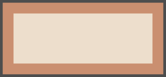
- Symbol, large area greater than 0.000001*: Wilderness
- Symbol Description, large area: Solid, gray outline with a dark brown band on the interior of the polygon area with a light brown fill.
- Symbol, secondary symbol, small area less than or equal to 0.000001*: Wilderness
- Symbol Description, small area: Solid, dark gray outline with a light brown fill on the interior of the polygon area.
Polygon Symbology Specifications
- Layer 1 (Large Area - Solid Stroke):
- Size: 0.70 pt
- Color (R,G,B): 77,77,77
- Transparency: 0%
- Layer 2 (Large Area - Solid Stroke):
- Size: 3.50 pt
- Color (R,G,B): 202,143,112
- Transparency: 0%
- Layer 3 (Large Area - Solid Fill):
- Size: Not applicable
- Color (R,G,B): 237,222,204
- Transparency: 60%
- Layer 1 (Small Area - Solid Stroke):
- Size: 0.70 pt
- Color (R,G,B): 77,77,77
- Transparency: 0%
- Layer 2 (Small Area - Solid Fill):
- Size: Not applicable
- Color (R,G,B): 202,143,112
- Transparency: 30%
Annotation
- Annotation Graphic Depiction:
- Annotation: Wilderness - Annotation
- Annotation Description: Uppercase, brown text with a white halo.
- Font Style: Charis SIL, Bold
- Font Size: 10.00 pt
- Font Color (R,G,B): 112,77,58
- Font Halo Size: 1.00 pt
- Font Halo Color (R,G,B): 255,255,255
- Placement Properties: Regular placement horizontal within the polygon.
INTERNATIONAL
International Boundary
Subtype of International
- FType: Not applicable
- FCode: Not applicable
- Feature Description: The boundary between two independent, self-governing, political entities (for example, the United States and Canada).
- Feature Geometry: Linear
Graphic Depiction

- Point Graphic Depiction: Not applicable
- Linear Graphic Depiction:
- Symbol: International Boundary
- Symbol Description: Dashed, black line.
- Polygon Graphic Depiction: Not applicable
Line Symbology Specifications
- Layer 1 (Stroke - Dash/Gap Pattern: 9·3·3·3·3·3·9·0):
- Size: 1.152 pt
- Color (R,G,B): 0,0,0
- Transparency: 0%
Annotation

- Annotation Graphic Depiction:
- Annotation: International Boundary - Annotation
- Annotation Description: Uppercase, black text with a light gray halo.
- Font Style: Charis SIL, Bold
- Font Size: 9.00 pt
- Font Color (R,G,B): 0,0,0
- Font Halo Size: 1.00 pt
- Font Halo Color (R,G,B): 240,240,240
- Placement Properties: Positioned along polygon boundary.
MILITARY
Air Force
Subtype of Military
- FType: Military
- FCode: 67303
- Feature Description: The aerial warfare, space warfare, and cyberwarfare branch of the U.S. Armed Forces.
- Feature Geometry: Polygon
Graphic Depiction


- Point Graphic Depiction: Not applicable
- Linear Graphic Depiction: Not applicable
- Polygon Graphic Depiction:
- Symbol, large area greater than 0.000001*: Air Force
- Symbol Description, large area: Solid, dark gray outline with a blue band on the interior of the polygon area.
- Symbol, secondary symbol, small area less than or equal to 0.000001*: Air Force
- Symbol Description, small area: Solid, dark gray outline with a light blue fill on the interior of the polygon area.
Polygon Symbology Specifications
- Layer 1 (Large Area - Solid Stroke):
- Size: 0.70 pt
- Color (R,G,B): 77,77,77
- Transparency: 0%
- Layer 2 (Large Area - Solid Stroke):
- Size: 3.50 pt
- Color (R,G,B): 84,148,204
- Transparency: 0%
- Layer 1 (Small Area - Solid Stroke):
- Size: 0.70 pt
- Color (R,G,B): 77,77,77
- Transparency: 0%
- Layer 2 (Small Area - Solid Fill):
- Size: Not applicable
- Color (R,G,B): 84,148,204
- Transparency: 0%
Annotation

- Annotation Graphic Depiction:
- Annotation: Air Force - Annotation
- Annotation Description: Uppercase, blue text with a light gray halo.
- Font Style: Charis SIL
- Font Size: 10.00 pt
- Font Color (R,G,B): 76,103,143
- Font Halo Size: 1.00 pt
- Font Halo Color (R,G,B): 240,240,240
- Placement Properties: Horizontal within the polygon.
Army
Subtype of Military
- FType: Military
- FCode: 67301
- Feature Description: A federal agency and a major Army command that is the world's largest public engineering, design and construction management agency.
- Feature Geometry: Polygon
Graphic Depiction
- Point Graphic Depiction: Not applicable
- Linear Graphic Depiction: Not applicable
- Polygon Graphic Depiction:
- Symbol, large area greater than 0.000001*: Army
- Symbol Description, large area: Solid, dark gray outline with a blue band on the interior of the polygon area.
- Symbol, secondary symbol, small area less than or equal to 0.000001*: Army
- Symbol Description, small area: Solid, dark gray outline with a light blue fill on the interior of the polygon area.
Polygon Symbology Specifications
- Layer 1 (Large Area - Solid Stroke):
- Size: 0.70 pt
- Color (R,G,B): 77,77,77
- Transparency: 0%
- Layer 2 (Large Area - Solid Stroke):
- Size: 3.50 pt
- Color (R,G,B): 84,148,204
- Transparency: 0%
- Layer 1 (Small Area - Solid Stroke):
- Size: 0.70 pt
- Color (R,G,B): 77,77,77
- Transparency: 0%
- Layer 2 (Small Area - Solid Fill):
- Size: Not applicable
- Color (R,G,B): 84,148,204
- Transparency: 0%
Annotation
- Annotation Graphic Depiction:
- Annotation: Army - Annotation
- Annotation Description: Uppercase, blue text with a light gray halo.
- Font Style: Charis SIL
- Font Size: 10.00 pt
- Font Color (R,G,B): 76,103,143
- Font Halo Size: 1.00 pt
- Font Halo Color (R,G,B): 240,240,240
- Placement Properties: Horizontal within the polygon.
Coast Guard
Subtype of Military
- FType: Military
- FCode: 67305
- Feature Description: A branch of the U.S. Armed Forces that is a maritime, military, multi-mission service unique among the military branches for having a maritime law enforcement mission (with jurisdiction in both domestic and international waters) and a federal regulatory agency mission as part of its mission set.
- Feature Geometry: Polygon
Graphic Depiction
- Point Graphic Depiction: Not applicable
- Linear Graphic Depiction: Not applicable
- Polygon Graphic Depiction:
- Symbol, large area greater than 0.000001*: Coast Guard
- Symbol Description, large area: Solid, dark gray outline with a blue band on the interior of the polygon area.
- Symbol, secondary symbol, small area less than or equal to 0.000001*: Coast Guard
- Symbol Description, small area: Solid, dark gray outline with a light blue fill on the interior of the polygon area.
Polygon Symbology Specifications
- Layer 1 (Large Area - Solid Stroke):
- Size: 0.70 pt
- Color (R,G,B): 77,77,77
- Transparency: 0%
- Layer 2 (Large Area - Solid Stroke):
- Size: 3.50 pt
- Color (R,G,B): 84,148,204
- Transparency: 0%
- Layer 1 (Small Area - Solid Stroke):
- Size: 0.70 pt
- Color (R,G,B): 77,77,77
- Transparency: 0%
- Layer 2 (Small Area - Solid Fill):
- Size: Not applicable
- Color (R,G,B): 84,148,204
- Transparency: 0%
Annotation
- Annotation Graphic Depiction:
- Annotation: Coast Guard - Annotation
- Annotation Description: Uppercase, blue text with a light gray halo.
- Font Style: Charis SIL
- Font Size: 10.00 pt
- Font Color (R,G,B): 76,103,143
- Font Halo Size: 1.00 pt
- Font Halo Color (R,G,B): 240,240,240
- Placement Properties: Horizontal within the polygon.
Marine
Subtype of Military
- FType: Military
- FCode: 67304
- Feature Description: The branch of the U.S. Armed Forces responsible for providing force projection from the sea, using the mobility of the United States Navy to rapidly deliver combined-arms task forces.
- Feature Geometry: Polygon
Graphic Depiction
- Point Graphic Depiction: Not applicable
- Linear Graphic Depiction: Not applicable
- Polygon Graphic Depiction:
- Symbol, large area greater than 0.000001*: Marine
- Symbol Description, large area: Solid, dark gray outline with a blue band on the interior of the polygon area.
- Symbol, secondary symbol, small area less than or equal to 0.000001*: Marine
- Symbol Description, small area: Solid, dark gray outline with a light blue fill on the interior of the polygon area.
Polygon Symbology Specifications
- Layer 1 (Large Area - Solid Stroke):
- Size: 0.70 pt
- Color (R,G,B): 77,77,77
- Transparency: 0%
- Layer 2 (Large Area - Solid Stroke):
- Size: 3.50 pt
- Color (R,G,B): 84,148,204
- Transparency: 0%
- Layer 1 (Small Area - Solid Stroke):
- Size: 0.70 pt
- Color (R,G,B): 77,77,77
- Transparency: 0%
- Layer 2 (Small Area - Solid Fill):
- Size: Not applicable
- Color (R,G,B): 84,148,204
- Transparency: 0%
Annotation
- Annotation Graphic Depiction:
- Annotation: Marine - Annotation
- Annotation Description: Uppercase, blue text with a light gray halo.
- Font Style: Charis SIL
- Font Size: 10.00 pt
- Font Color (R,G,B): 76,103,143
- Font Halo Size: 1.00 pt
- Font Halo Color (R,G,B): 240,240,240
- Placement Properties: Horizontal within the polygon.
Military
Subtype of Military
- FType: Military
- FCode: 67300
- Feature Description: Area for carrying out military activities. (Generic examples include: Air Force Base, Ammunition Depot, Arsenal, Bombing and Gunnery Range, Coast Guard Station, Fort, Military Airfield, Military Reservation, National Cemetery, National Guard Training Site, Naval Air Station, Weapons Station).
- Feature Geometry: Polygon
Graphic Depiction
- Point Graphic Depiction: Not applicable
- Linear Graphic Depiction: Not applicable
- Polygon Graphic Depiction:
- Symbol, large area greater than 0.000001*: Military
- Symbol Description, large area: Solid, dark gray outline with a blue band on the interior of the polygon area.
- Symbol, secondary symbol, small area less than or equal to 0.000001*: Military
- Symbol Description, small area: Solid, dark gray outline with a light blue fill on the interior of the polygon area.
Polygon Symbology Specifications
- Layer 1 (Large Area - Solid Stroke):
- Size: 0.70 pt
- Color (R,G,B): 77,77,77
- Transparency: 0%
- Layer 2 (Large Area - Solid Stroke):
- Size: 3.50 pt
- Color (R,G,B): 84,148,204
- Transparency: 0%
- Layer 1 (Small Area - Solid Stroke):
- Size: 0.70 pt
- Color (R,G,B): 77,77,77
- Transparency: 0%
- Layer 2 (Small Area - Solid Fill):
- Size: Not applicable
- Color (R,G,B): 84,148,204
- Transparency: 0%
Annotation
- Annotation Graphic Depiction:
- Annotation: Military - Annotation
- Annotation Description: Uppercase, blue text with a light gray halo.
- Font Style: Charis SIL
- Font Size: 10.00 pt
- Font Color (R,G,B): 76,103,143
- Font Halo Size: 1.00 pt
- Font Halo Color (R,G,B): 240,240,240
- Placement Properties: Horizontal within the polygon.
National Cemetery
Subtype of Military
- FType: Cemetery
- FCode: 67000
- Feature Description: Federal land for burying deceased military personnel, veterans, civilian leaders, national figures, and their eligible family members. Maintained by the National Cemetery Administration, Department of the Army or National Park Service.
- Feature Geometry: Polygon
Graphic Depiction
- Point Graphic Depiction: Not applicable
- Linear Graphic Depiction: Not applicable
- Polygon Graphic Depiction:
- Symbol, large area greater than 0.000001*: National Cemetery
- Symbol Description, large area: Solid, dark gray outline with a blue band on the interior of the polygon area.
- Symbol, secondary symbol, small area less than or equal to 0.000001*: National Cemetery
- Symbol Description, small area: Solid, dark gray outline with a light blue fill on the interior of the polygon area.
Polygon Symbology Specifications
- Layer 1 (Large Area - Solid Stroke):
- Size: 0.70 pt
- Color (R,G,B): 77,77,77
- Transparency: 0%
- Layer 2 (Large Area - Solid Stroke):
- Size: 3.50 pt
- Color (R,G,B): 84,148,204
- Transparency: 0%
- Layer 1 (Small Area - Solid Stroke):
- Size: 0.70 pt
- Color (R,G,B): 77,77,77
- Transparency: 0%
- Layer 2 (Small Area - Solid Fill):
- Size: Not applicable
- Color (R,G,B): 84,148,204
- Transparency: 0%
Annotation
- Annotation Graphic Depiction:
- Annotation: National Cemetery - Annotation
- Annotation Description: Uppercase, blue text with a light gray halo.
- Font Style: Charis SIL
- Font Size: 10.00 pt
- Font Color (R,G,B): 76,103,143
- Font Halo Size: 1.00 pt
- Font Halo Color (R,G,B): 240,240,240
- Placement Properties: Horizontal within the polygon.
National Guard
Subtype of Military
- FType: Military
- FCode: 67306
- Feature Description: A reserve military force composed of state National Guard militia members or units under federally recognized active or inactive armed force service for the United States.
- Feature Geometry: Polygon
Graphic Depiction
- Point Graphic Depiction: Not applicable
- Linear Graphic Depiction: Not applicable
- Polygon Graphic Depiction:
- Symbol, large area greater than 0.000001*: National Guard
- Symbol Description, large area: Solid, dark gray outline with a blue band on the interior of the polygon area.
- Symbol, secondary symbol, small area less than or equal to 0.000001*: National Guard
- Symbol Description, small area: Solid, dark gray outline with a light blue fill on the interior of the polygon area.
Polygon Symbology Specifications
- Layer 1 (Large Area - Solid Stroke):
- Size: 0.70 pt
- Color (R,G,B): 77,77,77
- Transparency: 0%
- Layer 2 (Large Area - Solid Stroke):
- Size: 3.50 pt
- Color (R,G,B): 84,148,204
- Transparency: 0%
- Layer 1 (Small Area - Solid Stroke):
- Size: 0.70 pt
- Color (R,G,B): 77,77,77
- Transparency: 0%
- Layer 2 (Small Area - Solid Fill):
- Size: Not applicable
- Color (R,G,B): 84,148,204
- Transparency: 0%
Annotation
- Annotation Graphic Depiction:
- Annotation: National Guard - Annotation
- Annotation Description: Uppercase, blue text with a light gray halo.
- Font Style: Charis SIL
- Font Size: 10.00 pt
- Font Color (R,G,B): 76,103,143
- Font Halo Size: 1.00 pt
- Font Halo Color (R,G,B): 240,240,240
- Placement Properties: Horizontal within the polygon.
Navy
Subtype of Military
- FType: Military
- FCode: 67302
- Feature Description: The sea branch of the U.S. Armed Forces.
- Feature Geometry: Polygon
Graphic Depiction
- Point Graphic Depiction: Not applicable
- Linear Graphic Depiction: Not applicable
- Polygon Graphic Depiction:
- Symbol, large area greater than 0.000001*: Navy
- Symbol Description, large area: Solid, dark gray outline with a blue band on the interior of the polygon area.
- Symbol, secondary symbol, small area less than or equal to 0.000001*: Navy
- Symbol Description, small area: Solid, dark gray outline with a light blue fill on the interior of the polygon area.
Polygon Symbology Specifications
- Layer 1 (Large Area - Solid Stroke):
- Size: 0.70 pt
- Color (R,G,B): 77,77,77
- Transparency: 0%
- Layer 2 (Large Area - Solid Stroke):
- Size: 3.50 pt
- Color (R,G,B): 84,148,204
- Transparency: 0%
- Layer 1 (Small Area - Solid Stroke):
- Size: 0.70 pt
- Color (R,G,B): 77,77,77
- Transparency: 0%
- Layer 2 (Small Area - Solid Fill):
- Size: Not applicable
- Color (R,G,B): 84,148,204
- Transparency: 0%
Annotation
- Annotation Graphic Depiction:
- Annotation: Navy - Annotation
- Annotation Description: Uppercase, blue text with a light gray halo.
- Font Style: Charis SIL
- Font Size: 10.00 pt
- Font Color (R,G,B): 76,103,143
- Font Halo Size: 1.00 pt
- Font Halo Color (R,G,B): 240,240,240
- Placement Properties: Horizontal within the polygon.
NATIVE AMERICAN AREA
Native American Reservation (Alaska only)
Subtype of Native American Area
- FType: Not applicable
- FCode: 64000
- Feature Description: An area that has been set aside by the federal government or a state government for the use of one or more officially recognized American Indian tribes.
- Feature Geometry: Polygon
Graphic Depiction

- Point Graphic Depiction: Not applicable
- Linear Graphic Depiction: Not applicable
- Polygon Graphic Depiction:
- Symbol: Native American Reservation (Alaska only)
- Symbol Description: Light brown, transparent outline with a light orange, transparent fill.
Polygon Symbology Specifications
- Layer 1 (Solid Stroke):
- Size: 0.29 pt
- Color (R,G,B): 175,75,0
- Transparency: 80%
- Layer 2 (Solid Fill):
- Size: Not applicable
- Color (R,G,B): 255,145,0
- Transparency: 80%
Annotation
- Annotation: Not applicable
PUBLIC LAND SURVEY SYSTEM (PLSS)
PLSS Section
Subtype of Public Land Survey System (PLSS)
- FType: Not applicable
- FCode: Not applicable
- Feature Description: First set of divisions for a Public Land Survey System (PLSS) Township, commonly the section, but can also be lots or tracts or protracted blocks.
- Feature Geometry: Polygon
Graphic Depiction
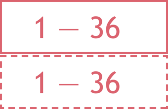
Section line (protracted) - Two layers: A dashed line on top of a solid white line. (lower image)
- Point Graphic Depiction: Not applicable
- Linear Graphic Depiction: Not applicable
- Polygon Graphic Depiction:
- Symbol: PLSS Section
- Symbol Description: Section line - A solid red line. (upper image)
Section line (protracted) - A dashed line on top of a solid white line. (lower image)
Polygon Symbology Specifications
- Layer 1 (Section - Solid Stroke):
- Size: 0.65 pt
- Color (R,G,B): 190,60,70
- Transparency: 0%
- Layer 1 (Protracted: Stroke - Dash/Gap Pattern: 2.16·1.44):
- Size: 0.65 pt
- Color (R,G,B): 190,60,70
- Transparency: 0%
- Layer 2 (Section (Protracted) - Solid Stroke):
- Size: 0.36 pt
- Color (R,G,B): 255,255,255
- Transparency: 0%
Annotation

- Annotation Graphic Depiction:
- Annotation: PLSS Section - Annotation
- Annotation Description: Uppercase, red alphanumeric text with a light gray halo.
- Font Style: Segoe UI
- Font Size: 10.00 pt
- Font Color (R,G,B): 204,32,48
- Font Halo Size: 1.00 pt
- Font Halo Color (R,G,B): 240,240,240
- Placement Properties: Horizontal within the polygon
PLSS Special Survey Land Grants
Subtype of Public Land Survey System (PLSS)
- FType: Not applicable
- FCode: Not applicable
- Feature Description: This feature class contains the Special Surveys that are nonrectangular components of the Public Land Survey System (PLSS) from Bureau of Land Management (BLM) survey records.
- Feature Geometry: Polygon
Graphic Depiction

- Point Graphic Depiction: Not applicable
- Linear Graphic Depiction: Not applicable
- Polygon Graphic Depiction:
- Symbol: PLSS Special Survey Land Grants
- Symbol Description: A dashed, red line on top of a solid white line.
Polygon Symbology Specifications
- Layer 1 (Stroke - Dash/Gap Pattern: 7.2·3.6·1.44·2.16·1.44·3.6):
- Size: 0.65 pt
- Color (R,G,B): 190,60,70
- Transparency: 0%
- Layer 2 (Solid Stroke):
- Size: 0.70 pt
- Color (R,G,B): 255,255,255
- Transparency: 0%
Annotation
- Annotation: Not applicable
PLSS Township / Range
Subtype of Public Land Survey System (PLSS)
- FType: Not applicable
- FCode: Not applicable
- Feature Description: Public Land Survey System (PLSS) Townships, the primary unit of survey for the PLSS.
- Feature Geometry: Polygon
Graphic Depiction
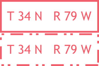
Township/Range line (protracted) - A dashed, red line on top of a solid white line. (lower image)
- Point Graphic Depiction: Not applicable
- Linear Graphic Depiction: Not applicable
- Polygon Graphic Depiction:
- Symbol: PLSS Township / Range
- Symbol Description: Township/Range line - A solid red line. (upper image)
Township/Range line (protracted) - A dashed, red line on top of a solid white line. (lower image)
Polygon Symbology Specifications
- Layer 1 (Township/Range - Solid Stroke):
- Size: 1.25 pt
- Color (R,G,B): 190,60,70
- Transparency: 0%
- Layer 1 (Protracted: Stroke - Dash/Gap Pattern: 2.16·1.44):
- Size: 1.25 pt
- Color (R,G,B): 190,60,70
- Transparency: 0%
- Layer 2 (Township/Range (Protracted) - Solid Stroke):
- Size: 0.72 pt
- Color (R,G,B): 255,255,255
- Transparency: 0%
Annotation

- Annotation Graphic Depiction:
- Annotation: PLSS Township / Range - Annotation
- Annotation Description: Uppercase, red alphanumeric text with a light gray halo.
- Font Style: Segoe UI, Bold
- Font Size: 12.00 pt
- Font Color (R,G,B): 204,32,48
- Font Halo Size: 1.00 pt
- Font Halo Color (R,G,B): 240,240,240
- Placement Properties: Horizontal within the polygon
STATE
Province
Subtype of State
- FType: Not applicable
- FCode: 61102
- Feature Description: A province is a jurisdictional unit within a country that exercises its own constitutional powers.
- Feature Geometry: Polygon
Graphic Depiction

- Point Graphic Depiction: Not applicable
- Linear Graphic Depiction: Not applicable
- Polygon Graphic Depiction:
- Symbol: Province
- Symbol Description: Dashed, black line on top of a solid white line.
Polygon Symbology Specifications
- Layer 1 (Stroke - Dash/Gap Pattern: 9·3·5·3·5·3·9·0):
- Size: 0.86 pt
- Color (R,G,B): 0,0,0
- Transparency: 0%
- Layer 2 (Solid Stroke):
- Size: 1.00 pt
- Color (R,G,B): 255,255,255
- Transparency: 0%
Annotation

- Annotation Graphic Depiction:
- Annotation: Province - Annotation
- Annotation Description: Uppercase, black text with a light gray halo.
- Font Style: Charis SIL
- Font Size: 8.00 pt
- Font Color (R,G,B): 0,0,0
- Font Halo Size: 1.00 pt
- Font Halo Color (R,G,B): 240,240,240
- Placement Properties: Positioned along polygon boundary
State
Subtype of State
- FType: Not applicable
- FCode: 61100
- Feature Description: A primary governmental division of the United States.
- Feature Geometry: Polygon
Graphic Depiction
- Point Graphic Depiction: Not applicable
- Linear Graphic Depiction: Not applicable
- Polygon Graphic Depiction:
- Symbol: State
- Symbol Description: Dashed, black line on top of a solid white line.
Polygon Symbology Specifications
- Layer 1 (Stroke - Dash/Gap Pattern: 9·3·5·3·5·3·9·0):
- Size: 0.86 pt
- Color (R,G,B): 0,0,0
- Transparency: 0%
- Layer 1 (Solid Stroke):
- Size: 1.00 pt
- Color (R,G,B): 255,255,255
- Transparency: 0%
Annotation
- Annotation Graphic Depiction:
- Annotation: State - Annotation
- Annotation Description: Uppercase, black text with a light gray halo.
- Font Style: Charis SIL
- Font Size: 8.00 pt
- Font Color (R,G,B): 0,0,0
- Font Halo Size: 1.00 pt
- Font Halo Color (R,G,B): 240,240,240
- Placement Properties: Positioned along polygon boundary
Territory
Subtype of State
- FType: Not applicable
- FCode: 61101
- Feature Description: A United States jurisdiction that is neither a part of one of the several States nor a federal district (for example, the United States Virgin Islands). The United States Congress determines whether the full United States Constitution or selected parts of the United States Constitution apply to the jurisdiction (incorporated territory and unincorporated territory, respectively).
- Feature Geometry: Polygon
Graphic Depiction
- Point Graphic Depiction: Not applicable
- Linear Graphic Depiction: Not applicable
- Polygon Graphic Depiction:
- Symbol: Territory
- Symbol Description: Dashed, black line on top of a solid white line.
Polygon Symbology Specifications
- Layer 1 (Stroke - Dash/Gap Pattern: 9·3·5·3·5·3·9·0):
- Size: 0.86 pt
- Color (R,G,B): 0,0,0
- Transparency: 0%
- Layer 1 (Solid Stroke):
- Size: 1.00 pt
- Color (R,G,B): 255,255,255
- Transparency: 0%
Annotation
- Annotation Graphic Depiction:
- Annotation: Territory - Annotation
- Annotation Description: Uppercase, black text with a light gray halo.
- Font Style: Charis SIL
- Font Size: 8.00 pt
- Font Color (R,G,B): 0,0,0
- Font Halo Size: 1.00 pt
- Font Halo Color (R,G,B): 240,240,240
- Placement Properties: Positioned along polygon boundary
Related Information
-
US Topo Cartographic Specifications - Map Symbol Guide US Topo Cartographic Specifications - Map Symbol Guide
US Topo cartographic specifications Map Symbol Guide.
US Topo Cartographic Specifications US Topo Cartographic Specifications
This page and associated links define the U.S. Geological Survey (USGS) US Topo digital topographic map cartographic specifications including feature symbology and annotation. The specifications are organized by data sets and themes listed below.
US Topo Cartographic Specifications - Version History US Topo Cartographic Specifications - Version History
This page highlights version history and details the refinements made to the published US Topo Cartographic Specifications.
US Topo Cartographic Specifications - Elevation US Topo Cartographic Specifications - Elevation
US Topo cartographic specifications including feature symbology and labels for elevation generated contours.
US Topo Cartographic Specifications - Geographic Names US Topo Cartographic Specifications - Geographic Names
US Topo cartographic specifications including feature symbology and annotation for Geographic Names Landforms.
US Topo Cartographic Specifications - Government Units US Topo Cartographic Specifications - Government Units
US Topo cartographic specifications including feature symbology and labels for Government Units (Boundaries) including County or Equivalent, Designated Areas, Federally Managed Lands, International, Military, Native American Area, Public Land Survey System (PLSS), and State.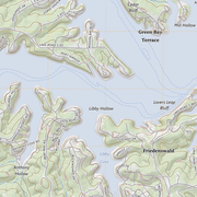
US Topo Cartographic Specifications - Hydrography US Topo Cartographic Specifications - Hydrography
US Topo cartographic specifications including feature symbology and annotation for Hydrography including NHDArea, NHDFlowline, NHDLine, NHDPoint, NHDWaterbody, and National Wetland Inventory (NWI).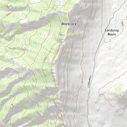
US Topo Cartographic Specifications - Land Cover US Topo Cartographic Specifications - Land Cover
US Topo cartographic specifications including feature symbology and annotation for Land Cover including Woodland.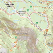
US Topo Cartographic Specifications - Structures US Topo Cartographic Specifications - Structures
US Topo cartographic specifications including feature symbology and labels for Structures including Emergency / Medical, Pipeline, Public Services, and Recreation.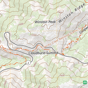
US Topo Cartographic Specifications - Transportation US Topo Cartographic Specifications - Transportation
US Topo cartographic specifications including feature symbology and annotation for Transportation including Airport, Rail, Route, and Trail.