
US Topo Cartographic Specifications - Version History
This page highlights version history and details the refinements made to the published US Topo Cartographic Specifications.
Click a version number to jump to the associated history notes:
1.0 | 1.1 | 1.2 | 1.3 | 1.4 |
2026:
Version 1.4
Published: 07/21/2026
Summary: Added Contacts, Other Resources, and Related Information sections to pages.
Elevation
- Added Contacts block
- Added Other Resources links
Geographic Names
- Added Contacts block
- Added Other Resources links
Government Units (Boundaries)
- Added Contacts block
- Added Other Resources links
Hydrography
- Added Contacts block
- Added Other Resources links
Land Cover
- Added Contacts block
- Added Other Resources links
Structures
- Added Contacts block
- Added Other Resources links
- Added links to National Structures Dataset - Data Model Poster
Transportation
- Added Contacts block
- Added Other Resources links
- Added links to National Transportation Dataset - Data Model Poster
Version History
- Added Contacts block
- Added Other Resources links
Version 1.3
Published: 2/13/2026
Summary: Version History tracking page publicly released for US Topo Cartographic Specifications.
Version History
- New Version History tracking page for cartographic specifications publicly released for US Topo
2025:
Version 1.2
Published: 5/9/2025
Summary: Reformatted landing page with an image card layout with unique images for each cartographic specification theme.
Layout
- Image card layout redesign with links to each cartographic specification theme
Version 1.1
Published: 2/20/2025
Summary: Replaced all images and supplemented tags for improved display and content discovery for all cartographic specification themes including Elevation, Geographic Names, Government Units (Boundaries), Hydrography, Land Cover, Structures, and Transportation published on 2/20/2025.
Elevation
- Replaced all symbols with higher resolution images for an improved display on all platforms
- Supplemented tags to improve content discovery
- Spelling and general format improvements
Geographic Names
- Replaced all symbols with higher resolution images for an improved display on all platforms
- Supplemented tags to improve content discovery
- Spelling and general format improvements
Government Units (Boundaries)
- Replaced all symbols with higher resolution images for an improved display on all platforms
- Supplemented tags to improve content discovery
- Spelling and general format improvements
Hydrography
- Replaced all symbols with higher resolution images for an improved display on all platforms
- Supplemented tags to improve content discovery
- Spelling and general format improvements
Land Cover
- Replaced all symbols with higher resolution images for an improved display on all platforms
- Supplemented tags to improve content discovery
- Spelling and general format improvements
Structures
- Replaced all symbols with higher resolution images for an improved display on all platforms
- Supplemented tags to improve content discovery
- Spelling and general format improvements
Transportation
- Replaced all symbols with higher resolution images for an improved display on all platforms
- Supplemented tags to improve content discovery
- Spelling and general format improvements
2023:
Version 1.0
Published: 9/25/2023
Summary: Complete set of cartographic specifications for Elevation, Geographic Names, Government Units (Boundaries), Hydrography, Land Cover, Structures, and Transportation published on 9/25/2023.
Related Information
Related Information
-
US Topo Cartographic Specifications US Topo Cartographic Specifications
This page and associated links define the U.S. Geological Survey (USGS) digital topographic map (US Topo) cartographic specifications including feature symbology and annotation. The specifications are organized by data sets and themes listed below.
US Topo Cartographic Specifications - Version History US Topo Cartographic Specifications - Version History
This page highlights version history and details the refinements made to the published US Topo Cartographic Specifications.
US Topo Cartographic Specifications - Elevation US Topo Cartographic Specifications - Elevation
US Topo cartographic specifications for elevation generated contours.
US Topo Cartographic Specifications - Geographic Names US Topo Cartographic Specifications - Geographic Names
US Topo cartographic specifications for Geographic Names Landforms.
US Topo Cartographic Specifications - Government Units US Topo Cartographic Specifications - Government Units
US Topo cartographic specifications for governmental units including Bureau of Land Management, Counties, International, Military, Native American Areas, Public Land Survey System, States, Forest Service, and Wildlife boundaries.
US Topo Cartographic Specifications - Hydrography US Topo Cartographic Specifications - Hydrography
US Topo cartographic specifications for Hydrography including NHDArea, NHDFlowline, NHDLine, NHDPoint, NHDWaterbody, and National Wetland Inventory (NWI).
US Topo Cartographic Specifications - Land Cover US Topo Cartographic Specifications - Land Cover
US Topo cartographic specifications for Land Cover including Woodland.
US Topo Cartographic Specifications - Structures US Topo Cartographic Specifications - Structures
US Topo cartographic specifications for Structures including Emergency Services, Medical Services, Pipelines, Public Services, and Recreation.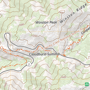
US Topo Cartographic Specifications - Transportation US Topo Cartographic Specifications - Transportation
US Topo cartographic specifications for Transportation including Airport, Rail, Route, and Trail.