
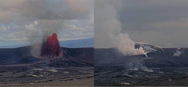
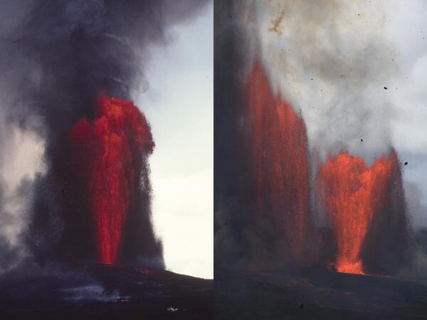
Comparison images from June 14, 2026, showing the episode 49 lava fountain at 11:01 a.m. (left) and the same location at 5:59 p.m., shortly after the fountaining stopped (right). Only the north vent produced lava fountaining during episode 49, while the south vent (located to the left of the fountain) displayed some minor spattering and jetting.
Multimedia
Webcams—Near-real-time images from webcams.
Videos—Collection of videos recorded during field excursions or caught on our webcams.
Image Galleries—Galleries of images and events with expanded descriptions.
The Kīlauea Photo and Video Chronology and Mauna Loa Photo and Video Chronology webpages also feature photos.
Images
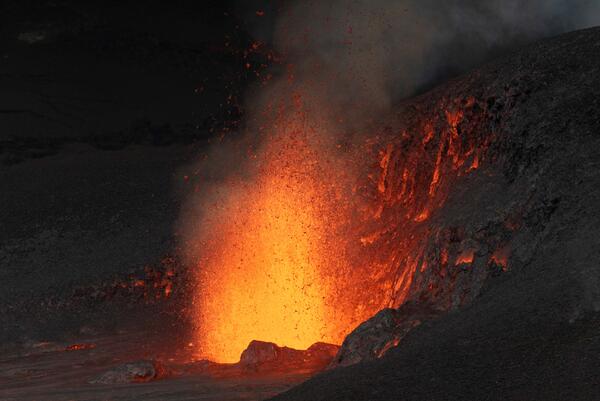
Kīlauea episode 49 during and after fountaining
Comparison images from June 14, 2026, showing the episode 49 lava fountain at 11:01 a.m. (left) and the same location at 5:59 p.m., shortly after the fountaining stopped (right). Only the north vent produced lava fountaining during episode 49, while the south vent (located to the left of the fountain) displayed some minor spattering and jetting.
Volcano Minute Logo
Logo for the Volcano Minute, a brief audio update about eruptions, earthquakes, or ongoing volcano science in Hawaii brought to you by scientists and affiliates of the U.S. Geological Survey Hawaiian Volcano Observatory.
Logo for the Volcano Minute, a brief audio update about eruptions, earthquakes, or ongoing volcano science in Hawaii brought to you by scientists and affiliates of the U.S. Geological Survey Hawaiian Volcano Observatory.
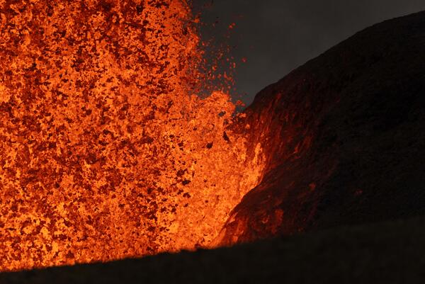
June 14, 2026 — Kīlauea north vent base during episode 49
June 14, 2026 — Kīlauea north vent base during episode 49This telephoto view of the north vent lava fountain during episode 49 on June 14. 2026, shows the incandescent lava landing on and illuminating the Halema‘uma‘u crater wall. USGS photo by T. Paladino.
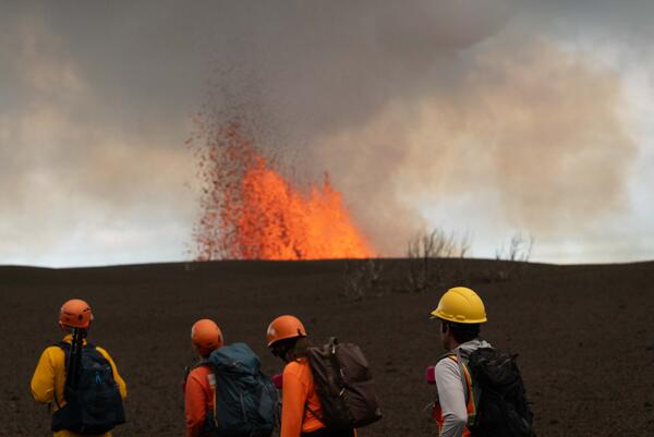
June 14, 2026 — Monitoring Kīlauea eruption episode 49
June 14, 2026 — Monitoring Kīlauea eruption episode 49USGS scientists traverse the tephra deposit from the ongoing Kīlauea summit eruption in Halema‘uma‘u on June 14, 2026, to collect real-time measurements of lava fountain heights, tephra dispersal, and crater floor coverage during episode 49.
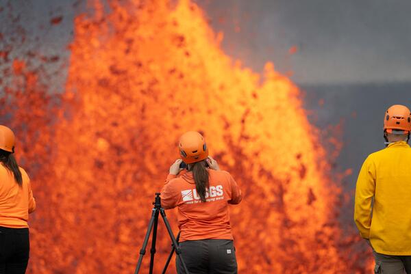
June 14, 2026 — Monitoring Kīlauea episode 49
During lava fountaining episodes at the summit of Kīlauea, USGS Hawaiian Volcano Observatory scientists use laser rangefinders to estimate high how the lava fountains are reaching above the vents and how far the lava flows have traveled from the vents. Additionally, they document eruption dynamics and record eruptive activity using high-resolution cameras.
During lava fountaining episodes at the summit of Kīlauea, USGS Hawaiian Volcano Observatory scientists use laser rangefinders to estimate high how the lava fountains are reaching above the vents and how far the lava flows have traveled from the vents. Additionally, they document eruption dynamics and record eruptive activity using high-resolution cameras.
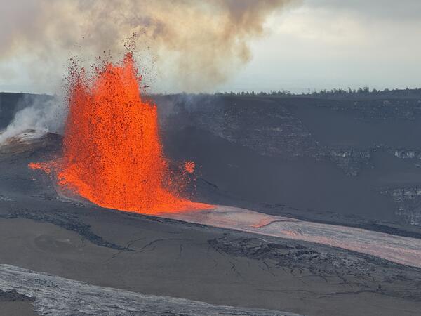
June 14, 2026 — Episode 49 at the summit of Kīlauea as it was ending
June 14, 2026 — Episode 49 at the summit of Kīlauea as it was endingEpisode 49 of the Kīlauea summit eruption in Halema‘uma‘u ended abruptly by 5:05 p.m. HST on June 14, after 7.5 hours of lava fountaining activity from the north vent. The final waning stage of fountaining activity lasted less than 5 minutes, during which the lava fountain dropped below 60-80 meters (200-260 ft) in height.
Videos

June 14, 2026 — V3cam video of dust devil during Kīlauea episode 49 of lava fountaining
June 14, 2026 — V3cam video of dust devil during Kīlauea episode 49 of lava fountainingThis video, taken just after 2 p.m. HST on June 14, 2026, shows a dust devil, or puahiohio, forming within Halemaʻumaʻu crater at the summit of Kīlauea during lava fountaining episode 49.

June 1, 2026 — Video of episode 48 lava fountain at the summit of Kīlauea
June 1, 2026 — Video of episode 48 lava fountain at the summit of KīlaueaLava fountains of episode 48 started at 4:40 a.m. HST from the north vent in Halema‘uma‘u crater at the summit of Kīlauea volcano. This video was taken just after 7 a.m. and shows most of the tephra fallout from the lava fountain landing back in the crater. USGS video by L. Gallant.

June 1, 2026 — V1cam video of whirlwind after episode 48 of lava fountaining at Kīlauea summit
June 1, 2026 — V1cam video of whirlwind after episode 48 of lava fountaining at Kīlauea summitRain at Kīlauea summit following nine hours of lava fountaining during episode 48 on June 1, 2026, created steamy conditions within Halemaʻumaʻu, the crater floor of which was 40% covered with new lava flows during the episode. In the V1cam, a prominent whirlwind (puahiohio in ʻŌlelo Hawaiʻi, or the Hawaiian language) was visible forming at 4:47 p.m.

June 1, 2026 — Video of episode 48 lava fountain within Halemaʻumaʻu at Kīlauea summit
June 1, 2026 — Video of episode 48 lava fountain within Halemaʻumaʻu at Kīlauea summitEpisode 48 lava fountain from the north vent in Halemaʻumaʻu crater, at the summit of Kīlauea volcano, as viewed from near Uēkahuna overlook in Hawaiʻi Volcanoes National Park. USGS video by M. Decker.

May 14-15, 2026 — KWcam timelapse video of episode 47 of lava fountaining at Kīlauea summit
May 14-15, 2026 — KWcam timelapse video of episode 47 of lava fountaining at Kīlauea summitThis video was taken by the KWcam, located on the north rim of Halemaʻumaʻu crater, during episode 47 of lava fountaining at the summit of Kīlauea on May 14-15, 2026. The episode began at 3:27 p.m., with a lava fountains from the north vent feeding lava flows that progressively traverse across the floor of the crater.

May 14-15, 2026 — B1cam timelapse video of episode 47 of lava fountaining at Kīlauea summit
May 14-15, 2026 — B1cam timelapse video of episode 47 of lava fountaining at Kīlauea summitThis video was taken by the B1cam, located on the south rim of Halemaʻumaʻu crater, during episode 47 of lava fountaining at the summit of Kīlauea on May 14-15, 2026. The episode began at 3:27 p.m., with a lava fountaining feeding lava flows across the floor of the crater. Although lava stopped erupting from the north vent at 12:27 a.m.
Audio
Volcano Minute — Episodes and Eruptions
The Volcano Minute is a brief audio update about eruptions, earthquakes, or ongoing volcano science in Hawaii, brought to you by scientists and affiliates of the U.S. Geological Survey Hawaiian Volcano Observatory.
The Volcano Minute is a brief audio update about eruptions, earthquakes, or ongoing volcano science in Hawaii, brought to you by scientists and affiliates of the U.S. Geological Survey Hawaiian Volcano Observatory.
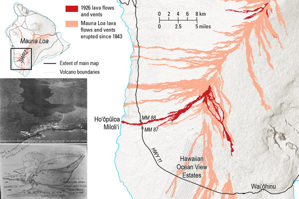
Volcano Minute — The 1926 eruption of Mauna Loa occurred 100 years ago this year
Volcano Minute — The 1926 eruption of Mauna Loa occurred 100 years ago this yearThe Volcano Minute is a brief audio update about eruptions, earthquakes, or ongoing volcano science in Hawaii, brought to you by scientists and affiliates of the U.S. Geological Survey Hawaiian Volcano Observatory.
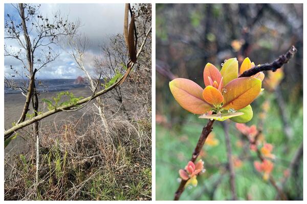
Volcano Minute — What happened to the leaves around Kīlauea summit?
Volcano Minute — What happened to the leaves around Kīlauea summit?The Volcano Minute is a brief audio update about eruptions, earthquakes, or ongoing volcano science in Hawaii, brought to you by scientists and affiliates of the U.S. Geological Survey Hawaiian Volcano Observatory.
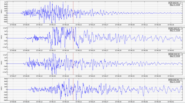
Volcano Minute — Magnitude-6.0 earthquake on May 22, 2026
Volcano Minute — Magnitude-6.0 earthquake on May 22, 2026The Volcano Minute is a brief audio update about eruptions, earthquakes, or ongoing volcano science in Hawaii, brought to you by scientists and affiliates of the U.S. Geological Survey Hawaiian Volcano Observatory.
Volcano Minute — Kīlauea's Halemaʻumaʻu eruption reaches a historic milestone
Volcano Minute — Kīlauea's Halemaʻumaʻu eruption reaches a historic milestoneThe Volcano Minute is a brief audio update about eruptions, earthquakes, or ongoing volcano science in Hawaii, brought to you by scientists and affiliates of the U.S. Geological Survey Hawaiian Volcano Observatory.
Volcano Minute — Forecasting fountaining episodes at Kīlauea's summit
Volcano Minute — Forecasting fountaining episodes at Kīlauea's summitIt’s Volcano Minute, brought to you by the USGS Hawaiian Volcano Observatory.
Volcano Minute — Forecasting fountaining episodes at Kīlauea's summit
Volcano Minute — Forecasting fountaining episodes at Kīlauea's summitIt’s Volcano Minute, brought to you by the USGS Hawaiian Volcano Observatory.
Webcams
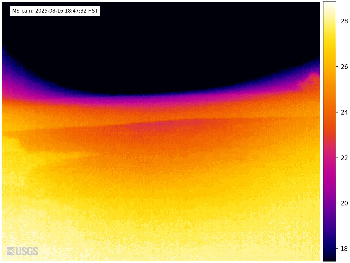
[MSTcam] South Pit and Upper Southwest Rift Zone - thermal image from Moku‘āweoweo south rim
[MSTcam] South Pit and Upper Southwest Rift Zone - thermal image from Moku‘āweoweo south rimThis image is from a research camera positioned on the south rim of Mokuʻāweoweo, Mauna Loa's summit caldera, in Hawaiʻi Volcanoes National Park. The camera looks west-southwest, across South Pit, focusing on the south part of Mauna Loa's summit region and upper Southwest Rift Zone.
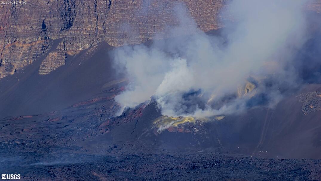
[V3cam] Kīlauea volcano, Hawaii (south Halemaʻumaʻu crater)
[V3cam] Kīlauea volcano, Hawaii (south Halemaʻumaʻu crater)Last 24 Hours - Live view of Halemaʻumaʻu crater within Kaluapele (Kīlauea caldera), from the south rim of the crater [V3cam]. This camera is a pan-tilt-zoom model and the view may change depending on activity.
Disclaimer
[V2cam] Kīlauea volcano, Hawaii (east Halemaʻumaʻu crater)
[V2cam] Kīlauea volcano, Hawaii (east Halemaʻumaʻu crater)Live view of Kaluapele (Kīlauea caldera) and Halemaʻumaʻu crater, from the northeast rim of the caldera [V2cam]. This camera is a pan-tilt-zoom model and the view may change depending on activity.
Disclaimer

[KOcam] Live Image of upper East Rift Zone from Maunaulu
[KOcam] Live Image of upper East Rift Zone from MaunauluThis image is from a temporary research camera positioned near Maunaulu, looking northwest toward the upper East Rift Zone of Kīlauea.
Disclaimer
[KOcam] Live Image of upper East Rift Zone from Maunaulu
[KOcam] Live Image of upper East Rift Zone from MaunauluThis image is from a temporary research camera positioned near Maunaulu, looking northwest toward the upper East Rift Zone of Kīlauea.
Disclaimer

[MDLcam] The Upper and Middle Parts of Mauna Loa's Southwest Rift Zone
[MDLcam] The Upper and Middle Parts of Mauna Loa's Southwest Rift ZoneLive image of Mauna Loa's upper and middle Southwest Rift Zone from Dandelion Cone along the middle part of the rift zone [MDLcam]. This camera is a pan-tilt-zoom model and the view may change depending on activity.
Disclaimer

[MSPcam] Mauna Loa's Southwest Rift Zone from the South Point area
[MSPcam] Mauna Loa's Southwest Rift Zone from the South Point areaLive image of Mauna Loa's Southwest Rift Zone from the South Point area [MSPcam]. This camera is a pan-tilt-zoom model and the view may change depending on activity.
Disclaimer