

Day 4 sandstone formations
Images
Explore our planet through photography and imagery, including climate change and water all the way back to the 1800s when the USGS was surveying the country by horse and buggy.
Filter Total Items: 21365


Tent with buttes
Day 3 Tent with buttes at dawn
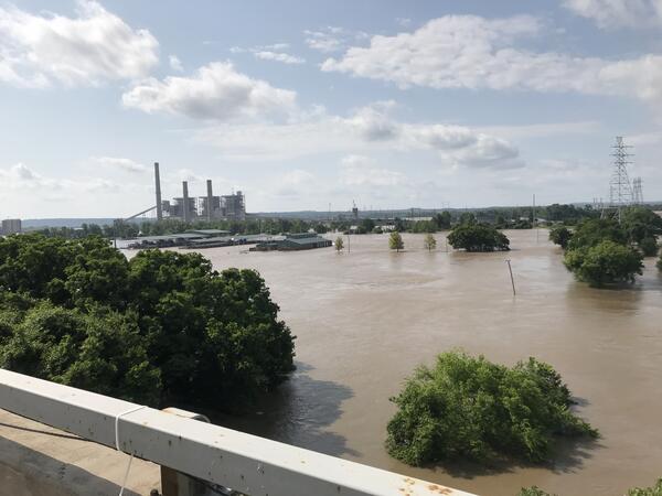
US Highway 62 bridge, Arkansas River near Muskogee, OK flooding
US Highway 62 bridge, Arkansas River near Muskogee, OK floodingLooking downstream from U.S. Highway 62 bridge at the widespread flooding and backwater conditions on the Arkansas River near Muskogee, Oklahoma, May 31, 2019.
U.S. Geological Survey Open-File Report 2020–1090


USGS personnel at the end of their journey at the Gates of Lodore, Gre
USGS personnel at the end of their journey at the Gates of Lodore, GreMembers of USGS Team B and paper Powell sharing a moment at the end of their 4-day river journey at the Gates of Lodore
USGS personnel at the end of their journey at the Gates of Lodore, Gre
USGS personnel at the end of their journey at the Gates of Lodore, GreMembers of USGS Team B and paper Powell sharing a moment at the end of their 4-day river journey at the Gates of Lodore

View towards Firehole
Day 2 Rusty looking towards Firehole public use area
Day 2 Rusty looking towards Firehole public use area

View towards town of Green River from scenic overlook
View towards town of Green River from scenic overlookView towards town of Green River from scenic overlook
View towards town of Green River from scenic overlook
View towards town of Green River from scenic overlookView towards town of Green River from scenic overlook

Wet photography
Day 5 SCREE Bailey Edward taking wet photo

Yellow SCREE expedition raft in Browns Park, Green River.
Yellow SCREE expedition raft in Browns Park, Green River.The yellow raft of SCREE expedition leader, Tom Minckley, floating through calm waters of Browns Park National Wildlife Refuge, Colorado. The far bank in the midground of the photo are the exposed sediments of the pre-dam floodplain of the Green River. The layers of rock in the background are the exposed layers of the red Uinta Mountain Group quartzite.

A close-up of the water ponds at the bottom of Halema‘uma‘u, using a
A close-up of the water ponds at the bottom of Halema‘uma‘u, using aA close-up of the water ponds at the bottom of Halema‘uma‘u, using a zoom lens on the thermal camera. The smaller hot patches above the main pond show areas of warm water in the smaller ponds.

Acoustic Telemetry Used to Track Fish
Staff from the USGS Great Lakes Science Center gaze at the Mackinac Bridge rising above the mist in the Straits of Mackinac, Michigan. The lines they are holding are attached to grappling hooks being used to retrieve acoustic telemetry equipment anchored on the bottom of the straits.
Staff from the USGS Great Lakes Science Center gaze at the Mackinac Bridge rising above the mist in the Straits of Mackinac, Michigan. The lines they are holding are attached to grappling hooks being used to retrieve acoustic telemetry equipment anchored on the bottom of the straits.

Cliff Swallow Nests in Swallow Canyon
A group of cliff swallow nests made from mud in the river in Swallow Canyon. Many of the nests have birds in them and can be identified by their yellow beaks sticking out.
A group of cliff swallow nests made from mud in the river in Swallow Canyon. Many of the nests have birds in them and can be identified by their yellow beaks sticking out.

Continued slow rise of water level at bottom of Halema‘uma‘u
Continued slow rise of water level at bottom of Halema‘uma‘uThe water level continues to slowly rise at the bottom of Halema‘uma‘u, resulting in enlargement and merging of the small ponds. Today, the second and third ponds (top of image) observed over the weekend have merged, and are nearly connected to the main pond (bottom of image). For scale, the main pond is about 15 meters (yards) wide.
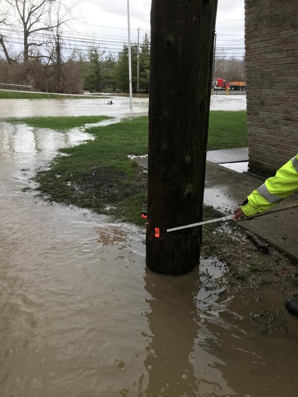
Cuyahoga River at Independence OH - 2018 high water mark
Cuyahoga River at Independence OH - 2018 high water markCuyahoga River at Independence OH - 2018 high water mark
Cuyahoga River at Independence OH - 2018 high water mark
Cuyahoga River at Independence OH - 2018 high water markCuyahoga River at Independence OH - 2018 high water mark

Cuyahoga River at Independence OH - flood water in gage house
Cuyahoga River at Independence OH - flood water in gage houseCuyahoga River at Independence OH - flood water in gage house
Cuyahoga River at Independence OH - flood water in gage house
Cuyahoga River at Independence OH - flood water in gage houseCuyahoga River at Independence OH - flood water in gage house

Entering Swallow Canyon of the Green River
View looking downstream at the red sandstone walls of Swallow Canyon. This small canyon is one of two canyons that divide Browns Park into series of intermittent alluvial-meandering and bedrock canyon segments. Unlike Red Canyon and Lodore Canyon, the slope of Swallow Canyon is not controlled by debris flows, and thus does not have any rapids.
View looking downstream at the red sandstone walls of Swallow Canyon. This small canyon is one of two canyons that divide Browns Park into series of intermittent alluvial-meandering and bedrock canyon segments. Unlike Red Canyon and Lodore Canyon, the slope of Swallow Canyon is not controlled by debris flows, and thus does not have any rapids.

Majestic eagle
A close-up of a bald eagle hanging out on a cliff along the Green River in swallow canyon
A close-up of a bald eagle hanging out on a cliff along the Green River in swallow canyon