Halema‘uma‘u crater eruption, Kīlauea summit—March 2, 2021
Halema‘uma‘u crater eruption, Kīlauea summit—March 2, 2021This video clip shows the inlet zone where lava enters the lake in Halema‘uma‘u crater, at the summit of Kīlauea.


Official websites use .gov
A .gov website belongs to an official government organization in the United States.

Secure .gov websites use HTTPS
A lock () or https:// means you’ve safely connected to the .gov website. Share sensitive information only on official, secure websites.

Explore a diverse collection of engaging videos showcasing the latest research, discoveries, and educational content from the U.S. Geological Survey. Dive into the fascinating world of geology, hydrology, ecology, and natural hazards as we bring science to life. Stay informed and inspired by our visual storytelling that highlights the vital work of USGS scientists and their impact on the planet.

This video clip shows the inlet zone where lava enters the lake in Halema‘uma‘u crater, at the summit of Kīlauea.
This video clip shows the inlet zone where lava enters the lake in Halema‘uma‘u crater, at the summit of Kīlauea.

Mike Poland, Scientist-in-Charge of the Yellowstone Volcano Observatory, debunks the misconception that if Yellowstone were to erupt, it would be Armageddon. In fact, the most common form of eruptive activity at Yellowstone is a lava flow, and even those aren't that common. They happen only once every few tens of thousands of years.
Mike Poland, Scientist-in-Charge of the Yellowstone Volcano Observatory, debunks the misconception that if Yellowstone were to erupt, it would be Armageddon. In fact, the most common form of eruptive activity at Yellowstone is a lava flow, and even those aren't that common. They happen only once every few tens of thousands of years.

The remote ice fields of southern Chile have seen some dramatic change over the past three decades; change made clear by Landsat's deep archive of imagery. In 1987, the terminus of Erasmo Glacier was at the end of a low sloping valley. By 2015 it had retreated almost 3 kilometers, and formed a water body referred to as a proglacial lake.
The remote ice fields of southern Chile have seen some dramatic change over the past three decades; change made clear by Landsat's deep archive of imagery. In 1987, the terminus of Erasmo Glacier was at the end of a low sloping valley. By 2015 it had retreated almost 3 kilometers, and formed a water body referred to as a proglacial lake.

USGS scientists collect water quality samples in the San Francisco Bay. The samples have been collected at the same locations for >50 years and are part of one of the longest running datasets of its kind in the United States.
USGS scientists collect water quality samples in the San Francisco Bay. The samples have been collected at the same locations for >50 years and are part of one of the longest running datasets of its kind in the United States.

Agenda:
Links:
Agenda:
Links:

What stories do rocks tell? What techniques do scientists use to study volcanoes? Dr. Heather Wright talks about the May 18, 1980 eruption of Mount St. Helens, provides an overview of volcanoes and how they erupt, and shows why scientists continue to monitor this active volcano, in this presentation to the Sno-Isle Libraries’ 2021 Whidbey Reads program.
What stories do rocks tell? What techniques do scientists use to study volcanoes? Dr. Heather Wright talks about the May 18, 1980 eruption of Mount St. Helens, provides an overview of volcanoes and how they erupt, and shows why scientists continue to monitor this active volcano, in this presentation to the Sno-Isle Libraries’ 2021 Whidbey Reads program.

What do USGS Hydrologic Technicians do on the job? This video features two Hydrologic Technicians from the South Atlantic Water Science Center sharing how they inspect streamgages, which is an integral part of a Hydrologic Technician's work. This video was sponsored by the USGS Hydrologic Data Advisory Committee.
What do USGS Hydrologic Technicians do on the job? This video features two Hydrologic Technicians from the South Atlantic Water Science Center sharing how they inspect streamgages, which is an integral part of a Hydrologic Technician's work. This video was sponsored by the USGS Hydrologic Data Advisory Committee.

This video shows a close-up of the small inlet where lava enters the lava lake in Halema‘uma‘u crater, at the summit of Kīlauea. The inlet consists of a small upwelling zone, with lava rapidly developing a thin flexible crust as it moves away from the source.
This video shows a close-up of the small inlet where lava enters the lava lake in Halema‘uma‘u crater, at the summit of Kīlauea. The inlet consists of a small upwelling zone, with lava rapidly developing a thin flexible crust as it moves away from the source.

On February 11, 2021, no major changes were observed at the lava lake within Halema‘uma‘u crater, at the summit of Kīlauea. The inlet site where lava is entering the lake had a small upwelling zone raised slightly above the surrounding lake surface.
On February 11, 2021, no major changes were observed at the lava lake within Halema‘uma‘u crater, at the summit of Kīlauea. The inlet site where lava is entering the lake had a small upwelling zone raised slightly above the surrounding lake surface.

An overflight today provided aerial views of Kīlauea's ongoing summit eruption. No major changes were observed at the lava lake in Halema‘uma‘u crater. Active surface lava is still largely limited to the western portion of the lake. Snow on Mauna Kea can be seen in the distance.
An overflight today provided aerial views of Kīlauea's ongoing summit eruption. No major changes were observed at the lava lake in Halema‘uma‘u crater. Active surface lava is still largely limited to the western portion of the lake. Snow on Mauna Kea can be seen in the distance.

Welcome to the "The I Am A..." series. This is the fifth video in a series of USGS whiteboard animations that highlight USGS careers.
Welcome to the "The I Am A..." series. This is the fifth video in a series of USGS whiteboard animations that highlight USGS careers.

This video clip from February 4, 2021, shows the erupting west vent and the growing lava lake within Halema'uma'u. The start of this video focuses on the active western portion of the lava lake, which measured approximately 212 m (696 ft) deep at this time. A plume of volcanic gas is seen rising continuously from the west vent.
This video clip from February 4, 2021, shows the erupting west vent and the growing lava lake within Halema'uma'u. The start of this video focuses on the active western portion of the lava lake, which measured approximately 212 m (696 ft) deep at this time. A plume of volcanic gas is seen rising continuously from the west vent.

Presenter: Ethan Shavers, USGS National Geospatial Program Center for Excellence in GIS (CEGIS)
Topic: Automating Validation and Update of the NHD
Presenter: Ethan Shavers, USGS National Geospatial Program Center for Excellence in GIS (CEGIS)
Topic: Automating Validation and Update of the NHD

Eruptive activity continues at the lava lake in Halema‘uma‘u crater, at the summit of Kīlauea. This video was taken on February 1 from the morning helicopter overflight. The western fissure supplies lava to the lake at an inlet site along the west lake margin. Activity has been stable in recent days with no major changes.
Eruptive activity continues at the lava lake in Halema‘uma‘u crater, at the summit of Kīlauea. This video was taken on February 1 from the morning helicopter overflight. The western fissure supplies lava to the lake at an inlet site along the west lake margin. Activity has been stable in recent days with no major changes.

Mike Poland, Scientist-in-Charge of the Yellowstone Volcano Observatory, gives an overview of activity at Yellowstone Volcano during January 2021.
Mike Poland, Scientist-in-Charge of the Yellowstone Volcano Observatory, gives an overview of activity at Yellowstone Volcano during January 2021.

Eruptive activity continues within Halema‘uma‘u crater, at the summit of Kīlauea. The western fissure continues to supply lava into the lava lake, with active surface lava largely confined to the western portion of the lake.
Eruptive activity continues within Halema‘uma‘u crater, at the summit of Kīlauea. The western fissure continues to supply lava into the lava lake, with active surface lava largely confined to the western portion of the lake.
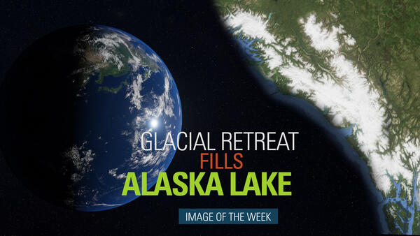
The visible impact of climate change on the Earth’s surface is often clearest in the Arctic’s receding glaciers and swelling glacial lakes. Southeastern Alaska’s Harlequin Lake is one of the fastest-growing in North America. These false color Landsat images show the rapidly-retreating Yakutat Glacier, which feeds the lake.
The visible impact of climate change on the Earth’s surface is often clearest in the Arctic’s receding glaciers and swelling glacial lakes. Southeastern Alaska’s Harlequin Lake is one of the fastest-growing in North America. These false color Landsat images show the rapidly-retreating Yakutat Glacier, which feeds the lake.

Alaska's coastal and offshore waters provide foraging habitat for an estimated 100 million birds comprising more than 90 different species. Researchers at the USGS Alaska Science Center work in collaboration with many partner agencies, non-governmental organizations, universities and rehabilitation centers to investigate seabirds.
Alaska's coastal and offshore waters provide foraging habitat for an estimated 100 million birds comprising more than 90 different species. Researchers at the USGS Alaska Science Center work in collaboration with many partner agencies, non-governmental organizations, universities and rehabilitation centers to investigate seabirds.

The surface temperature of the land changes rapidly across the world throughout the course of one year. This video shows the changing temperatures throughout 2020 using 8-day land surface temperature (LST) data from the Terra MODIS satellite sensor.
The surface temperature of the land changes rapidly across the world throughout the course of one year. This video shows the changing temperatures throughout 2020 using 8-day land surface temperature (LST) data from the Terra MODIS satellite sensor.

Because Mauna Loa has been quiet for almost 30 years, residents may not be aware that Mauna Loa is an active volcano. When Mauna Loa erupts, it is capable of disrupting lives and commerce throughout the Island of Hawai‘i. What can we learn from Mauna Loa’s past eruptions?
Because Mauna Loa has been quiet for almost 30 years, residents may not be aware that Mauna Loa is an active volcano. When Mauna Loa erupts, it is capable of disrupting lives and commerce throughout the Island of Hawai‘i. What can we learn from Mauna Loa’s past eruptions?

Cyclic fluctuations in eruptive vigor were present recently at the western fissure in Halema‘uma‘u, at the summit of Kīlauea. The cycles occurred on January 22 and 23, with cycles lasting 5-6 minutes. Peaks in the cycles were expressed as high flow rates in the channel and spattering at the vents. During troughs in the cycles, the channel became nearly inactive.
Cyclic fluctuations in eruptive vigor were present recently at the western fissure in Halema‘uma‘u, at the summit of Kīlauea. The cycles occurred on January 22 and 23, with cycles lasting 5-6 minutes. Peaks in the cycles were expressed as high flow rates in the channel and spattering at the vents. During troughs in the cycles, the channel became nearly inactive.