
Deep Dive: Enhancing Economic and National Security for Alaska and the Nation
Alaska’s vast natural resources and strategic location play a vital role in supporting U.S. economic strength and security. Explore how science from the Alaska CASC is supporting natural resource management, energy development, and national security.
North to the Future: Alaska’s Abundant Natural Resource Potential
Alaska is home to a wealth of natural resources that fuel its economy. The North Slope contains some of the largest oil and gas fields in the country, the Southeast and Southcentral coasts harbor high quality timber, and the state’s waters yield billions of dollars per year in fisheries harvests. Alaska also holds vast, largely untapped coal reserves and is a major producer of zinc, gold, and other valuable minerals.
In addition to its bountiful natural resources, Alaska's geographically strategic position makes it a critical player in homeland defense, serving as a first line of missile defense and base for troops capable of rapid deployment to any theater in the Northern Hemisphere.
Recent Executive and Department of the Interior Secretarial Orders outline actions for unleashing Alaska’s resource potential (EO14153, SO3422) and American energy (EO14096) to enhance the nation’s economic and national security for generations to come. However, Alaska is experiencing rapid environmental changes like thawing permafrost and more frequent and severe wildfires that have significant implications for access and development of natural resources and for military infrastructure and operations.
The Alaska Climate Adaptation Science Center (CASC) provides scientific information and tools to better understand and forecast environmental change in Alaska, supporting natural resource management, energy development, and national security.
Explore our science below
Permafrost
Wildfire
Avalanches
Wild Salmon
Bridging Data Gaps
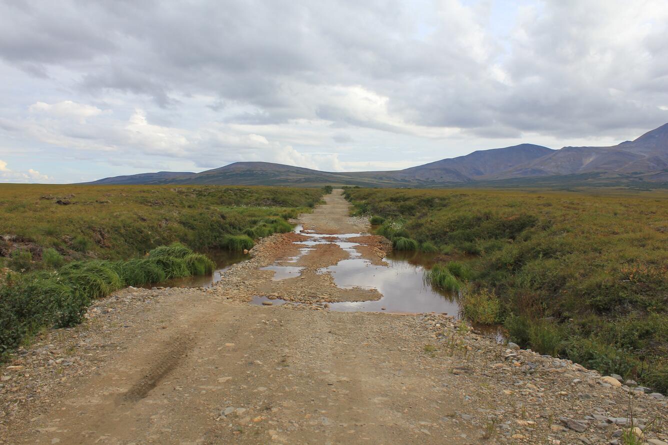
Permafrost: The Backbone of Arctic Infrastructure
Much of the Arctic’s infrastructure is built on frozen ground known as “permafrost.” But as the Arctic experiences rapidly warming temperatures, permafrost is thawing. During this process, the soil weakens and becomes less capable of supporting structures, threatening the integrity of roads, buildings, bridges, and runways.
Globally, approximately 70% of Arctic infrastructure exists in areas with a high potential for permafrost thaw and infrastructure losses are estimated to cost Alaska \$37 to \$51 billion by mid- to late-century. In addition to these economic costs, changes to permafrost have implications for energy development and national security. Permafrost thaw regularly damages pipelines and power grids. It has significantly undermined infrastructure on Arctic military bases and can make access to training grounds less predictable.
The Alaska CASC is identifying where the ground will remain frozen and where and when it will thaw. This information is critical for appropriately engineering and siting roads, pipelines, and facilities for energy development and for mitigating potential damage to the military infrastructure that underpins the U.S.’s northern defense capabilities.
Our Science
Visualizing the Future of Alaska’s Landscapes
In Arctic and boreal landscapes, permafrost, hydrology, wildfires, and vegetation all influence each other and are sensitive to environmental change. For example, wildfire can accelerate permafrost thaw, and permafrost thaw can lead to substantial changes in vegetation. The Alaska CASC developed an approach to combine forecasts for each of these variables to provide a more complete and accurate picture of how Alaska’s landscapes will change. This work has allowed scientists to answer a range of management questions, including how vulnerable Alaska’s Interior and North Slope are to permafrost thaw, so that impacts to existing or planned infrastructure can be mitigated. Learn more>>
Exploring Community Risk to Permafrost Thaw
The Alaska CASC developed the Community Permafrost Data tool to explore permafrost risks and hazards for rural communities in Alaska that incorporates information on existing infrastructure challenges and permafrost occurrence, temperature, and thaw susceptibility. Permafrost conditions in Alaskan communities vary widely, even within the same community. This tool provides communities with the ability to more precisely understand and prepare for permafrost-related threats.
Mapping Future Permafrost Degradation
The Alaska CASC is mapping where permafrost is likely to become uneven, marshy thermokarst through 2100. Thermokarst forms where the ground no longer completely refreezes during winter, so scientists are using projections of future climate conditions to identify areas on the landscape where a transition from permafrost to thermokarst is likely. These maps will help the State of Alaska Division of Natural Resources, DOI, and private industry identify where infrastructure will need to be engineered to withstand these future changes.
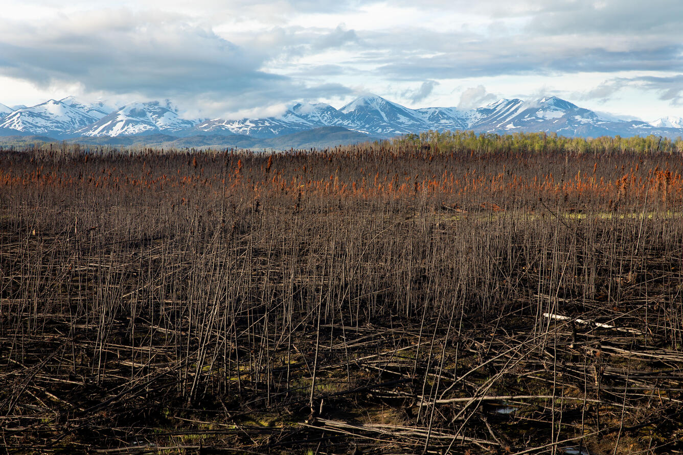
Wildfire: A Growing Risk
Wildfires can burn millions of acres in Alaska in a given year, with most fires occurring in the interior boreal forest. Fires pose a serious threat to infrastructure, including energy-related facilities like the Trans-Alaska Pipeline, which runs through fire-prone regions. They also disrupt the electrical grid. Because Alaska’s energy sector relies on a patchwork of isolated “microgrids,” damaged powerlines can lead to prolonged blackouts, as communities have no way to redirect electricity from neighboring areas. Wildfires can damage military facilities, force the cancellation of training exercises, and restrict access to training areas.
Additionally, smoke from wildfires can cause many problems. Smoke can hinder aviation, causing significant challenges in a state where 82% of communities are inaccessible by road, and air travel is essential for servicing communities, accessing natural resources, and suppressing fires from the air. Smoke also impacts the ability of the military to conduct training and operations.
Wildfires in Alaska are becoming more intense and destructive, while the fire season is getting longer. Where fires burn is also changing. While the majority of fires in Alaska occur in the boreal forest, fire activity has increased in the treeless tundra of northern and western Alaska over the past two decades. Warmer springs, longer summers, more frequent lightning strikes, and changes in vegetation have contributed to these changes in fire.
The Alaska CASC’s efforts to forecast future wildfires and predict fire behavior will improve the ability of industries, the military, natural resource managers, and communities to anticipate and prepare for these events.
Our Science
Identifying the Most Accurate Wildfire Forecasting Methods
As wildfire activity changes, Alaska’s fire management community relies on accurate forecasts of wildfire risk to appropriately allocate resources. Different indices are available for assessing daily and seasonal fire danger based on the amount and flammability of fuel loads. The Alaska CASC compared how well 13 different fire indices performed in Alaska, to determine which approach best identifies when, where, and how significant wildfire activity occurs in the state. Learn more>>
A Closer Look at the Future of Fire in Alaska
On the whole, fires across the boreal forest are expected to become more frequent and cover larger areas. However, this shift won’t unfold uniformly across the landscape, underscoring the need to analyze future fire patterns at a finer scale. The Alaska CASC developed models to pinpoint how fire trends might differ in the state, identifying which areas are expected to see more frequent fires, which areas could experience an increase in the amount of land burned, and which areas could see a slower rate of expansion in land burned or even a decrease. This information can support more tailored wildfire planning by the National Park Service, U.S. Fish and Wildlife Service, and U.S. Forest Service and the State of Alaska.
Mapping Future Fire Danger
Wildfire planning in Alaska is based on typical fire years, so resources can quickly run out during years when fires are worse than usual. The ability to forecast future fire danger is critical for effective fire management planning and resource allocation. In response to a request from the National Park Service, the Alaska CASC developed daily projections of key fire indices through 2099 for Alaska’s boreal region, creating a better understanding of future fire danger.
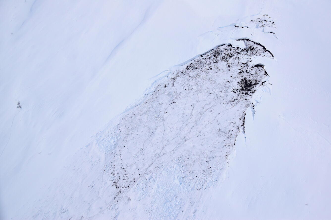
Avalanches: A Dynamic and Complex Hazard
In southern Alaska, avalanches can damage roads, railways, buildings, and power transmission lines. In Juneau, Alaska Electrical Lights & Power Co. has invested in multi-million-dollar avalanche diversion structures that protect transmission towers, following damage from avalanches in 2008 and 2009. Avalanches can also block transportation corridors, impeding access to natural resources and critical public services.
Despite their profound societal and environmental impacts, comprehensive avalanche hazard information is severely limited due to a lack of meteorological and snowpack observations, particularly in the vast, sparsely populated areas such as Southeast Alaska. This data scarcity limits the ability to adapt to, mitigate, and prepare for future avalanches. Furthermore, warming temperatures and increased rain-on-snow events are expected to alter snowpack conditions and influence avalanche frequency and magnitude, making them even harder to predict and potentially increasing the region’s vulnerability.
The Alaska CASC is identifying the conditions that lead to avalanches in Southeast Alaska, improving forecasting capabilities and enabling partners from across sectors to better understand where and when avalanches could occur in the future.
Our Science
Forecasting Avalanche Hazard Risk
As avalanche behavior changes, they are becoming harder to predict. The Alaska CASC is forecasting changing snowpack conditions and avalanche risks in Southeast Alaska and working with city planners, transportation engineers, utility managers, and federal agencies to assess the potential impacts of changes on public safety, critical infrastructure, access to natural resources, and more. The resulting large-scale Avalanche Hazard Indication Maps are significantly cheaper to produce than site-specific hazard maps and represent a critical step towards improving avalanche preparedness in the region. Learn more>>
The Alaska CASC is also identifying how weather and climate affected past avalanches in Southern Alaska, to better forecast future avalanche risk for the City and Borough of Juneau. The work is focused on four sites of critical infrastructure: the Kensington Mine, the Snettisham hydroelectric power plant, Eaglecrest Ski Area, and the neighborhood of Behrends Avenue. Learn more>>
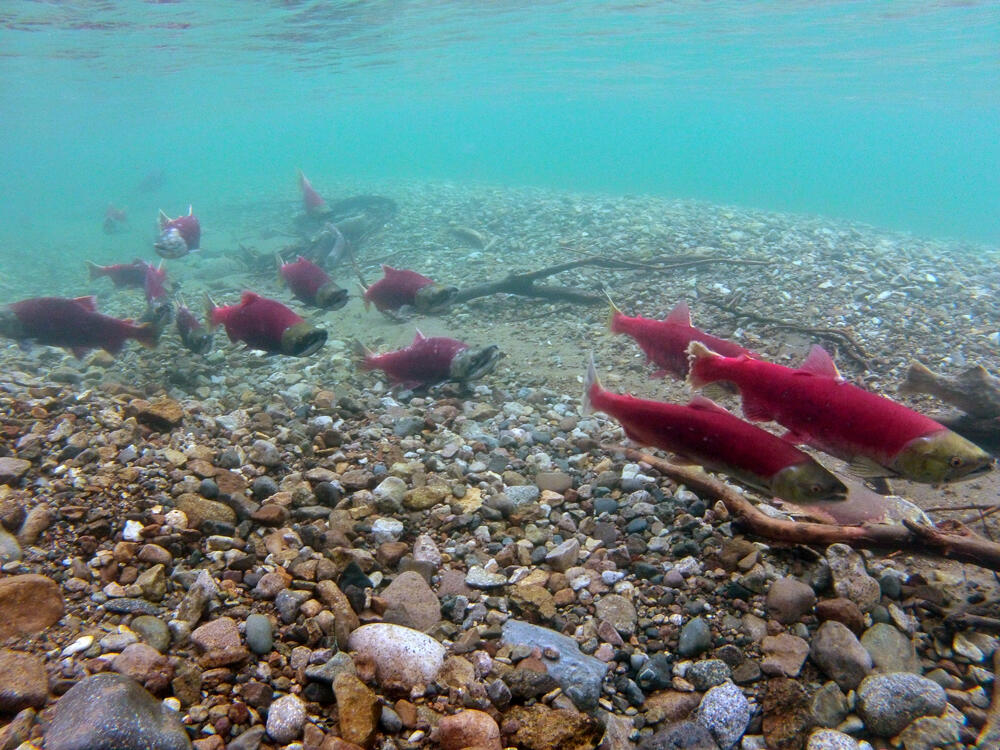
Wild Salmon: An Economic Powerhouse
Alaska’s waters provide prime habitat for five species of Pacific salmon that drive annual commercial harvests worth hundreds of millions of dollars, contribute to the state’s billion-dollar sportfishing industry, and provide a subsistence food source for rural and Indigenous communities.
However, warming water temperatures and changes in streamflow due to more frequent floods and droughts are significantly altering salmon spawning habitat and threatening this vital resource. For example, in 2019, some rivers in Alaska reached 80 degrees Fahrenheit and thousands of salmon died before they could spawn. These climate-related impacts compound other threats such as habitat loss and degradation, invasive species, development, and overfishing.
The Alaska CASC is studying how changes to Alaska’s rivers are affecting salmon, enabling managers to prioritize cost-effective restoration activities to improve salmon habitat and sustain populations for the benefit of the commercial, subsistence, and sportfishing communities.
Our Science
Untangling the Causes of Salmon Decline in the Yukon River Basin
In the Yukon River Basin, salmon abundance has plummeted in recent years, leading to unprecedented fisheries closures. These declines are linked to changes in climate, interactions with other species, and habitat quality. The Alaska CASC is identifying and mapping how these factors are affecting salmon on the Yukon River to better understand what is driving salmon declines and address a critical information gap: where, when, and how can local and regional restoration efforts most benefit salmon recovery? Learn more>>
A Robust Alternative for Assessing Salmon Run Size
To monitor changes in salmon populations and manage fisheries, the Alaska Department of Fish and Game, U.S. Fish and Wildlife Service, and Tanana Chiefs Conference track how many adult salmon return to key tributaries each year using weirs, counting towers, and sonar installations. However, these assessment methods can fail during periods of high streamflow, which are becoming more common, introducing data gaps that impede management. The Alaska CASC is developing an efficient and cost-effective approach that uses environmental DNA (eDNA), or the amount of DNA shed by salmon into the water, to predict the daily numbers of salmon swimming upstream. Learn more>>
Bridging the Climate Data Gap
Rapid environmental change in Alaska is fueling the need for data on climate patterns that can help the state plan for the future. Large portions of Alaska lack weather stations, so gridded climate data is used to fill in the gaps and provide consistent coverage of variables like temperature, precipitation, and wind.
However, modeling climate patterns is notoriously difficult in Alaska. Factors like steep mountains, a complex coastline, ice sheets, and extreme seasonal temperature make it difficult to accurately model temperature and precipitation in Alaska using readily available global climate models. To make these models more relevant for local-scale decision-making, they must be “downscaled”, a process that increases the spatial resolution of the data to better capture Alaska’s unique environmental conditions.
The Alaska CASC develops downscaled, high-resolution climate datasets for Alaska, providing data that are critical for planning air, ground, and naval operations; hydropower operations; infrastructure development; and the management of natural resources.
Our Science
Forecasting Rain-on-Snow Events
Cold-season rainfall, also known as “rain-on-snow", presents unique hazards to transportation and wildlife. These events cause ice to form on roads, making them hazardous until the spring, and an icy layer over the snow that prevents caribou and other wildlife from accessing winter forage. The sparse network of weather stations in Alaska makes studying these events challenging, so the Alaska CASC developed high-resolution climate datasets to understand how the frequency of rain-on-snow events will change across the state, helping managers plan for the effects on infrastructure, wildlife, and the economy. Learn more>>
Fine-Scale Climate Data for Extreme Weather Planning
The Alaska CASC is downscaling the latest global climate models to produce finer-scale data that will meet a range of federal and state partner needs for information that will allow them to better plan for local extreme weather. For example, Wrangell St. Elias National Park identified critical resource concerns that require high-resolution products to evaluate high runoff events that impact salmon migration and infrastructure. Learn more>>

Learn More
About the Alaska CASC
More Alaska CASC Science
More CASC Deep Dives
Alaska’s vast natural resources and strategic location play a vital role in supporting U.S. economic strength and security. Explore how science from the Alaska CASC is supporting natural resource management, energy development, and national security.
North to the Future: Alaska’s Abundant Natural Resource Potential
Alaska is home to a wealth of natural resources that fuel its economy. The North Slope contains some of the largest oil and gas fields in the country, the Southeast and Southcentral coasts harbor high quality timber, and the state’s waters yield billions of dollars per year in fisheries harvests. Alaska also holds vast, largely untapped coal reserves and is a major producer of zinc, gold, and other valuable minerals.
In addition to its bountiful natural resources, Alaska's geographically strategic position makes it a critical player in homeland defense, serving as a first line of missile defense and base for troops capable of rapid deployment to any theater in the Northern Hemisphere.
Recent Executive and Department of the Interior Secretarial Orders outline actions for unleashing Alaska’s resource potential (EO14153, SO3422) and American energy (EO14096) to enhance the nation’s economic and national security for generations to come. However, Alaska is experiencing rapid environmental changes like thawing permafrost and more frequent and severe wildfires that have significant implications for access and development of natural resources and for military infrastructure and operations.
The Alaska Climate Adaptation Science Center (CASC) provides scientific information and tools to better understand and forecast environmental change in Alaska, supporting natural resource management, energy development, and national security.
Explore our science below
Permafrost
Wildfire
Avalanches
Wild Salmon
Bridging Data Gaps
Permafrost: The Backbone of Arctic Infrastructure
Much of the Arctic’s infrastructure is built on frozen ground known as “permafrost.” But as the Arctic experiences rapidly warming temperatures, permafrost is thawing. During this process, the soil weakens and becomes less capable of supporting structures, threatening the integrity of roads, buildings, bridges, and runways.
Globally, approximately 70% of Arctic infrastructure exists in areas with a high potential for permafrost thaw and infrastructure losses are estimated to cost Alaska \$37 to \$51 billion by mid- to late-century. In addition to these economic costs, changes to permafrost have implications for energy development and national security. Permafrost thaw regularly damages pipelines and power grids. It has significantly undermined infrastructure on Arctic military bases and can make access to training grounds less predictable.
The Alaska CASC is identifying where the ground will remain frozen and where and when it will thaw. This information is critical for appropriately engineering and siting roads, pipelines, and facilities for energy development and for mitigating potential damage to the military infrastructure that underpins the U.S.’s northern defense capabilities.
Our Science
Visualizing the Future of Alaska’s Landscapes
In Arctic and boreal landscapes, permafrost, hydrology, wildfires, and vegetation all influence each other and are sensitive to environmental change. For example, wildfire can accelerate permafrost thaw, and permafrost thaw can lead to substantial changes in vegetation. The Alaska CASC developed an approach to combine forecasts for each of these variables to provide a more complete and accurate picture of how Alaska’s landscapes will change. This work has allowed scientists to answer a range of management questions, including how vulnerable Alaska’s Interior and North Slope are to permafrost thaw, so that impacts to existing or planned infrastructure can be mitigated. Learn more>>
Exploring Community Risk to Permafrost Thaw
The Alaska CASC developed the Community Permafrost Data tool to explore permafrost risks and hazards for rural communities in Alaska that incorporates information on existing infrastructure challenges and permafrost occurrence, temperature, and thaw susceptibility. Permafrost conditions in Alaskan communities vary widely, even within the same community. This tool provides communities with the ability to more precisely understand and prepare for permafrost-related threats.
Mapping Future Permafrost Degradation
The Alaska CASC is mapping where permafrost is likely to become uneven, marshy thermokarst through 2100. Thermokarst forms where the ground no longer completely refreezes during winter, so scientists are using projections of future climate conditions to identify areas on the landscape where a transition from permafrost to thermokarst is likely. These maps will help the State of Alaska Division of Natural Resources, DOI, and private industry identify where infrastructure will need to be engineered to withstand these future changes.
Wildfire: A Growing Risk
Wildfires can burn millions of acres in Alaska in a given year, with most fires occurring in the interior boreal forest. Fires pose a serious threat to infrastructure, including energy-related facilities like the Trans-Alaska Pipeline, which runs through fire-prone regions. They also disrupt the electrical grid. Because Alaska’s energy sector relies on a patchwork of isolated “microgrids,” damaged powerlines can lead to prolonged blackouts, as communities have no way to redirect electricity from neighboring areas. Wildfires can damage military facilities, force the cancellation of training exercises, and restrict access to training areas.
Additionally, smoke from wildfires can cause many problems. Smoke can hinder aviation, causing significant challenges in a state where 82% of communities are inaccessible by road, and air travel is essential for servicing communities, accessing natural resources, and suppressing fires from the air. Smoke also impacts the ability of the military to conduct training and operations.
Wildfires in Alaska are becoming more intense and destructive, while the fire season is getting longer. Where fires burn is also changing. While the majority of fires in Alaska occur in the boreal forest, fire activity has increased in the treeless tundra of northern and western Alaska over the past two decades. Warmer springs, longer summers, more frequent lightning strikes, and changes in vegetation have contributed to these changes in fire.
The Alaska CASC’s efforts to forecast future wildfires and predict fire behavior will improve the ability of industries, the military, natural resource managers, and communities to anticipate and prepare for these events.
Our Science
Identifying the Most Accurate Wildfire Forecasting Methods
As wildfire activity changes, Alaska’s fire management community relies on accurate forecasts of wildfire risk to appropriately allocate resources. Different indices are available for assessing daily and seasonal fire danger based on the amount and flammability of fuel loads. The Alaska CASC compared how well 13 different fire indices performed in Alaska, to determine which approach best identifies when, where, and how significant wildfire activity occurs in the state. Learn more>>
A Closer Look at the Future of Fire in Alaska
On the whole, fires across the boreal forest are expected to become more frequent and cover larger areas. However, this shift won’t unfold uniformly across the landscape, underscoring the need to analyze future fire patterns at a finer scale. The Alaska CASC developed models to pinpoint how fire trends might differ in the state, identifying which areas are expected to see more frequent fires, which areas could experience an increase in the amount of land burned, and which areas could see a slower rate of expansion in land burned or even a decrease. This information can support more tailored wildfire planning by the National Park Service, U.S. Fish and Wildlife Service, and U.S. Forest Service and the State of Alaska.
Mapping Future Fire Danger
Wildfire planning in Alaska is based on typical fire years, so resources can quickly run out during years when fires are worse than usual. The ability to forecast future fire danger is critical for effective fire management planning and resource allocation. In response to a request from the National Park Service, the Alaska CASC developed daily projections of key fire indices through 2099 for Alaska’s boreal region, creating a better understanding of future fire danger.
Avalanches: A Dynamic and Complex Hazard
In southern Alaska, avalanches can damage roads, railways, buildings, and power transmission lines. In Juneau, Alaska Electrical Lights & Power Co. has invested in multi-million-dollar avalanche diversion structures that protect transmission towers, following damage from avalanches in 2008 and 2009. Avalanches can also block transportation corridors, impeding access to natural resources and critical public services.
Despite their profound societal and environmental impacts, comprehensive avalanche hazard information is severely limited due to a lack of meteorological and snowpack observations, particularly in the vast, sparsely populated areas such as Southeast Alaska. This data scarcity limits the ability to adapt to, mitigate, and prepare for future avalanches. Furthermore, warming temperatures and increased rain-on-snow events are expected to alter snowpack conditions and influence avalanche frequency and magnitude, making them even harder to predict and potentially increasing the region’s vulnerability.
The Alaska CASC is identifying the conditions that lead to avalanches in Southeast Alaska, improving forecasting capabilities and enabling partners from across sectors to better understand where and when avalanches could occur in the future.
Our Science
Forecasting Avalanche Hazard Risk
As avalanche behavior changes, they are becoming harder to predict. The Alaska CASC is forecasting changing snowpack conditions and avalanche risks in Southeast Alaska and working with city planners, transportation engineers, utility managers, and federal agencies to assess the potential impacts of changes on public safety, critical infrastructure, access to natural resources, and more. The resulting large-scale Avalanche Hazard Indication Maps are significantly cheaper to produce than site-specific hazard maps and represent a critical step towards improving avalanche preparedness in the region. Learn more>>
The Alaska CASC is also identifying how weather and climate affected past avalanches in Southern Alaska, to better forecast future avalanche risk for the City and Borough of Juneau. The work is focused on four sites of critical infrastructure: the Kensington Mine, the Snettisham hydroelectric power plant, Eaglecrest Ski Area, and the neighborhood of Behrends Avenue. Learn more>>
Wild Salmon: An Economic Powerhouse
Alaska’s waters provide prime habitat for five species of Pacific salmon that drive annual commercial harvests worth hundreds of millions of dollars, contribute to the state’s billion-dollar sportfishing industry, and provide a subsistence food source for rural and Indigenous communities.
However, warming water temperatures and changes in streamflow due to more frequent floods and droughts are significantly altering salmon spawning habitat and threatening this vital resource. For example, in 2019, some rivers in Alaska reached 80 degrees Fahrenheit and thousands of salmon died before they could spawn. These climate-related impacts compound other threats such as habitat loss and degradation, invasive species, development, and overfishing.
The Alaska CASC is studying how changes to Alaska’s rivers are affecting salmon, enabling managers to prioritize cost-effective restoration activities to improve salmon habitat and sustain populations for the benefit of the commercial, subsistence, and sportfishing communities.
Our Science
Untangling the Causes of Salmon Decline in the Yukon River Basin
In the Yukon River Basin, salmon abundance has plummeted in recent years, leading to unprecedented fisheries closures. These declines are linked to changes in climate, interactions with other species, and habitat quality. The Alaska CASC is identifying and mapping how these factors are affecting salmon on the Yukon River to better understand what is driving salmon declines and address a critical information gap: where, when, and how can local and regional restoration efforts most benefit salmon recovery? Learn more>>
A Robust Alternative for Assessing Salmon Run Size
To monitor changes in salmon populations and manage fisheries, the Alaska Department of Fish and Game, U.S. Fish and Wildlife Service, and Tanana Chiefs Conference track how many adult salmon return to key tributaries each year using weirs, counting towers, and sonar installations. However, these assessment methods can fail during periods of high streamflow, which are becoming more common, introducing data gaps that impede management. The Alaska CASC is developing an efficient and cost-effective approach that uses environmental DNA (eDNA), or the amount of DNA shed by salmon into the water, to predict the daily numbers of salmon swimming upstream. Learn more>>
Bridging the Climate Data Gap
Rapid environmental change in Alaska is fueling the need for data on climate patterns that can help the state plan for the future. Large portions of Alaska lack weather stations, so gridded climate data is used to fill in the gaps and provide consistent coverage of variables like temperature, precipitation, and wind.
However, modeling climate patterns is notoriously difficult in Alaska. Factors like steep mountains, a complex coastline, ice sheets, and extreme seasonal temperature make it difficult to accurately model temperature and precipitation in Alaska using readily available global climate models. To make these models more relevant for local-scale decision-making, they must be “downscaled”, a process that increases the spatial resolution of the data to better capture Alaska’s unique environmental conditions.
The Alaska CASC develops downscaled, high-resolution climate datasets for Alaska, providing data that are critical for planning air, ground, and naval operations; hydropower operations; infrastructure development; and the management of natural resources.
Our Science
Forecasting Rain-on-Snow Events
Cold-season rainfall, also known as “rain-on-snow", presents unique hazards to transportation and wildlife. These events cause ice to form on roads, making them hazardous until the spring, and an icy layer over the snow that prevents caribou and other wildlife from accessing winter forage. The sparse network of weather stations in Alaska makes studying these events challenging, so the Alaska CASC developed high-resolution climate datasets to understand how the frequency of rain-on-snow events will change across the state, helping managers plan for the effects on infrastructure, wildlife, and the economy. Learn more>>
Fine-Scale Climate Data for Extreme Weather Planning
The Alaska CASC is downscaling the latest global climate models to produce finer-scale data that will meet a range of federal and state partner needs for information that will allow them to better plan for local extreme weather. For example, Wrangell St. Elias National Park identified critical resource concerns that require high-resolution products to evaluate high runoff events that impact salmon migration and infrastructure. Learn more>>