
What Makes the Ecosystems' Land Change Science Program Unique?
USGS science is important to partners across many different sectors. Here are the ways in which research supported by the Land Change Science Program in the USGS Ecosystems Mission Area is unique and can be distinguished from other parts of the USGS.
All of USGS, including the Land Change Science Program in the Ecosystems Mission Area, does science research that benefits partners including other bureaus in the Department of the Interior as well as other federal, state, local, academic, tribal and non-profit partners. But there are some aspects of the Ecosystems' Land Change Science Program that distinguish it from other parts of USGS. The program funds scientists across the agency from many different disciplines including geologists, hydrologists, ecologists, geographers, modelers, and paleoclimatologists. In particular the program has three strengths (or one could think of them as superpowers) that are particularly important.
1. Long-term Research Projects and Data Collection
The program typically funds scientists for several project cycles (each cycle is 5 years) which enables scientists to have funding for a topic for longer periods of time than is typical in an academic setting or even in other federally funded initiatives.
Projects that receive support for several funding cycles, are able to maintain study sites and collect incredibly useful, long-term data records. This allows scientists to explore more complex questions, collect enough data to be able to tease apart impacts of natural variability versus human actions, and see changes in ecosystems that take decades to manifest themselves.
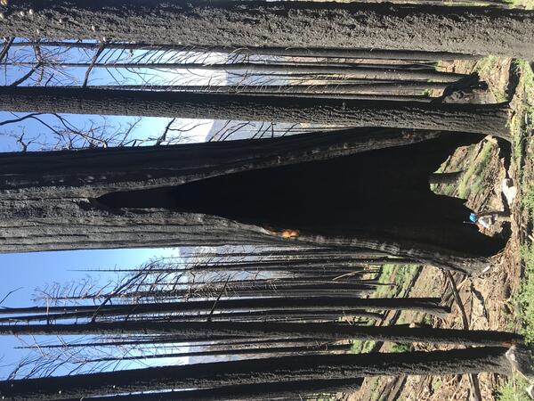
For example, some long-term study sites have happened to be in the path of disasters, such as forest fires. Although having one’s research site burn is usually not part of the plan, the fact that these sites have both pre- and post-disturbance data helps scientists better understand the impacts of the disturbance on ecosystems. This is then very helpful for natural resource management partners.
As a result, USGS program scientists have become national and international experts on many topics where environmental and/or climate change are impacting ecosystems including (but not limited to) glacier science, coastal wetlands, western forests, alpine lakes, and permafrost dynamics. Many of the long-term research sites have attracted collaborators from other agencies or academic institutions who have chosen to work at these sites because of the valuable long-term data records that enable them to build on the USGS data and to ask new questions.
2. Innovative Science and Methods
The relative stability of project funding enables many program scientists to develop and test new scientific methods. This allows USGS scientists to lead innovation in scientific inquiry in several fields, and several examples are described below.
The USGS pioneered the application of Structural Equation Modeling (SEM) in the field of ecology, which improved our ability to understand interactions between processes in complex biological systems. This statistical modeling technique has facilitated the exploration of how different factors interact, directly and indirectly, and allows scientists to put forward hypotheses about how different environmental or human factors are related and to test whether the data support the hypothesized relationships. For biological and ecological data, which are almost always messy and complicated, this statistical method has helped to see patterns and relationships despite the messiness.
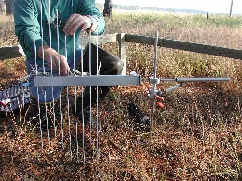
The USGS also developed what is now considered the global best standard for how to measure changes in ground surface elevation of coastal wetlands with the Surface Elevation Table (SET) approach. In short, the approach involves dropping pins carefully onto the surface of a wetland over time to measure very small changes in elevation. The implications of this work are very important in the context of sea level change and measuring how well coastal wetlands are able to keep pace with rising seas and where they may falling behind and likely to eventually drown.
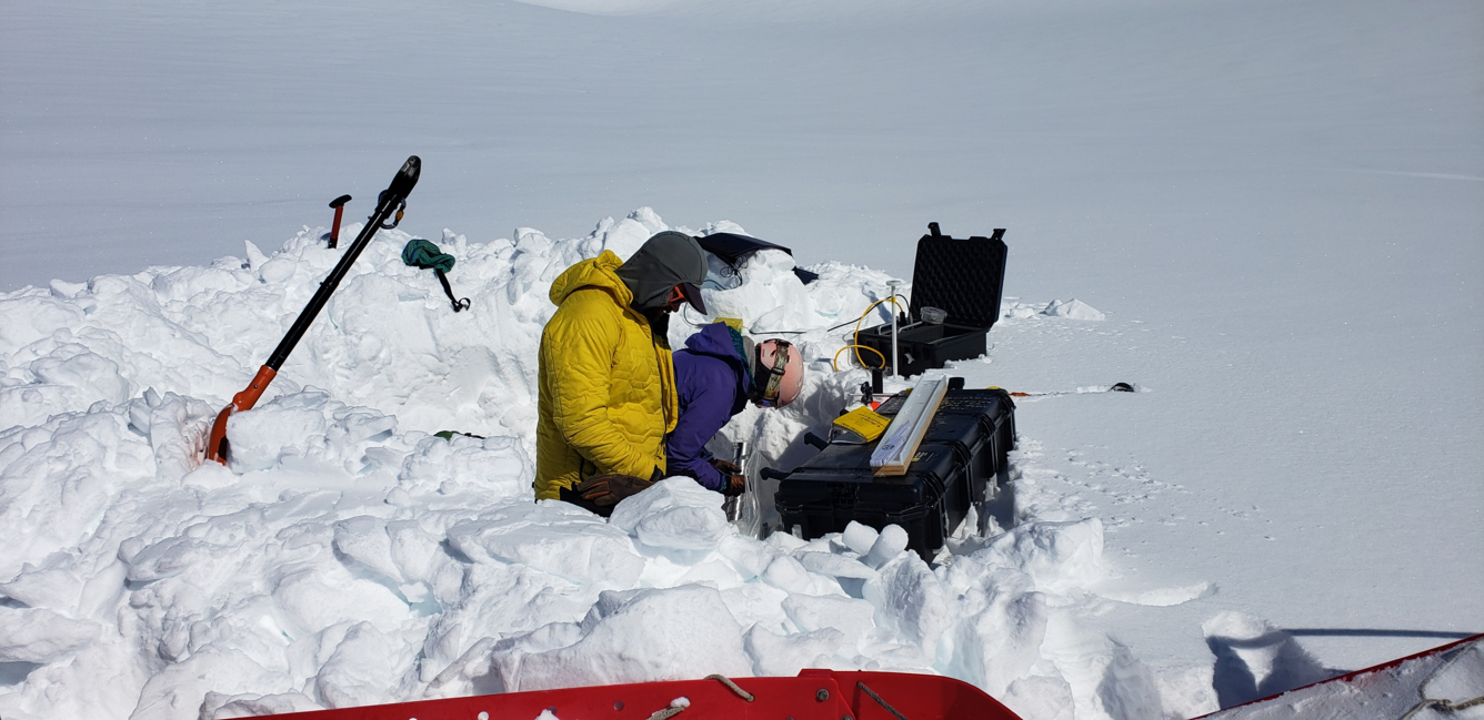
Program scientists in the Benchmark Glacier Project have also refined glacier mass balance methods by calibrating point measurements collected in the field against remote sensing data collected from airborne and spaceborne platforms. This research effort, combined with physical process investigation on how meltwater infiltrates porous snow, leverages the seasonal insight that only field data can provide, quantifies uncertainty estimates, and empowers regional scale insight. Benchmark Glacier Project science informs both international intercomparison experiments and local stakeholder needs.
Lastly, see another story about three additional new methods developed by program scientists for studying past environmental and climate conditions from before instrumental records existed, including: studying marine clam shells for paleoceanography; expanding ice core data beyond glaciers to include ice patch data; and weaving together paleoecology and indigenous knowledge.
3. Vast Paleoclimate Community and Expertise
Lastly, the program has one of the largest and most experienced teams of paleoclimate researchers in the U.S. Paleoclimate scientists use many ways to collect data about environmental and climate conditions in the past from before we had instrumental records. The work helps us understand both what the Earth system used to be like, and what it might be like in the future based on conditions in the past.
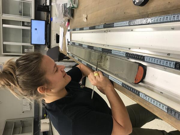
Paleoclimate data are collected from sediment cores, tree rings, ice cores, corals, and packrat middens, which all preserve different proxy records of past environmental and climatic conditions. USGS scientists are also pioneering some new paleoclimate methods (see above).
The Program’s paleoclimate team has a tremendous breadth of knowledge on different methods, has research sites all over North America and in the surrounding oceans, and can bring their vast array of expertise to bear on just about any question of interest about past environmental and climate variability.
This team put together an impressive synthesis of paleoclimate data to help us better understand North American hydroclimate over the last 2,000 years and is now working to fill some of the identified gaps in that synthesis. This type of team of paleoclimate researchers is virtually unprecedented and sets the USGS apart from most other federal and academic institutions.
In summary, the Land Change Science Program in the USGS Ecosystems Mission Area funds great science, including pre-eminent long-term ecological studies and paleoclimate efforts, and pushes scientific boundaries through innovation and refinement of methods. It is an exciting and important part of the USGS, that supplies strong foundational science to support many other research applications and management decisions particularly focused on understanding changing Earth processes and predictions of future changes to inform decisions.