
Photo Roundup - November-December 2021
A selection of coastal, lake, and ocean images from across the USGS.
Aerial view of a southeast Louisiana coastal marsh. Learn about: Gulf Coast Wetland Shoreline Change

Scientists from the USGS Woods Hole Coastal and Marine Science Center and Woods Hole Oceanographic Institution (WHOI) conducted near-shore bathymetric surveys on Cape Cod National Seashore. Bathymetry is the study of underwater depth of ocean floors or lake floors. By collecting data and plotting points on our beaches with cameras, survey equipment, and even a surf-capable autonomous surface vessel (ASV), scientists can learn more about the dynamic processes shaping our coasts. The knowledge gained from this research will improve computer-derived simulations of coastal flooding and shoreline change that communities can use to identify hazards in areas vulnerable to storms, chronic erosion, and sea-level rise. Learn about: Massachusetts Integrated Coastal Studies

Winter temperature extremes control the distributions of subtropical fishes. Common snook (Centropomus undecimalis), aggregate at a spring in northern Florida during winter. Snook are warm saltwater game fish, common in Florida, that have been moving further northward as extreme cold spells become less frequent and less intense. Learn about: Climate Adaptation Science Centers Program's Fish Research

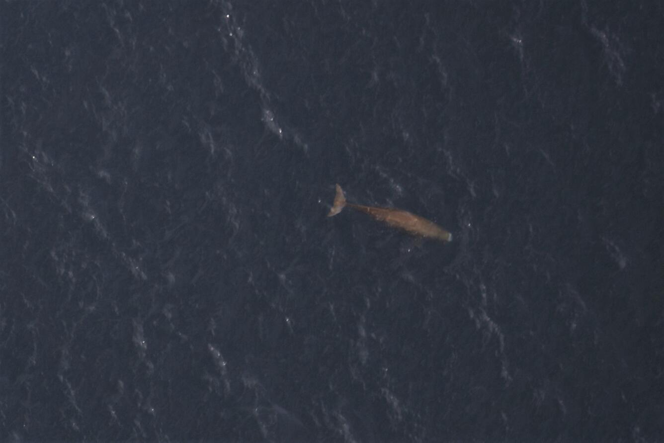
Zoomed image of a Sperm Whale (Physeter macrocephalus) below the surface, with contrast increased for clarity.The Seabird Studies Team at the USGS Western Ecological Research Center is conducting aerial photographic surveys of the ocean off central and southern California to create comprehensive maps of seabird and marine mammal distributions. Learn about: Aerial Seabird and Marine Mammal Surveys
Emily Wimmer (USGS Great Lakes Science Center, Ann Arbor, Michigan) collects Cladophora growing at 6 meters' depth in Lake Michigan. Learn about: Development and application of a robot-assisted computer vision system to map Great Lakes bottom habitats and biology

A Western sandpiper in San Francisco Bay. Learn about: Food Web and Invertebrate Ecology Studies in Pacific Coast Estuaries
