
Tracking sediment erosion and transport in a reef-adjacent watershed
A new study from USGS uses strontium isotopes and mixing models to determine the provenance of terrestrial sediment clouding an ecologically important bay in southwestern Puerto Rico, offering a clearer path for restoration efforts aimed at protecting coastal waters and territorially protected coral reef habitats.
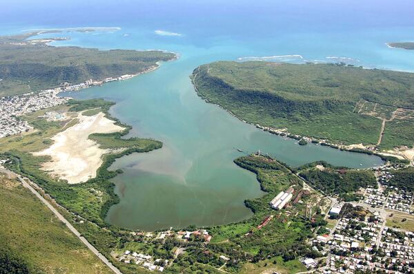
The research focuses on the Río Loco watershed and Bahía de Guánica, a priority watershed identified by the U.S. Coral Reef Task Force.
Excess sediment washing from land into coastal waters can reduce water quality and smother shallow marine habitats, stressing coral reef ecosystems. Understanding where that material originates is crucial for guiding restoration efforts to reduce sediment erosion at its source.
Using Isotopes as a Geological Fingerprint
To track the sediment, scientists turned to a chemical tracing method based on strontium (Sr) isotopes.
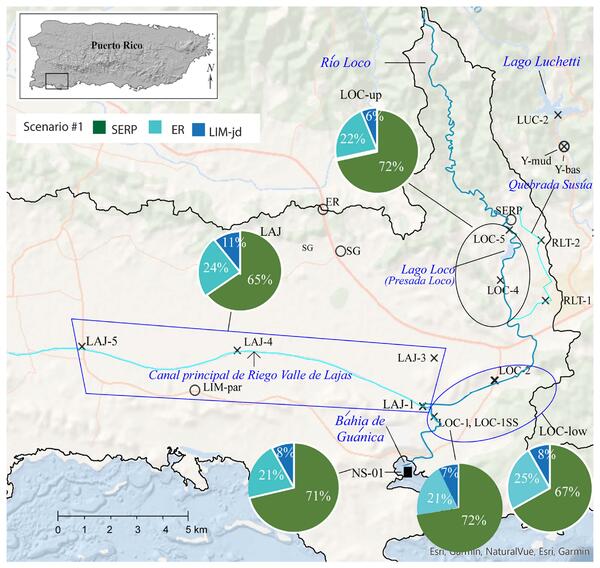
Different rock types contain distinct ratios of Sr isotopes, specifically ⁸⁷Sr/⁸⁶Sr, which act like a geological fingerprint. By measuring these signatures in stream sediment, researchers could determine which landscapes and rock formations contributed material downstream. They then used mixing models to estimate the proportion of sediment coming from different parts of the watershed.
The study found that serpentinite-rich upland areas, historically used for coffee farming, contributed approximately 71% of the sediment reaching Bahía de Guánica. Additional sources included 21% from basalts in the foothills and 8% from the coastal plain.
Interestingly, other possible contributors — including the Canal Principal de Riego Valle de Lajas in a former natural wetland and the tributary Quebrada Susúa where watershed restoration efforts occurred — did not appear to be significant sediment sources during the dry-season study.
A Tool for Better Watershed Management
The findings indicate that sediment from the watershed’s upland serpentinite zones is being efficiently transported through the river system to the coast, where it ultimately enters Bahía de Guánica and negatively impacts coastal ecosystems.
That matters because this information allows watershed restoration efforts to be directed on the primary source areas of the terrestrial sediment impacting the bay and reefs, increasing the likelihood of restoration success and lowering its cost by focusing in where it is needed most.
Using the Río Loco and Bahía de Guánica as a case study, the research demonstrates the broader potential of Sr isotopes as a tool for tracing sediment sources in tropical, volcanic watersheds. This approach could help guide more effective, science-based strategies to reduce erosion, improve water quality, and protect coastal ecosystems.
Related

Coral Reef Project
Related