
Data
Browse real-time data, data releases, software/code releases and more.
Filter Total Items: 194
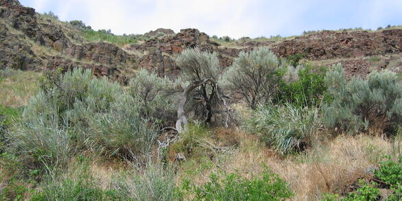
Wyoming Range Physicochemical and Biological Data (2016) Wyoming Range Physicochemical and Biological Data (2016)
This data release supports the manuscript: Walker, R.H. and A.W. Walters. 2019. A mechanistic understanding of ecological responses to anthropogenic surface disturbance in headwater streams. Ecosphere 10(10):e02907. 10.1002/ecs2.2907. It includes one data set with physicochemical and biological data from 40 stream sites (100 m length) in the Wyoming Range for summer 2016.
Reproductive Physiology of Brown Pelican Along the Coast of Alabama, 2017-2018 Reproductive Physiology of Brown Pelican Along the Coast of Alabama, 2017-2018
The datasets stored in this folder summarize reproductive data for Brown Pelicans nesting on Gaillard and Cat Islands, Alabama, in 2017 and 2018. Data include nest and nestling survival, nest site characteristics, environmental covariates, and temperatures recorded inside nests.
Physiological Ecology of Brown Pelican in the Gulf of Mexico, 2013-2016 Physiological Ecology of Brown Pelican in the Gulf of Mexico, 2013-2016
The datasets stored in this folder summarize health data for Brown Pelican nestlings and breeding adults from 2013-2016 in the Northern Gulf of Mexico at 9 breeding colonies from Texas to the Florida Panhandle. Data include values of blood analyte, and concentration of polycyclic aromatic hydrocarbons in blood and feather samples.
Geospatial data sets and hydraulic models for selected streams in Stark County, Ohio Geospatial data sets and hydraulic models for selected streams in Stark County, Ohio
Digital flood-inundation maps for selected streams in Stark County were created by the U.S. Geological Survey (USGS) in cooperation with the Muskingum Watershed Conservancy District and the Stark County Commissioners as part of a Federal Emergency Management Agency (FEMA) Flood Insurance Study (FIS). The flood-inundation maps show estimates of the areal extent corresponding to the 1% and...
Data Supporting a Framework to Incorporate Established Conservation Networks into Freshwater Conservation Planning Data Supporting a Framework to Incorporate Established Conservation Networks into Freshwater Conservation Planning
This data set provides the results of a conservation prioritization analysis for wadeable streams in Missouri, USA. Higher values (Maximum of 1) represent higher conservation value. Conservation values were derived using Zonation conservation planning software which used species distribution models, a prioritization algorithm (either Core-Area or Additive Benefit), species weighting...
Bluegill catch rates and total length distributions among four sampling gears used in two Wisconsin lakes 2017 Bluegill catch rates and total length distributions among four sampling gears used in two Wisconsin lakes 2017
Data represent catch rates and total lengths of bluegill (Lepomis macrochirus) collected from two northern Wisconsin lakes using four different sampling gears.The data include number of bluegills captured in individual units of effort for 4 different sampling gears (Isermann_Bluegill_Sampling_catch.csv) and total lengths measured for a subsample of those fish (Isermann_Bluegill_Sampling...
Wyoming Range Stream Data (2012-2016) Wyoming Range Stream Data (2012-2016)
This data release supports the manuscript entitled "Multiple approaches to surface water quality assessment provide insight for small streams experiencing oil and natural gas development" (DOI )and includes two data sets: 1) Mean daily discharge, temperature, and conductivity data from three stream sites in the Wyoming Range for summers 2012-2016; 2) Suspended sediment and...
Activity patterns of cave-dwelling bat species during pre-hibernation swarming and post-hibernation emergence in the central Appalachians Activity patterns of cave-dwelling bat species during pre-hibernation swarming and post-hibernation emergence in the central Appalachians
Bat activity around known hibernacula in Virginia and West Virginia portion of the central Appalachians during the fall swarm and spring emergence, 2015-2017
Activity patterns in regional and long-distance migrant bat species during the fall and spring along ridgelines in the central Appalachians, 2015-2017 Activity patterns in regional and long-distance migrant bat species during the fall and spring along ridgelines in the central Appalachians, 2015-2017
Data contain zero-crossing, frequency acoustic detector locations, date to hour, species of bats recorded and identified and various wind and precipitation values associated with either day or hour for ridges, sideslopes and valleys at 5 locations in western Virginia's Appalachian Mountains.
Avian point count survey-specific data in Northern New England 2013 to 2015 Avian point count survey-specific data in Northern New England 2013 to 2015
Avian point count, vegetation, and management data from surveys in Northern New England at four National Wildlife Refuges (NWRs), Baxter State Park, and prviate lands in Northern Maine surveyed during the breeding and postbreeding season bewteen 1 June and 4 August 2013 to 2015. NWRs include Nulhegan (Silvio O. Conte), Umbagog, Moosehorn, and Aroostook. This data release includes five...
Amphibian Occupancy and Effects of Habitat Use on Pesticide Exposure in Iowa Wetlands Amphibian Occupancy and Effects of Habitat Use on Pesticide Exposure in Iowa Wetlands
Amphibians living in agricultural areas encounter many challenges. Two factors affecting individuals in these landscapes are habitat loss and pesticides. This thesis focuses on amphibians using agricultural wetlands in Iowa, where row crops such as corn and soybeans dominate the landscape. The goal of my first study was to determine the influences of site characteristics on amphibian...
Habitat and fish field survey data from Wyoming Range streams in 2012 and 2013 Habitat and fish field survey data from Wyoming Range streams in 2012 and 2013
Stream habitat characteristics, energy development metrics, and fish catch per unit effort data for 91 sites (100m stream reach) sampled in the summers of 2012 and 2013.We sampled four streams in the Dry Piney Drainage (Dry Piney, Beaver Dam, Black Canyon, and North Black Canyon), five in the Fogarty Drainage (North and South Fogarty, North and South Pine Grove, and Sawmill) and four in...