



Holding the Ground: Long-Term Science and Partnerships Help Protect Soil Health and Local Economies Across the Colorado Plateau
By combining long-term science with enduring partnerships, USGS is helping decision makers protect soil resources, reduce erosion risks, and steward America's public lands for future generations.
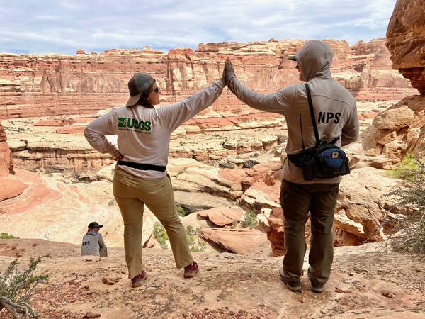
Healthy soils are the foundation of healthy landscapes. Across the drylands of the Colorado Plateau, soil supports livestock grazing, wildlife habitat, recreation, clean air and water, and local economies. Yet these landscapes face growing pressures from prolonged drought, increasing temperatures, invasive species, and land disturbance—all of which can contribute to soil degradation and accelerated soil erosion.
For decades, scientists with the U.S. Geological Survey have worked alongside land managers and partners to better understand these challenges and identify practical strategies to help conserve soil and sustain ecosystem health. Through long-term research and collaboration with the Bureau of Land Management (BLM), National Park Service (NPS), U.S. Department of Agriculture (USDA), Department of Energy (DOE), The Nature Conservancy, and others, USGS science is helping decision makers protect some of the nation's most iconic and economically important dryland landscapes.
DOI lands—including national parks and public grazing lands where this research is conducted—generate billions of dollars in economic activity and support hundreds of thousands of jobs, highlighting the importance of science that informs their stewardship.
Science That Supports Management Solutions
USGS research is designed not only to understand environmental change but also to provide information that managers can use.
Studies examining wind erosion drivers have identified the importance of maintaining vegetation cover, protecting biological soil crusts, minimizing unnecessary surface disturbance, and prioritizing restoration in vulnerable areas (Duniway et al., 2019; Nauman et al., 2023). Further, USGS contributions to the National Wind Erosion Network have supported critical wind erosion modelling frameworks that are applied widely by federal agencies. These findings and tools help land managers identify areas most susceptible to soil loss and evaluate strategies that can improve soil stability and ecosystem resilience.
This information supports planning and decision-making across millions of acres of public lands managed by federal, state, Tribal, and local partners. By identifying the factors that promote healthy soils and resilient landscapes, USGS science contributes to practical strategies that support multiple land uses while conserving natural resources.
As drought and climate pressures continue to affect the American West, science-based adaptation strategies will become increasingly important. Long-term monitoring and research provide the foundation needed to evaluate what is working, where risks are increasing, and how management approaches can be refined over time.
Understanding a Growing Challenge
Wind erosion is a natural process in dryland ecosystems, but changing environmental conditions can accelerate soil loss. A comprehensive review led by USGS scientists found that increasing aridity, vegetation loss, wildfire, land disturbance, and climate change are contributing to elevated wind erosion and dust emissions across many U.S. drylands, including the Colorado Plateau.
When soil is lost, the consequences extend far beyond the affected site. Dust emissions can reduce air quality, impact human health, degrade ecosystem function, and affect water resources. Research in the Upper Colorado River Basin demonstrated that dust deposited on mountain snowpack can accelerate snowmelt reducing water quantity and altering runoff timing for downstream communities and ecosystems.
Research conducted on the Colorado Plateau has also shown that land-use practices, vehicle disturbance, improper grazing, and increasing aridity can interact to increase dust emissions from vulnerable landscapes. More recent work found that soil properties, land use, and climate conditions combine to influence wind erosion risk, highlighting the importance of integrated management approaches.
Long-Term Research Reveals What Makes Landscapes Resilient
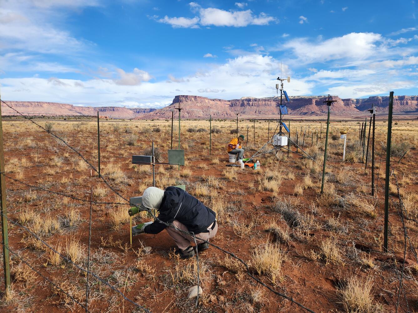
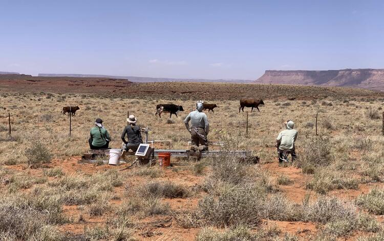
One of the strengths of USGS science is its long-term perspective. Near Moab, Utah, USGS scientists maintain several long-running wind erosion monitoring studies, including a 10+ year National Wind Erosion Research Network site, a collaborative effort led by USDA Agricultural Research Service, and USGS initiated >25-year-long local wind erosion monitoring network. Data collected through these networks help researchers understand how climate, vegetation, soils, and land management interact to influence erosion risk and soil stability. help researchers understand how climate, vegetation, soils, and land management interact to influence erosion risk and soil stability.
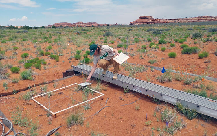
In addition to dust monitoring, long-term landscape monitoring and global change (i.e. drought and warming) experiments on the Colorado Plateau have provided critical insight into how ecosystems respond to increasingly dry conditions. A fifteen- year experimental drought study found that prolonged drought can alter plant communities, reduce ecosystem productivity, and affect the ability of landscapes to recover from environmental stress. These findings provide important information for managers seeking to sustain ecosystem function under increasingly variable climate conditions.
Biological soil crusts—communities of mosses, lichens, cyanobacteria, and other organisms that live on the soil surface—play an especially important role in maintaining soil health in dryland systems. These living crusts help stabilize soil, reduce erosion, improve water infiltration and retention, and contribute to nutrient cycling.
Research led by USGS scientists found that increasing summertime temperatures are contributing to declines in nitrogen-fixing lichens, a key component of biological soil crust communities across the Colorado Plateau. Additionally, a USGS led, twenty-year warming experiment found that increasing temperatures can also lead to biocrust mortality and a decrease in soil stability, with similar deleterious effects as physical trampling.
Combined, these studies show that ongoing drought and warming conditions could diminish biocrust cover which could result in greater areas of bare soil that are susceptible to erosional forces. Luckily, science-based management and new insights might be able to lessen these risks by informing managers of climate-sensitive areas to mitigate disturbance from grazing and recreational activities.
Partnerships Make the Science Possible
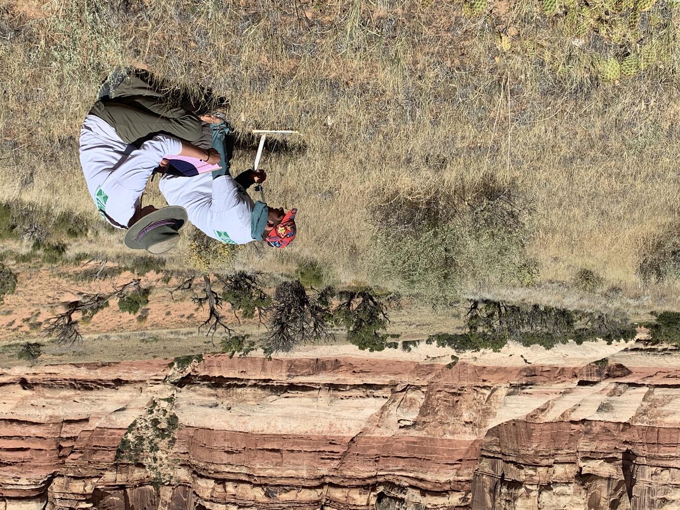
The success of this work depends on enduring partnerships. For many years, USGS scientists have worked closely with BLM, NPS, USDA, The Nature Conservancy, universities, and other partners to design studies, maintain long-term monitoring sites, share expertise, and translate scientific findings into management applications. These collaborations allow researchers to collect long-term data, evaluate management outcomes, and ensure that scientific information reaches those responsible for stewarding public lands.
“USGS technical expertise is invaluable for managing NPS lands. Their analysis of long-term monitoring provides scientific insights for management decisions, so we are better equipped to address growing challenges like drought, warming, soil erosion, and increasing visitation. Partnership with USGS ensures that park managers have the information they need to protect the extraordinary landscapes in our care and preserve these iconic places for future generations.” -Liz Ballenger, Supervisory Biologist, Southeast Utah Group, National Park Service
The challenges facing dryland ecosystems often unfold over decades. By combining sustained scientific investment with strong collaboration among land managers and conservation organizations, USGS and its partners are helping keep the soil in place, reduce erosion risks, and maintain resilient landscapes that support communities, economies, and ecosystems. The lessons learned on the Colorado Plateau demonstrate the value of long-term science: understanding change, identifying practical solutions, and providing decision makers with the information needed to steward America's lands in a changing world.
At a Glance
Research conducted by the USGS and our partners is helping land managers better understand how drought, land disturbance, and climate variability affect soil health and erosion risk across dryland ecosystems. This science supports practical management decisions that help:
- Keep soil on the landscape. Healthy vegetation and biological soil crusts help reduce wind erosion and protect valuable topsoil.
- Reduce dust emissions. Limiting soil loss can improve air quality, protect ecosystem health, and reduce impacts to communities.
- Support resilient public lands. Long-term research helps identify management approaches that improve ecosystem stability under changing environmental conditions.
- Protect water resources. Reducing erosion and dust impacts can benefit watersheds and help maintain the natural processes that support water availability across the West.
- Inform effective land stewardship. Partnerships among USGS, BLM, NPS, USDA, The Nature Conservancy, and other organizations provide science-based information that helps managers make informed decisions for the lands they oversee.
- Maximize the value of public investments. Long-term monitoring and research help managers target resources where they are most effective, supporting informed decisions and reducing the costs associated with land degradation and erosion.
Decades of collaborative research on the Colorado Plateau demonstrate how sustained science and strong partnerships can help conserve soil resources, reduce erosion risks, and support healthy, productive landscapes for future generations.
By combining long-term science with enduring partnerships, USGS is helping decision makers protect soil resources, reduce erosion risks, and steward America's public lands for future generations.
Healthy soils are the foundation of healthy landscapes. Across the drylands of the Colorado Plateau, soil supports livestock grazing, wildlife habitat, recreation, clean air and water, and local economies. Yet these landscapes face growing pressures from prolonged drought, increasing temperatures, invasive species, and land disturbance—all of which can contribute to soil degradation and accelerated soil erosion.
For decades, scientists with the U.S. Geological Survey have worked alongside land managers and partners to better understand these challenges and identify practical strategies to help conserve soil and sustain ecosystem health. Through long-term research and collaboration with the Bureau of Land Management (BLM), National Park Service (NPS), U.S. Department of Agriculture (USDA), Department of Energy (DOE), The Nature Conservancy, and others, USGS science is helping decision makers protect some of the nation's most iconic and economically important dryland landscapes.
DOI lands—including national parks and public grazing lands where this research is conducted—generate billions of dollars in economic activity and support hundreds of thousands of jobs, highlighting the importance of science that informs their stewardship.
Science That Supports Management Solutions
USGS research is designed not only to understand environmental change but also to provide information that managers can use.
Studies examining wind erosion drivers have identified the importance of maintaining vegetation cover, protecting biological soil crusts, minimizing unnecessary surface disturbance, and prioritizing restoration in vulnerable areas (Duniway et al., 2019; Nauman et al., 2023). Further, USGS contributions to the National Wind Erosion Network have supported critical wind erosion modelling frameworks that are applied widely by federal agencies. These findings and tools help land managers identify areas most susceptible to soil loss and evaluate strategies that can improve soil stability and ecosystem resilience.
This information supports planning and decision-making across millions of acres of public lands managed by federal, state, Tribal, and local partners. By identifying the factors that promote healthy soils and resilient landscapes, USGS science contributes to practical strategies that support multiple land uses while conserving natural resources.
As drought and climate pressures continue to affect the American West, science-based adaptation strategies will become increasingly important. Long-term monitoring and research provide the foundation needed to evaluate what is working, where risks are increasing, and how management approaches can be refined over time.
Understanding a Growing Challenge
Wind erosion is a natural process in dryland ecosystems, but changing environmental conditions can accelerate soil loss. A comprehensive review led by USGS scientists found that increasing aridity, vegetation loss, wildfire, land disturbance, and climate change are contributing to elevated wind erosion and dust emissions across many U.S. drylands, including the Colorado Plateau.
When soil is lost, the consequences extend far beyond the affected site. Dust emissions can reduce air quality, impact human health, degrade ecosystem function, and affect water resources. Research in the Upper Colorado River Basin demonstrated that dust deposited on mountain snowpack can accelerate snowmelt reducing water quantity and altering runoff timing for downstream communities and ecosystems.
Research conducted on the Colorado Plateau has also shown that land-use practices, vehicle disturbance, improper grazing, and increasing aridity can interact to increase dust emissions from vulnerable landscapes. More recent work found that soil properties, land use, and climate conditions combine to influence wind erosion risk, highlighting the importance of integrated management approaches.
Long-Term Research Reveals What Makes Landscapes Resilient
One of the strengths of USGS science is its long-term perspective. Near Moab, Utah, USGS scientists maintain several long-running wind erosion monitoring studies, including a 10+ year National Wind Erosion Research Network site, a collaborative effort led by USDA Agricultural Research Service, and USGS initiated >25-year-long local wind erosion monitoring network. Data collected through these networks help researchers understand how climate, vegetation, soils, and land management interact to influence erosion risk and soil stability. help researchers understand how climate, vegetation, soils, and land management interact to influence erosion risk and soil stability.
In addition to dust monitoring, long-term landscape monitoring and global change (i.e. drought and warming) experiments on the Colorado Plateau have provided critical insight into how ecosystems respond to increasingly dry conditions. A fifteen- year experimental drought study found that prolonged drought can alter plant communities, reduce ecosystem productivity, and affect the ability of landscapes to recover from environmental stress. These findings provide important information for managers seeking to sustain ecosystem function under increasingly variable climate conditions.
Biological soil crusts—communities of mosses, lichens, cyanobacteria, and other organisms that live on the soil surface—play an especially important role in maintaining soil health in dryland systems. These living crusts help stabilize soil, reduce erosion, improve water infiltration and retention, and contribute to nutrient cycling.
Research led by USGS scientists found that increasing summertime temperatures are contributing to declines in nitrogen-fixing lichens, a key component of biological soil crust communities across the Colorado Plateau. Additionally, a USGS led, twenty-year warming experiment found that increasing temperatures can also lead to biocrust mortality and a decrease in soil stability, with similar deleterious effects as physical trampling.
Combined, these studies show that ongoing drought and warming conditions could diminish biocrust cover which could result in greater areas of bare soil that are susceptible to erosional forces. Luckily, science-based management and new insights might be able to lessen these risks by informing managers of climate-sensitive areas to mitigate disturbance from grazing and recreational activities.
Partnerships Make the Science Possible
The success of this work depends on enduring partnerships. For many years, USGS scientists have worked closely with BLM, NPS, USDA, The Nature Conservancy, universities, and other partners to design studies, maintain long-term monitoring sites, share expertise, and translate scientific findings into management applications. These collaborations allow researchers to collect long-term data, evaluate management outcomes, and ensure that scientific information reaches those responsible for stewarding public lands.
“USGS technical expertise is invaluable for managing NPS lands. Their analysis of long-term monitoring provides scientific insights for management decisions, so we are better equipped to address growing challenges like drought, warming, soil erosion, and increasing visitation. Partnership with USGS ensures that park managers have the information they need to protect the extraordinary landscapes in our care and preserve these iconic places for future generations.” -Liz Ballenger, Supervisory Biologist, Southeast Utah Group, National Park Service
The challenges facing dryland ecosystems often unfold over decades. By combining sustained scientific investment with strong collaboration among land managers and conservation organizations, USGS and its partners are helping keep the soil in place, reduce erosion risks, and maintain resilient landscapes that support communities, economies, and ecosystems. The lessons learned on the Colorado Plateau demonstrate the value of long-term science: understanding change, identifying practical solutions, and providing decision makers with the information needed to steward America's lands in a changing world.
At a Glance
Research conducted by the USGS and our partners is helping land managers better understand how drought, land disturbance, and climate variability affect soil health and erosion risk across dryland ecosystems. This science supports practical management decisions that help:
- Keep soil on the landscape. Healthy vegetation and biological soil crusts help reduce wind erosion and protect valuable topsoil.
- Reduce dust emissions. Limiting soil loss can improve air quality, protect ecosystem health, and reduce impacts to communities.
- Support resilient public lands. Long-term research helps identify management approaches that improve ecosystem stability under changing environmental conditions.
- Protect water resources. Reducing erosion and dust impacts can benefit watersheds and help maintain the natural processes that support water availability across the West.
- Inform effective land stewardship. Partnerships among USGS, BLM, NPS, USDA, The Nature Conservancy, and other organizations provide science-based information that helps managers make informed decisions for the lands they oversee.
- Maximize the value of public investments. Long-term monitoring and research help managers target resources where they are most effective, supporting informed decisions and reducing the costs associated with land degradation and erosion.
Decades of collaborative research on the Colorado Plateau demonstrate how sustained science and strong partnerships can help conserve soil resources, reduce erosion risks, and support healthy, productive landscapes for future generations.