
The USGS and its cooperators have installed instruments in a steep hillside about 20 km southeast of Reedsport in the Elliott State Forest.
Recent Conditions
The USGS is not actively collecting real-time monitoring data at this site.
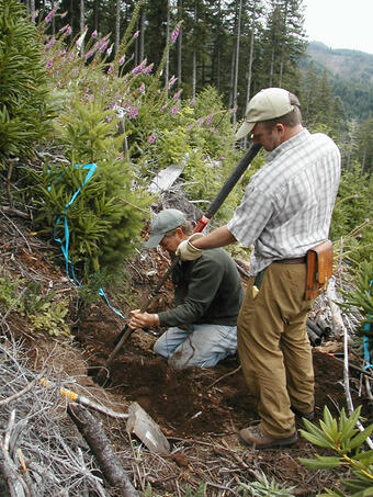
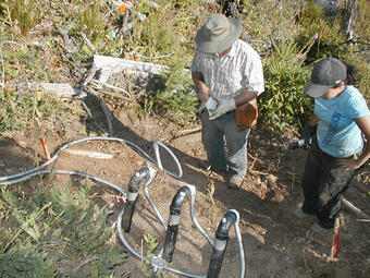
The instruments for this site were installed in the summer and fall of 2009 and previously used to monitor and detect changes in local conditions, including:
- Rainfall
- Ground Water Pressure (Tensionmeters)
- Ground Water and Atmospheric Pressure (Piezometers)
- Soil Water Content
- Soil Temperature
Project Background
Landslides in the Oregon Coast Range impact people and the environment and are commonly induced by intense or prolonged rainfall associated with strong storms in the late fall and winter seasons. For example, in February and November of 1996 heavy rainfall from two unusually large storms induced thousands of landslides over a large part of western Oregon.
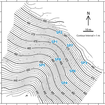
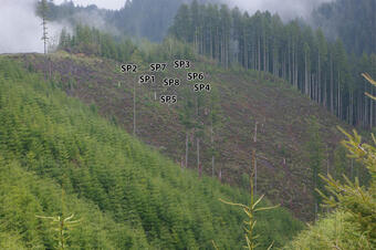
The USGS and its cooperators have installed instruments in a steep hillside about 20 km southeast of Reedsport in the Elliott State Forest. Data collection at this site supports research on hydrologic factors that control landslide initiation. In many landslide-prone hillsides, infiltration of water from rainfall or snowmelt increases ground-water pressures. These elevated pressures can, in turn, induce landslide movement.

The USGS and its cooperators have installed instruments in a steep hillside about 20 km southeast of Reedsport in the Elliott State Forest.
Recent Conditions
The USGS is not actively collecting real-time monitoring data at this site.
The instruments for this site were installed in the summer and fall of 2009 and previously used to monitor and detect changes in local conditions, including:
- Rainfall
- Ground Water Pressure (Tensionmeters)
- Ground Water and Atmospheric Pressure (Piezometers)
- Soil Water Content
- Soil Temperature
Project Background
Landslides in the Oregon Coast Range impact people and the environment and are commonly induced by intense or prolonged rainfall associated with strong storms in the late fall and winter seasons. For example, in February and November of 1996 heavy rainfall from two unusually large storms induced thousands of landslides over a large part of western Oregon.
The USGS and its cooperators have installed instruments in a steep hillside about 20 km southeast of Reedsport in the Elliott State Forest. Data collection at this site supports research on hydrologic factors that control landslide initiation. In many landslide-prone hillsides, infiltration of water from rainfall or snowmelt increases ground-water pressures. These elevated pressures can, in turn, induce landslide movement.