
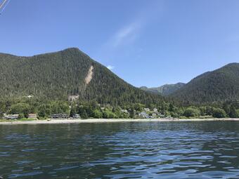
On August 18, 2015, heavy rainfall triggered around 60 landslides in and around the city of Sitka, AK. The landslides moved downslope rapidly; several were damaging and one of these demolished a home on South Kramer Avenue killing three people.
Recent Conditions
The USGS is not actively collecting real-time monitoring data at this site.
When active, instruments are used to monitor and detect changes in local conditions, including:
- Rainfall
- Soil Moisture
- Groundwater Level and Soil Water Potential
- Air, Soil Temperature, and Battery Voltage.
Project Background
On August 18, 2015, heavy rainfall triggered around 60 landslides in and around the city of Sitka, AK. The landslides moved downslope rapidly; several were damaging and one of these demolished a home on South Kramer Avenue killing three people.
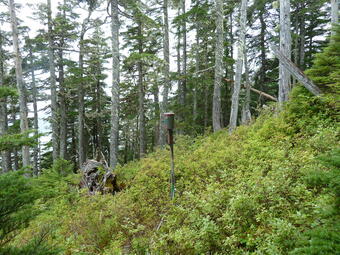
The USGS has installed instruments at a site near the initiation zone of the fatal Kramer Ave. landslide on Harbor Mountain, above Sitka. The sensors are installed in two soil pits on the edge of a steep hollow similar to the initiation zones of past landslides. Data collection at this site supports research on hydrologic factors that control landslide initiation. In many landslide-prone hillsides, infiltration of water from rainfall increases ground-water pressures. These elevated pressures can, in turn, induce landslide movement.
On August 18, 2015, heavy rainfall triggered around 60 landslides in and around the city of Sitka, AK. The landslides moved downslope rapidly; several were damaging and one of these demolished a home on South Kramer Avenue killing three people.
Recent Conditions
The USGS is not actively collecting real-time monitoring data at this site.
When active, instruments are used to monitor and detect changes in local conditions, including:
- Rainfall
- Soil Moisture
- Groundwater Level and Soil Water Potential
- Air, Soil Temperature, and Battery Voltage.
Project Background
On August 18, 2015, heavy rainfall triggered around 60 landslides in and around the city of Sitka, AK. The landslides moved downslope rapidly; several were damaging and one of these demolished a home on South Kramer Avenue killing three people.
The USGS has installed instruments at a site near the initiation zone of the fatal Kramer Ave. landslide on Harbor Mountain, above Sitka. The sensors are installed in two soil pits on the edge of a steep hollow similar to the initiation zones of past landslides. Data collection at this site supports research on hydrologic factors that control landslide initiation. In many landslide-prone hillsides, infiltration of water from rainfall increases ground-water pressures. These elevated pressures can, in turn, induce landslide movement.