
U.S. Highway 50, California - Monitoring Discontinued
As of October 2024, U.S. Geological Survey (USGS) monitoring at this landslide has been discontinued.
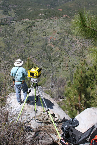
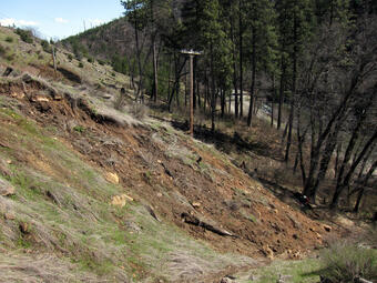
In previous years since 1997, the landslide was monitored using data acquisition systems and radio telemetry developed by the USGS Volcano Hazards Program to operate in remote, hazardous sites with limited power. At this landslide, infiltration of rainfall or rapid snowmelt increases groundwater pressures. These elevated pressures can, in turn, trigger landslide movement. The landslide typically moves during a wet winter and spring and is dormant during dry times.
Real-time Data
The USGS no longer collects real-time monitoring data from this landslide.
Below are other science projects associated with this project.

U.S. Highway 50, California - Current Landslide Status

U.S. Highway 50, California - Yearly Information

U.S. Highway 50, California - Report
As of October 2024, U.S. Geological Survey (USGS) monitoring at this landslide has been discontinued.
In previous years since 1997, the landslide was monitored using data acquisition systems and radio telemetry developed by the USGS Volcano Hazards Program to operate in remote, hazardous sites with limited power. At this landslide, infiltration of rainfall or rapid snowmelt increases groundwater pressures. These elevated pressures can, in turn, trigger landslide movement. The landslide typically moves during a wet winter and spring and is dormant during dry times.
Real-time Data
The USGS no longer collects real-time monitoring data from this landslide.
Below are other science projects associated with this project.
U.S. Highway 50, California - Current Landslide Status
U.S. Highway 50, California - Yearly Information