U.S. flag

An official website of the United States government

Images

National Geospatial Program images.

Filter Total Items: 255
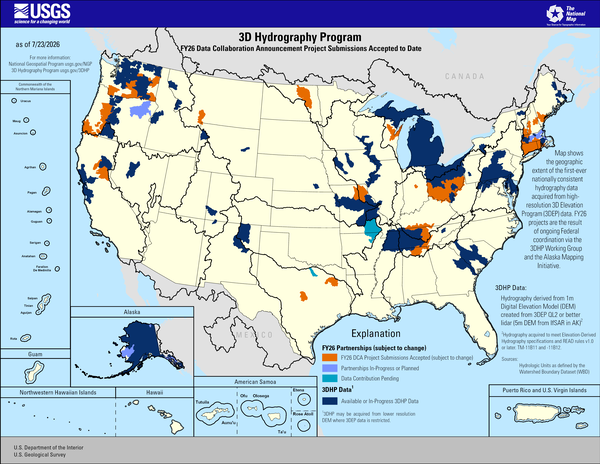
3D Hydrography Program FY26 DCA Project Submissions Accepted to Date

This map of the United States and its territories shows geographic extent of the first-ever nationally consistent hydrography data acquired from high-resolution 3D Elevation Program (3DEP) data. FY26 projects are the result of ongoing Federal coordination via the 3DHP Working Group and the Alaska Mapping Initiative.

Sources/Usage
This map of the United States and its territories shows geographic extent of the first-ever nationally consistent hydrography data acquired from high-resolution 3D Elevation Program (3DEP) data. FY26 projects are the result of ongoing Federal coordination via the 3DHP Working Group and the Alaska Mapping Initiative.

Sources/Usage
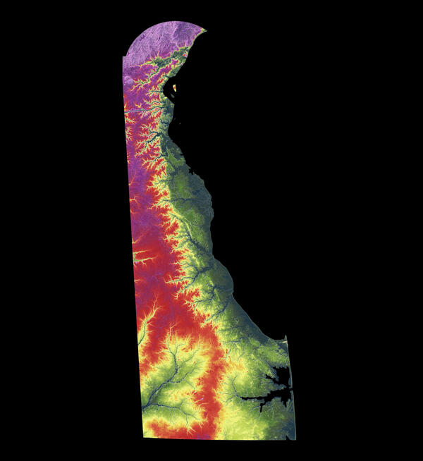
3DEP As Art - Delaware

A modern illustration of each state's landscape uses 3DEP data to showcase subtle beauty in their elevation differences like never before. Every state has been consistently adjusted and colorized using the seamless 3DEP 1/3rd arc-second data according to its highest and lowest elevations, which helps accentuate differences even in states with low relief.

A modern illustration of each state's landscape uses 3DEP data to showcase subtle beauty in their elevation differences like never before. Every state has been consistently adjusted and colorized using the seamless 3DEP 1/3rd arc-second data according to its highest and lowest elevations, which helps accentuate differences even in states with low relief.

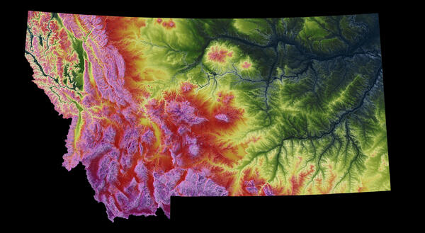
3DEP As Art - Montana

A modern illustration of each state's landscape uses 3DEP data to showcase subtle beauty in their elevation differences like never before. Every state has been consistently adjusted and colorized using the seamless 3DEP 1/3rd arc-second data according to its highest and lowest elevations, which helps accentuate differences even in states with low relief.

A modern illustration of each state's landscape uses 3DEP data to showcase subtle beauty in their elevation differences like never before. Every state has been consistently adjusted and colorized using the seamless 3DEP 1/3rd arc-second data according to its highest and lowest elevations, which helps accentuate differences even in states with low relief.

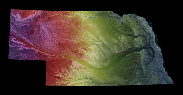
3DEP As Art - Nebraska

A modern illustration of each state's landscape uses 3DEP data to showcase subtle beauty in their elevation differences like never before. Every state has been consistently adjusted and colorized using the seamless 3DEP 1/3rd arc-second data according to its highest and lowest elevations, which helps accentuate differences even in states with low relief.

A modern illustration of each state's landscape uses 3DEP data to showcase subtle beauty in their elevation differences like never before. Every state has been consistently adjusted and colorized using the seamless 3DEP 1/3rd arc-second data according to its highest and lowest elevations, which helps accentuate differences even in states with low relief.

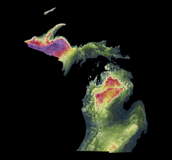
3DEP As Art - Michigan

A modern illustration of each state's landscape uses 3DEP data to showcase subtle beauty in their elevation differences like never before. Every state has been consistently adjusted and colorized using the seamless 3DEP 1/3rd arc-second data according to its highest and lowest elevations, which helps accentuate differences even in states with low relief.

A modern illustration of each state's landscape uses 3DEP data to showcase subtle beauty in their elevation differences like never before. Every state has been consistently adjusted and colorized using the seamless 3DEP 1/3rd arc-second data according to its highest and lowest elevations, which helps accentuate differences even in states with low relief.

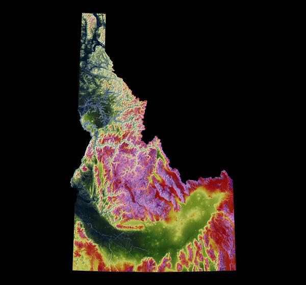
3DEP As Art - Idaho
3DEP As Art - Idaho
3DEP As Art - Idaho
3DEP As Art - Idaho

A modern illustration of each state's landscape uses 3DEP data to showcase subtle beauty in their elevation differences like never before. Every state has been consistently adjusted and colorized using the seamless 3DEP 1/3rd arc-second data according to its highest and lowest elevations, which helps accentuate differences even in states with low relief.

A modern illustration of each state's landscape uses 3DEP data to showcase subtle beauty in their elevation differences like never before. Every state has been consistently adjusted and colorized using the seamless 3DEP 1/3rd arc-second data according to its highest and lowest elevations, which helps accentuate differences even in states with low relief.

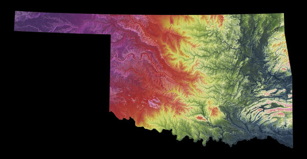
3DEP As Art - Oklahoma

A modern illustration of each state's landscape uses 3DEP data to showcase subtle beauty in their elevation differences like never before. Every state has been consistently adjusted and colorized using the seamless 3DEP 1/3rd arc-second data according to its highest and lowest elevations, which helps accentuate differences even in states with low relief.

A modern illustration of each state's landscape uses 3DEP data to showcase subtle beauty in their elevation differences like never before. Every state has been consistently adjusted and colorized using the seamless 3DEP 1/3rd arc-second data according to its highest and lowest elevations, which helps accentuate differences even in states with low relief.

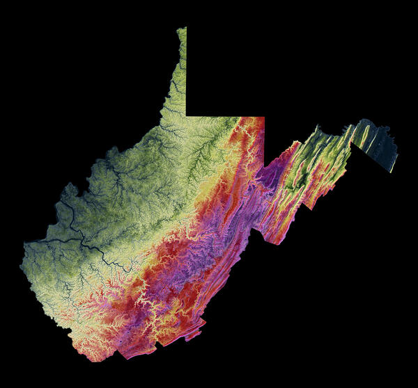
3DEP As Art - West Virginia

A modern illustration of each state's landscape uses 3DEP data to showcase subtle beauty in their elevation differences like never before. Every state has been consistently adjusted and colorized using the seamless 3DEP 1/3rd arc-second data according to its highest and lowest elevations, which helps accentuate differences even in states with low relief.

A modern illustration of each state's landscape uses 3DEP data to showcase subtle beauty in their elevation differences like never before. Every state has been consistently adjusted and colorized using the seamless 3DEP 1/3rd arc-second data according to its highest and lowest elevations, which helps accentuate differences even in states with low relief.

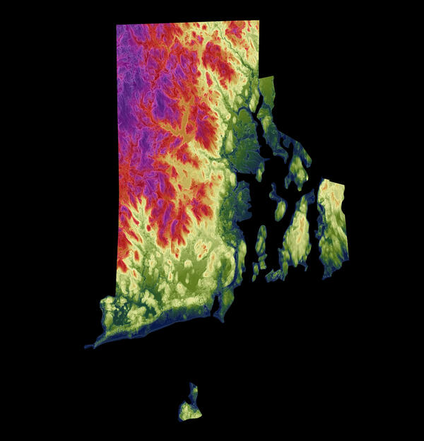
3DEP As Art - Rhode Island

A modern illustration of each state's landscape uses 3DEP data to showcase subtle beauty in their elevation differences like never before. Every state has been consistently adjusted and colorized using the seamless 3DEP 1/3rd arc-second data according to its highest and lowest elevations, which helps accentuate differences even in states with low relief.

A modern illustration of each state's landscape uses 3DEP data to showcase subtle beauty in their elevation differences like never before. Every state has been consistently adjusted and colorized using the seamless 3DEP 1/3rd arc-second data according to its highest and lowest elevations, which helps accentuate differences even in states with low relief.

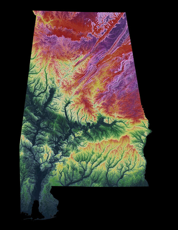
3DEP As Art - Alabama

A modern illustration of each state's landscape uses 3DEP data to showcase subtle beauty in their elevation differences like never before. Every state has been consistently adjusted and colorized using the seamless 3DEP 1/3rd arc-second data according to its highest and lowest elevations, which helps accentuate differences even in states with low relief.

A modern illustration of each state's landscape uses 3DEP data to showcase subtle beauty in their elevation differences like never before. Every state has been consistently adjusted and colorized using the seamless 3DEP 1/3rd arc-second data according to its highest and lowest elevations, which helps accentuate differences even in states with low relief.

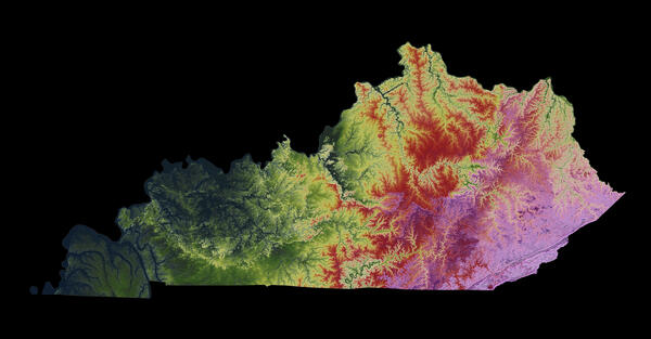
3DEP As Art - Kentucky

A modern illustration of each state's landscape uses 3DEP data to showcase subtle beauty in their elevation differences like never before. Every state has been consistently adjusted and colorized using the seamless 3DEP 1/3rd arc-second data according to its highest and lowest elevations, which helps accentuate differences even in states with low relief.

A modern illustration of each state's landscape uses 3DEP data to showcase subtle beauty in their elevation differences like never before. Every state has been consistently adjusted and colorized using the seamless 3DEP 1/3rd arc-second data according to its highest and lowest elevations, which helps accentuate differences even in states with low relief.

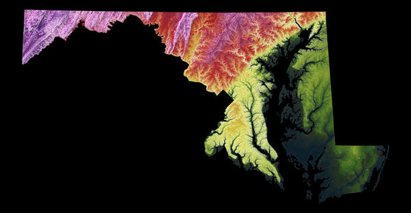
3DEP As Art - Maryland

A modern illustration of each state's landscape uses 3DEP data to showcase subtle beauty in their elevation differences like never before. Every state has been consistently adjusted and colorized using the seamless 3DEP 1/3rd arc-second data according to its highest and lowest elevations, which helps accentuate differences even in states with low relief.

A modern illustration of each state's landscape uses 3DEP data to showcase subtle beauty in their elevation differences like never before. Every state has been consistently adjusted and colorized using the seamless 3DEP 1/3rd arc-second data according to its highest and lowest elevations, which helps accentuate differences even in states with low relief.

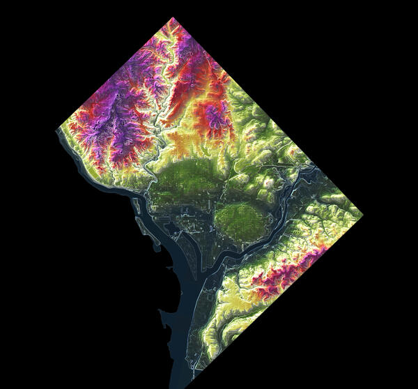
3DEP As Art - District of Columbia

A modern illustration of each state's landscape uses 3DEP data to showcase subtle beauty in their elevation differences like never before. Every state has been consistently adjusted and colorized using the seamless 3DEP 1/3rd arc-second data according to its highest and lowest elevations, which helps accentuate differences even in states with low relief.

A modern illustration of each state's landscape uses 3DEP data to showcase subtle beauty in their elevation differences like never before. Every state has been consistently adjusted and colorized using the seamless 3DEP 1/3rd arc-second data according to its highest and lowest elevations, which helps accentuate differences even in states with low relief.

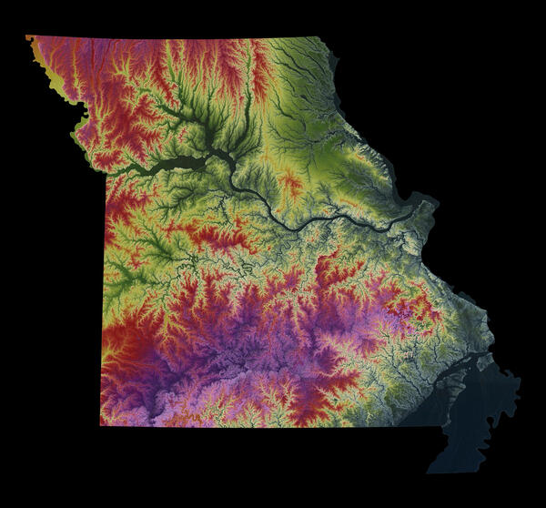
3DEP As Art - Missouri

A modern illustration of each state's landscape uses 3DEP data to showcase subtle beauty in their elevation differences like never before. Every state has been consistently adjusted and colorized using the seamless 3DEP 1/3rd arc-second data according to its highest and lowest elevations, which helps accentuate differences even in states with low relief.

A modern illustration of each state's landscape uses 3DEP data to showcase subtle beauty in their elevation differences like never before. Every state has been consistently adjusted and colorized using the seamless 3DEP 1/3rd arc-second data according to its highest and lowest elevations, which helps accentuate differences even in states with low relief.

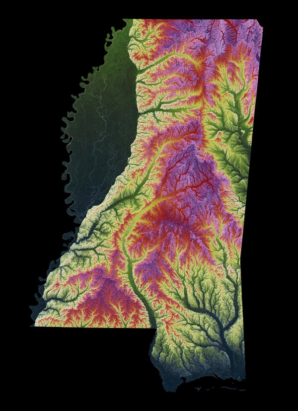
3DEP As Art - Mississippi

A modern illustration of each state's landscape uses 3DEP data to showcase subtle beauty in their elevation differences like never before. Every state has been consistently adjusted and colorized using the seamless 3DEP 1/3rd arc-second data according to its highest and lowest elevations, which helps accentuate differences even in states with low relief.

A modern illustration of each state's landscape uses 3DEP data to showcase subtle beauty in their elevation differences like never before. Every state has been consistently adjusted and colorized using the seamless 3DEP 1/3rd arc-second data according to its highest and lowest elevations, which helps accentuate differences even in states with low relief.

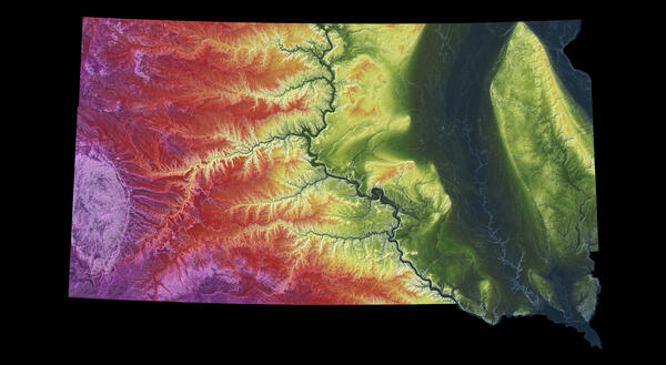
3DEP As Art - South Dakota

A modern illustration of each state's landscape uses 3DEP data to showcase subtle beauty in their elevation differences like never before. Every state has been consistently adjusted and colorized using the seamless 3DEP 1/3rd arc-second data according to its highest and lowest elevations, which helps accentuate differences even in states with low relief.

A modern illustration of each state's landscape uses 3DEP data to showcase subtle beauty in their elevation differences like never before. Every state has been consistently adjusted and colorized using the seamless 3DEP 1/3rd arc-second data according to its highest and lowest elevations, which helps accentuate differences even in states with low relief.

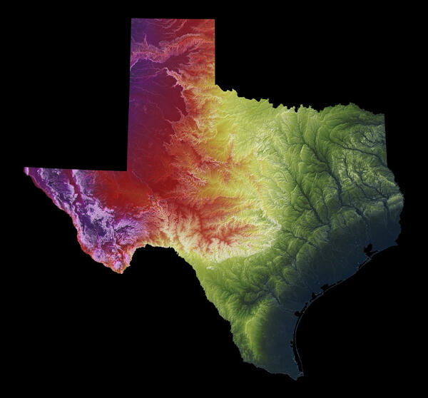
3DEP As Art - Texas
3DEP As Art - Texas
3DEP As Art - Texas
3DEP As Art - Texas

A modern illustration of each state's landscape uses 3DEP data to showcase subtle beauty in their elevation differences like never before. Every state has been consistently adjusted and colorized using the seamless 3DEP 1/3rd arc-second data according to its highest and lowest elevations, which helps accentuate differences even in states with low relief.

A modern illustration of each state's landscape uses 3DEP data to showcase subtle beauty in their elevation differences like never before. Every state has been consistently adjusted and colorized using the seamless 3DEP 1/3rd arc-second data according to its highest and lowest elevations, which helps accentuate differences even in states with low relief.

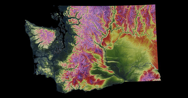
3DEP As Art - Washington

A modern illustration of each state's landscape uses 3DEP data to showcase subtle beauty in their elevation differences like never before. Every state has been consistently adjusted and colorized using the seamless 3DEP 1/3rd arc-second data according to its highest and lowest elevations, which helps accentuate differences even in states with low relief.

A modern illustration of each state's landscape uses 3DEP data to showcase subtle beauty in their elevation differences like never before. Every state has been consistently adjusted and colorized using the seamless 3DEP 1/3rd arc-second data according to its highest and lowest elevations, which helps accentuate differences even in states with low relief.

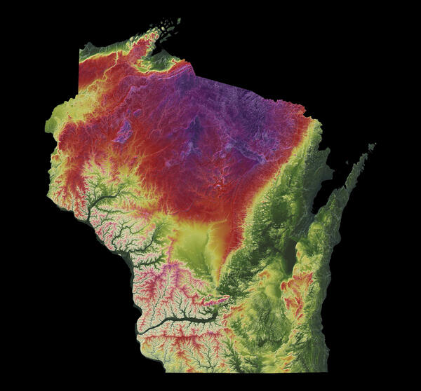
3DEP As Art - Wisconsin

A modern illustration of each state's landscape uses 3DEP data to showcase subtle beauty in their elevation differences like never before. Every state has been consistently adjusted and colorized using the seamless 3DEP 1/3rd arc-second data according to its highest and lowest elevations, which helps accentuate differences even in states with low relief.

A modern illustration of each state's landscape uses 3DEP data to showcase subtle beauty in their elevation differences like never before. Every state has been consistently adjusted and colorized using the seamless 3DEP 1/3rd arc-second data according to its highest and lowest elevations, which helps accentuate differences even in states with low relief.

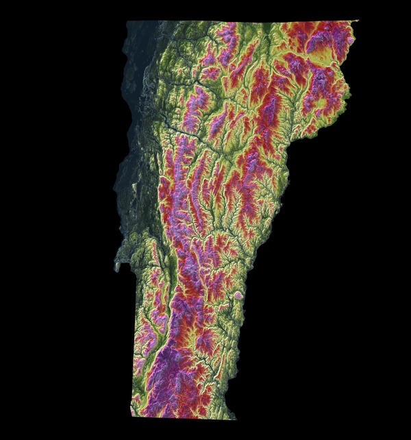
3DEP As Art - Vermont

A modern illustration of each state's landscape uses 3DEP data to showcase subtle beauty in their elevation differences like never before. Every state has been consistently adjusted and colorized using the seamless 3DEP 1/3rd arc-second data according to its highest and lowest elevations, which helps accentuate differences even in states with low relief.

A modern illustration of each state's landscape uses 3DEP data to showcase subtle beauty in their elevation differences like never before. Every state has been consistently adjusted and colorized using the seamless 3DEP 1/3rd arc-second data according to its highest and lowest elevations, which helps accentuate differences even in states with low relief.

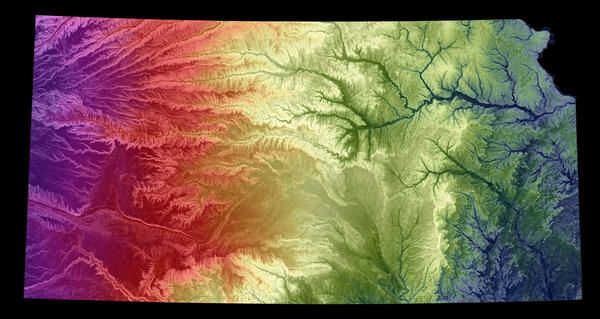
3DEP As Art - Kansas

A modern illustration of each state's landscape uses 3DEP data to showcase subtle beauty in their elevation differences like never before. Every state has been consistently adjusted and colorized using the seamless 3DEP 1/3rd arc-second data according to its highest and lowest elevations, which helps accentuate differences even in states with low relief.

A modern illustration of each state's landscape uses 3DEP data to showcase subtle beauty in their elevation differences like never before. Every state has been consistently adjusted and colorized using the seamless 3DEP 1/3rd arc-second data according to its highest and lowest elevations, which helps accentuate differences even in states with low relief.

Was this page helpful?