USGS invited all federally recognized Tribes, Alaska Native Corporations, and Native Hawaiian Organizations to virtual informational meetings on March 11, 2024 and March 22, 2024 about the 3D National Topography Model and its components, the 3D Elevation Program and the 3D Hydrography Program.
Videos
 2024 Overview of the USGS 3D Elevation Program and 3D Hydrography Program for Tribes
USGS invited all federally recognized Tribes, Alaska Native Corporations, and Native Hawaiian Organizations to virtual informational meetings on March 11, 2024 and March 22, 2024 about the 3D National Topography Model and its components, the 3D Elevation Program and the 3D Hydrography Program.
 Development of a Geographic Information System Methodology for the Public Drinking Water Source Water Assessment Program in Tennessee
Development of a Geographic Information System Methodology for the Public Drinking Water Source Water Assessment Program in Tennessee
linkPresenters are Rebecca Ransom and David Ladd with the USGS Lower Mississippi Gulf Water Science Center in Nashville, TN.
Development of a Geographic Information System Methodology for the Public Drinking Water Source Water Assessment Program in Tennessee
linkPresenters are Rebecca Ransom and David Ladd with the USGS Lower Mississippi Gulf Water Science Center in Nashville, TN.
The US Army Corps of Engineers (USACE) office in Huntington, WV provides a number of floodplain management services. These include base flood elevation (BFE) evaluations, watershed modeling, project planning, and responding to numerous technical questions.
The US Army Corps of Engineers (USACE) office in Huntington, WV provides a number of floodplain management services. These include base flood elevation (BFE) evaluations, watershed modeling, project planning, and responding to numerous technical questions.
 Strategies for improving the Washington State Hydrography Dataset (WASHD)
Joshua Greenberg works at the Washington Department of Ecology as the Hydrography Steward. He has been very active in supporting professional GIS organizations within Washington, including being on the board of the local ASPRS chapter, WAGISA (WAURISA), and WAGIC co-chair. Josh earned his B.A.
Joshua Greenberg works at the Washington Department of Ecology as the Hydrography Steward. He has been very active in supporting professional GIS organizations within Washington, including being on the board of the local ASPRS chapter, WAGISA (WAURISA), and WAGIC co-chair. Josh earned his B.A.
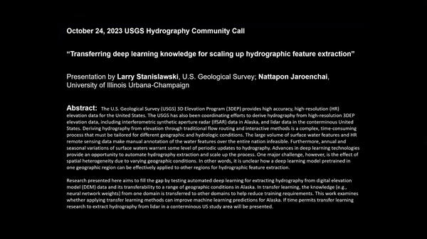
 Transferring Deep Learning Knowledge for Scaling Up Hydrographic Feature Extraction
The U.S. Geological Survey (USGS) 3D Elevation Program (3DEP) provides high accuracy, high-resolution (HR) elevation data for the United States.
The U.S. Geological Survey (USGS) 3D Elevation Program (3DEP) provides high accuracy, high-resolution (HR) elevation data for the United States.
The presenter is Dave Blodgett. Dave is a Civil Engineer with the USGS Water Mission Area and is also on assignment to NGTOC's Topographic Applied Research Team.
The presenter is Dave Blodgett. Dave is a Civil Engineer with the USGS Water Mission Area and is also on assignment to NGTOC's Topographic Applied Research Team.
 Towards an Internet of Water: Creating a community search index for water data
Our topic will be "Towards an Internet of Water: Creating a community search index for water data.” The presenter will be Kyle Onda, Director, Internet of Water with the Center for Geospatial Solutions, Lincoln Institute of Land Policy.
Summary:
Our topic will be "Towards an Internet of Water: Creating a community search index for water data.” The presenter will be Kyle Onda, Director, Internet of Water with the Center for Geospatial Solutions, Lincoln Institute of Land Policy.
Summary:
Agenda: Youtube (linked to video on Youtube)
Agenda: Youtube (linked to video on Youtube)
 The 3D Hydrography Program – transition status July 25, 2023
Agenda:
 Lesson 4b - Downloading Maps and Data with The National Map Download Application
In this lesson we will provide a brief introduction on how to use The National Map Download Application to download USGS maps and data. The TNM Download Application allows users to explore and access the USGS staged products available for download.
In this lesson we will provide a brief introduction on how to use The National Map Download Application to download USGS maps and data. The TNM Download Application allows users to explore and access the USGS staged products available for download.
 What’s Happening with National Hydrography – USGS at AWRA Geospatial Water Technology Conference May 2022
What’s Happening with National Hydrography – USGS at AWRA Geospatial Water Technology Conference May 2022
linkOur material is taken from the "USGS National Hydrography Datasets – What’s Happening Now?" session previously held at the recent American Water Resources Association (AWRA) Geospatial Water Technology Conference earlier in May. We will cover:
Topic is “The NHD to 3DHP – midyear update”
Agenda:
- 00:00 – Start
- 1:57 - The NHD to 3DHP – midyear update (section1 - Steve Aichele)
- 28:13 - The NHD to 3DHP – midyear update (section2 – Sue Buto)
- 43:05 - Closing remarks
Links:
Topic is “The NHD to 3DHP – midyear update”
Agenda:
- 00:00 – Start
- 1:57 - The NHD to 3DHP – midyear update (section1 - Steve Aichele)
- 28:13 - The NHD to 3DHP – midyear update (section2 – Sue Buto)
- 43:05 - Closing remarks
Links:
The HydroAdd tool is a web application built by USGS that allows collaborative addressing (or linear referencing) of diverse datasets to the NHD. HydroAdd also provides tools that allow users to migrate datasets that have been previously addressed to the NHD.
The HydroAdd tool is a web application built by USGS that allows collaborative addressing (or linear referencing) of diverse datasets to the NHD. HydroAdd also provides tools that allow users to migrate datasets that have been previously addressed to the NHD.
 Lesson 10g1 – Importing and Visualizing Elevation Data Using GRASS GIS
This lesson will show how to run GRASS GIS and utilize GRASS’s unique user interface to import and visualize elevation data.
This lesson will show how to run GRASS GIS and utilize GRASS’s unique user interface to import and visualize elevation data.
In this lesson, we will discuss each of the eight base layers of The National Map (TNM). Understanding the content of each layer, where the data comes from, and how this information is managed, is an important step in better utilizing The National Map and its products and services.
Timestamps:
In this lesson, we will discuss each of the eight base layers of The National Map (TNM). Understanding the content of each layer, where the data comes from, and how this information is managed, is an important step in better utilizing The National Map and its products and services.
Timestamps:
 WaterML2 Part 3: Surface Hydrology Features (HY_Features) Conceptual Model and the Mainstems Logistical Data Model
WaterML2 Part 3: Surface Hydrology Features (HY_Features) Conceptual Model and the Mainstems Logistical Data Model
linkHY_Features is the international standard conceptual data model for surface hydrologic features which will be used as the basis for the 3DHP data model – the planned successor to the NHD.
 Governance, Partnerships, and Data Acquisition to Support the 3D Hydrography Program
The U.S. Geological Survey (USGS) has developed a vision for the 3D National Topography Model (3DNTM), which will integrate USGS elevation and hydrography datasets to model the Nation's topography in 3D.
The U.S. Geological Survey (USGS) has developed a vision for the 3D National Topography Model (3DNTM), which will integrate USGS elevation and hydrography datasets to model the Nation's topography in 3D.
 Lesson 11a - The US Interagency Elevation Inventory (USIEI)
The US Interagency Elevation Inventory, or USIEI, is a nationwide listing of known publicly available high-accuracy topographic and bathymetric source elevation data for the United States and its territories. The inventory provides a single resource for information about all known completed and in-progress broad-area public domain elevation data.
The US Interagency Elevation Inventory, or USIEI, is a nationwide listing of known publicly available high-accuracy topographic and bathymetric source elevation data for the United States and its territories. The inventory provides a single resource for information about all known completed and in-progress broad-area public domain elevation data.
 Using Google Earth Engine to Generate Monthly-to-Weekly Maps of Surface Water
Our topic will be "Using Google Earth Engine to Generate Monthly-to-Weekly Maps of Surface Water." The presenter will be Chris Soulard with the USGS Western Geographic Science Center.
Our topic will be "Using Google Earth Engine to Generate Monthly-to-Weekly Maps of Surface Water." The presenter will be Chris Soulard with the USGS Western Geographic Science Center.
 Lesson 4a – Using The National Map Download Application
In this lesson we will provide a brief introduction on how to use The National Map Download Application. The TNM Download application allows users to explore and access the USGS staged products available for download. This application is a user-friendly version of the USGS staged-product application programming interface, and it is available on most platforms.
In this lesson we will provide a brief introduction on how to use The National Map Download Application. The TNM Download application allows users to explore and access the USGS staged products available for download. This application is a user-friendly version of the USGS staged-product application programming interface, and it is available on most platforms.
The USGS is pleased to announce the release of the National Hydrography Dataset Plus (NHDPlus HR) National Release 1 downloadable staged product. The NHDPlus HR National Release 1 presents a single, nationally continuous representation of all published NHDPlus HR Vector Processing Unit (VPU) datasets.
The USGS is pleased to announce the release of the National Hydrography Dataset Plus (NHDPlus HR) National Release 1 downloadable staged product. The NHDPlus HR National Release 1 presents a single, nationally continuous representation of all published NHDPlus HR Vector Processing Unit (VPU) datasets.


