



The USGS has updated the 3D Hydrography Program (3DHP) web service (accessible at https://3dhp.nationalmap.gov/arcgis/rest/services/usgs_3dhp_all/FeatureServer). This updated service includes the first new hydrography data published by the 3DHP and aligned with 3
Images
National Geospatial Program images.
Filter Total Items: 255
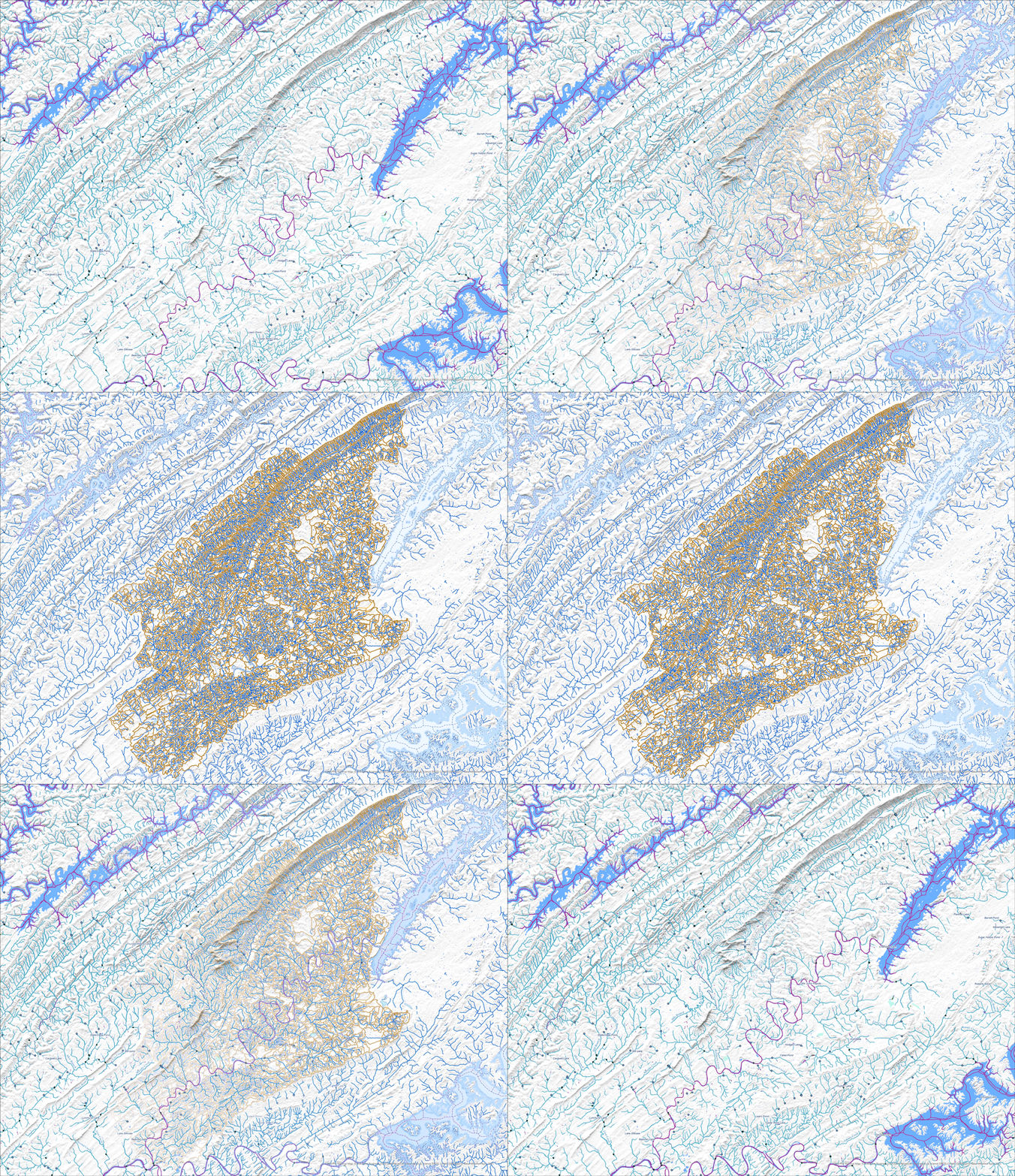
Holston River NHD to 3DHP Animation
The USGS has updated the 3D Hydrography Program (3DHP) web service (accessible at https://3dhp.nationalmap.gov/arcgis/rest/services/usgs_3dhp_all/FeatureServer). This updated service includes the first new hydrography data published by the 3DHP and aligned with 3
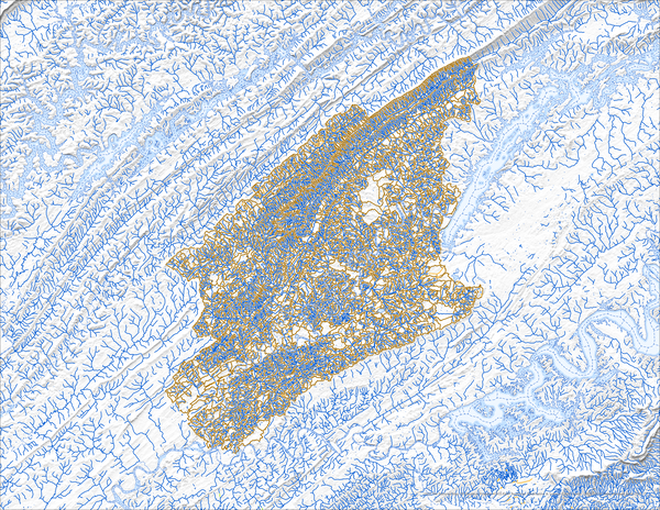
Holston River 3DHP Data Feature Service
The USGS has updated the 3D Hydrography Program (3DHP) web service (accessible at https://3dhp.nationalmap.gov/arcgis/rest/services/usgs_3dhp_all/FeatureServer). This updated service includes the first new hydrography data published by the 3DHP and aligned with 3
The USGS has updated the 3D Hydrography Program (3DHP) web service (accessible at https://3dhp.nationalmap.gov/arcgis/rest/services/usgs_3dhp_all/FeatureServer). This updated service includes the first new hydrography data published by the 3DHP and aligned with 3
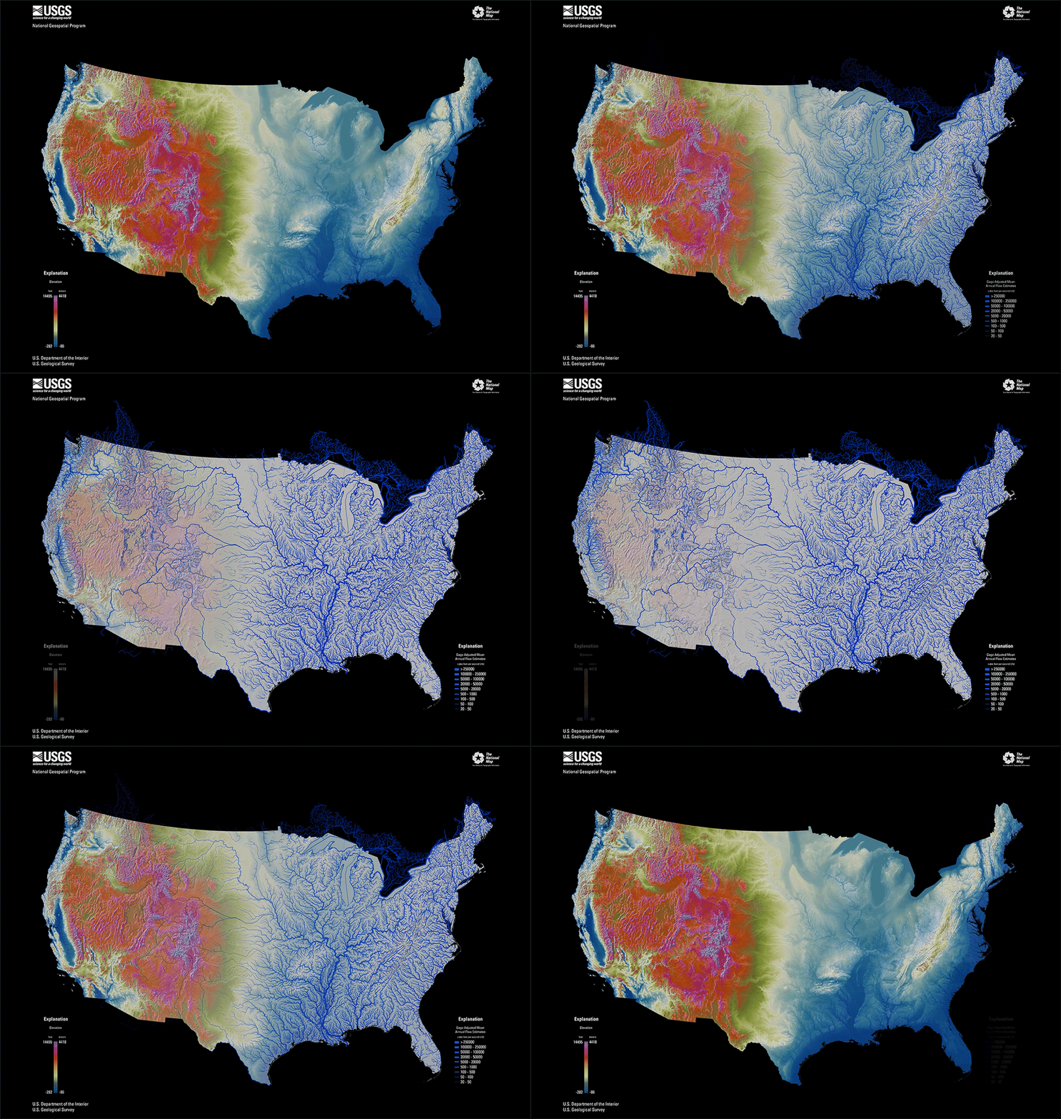
CONUS Elevation and Hydrography Animation
CONUS elevation map in bright, vibrant colors with purple as highest elevation and blue as lowest elevation and the hydrography map with larger annual flow volumes as thicker lines.
CONUS elevation map in bright, vibrant colors with purple as highest elevation and blue as lowest elevation and the hydrography map with larger annual flow volumes as thicker lines.

The National Map 3D Viewer 3D View from Wotans Throne, CA
The National Map 3D Viewer 3D View from Wotans Throne, CAScreenshot of the National Map 3D Viewer showing a 3D view looking northeast. The location is near Wotans Throne.
The National Map 3D Viewer 3D View from Wotans Throne, CA
The National Map 3D Viewer 3D View from Wotans Throne, CAScreenshot of the National Map 3D Viewer showing a 3D view looking northeast. The location is near Wotans Throne.

The National Map 3D Viewer, Elevation Profile
Screenshot of the National Map 3D Viewer showing the elevation profile tool. The screen shot is of the Inyo National Forest area of California, near Tunnabora Peak.
Screenshot of the National Map 3D Viewer showing the elevation profile tool. The screen shot is of the Inyo National Forest area of California, near Tunnabora Peak.
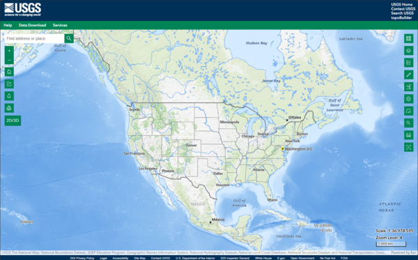
The National Map 3D Viewer
This is a screen shot of the National Map (TNM) 3D Viewer Application. This new application will replace the existing TNM Viewer on or around April 7th 2025
This is a screen shot of the National Map (TNM) 3D Viewer Application. This new application will replace the existing TNM Viewer on or around April 7th 2025
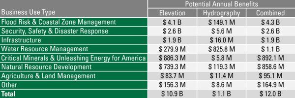
3DTNM Potential Annual Benefits
Potential Annual Benefits by Business Use Type for Elevation and Hydrography Data if all needs are met.
Potential Annual Benefits by Business Use Type for Elevation and Hydrography Data if all needs are met.

Postfire Modified Hillshade over the Eaton Fire
A modified hillshade of a postfire lidar-derived digital surface model over a portion of the Eaton wildfire
A modified hillshade of a postfire lidar-derived digital surface model over a portion of the Eaton wildfire

A Modified Hillshade over the Pallisades Fire
A modified hillshade rendering from lidar-derived DSM data over part of the Pallisades Fire
A modified hillshade rendering from lidar-derived DSM data over part of the Pallisades Fire

Eaton Fire DSM Hillshade
A modified hillshade rendering from lidar-derived DSM data over par of the Eaton Fire
A modified hillshade rendering from lidar-derived DSM data over par of the Eaton Fire

Eaton Fire Modified Hillshade over NASA Jet Propulsion Lab Campus
Eaton Fire Modified Hillshade over NASA Jet Propulsion Lab CampusA modified hillshade rendering from lidar-derived DSM data over the NASA Jet Propulsion Lab Campus
Eaton Fire Modified Hillshade over NASA Jet Propulsion Lab Campus
Eaton Fire Modified Hillshade over NASA Jet Propulsion Lab CampusA modified hillshade rendering from lidar-derived DSM data over the NASA Jet Propulsion Lab Campus

Eaton Fire hillshade rendering
A modified hillshade rendering from lidar-derived DSM data over the Eaton Fire showing burned structures
A modified hillshade rendering from lidar-derived DSM data over the Eaton Fire showing burned structures

A Modified Hillshade over the Pallisades Fire
A modified hillshade rendering from lidar-derived DSM data over the Pallisades Fire
A modified hillshade rendering from lidar-derived DSM data over the Pallisades Fire

Modified Hillshade of Pallisades Fire
A modified hillshade rendering from lidar-derived DSM data over the Pallisades Fire
A modified hillshade rendering from lidar-derived DSM data over the Pallisades Fire

Eaton fire modified hillshade
A modified hillshade rendering from lidar-derived DSM data over part of the Eaton Fire
A modified hillshade rendering from lidar-derived DSM data over part of the Eaton Fire
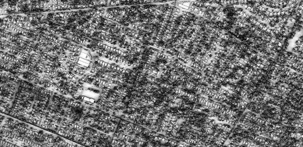
Prefire Modified Hillshade over the Eaton Fire
A modified hillshade of a prefire lidar-derived digital surface model over a portion of the Eaton wildfire
A modified hillshade of a prefire lidar-derived digital surface model over a portion of the Eaton wildfire

Post Wildfire 3D Rendering of a Lidar-Derived DSM of the Area Around Altadena, CA
Post Wildfire 3D Rendering of a Lidar-Derived DSM of the Area Around Altadena, CAPost wildfire 3D rendering of a lidar-derived DSM of the area around Altadena, CA with a green to gray symbology
Post Wildfire 3D Rendering of a Lidar-Derived DSM of the Area Around Altadena, CA
Post Wildfire 3D Rendering of a Lidar-Derived DSM of the Area Around Altadena, CAPost wildfire 3D rendering of a lidar-derived DSM of the area around Altadena, CA with a green to gray symbology

Post Wildfire Lidar-derived DSM of Eaton, CA
Post Wildfire Lidar-derived DSM showing the full extent of the Eaton, CA Wildfire with a green to gray symbology
Post Wildfire Lidar-derived DSM showing the full extent of the Eaton, CA Wildfire with a green to gray symbology

Post Wildfire Lidar-derived DSM of the Area around the NASA Jet Propulsion Laboratory Campus, CA
Post Wildfire Lidar-derived DSM of the Area around the NASA Jet Propulsion Laboratory Campus, CAPost Wildfire Lidar-derived DSM of the Area around the NASA Jet Propulsion Laboratory Campus, CA with a green to brown symbology
Post Wildfire Lidar-derived DSM of the Area around the NASA Jet Propulsion Laboratory Campus, CA
Post Wildfire Lidar-derived DSM of the Area around the NASA Jet Propulsion Laboratory Campus, CAPost Wildfire Lidar-derived DSM of the Area around the NASA Jet Propulsion Laboratory Campus, CA with a green to brown symbology
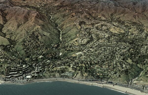
Post Wildfire Lidar-derived DSM of the Area Around Castle Rock Beach, Los Angeles, CA
Post Wildfire Lidar-derived DSM of the Area Around Castle Rock Beach, Los Angeles, CAPost Wildfire Lidar-derived DSM of the Area Around Castle Rock Beach, Los Angeles, CA with semi-transparent imagery overlaid
Post Wildfire Lidar-derived DSM of the Area Around Castle Rock Beach, Los Angeles, CA
Post Wildfire Lidar-derived DSM of the Area Around Castle Rock Beach, Los Angeles, CAPost Wildfire Lidar-derived DSM of the Area Around Castle Rock Beach, Los Angeles, CA with semi-transparent imagery overlaid
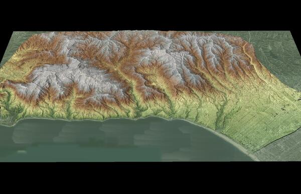
Post Wildfire Lidar-derived DSM of Pacific Palisades, Los Angeles, CA
Post Wildfire Lidar-derived DSM of Pacific Palisades, Los Angeles, CAPost Wildfire Lidar-derived DSM of Pacific Palisades, Los Angeles, CA with a green to brown symbology
Post Wildfire Lidar-derived DSM of Pacific Palisades, Los Angeles, CA
Post Wildfire Lidar-derived DSM of Pacific Palisades, Los Angeles, CAPost Wildfire Lidar-derived DSM of Pacific Palisades, Los Angeles, CA with a green to brown symbology