
US Topo Map Evolution
topoBuilder
Create custom USGS topographic maps on demand using the best available data from The National Map
Create custom USGS topographic maps on demand using the best available data from The National Map
In 2017, the US Topo map production system was redesigned and modernized to provide a system that facilitates long term goals for more efficient production and continued product improvements.
Create an OnDemand Topo
Create an OnDemand Topo
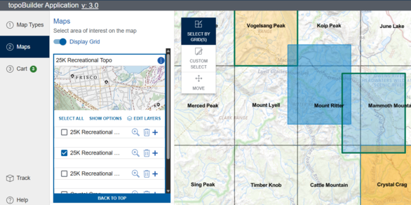
Build a USGS topographic map with choice of format, area of interest, scale, and National Map content.