
Supporting Themes
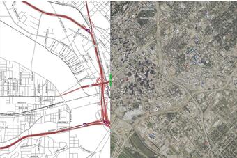
Example Map with Transportation
Example Map with Boundaries
Example of Imagery
Example Map with Railroads
Example Map with Structures Tint
Supporting themes for The National Map (TNM) include Transportation, Structures, Boundaries, Imagery, Land Cover, and Small-Scale datasets.

Providing Context for the Nation's Topography
Since there is not a single authoritative, nationally consistent source for TNM supporting themes (transportation, structures, boundaries, imagery, land cover), the USGS actively seeks the most cost effective and efficient means to aggregate and collect the data for use in TNM products and services. This is done through partnerships with collaborators who are the authoritative sources, and through The National Map Corps which facilitates volunteer contributions. The partnerships are mutually beneficial since data updates and revisions are shared. Federal partners include U.S. Census Bureau, U.S. Forest Service, National Park Service, U.S. Fish and Wildlife Service, Bureau of Land Management, Tennessee Valley Authority, U.S. Department of Transportation, U.S. Department of Agriculture - Farm Production and Conservation Business Center, and the National Geospatial-Intelligence Agency. The supporting themes can be easily viewed in The National Map Viewer.
Transportation, Structures, and Boundaries
The Transportation data theme consists of roads, airports, trails, railroads, and other features associated with the transport of people or commerce. USGS data portray selected Structures data including schools, fire stations, police stations, visitor centers, post offices, and hospitals. Boundaries data, or Governmental Units, represent major civil areas including States, counties, Federal, Tribal lands, and incorporated places such as cities and towns. The USGS makes nationally consistent geospatial data available for these themes in the National Transportation Dataset, the National Structures Dataset, and the National Boundary Dataset. These datasets are available in the public domain.
The imagery available through the National Map for the conterminous United States is data obtained through partnership with the National Agriculture Imagery Program (NAIP). These digital ortho photographs are high resolution aerial images that combine the visual attributes of an aerial photograph with the spatial accuracy and reliability of a planimetric map and are available in the public domain. For areas where NAIP is not available (Alaska, Hawaii, U.S. Territories), the TNM map viewer uses imagery from commercial sources. In the future there will be NAIP available for Hawaii, Puerto Rico, and U.S. Virgin Islands.
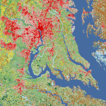
Land Cover
The National Land Cover Database (NLCD) serves as the definitive Landsat-based, 30-meter resolution, land cover database for the Nation. NLCD provides spatial reference and descriptive data for characteristics of the land surface such as thematic class (for example, urban, agriculture, and forest), percent impervious surface, and percent tree canopy cover. NLCD supports a wide variety of Federal, State, Tribal, local, and nongovernmental applications that seek to assess ecosystem status and health, understand the spatial patterns of biodiversity, assess effects of climate change, and develop land management policy. NLCD products are created by the Multi-Resolution Land Characteristics (MRLC) Consortium, a partnership of Federal agencies led by the U.S. Geological Survey. Please see https://www.mrlc.gov/ for more information. The woodland tint shown on the US Topo and OnDemand topo maps are derived from this data.
The National Map Small-Scale Data
The small-scale data for boundaries, contours, hydrography, and transportation can be found and downloaded free at TNM Downloader. The National Map incorporates the small-scale data in its web mapping and web feature services as part of TNM multi-scale theme overlay services. These services are listed in the TNM Service List and can be viewed in the National Map Viewer or added to a variety of GIS software or applications for further use.
These data originated from the 1997-2014 Edition of the National Atlas of the United States that was retired in September 2014. The archived National Atlas digital maps are available via the USGS EROS EarthExplorer. More information is available on the Small-Scale Data page.
All these datasets, combined with other products and services provided by TNM, provide a valuable resource of consistent, complete, high quality nationwide coverage available to a variety of end users, including (but not limited to) the following:
- Water resource and flood risk management
- Geologic mapping
- Natural hazards
- Natural resource conservation
- Emergency management
- Recreation