
About
The fundamental goal of the NLI Program is to provide the Federal Government and the public with a primary source of remotely sensed data and applications and to be a leader in defining the future of land remote sensing, nationally and internationally.

Pecora Pecora
The Pecora Award and Pecora Conference highlight advances in remote sensing and recognize contributions that support the use of Earth observation. Together, they reflect the ongoing importance of collaboration, innovation, and long-term commitment to understanding our planet.
Operations Operations
The U.S. Geological Survey’s National Land Imaging Program manages a range of operational activities that ensure the consistent acquisition, delivery, and application of Earth observation data. These efforts support Landsat satellite operations, coordinate remote sensing capabilities across federal and international partners, and provide rapid access to imagery during disasters and emergencies.

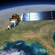
About National Land Imaging About National Land Imaging
The surface of the Earth is changing rapidly, at local, regional, national, even global scales, with significant repercussions for people, the economy, and the environment.

Learn about National Land Imaging Learn about National Land Imaging
Learn about how National Land Imaging data is used.

NLI History, Authorities, Initiatives and Grants NLI History, Authorities, Initiatives and Grants
National Land Imaging plans, reports, and green books.