
Operations
The U.S. Geological Survey’s National Land Imaging Program manages a range of operational activities that ensure the consistent acquisition, delivery, and application of Earth observation data. These efforts support Landsat satellite operations, coordinate remote sensing capabilities across federal and international partners, and provide rapid access to imagery during disasters and emergencies.
Landsat Missions

Since 1972, Landsat satellites have continuously acquired images of the Earth’s land surface, providing uninterrupted data to help land managers and policymakers make informed decisions about natural resources and the environment. The Landsat program is jointly managed by the USGS and NASA.
RCA-EO

Requirements, Capabilities, and Analysis for Earth Observations (RCA-EO) evaluates satellite capabilities to identify effective ways to address civil and societal challenges, helping land managers and policymakers make informed decisions about natural resources and the environment.
NUSO
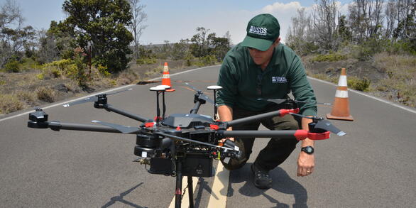
The National Uncrewed Systems Office (NUSO) leads the research activities needed to make Uncrewed Aircraft Systems (UAS) data collection an efficient, safe, and cost-effective remote sensing tool for Department of the Interior and USGS scientists.