
Terrestrial Analogs: Using Earth to Study Space
Did you know the USGS uses sites on Earth to study space? These locations are called terrestrial analogs, and can be used for many different things like conducting research, teaching, and testing instruments. Learn more about terrestrial analogs and space science below!
What is a terrestrial analog?
Planetary scientists study bodies across the solar system. While it would be very helpful to visit these locations and study them directly, traveling to these locations is difficult, time consuming, and expensive. Fortunately, the Earth displays many similar landforms and geologic processes (for example, volcanic eruptions) that are also observed on other planetary bodies. These locations on Earth (called terrestrial analogs) can be studied more easily than other planetary bodies, and the basic geologic principles can then be used to better understand similar sites across the solar system. Terrestrial analogs can be used for a wide variety of science investigations, but also for training, technology demonstrations, route (traverse) planning, and field simulations.


How does the USGS use terrestrial analogs?
Understanding geologic processes

Since planetary scientists can't visit the places they study, they often use similar locations here on Earth (terrestrial analogs) to better understand the geologic processes that are occurring. This includes locations like dune fields, volcanoes, rivers and lakes, impact craters, and glaciers. By studying the processes that create these features on Earth, planetary scientists can then take what they know about how these features form and use it to interpret similar features on other planetary bodies. Sometimes the feature is made of a different material than it is on Earth (for example, water-based volcanism - "cryovolcanism" - on icy bodies in the outer solar system). Understanding how a geologic process works on Earth also helps planetary scientists understand how those different materials may affect it on another body.
Learn more about how USGS scientists use terrestrial analogs to study our solar system.
Terrestrial Analogs for Research and Geologic Exploration Training
Terrestrial analogs data portal
Terrestrial Analog Sample Collection
Training and testing
Every astronaut that has ever walked on the Moon trained with the USGS in Flagstaff, Arizona. Terrestrial analogs like Cinder Lake crater field, Sunset Crater, the Grand Canyon, and Meteor Crater were used to teach astronauts the importance of geology, how to understand landforms and the processes that make them, and how to create a geologic map. Terrestrial analog sites were critical in preparing the astronauts to explore the surface of the Moon safely, while also making valuable scientific observations for the scientists back on Earth. These pre-mission practices were an opportunity to learn and practice on terrain that was similar to the Moon, without the risk or expense of space travel. In fact, the USGS even made an exact copy of two locations on the Moon! Cinder Lake Crater Field was created with carefully planned explosives, and was an exact copy of two of the possible Apollo landing sites.

Along with astronaut training, instruments, roving vehicles, and traverse logistics were also tested at these sites. Grover the Geologic Rover was a prototype of the Lunar Roving Vehicle, and was used by Apollo 15, 16, and 17 to practice traversing across the "lunar surface" near Flagstaff. Today, you can find Grover proudly on display at the USGS Astrogeology Science Center in Flagstaff.

Today, the USGS is using terrestrial analogs to help prepare the Artemis mission return to the Moon! Learn more about the USGS and mission operations here.
What are some commonly used analog sites?
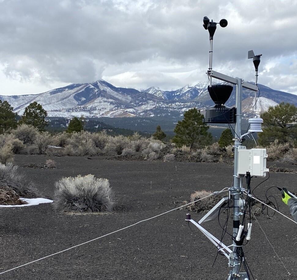
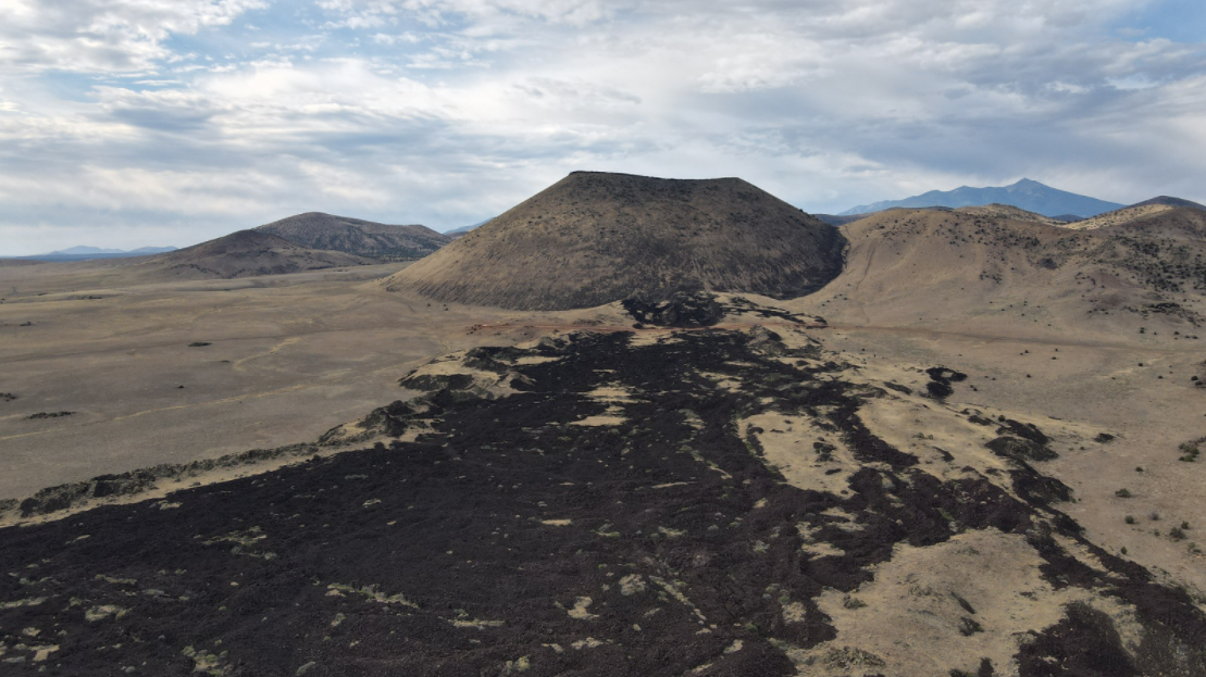
Click the images below to learn about some of the commonly used analog sites in northern Arizona. These sites are used in many ways, including traverse testing and technology demonstrations (SP Mountain, Hopi Buttes, Cinder Lake Crater Field), radiation protection for astronauts and cave microclimates (Lava River Cave), volcanism on other planetary bodies (SP Mountain, Sunset Crater), and water-lava interactions (Verde Valley).
Meteor Crater
Cinder Lake Crater Field
SP Mountain
Sunset Crater
Grand Falls
San Francisco Volcanic Field
Lava River Cave
Verde Valley
Grand Canyon
Did you know the USGS uses sites on Earth to study space? These locations are called terrestrial analogs, and can be used for many different things like conducting research, teaching, and testing instruments. Learn more about terrestrial analogs and space science below!
What is a terrestrial analog?
Planetary scientists study bodies across the solar system. While it would be very helpful to visit these locations and study them directly, traveling to these locations is difficult, time consuming, and expensive. Fortunately, the Earth displays many similar landforms and geologic processes (for example, volcanic eruptions) that are also observed on other planetary bodies. These locations on Earth (called terrestrial analogs) can be studied more easily than other planetary bodies, and the basic geologic principles can then be used to better understand similar sites across the solar system. Terrestrial analogs can be used for a wide variety of science investigations, but also for training, technology demonstrations, route (traverse) planning, and field simulations.
How does the USGS use terrestrial analogs?
Understanding geologic processes
Since planetary scientists can't visit the places they study, they often use similar locations here on Earth (terrestrial analogs) to better understand the geologic processes that are occurring. This includes locations like dune fields, volcanoes, rivers and lakes, impact craters, and glaciers. By studying the processes that create these features on Earth, planetary scientists can then take what they know about how these features form and use it to interpret similar features on other planetary bodies. Sometimes the feature is made of a different material than it is on Earth (for example, water-based volcanism - "cryovolcanism" - on icy bodies in the outer solar system). Understanding how a geologic process works on Earth also helps planetary scientists understand how those different materials may affect it on another body.
Learn more about how USGS scientists use terrestrial analogs to study our solar system.
Terrestrial Analogs for Research and Geologic Exploration Training
Terrestrial analogs data portal
Terrestrial Analog Sample Collection
Training and testing
Every astronaut that has ever walked on the Moon trained with the USGS in Flagstaff, Arizona. Terrestrial analogs like Cinder Lake crater field, Sunset Crater, the Grand Canyon, and Meteor Crater were used to teach astronauts the importance of geology, how to understand landforms and the processes that make them, and how to create a geologic map. Terrestrial analog sites were critical in preparing the astronauts to explore the surface of the Moon safely, while also making valuable scientific observations for the scientists back on Earth. These pre-mission practices were an opportunity to learn and practice on terrain that was similar to the Moon, without the risk or expense of space travel. In fact, the USGS even made an exact copy of two locations on the Moon! Cinder Lake Crater Field was created with carefully planned explosives, and was an exact copy of two of the possible Apollo landing sites.
Along with astronaut training, instruments, roving vehicles, and traverse logistics were also tested at these sites. Grover the Geologic Rover was a prototype of the Lunar Roving Vehicle, and was used by Apollo 15, 16, and 17 to practice traversing across the "lunar surface" near Flagstaff. Today, you can find Grover proudly on display at the USGS Astrogeology Science Center in Flagstaff.
Today, the USGS is using terrestrial analogs to help prepare the Artemis mission return to the Moon! Learn more about the USGS and mission operations here.
What are some commonly used analog sites?
Click the images below to learn about some of the commonly used analog sites in northern Arizona. These sites are used in many ways, including traverse testing and technology demonstrations (SP Mountain, Hopi Buttes, Cinder Lake Crater Field), radiation protection for astronauts and cave microclimates (Lava River Cave), volcanism on other planetary bodies (SP Mountain, Sunset Crater), and water-lava interactions (Verde Valley).