
Sound Waves Newsletter: October 2024-January 2025
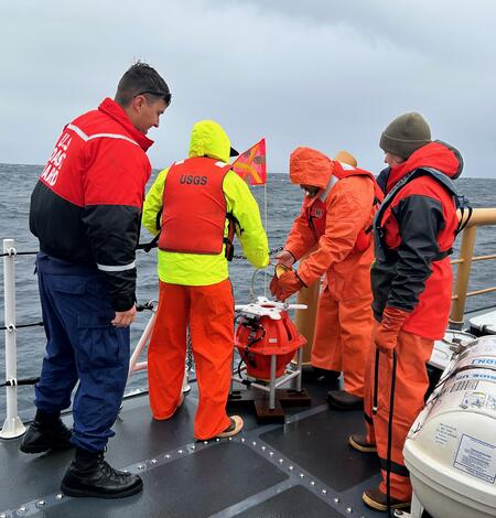
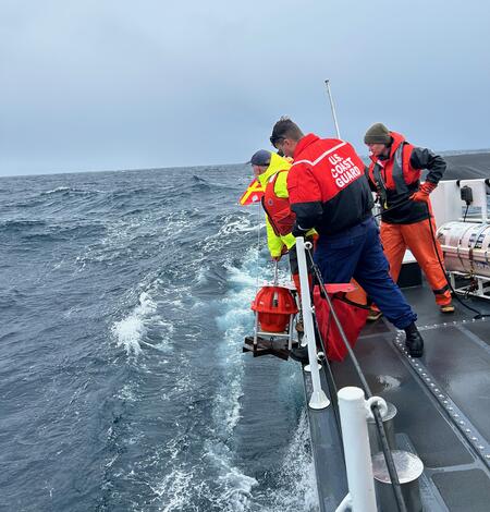
Seafloor Seismographs Rapidly Deployed Following Major Earthquake Offshore Northern California
The rapid response ocean bottom seismograph fleet, jointly developed and maintained by the Woods Hole Oceanographic Institution and USGS, was swiftly deployed after a major earthquake hit Northern California and the Pacific Northwest. The quick deployment of these instruments will enable the collection of the high-value data needed to produce the most accurate and useful hazard assessment.

Major Update to Satellite-Based Datasets Used to Assess Salt Marsh Vulnerability Nationwide
The Unvegetated-Vegetated Marsh Ratio now computes national salt marsh vulnerability using satellite imagery from 1985-2023—a significant increase from the original 2014-2018 dataset.
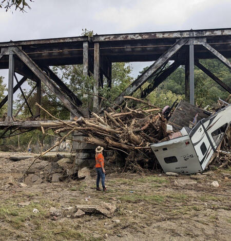
USGS experts responding simultaneously to two major natural hazards
To learn more about USGS science related to Hurricane Helene:
Cost Benefit Study Confirms Coral Reef Restoration Could Be a Cost-Effective Way to Save Lives and Money
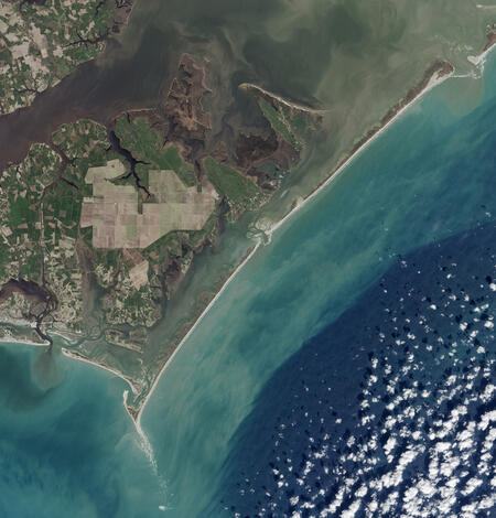
Rising Seas and Stronger Storms Threaten Barrier Island Systems
A new study led by USGS models projected overland flooding, groundwater depth, shoreline change, and vertical land motion at Cape Lookout National Seashore in North Carolina, finding that rising sea levels and shifting storm patterns will make barrier island systems like Cape Lookout increasingly vulnerable to coastal hazards over the coming decades.
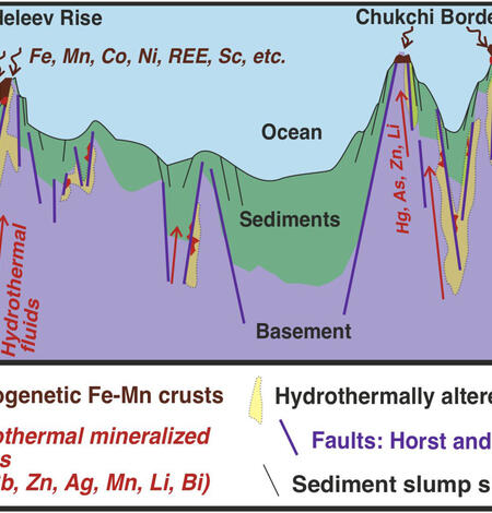
Marine Mineral Formations in the Arctic Ocean Challenge Existing Geologic Theories
A new study from USGS describes a previously unknown process of marine mineral formation in the Arctic Ocean, driven by frictional heating along tectonic faults rather than by hydrothermal activity.
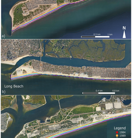
Satellite-Derived Shoreline Change Along Western Long Island, New York
A new study by USGS details how beaches along Long Island's western south shore have evolved over the past several decades. Using satellite-derived imagery to measure shoreline changes from 1984 to 2022, researchers analyzed three prominent beaches—Rockaway Peninsula, Long Beach, and Jones Beach Island—known for their recreational value and dynamic coastal conditions.
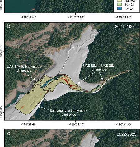
Post-Wildfire Sediment Yield in a Sierra Nevada Watershed
A new study by USGS and the California Geological Survey analyzes post-fire landscape response following the 2021 Caldor Fire, which burned a heavily managed forest setting highly likely to see more large, intense fires in the coming decades.
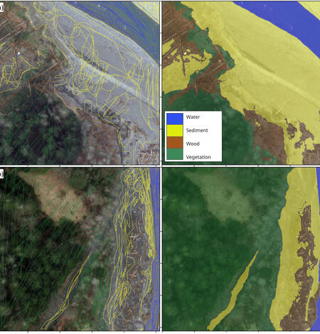
Remote-Sensing Large-Wood Storage Downstream from Reservoirs After Dam Removal
For nearly a century, two dams on the Elwha River blocked the natural flow of sediment and wood, leading to a highly altered river environment. Removal of the dams unleashed large quantities of sediment and wood that had been trapped behind the reservoirs. This debris was carried downstream, reshaping the river’s course and impacting its ecosystems.
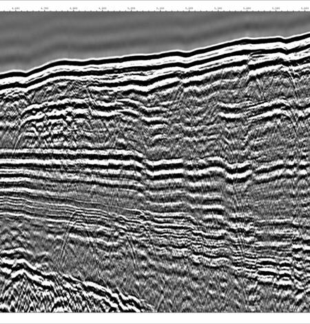
Haunted Seismic Data, Ghostbusted by Science
Removing ghostly artifacts from sparker seismic reflection data doesn’t require a phone call to a certain group of parapsychologists in matching jumpsuits. The so-called “ghostbuster” capability developed by USGS provides the highest resolution and most accurate sub-bottom images for scientists to make the best possible interpretations and seismic hazard assessments.

Separating the land from the sea: image segmentation in support of coastal hazards research and community early warning systems
Group of USGS researchers develops machine learning model to extract water level data from images of the shoreline. The project was partially funded by the USGS Community for Data Integration.
News Briefs: October 2024-January 2025
News Briefs - featuring coastal and ocean science from across the USGS.
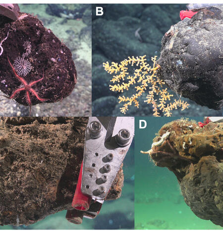
Photo Roundup: October 2024-January 2025
A selection of coastal and ocean videos and photographs from across the USGS.