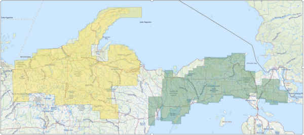
Map of the Upper Peninsula of Michigan and nearby areas of Northern Wisconsin, with areas of overflights shaded in yellow (Wisconsin) and green (Michigan).
Multimedia
Find photos and other multimedia related to Earth MRI.
Images
Map of the Upper Peninsula of Michigan and nearby areas of Northern Wisconsin, with areas of overflights shaded in yellow (Wisconsin) and green (Michigan).

Mineral Systems Map: Areas with Potential to Host Subsurface Critical Minerals
Mineral Systems Map: Areas with Potential to Host Subsurface Critical MineralsThis map shows the mineral systems map from the Earth Mapping Resources Initiative (Earth MRI). Through Earth MRI, USGS brings together federal and state experts to:
Earth MRI: The First Five Years
The Earth Mapping Resources Initiative (Earth MRI) is modernizing the Nation’s mapping and geoscience data, benefitting regions, states and local communities.
By the Numbers:
40 States and Territories partnered with Earth MRI
Earth MRI: The First Five Years
The Earth Mapping Resources Initiative (Earth MRI) is modernizing the Nation’s mapping and geoscience data, benefitting regions, states and local communities.
By the Numbers:
40 States and Territories partnered with Earth MRI


