
Data
USGS Data release products in support of Earth MRI are listed below. New data releases collected under Earth MRI will be provided as they become available.

The GEMMA Dispatch
The GEMMA Dispatch
Get USGS Geology, Energy and Minerals data and news straight to your inbox.
Filter Total Items: 62
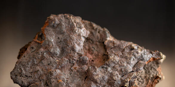
Magnetic susceptibility measurements on rocks in Alaska to aid geophysical interpretation Magnetic susceptibility measurements on rocks in Alaska to aid geophysical interpretation
The U.S. Geological Survey (USGS) collects magnetic susceptibility measurements on in-situ and laboratory rock samples to help identify the sources of anomalies in aeromagnetic surveys in Alaska. Magnetic susceptibility is a measure of how much a material will become magnetized in an applied magnetic field and is the ratio of magnetization, M (magnetic moment per unit volume), to the...
Airborne magnetic and radiometric survey, Laramie Mountains region, Wyoming, 2024-2025 Airborne magnetic and radiometric survey, Laramie Mountains region, Wyoming, 2024-2025
This data release provides digital flight line data for a high-resolution airborne magnetic and radiometric survey over the Laramie Mountains region of Wyoming. The airborne survey was funded by the Earth Mapping Resources Initiative (Earth MRI). The survey was designed by the USGS in collaboration with the Wyoming State Geological Survey and contracted by the USGS. The survey was...
Airborne electromagnetic and magnetic survey of the western Mojave Desert, California, 2024 Airborne electromagnetic and magnetic survey of the western Mojave Desert, California, 2024
Airborne electromagnetic (AEM) and magnetic survey data were collected during November 4–20, 2024 over a distance of 3,251 line kilometers in the western Mojave Desert, California. These data were collected in support of the U.S. Geological Survey (USGS) Earth Mapping Resources Initiative (Earth MRI), which aims to improve knowledge of the geologic framework of the United States through...
Airborne magnetic and radiometric survey over northwest Arkansas, 2019-2020 (ver 2.0, May 2026) Airborne magnetic and radiometric survey over northwest Arkansas, 2019-2020 (ver 2.0, May 2026)
This data release contains digital radiometric flight line data for a high-resolution airborne magnetic and radiometric survey over an area of northwest Arkansas (version 2.0, May 2026). Data and documentation for the original version, including associated airborne magnetic data, can be found at https://doi.org/10.5066/P91O2Y8W. The airborne geophysical survey was jointly funded by the...
Airborne magnetic and radiometric survey, Elk Creek region, Nebraska and Kansas, 2024-2025 Airborne magnetic and radiometric survey, Elk Creek region, Nebraska and Kansas, 2024-2025
This data release provides digital flight line data for a high-resolution airborne magnetic and radiometric survey over the Elk Creek region of Nebraska and Kansas. The airborne survey was funded by the Earth Mapping Resources Initiative (Earth MRI). The survey was designed by the USGS in collaboration with the Nebraska Conservation and Survey Division and the Kansas Geological Survey...
Airborne Magnetic and Radiometric Survey, Colorado Mineral Belt, Northeast Block, 2024 Airborne Magnetic and Radiometric Survey, Colorado Mineral Belt, Northeast Block, 2024
This data release provides digital flight-line and gridded data for a high-resolution airborne magnetic and radiometric survey over the northeastern portion of the Colorado Mineral Belt, northern Colorado. The Colorado Mineral Belt is a broad, northeast-southwest trending alignment of historic mining districts that have produced multiple types of commodities, including critical minerals...
Radiometric data collected from an uncrewed airborne system and handheld meters at the Grand Junction Regional Airport radiometric calibration facility, 2023-2024 Radiometric data collected from an uncrewed airborne system and handheld meters at the Grand Junction Regional Airport radiometric calibration facility, 2023-2024
Radiometric data were collected at the Grand Junction Regional Airport radiometric calibration facility in March 2023 and August 2024. The facility consists of five ~9 by ~12 m (30 x 40 feet) concrete pads, each 18 in thick. Each pad provides sources of radioelements that are spatially homogeneous (see Ward, 1978). Three pads are dedicated K, Th, and U pads, each of which contains high...
Airborne magnetic and radiometric survey, east central Idaho and Montana, 2023-2024 Airborne magnetic and radiometric survey, east central Idaho and Montana, 2023-2024
This data release provides digital flight-line and gridded data for a high-resolution airborne magnetic and radiometric survey over parts of eastern Idaho and western Montana. The survey was acquired as part of the UGSS Earth Mapping Resource Initiative (Earth MRI) to improve our understanding of the fundamental geologic framework of the region with applications to evaluating natural...
Airborne magnetic and radiometric survey, Hartville Uplift and Shirley Mountains regions, Wyoming, 2025 Airborne magnetic and radiometric survey, Hartville Uplift and Shirley Mountains regions, Wyoming, 2025
This data release provides digital flight line data for a high-resolution airborne magnetic and radiometric survey over the Hartville Uplift and Shirley Mountains regions of Wyoming. The survey is split into two blocks, one covering the Hartville Uplift region (Block A), and the other covering the Shirley Mountains region (Block B). The airborne survey was mainly funded by the State of...
Density and magnetic susceptibility measurements on Archean and Proterozoic rocks, southern Medicine Bow Mountains, Wyoming, 2021-2024 Density and magnetic susceptibility measurements on Archean and Proterozoic rocks, southern Medicine Bow Mountains, Wyoming, 2021-2024
Rock physical property measurements were collected on outcrops to help understand the causative sources of gravity and magnetic survey anomalies in the southern Medicine Bow Mountains of Wyoming. A total of 539 magnetic susceptibility measurements and 318 density measurements have been conducted. The resulting data aid in interpretation of gravity and airborne magnetic data that are...
National Mine Waste Inventory National Mine Waste Inventory
This U.S. Geological Survey (USGS) data release is a collaborative geospatial database compiled by the USGS and participating State geological surveys, with support from the Earth Mapping Resources Initiative (Earth MRI) program. The database represents the first phase of cataloging above-ground mine waste features —such as tailings and waste rock piles— that are remnants of historical...
Airborne magnetic and radiometric survey, west central Utah, 2023-2024 Airborne magnetic and radiometric survey, west central Utah, 2023-2024
This data release provides digital flight-line and gridded data for a high-resolution airborne magnetic and radiometric survey over a part of west central Utah. The survey was acquired as part of the UGSS Earth Mapping Resource Initiative (Earth MRI) to improve our understanding of the fundamental geologic framework of the region with applications to evaluating natural resources and...