Shoreline Definition of Inland Water Bodies Not Hydrologically Connected to the Ocean
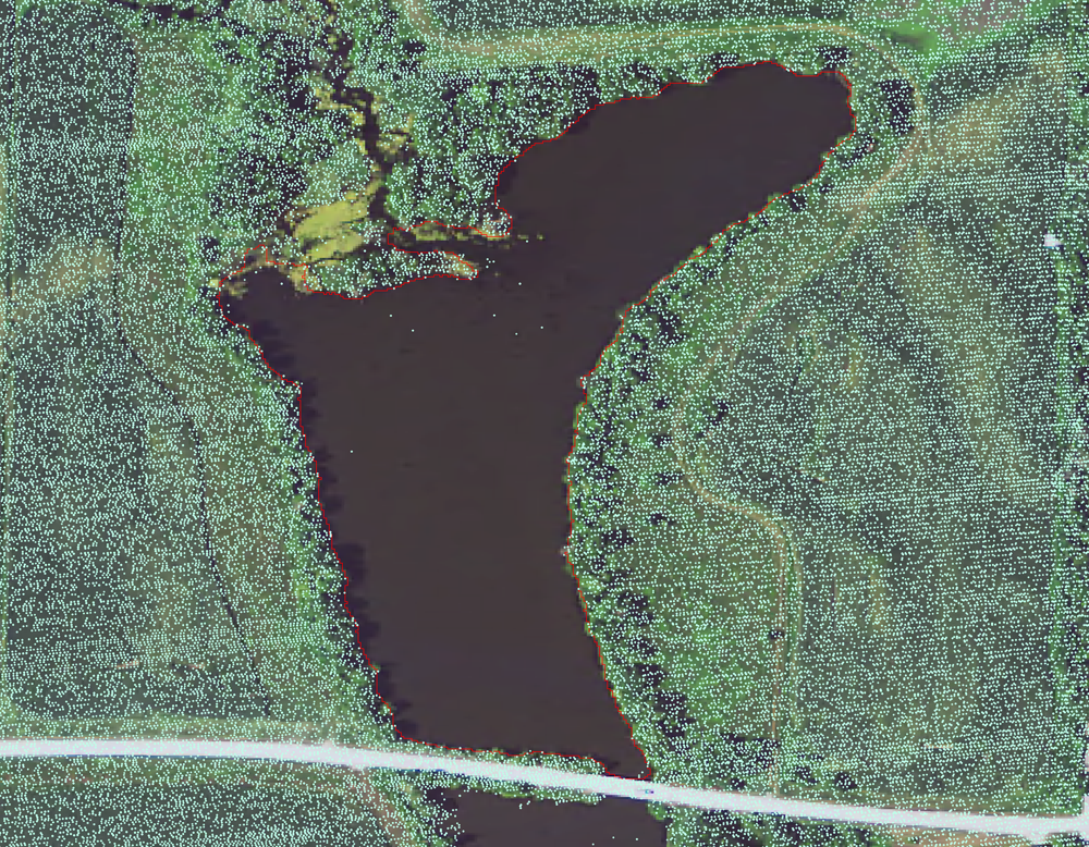
Most airborne topographic light detection and ranging (lidar) systems operate within the near-infrared spectrum. Laser pulses from these systems frequently are absorbed by water and do not generate reflected returns on water bodies in the resulting lidar point cloud. Thus, the absence of lidar returns over water is useful for identifying inland water bodies that are not connected by any path to the ocean, particularly in the complex estuarine wetlands.
Historically, the approach for delineating water bodies was to digitize water features from aerial photographs. However, as new methods were developed to generate 3D topographic information from remotely sensed lidar data, inland water bodies can be identified through analysis of the lidar point cloud density and delineated with more objective and consistent methods.
Techniques to detect reduced lidar return densities will provide detailed lidar-derived inland water delineations for wetlands in coastal New Jersey, an area dominated by a complex configuration of estuarine wetlands. These data will provide consistent, comprehensive water bodies delineations useful for hydrodynamic models, change detection analyses, and could serve as a base layer for wetland classification maps.
Additional information on point density analysis is located at https://dx.doi.org/10.3133/sir20145191.

Below are other science projects associated with this project.
Coastal National Elevation Database (CoNED) Applications Project
Coastal National Elevation Database (CoNED) Applications Project
Most airborne topographic light detection and ranging (lidar) systems operate within the near-infrared spectrum. Laser pulses from these systems frequently are absorbed by water and do not generate reflected returns on water bodies in the resulting lidar point cloud. Thus, the absence of lidar returns over water is useful for identifying inland water bodies that are not connected by any path to the ocean, particularly in the complex estuarine wetlands.
Historically, the approach for delineating water bodies was to digitize water features from aerial photographs. However, as new methods were developed to generate 3D topographic information from remotely sensed lidar data, inland water bodies can be identified through analysis of the lidar point cloud density and delineated with more objective and consistent methods.
Techniques to detect reduced lidar return densities will provide detailed lidar-derived inland water delineations for wetlands in coastal New Jersey, an area dominated by a complex configuration of estuarine wetlands. These data will provide consistent, comprehensive water bodies delineations useful for hydrodynamic models, change detection analyses, and could serve as a base layer for wetland classification maps.
Additional information on point density analysis is located at https://dx.doi.org/10.3133/sir20145191.

Below are other science projects associated with this project.


