
Data
USGS Data release products in support of Earth MRI are listed below. New data releases collected under Earth MRI will be provided as they become available.

The GEMMA Dispatch
The GEMMA Dispatch
Get USGS Geology, Energy and Minerals data and news straight to your inbox.
Filter Total Items: 62
Density and magnetic susceptibility measurements on Archean rocks, northwestern Minnesota, 2021 Density and magnetic susceptibility measurements on Archean rocks, northwestern Minnesota, 2021
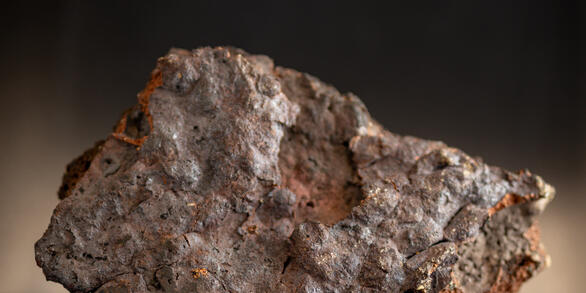
Rock physical property measurements were collected on core samples to help understand the causative sources of gravity and magnetic survey anomalies in northwestern Minnesota. A total of 410 measurements of magnetic susceptibility and density on Archean core samples from 20 boreholes have been conducted. The measurements aid in interpretation of gravity and airborne magnetic data that...
Magnetic susceptibility and gamma ray spectrometry measurements in southwestern Montana, 2025 Magnetic susceptibility and gamma ray spectrometry measurements in southwestern Montana, 2025
This dataset includes rock magnetic susceptibility and gamma ray spectrometry measurements from 204 outcrops in southwest Montana during 2025. The measurements were collected to understand the causative sources of airborne magnetic and radiometric survey anomalies in the Idaho-Montana porphyry belt. Sixteen magnetic susceptibility measurements were collected at each analyzed site using a...
Airborne Magnetic and Radiometric Survey over parts of central and northern Florida and southeastern Georgia, 2023-2024 Airborne Magnetic and Radiometric Survey over parts of central and northern Florida and southeastern Georgia, 2023-2024
This data release provides digital flight-line and gridded data for a high-resolution airborne magnetic and radiometric survey over parts of central and northeastern Florida and southeastern Georgia. The survey was acquired as part of the USGS Earth Mapping Resource Initiative (Earth MRI) to improve our understanding of the fundamental geologic framework of the region with applications...
Airborne magnetic and radiometric survey over Puerto Rico and the Surrounding Islands and Shelf, 2023-2024 Airborne magnetic and radiometric survey over Puerto Rico and the Surrounding Islands and Shelf, 2023-2024
This data release provides digital flight-line and gridded data for a high-resolution airborne magnetic and radiometric survey over Puerto Rico, the islands of Vieques and Culebra, and the surrounding shelf. The survey was acquired through funding from the USGS Earth Mapping Resource Initiative (Earth MRI), the USGS Coastal and Marine Resources and Hazards Program, and the USGS...
Airborne magnetic and radiometric survey, Maryland, Pennsylvania, and West Virginia, 2022-2023 Airborne magnetic and radiometric survey, Maryland, Pennsylvania, and West Virginia, 2022-2023
This data release provides digital flight-line and gridded data for a high-resolution airborne magnetic and radiometric survey over parts of Maryland, Pennsylvania, and West Virginia. The survey was acquired as part of the USGS Earth Mapping Resource Initiative (Earth MRI) to improve our understanding of the fundamental geologic framework of the region with applications to evaluating...
Regional airborne electromagnetic and magnetic surveys of the Basin and Range Province in Nevada, Oregon, and California, 2022-2023 Regional airborne electromagnetic and magnetic surveys of the Basin and Range Province in Nevada, Oregon, and California, 2022-2023
Airborne electromagnetic (AEM) and magnetic survey data were collected from December 2022 through March 2023 over a distance of 11,079 line kilometers in western Nevada and eastern California; central Nevada; and northern Nevada and southeastern Oregon. These data were collected in support of the U.S. Geological Survey (USGS) Earth Mapping Resources Initiative (Earth MRI), which aims to...
Airborne magnetic and radiometric survey, Sierra Madre-Elkhead Mountains-Medicine Bow Mountains region, Wyoming and Colorado, 2023-2024 Airborne magnetic and radiometric survey, Sierra Madre-Elkhead Mountains-Medicine Bow Mountains region, Wyoming and Colorado, 2023-2024
This data release provides digital flight line data for a high-resolution airborne magnetic and radiometric survey over the Sierra Madre-Elkhead Mountains-Medicine Bow Mountains region of southern Wyoming and northern Colorado. The airborne survey was funded by the Earth Mapping Resources Initiative. The survey was designed to meet complementary needs related to geologic mapping and
Airborne magnetic and radiometric survey, southeastern Illinois, western Kentucky, and southern Indiana, 2019 (version 2.0, August 2025) Airborne magnetic and radiometric survey, southeastern Illinois, western Kentucky, and southern Indiana, 2019 (version 2.0, August 2025)
This data release contains digital radiometric flight line data for a high-resolution airborne magnetic and radiometric survey over southeastern Illinois, western Kentucky, and southern Indiana, 2019 (version 2.0, August 2025). Data and documentation for the original version, including associated airborne magnetic data, can be found at https://doi.org/10.5066/P9R05B0M. The airborne...
Airborne magnetic and radiometric survey of the Boulder Batholith region, Montana, Butte extension 2023 Airborne magnetic and radiometric survey of the Boulder Batholith region, Montana, Butte extension 2023
This data release provides digital flight line data for a high-resolution airborne magnetic and radiometric survey over parts of Montana in the vicinity of the Boulder Batholith. The airborne survey was funded by the Earth Mapping Resources Initiative and was designed to meet complementary needs related to geologic mapping and characterization of mineral resource potential. A total of 45...
Magnetic susceptibility and gamma ray spectrometry measurements in southwestern Montana, 2023-2024 Magnetic susceptibility and gamma ray spectrometry measurements in southwestern Montana, 2023-2024
This dataset includes rock magnetic susceptibility and gamma ray spectrometer measurements from 243 outcrops in southwest Montana during 2023-2024. The measurements were collected to understand the causative sources of airborne magnetic and radiometric survey anomalies in the Idaho-Montana porphyry belt. Sixteen magnetic susceptibility measurements were collected at each analyzed site...
Airborne magnetic and radiometric survey, central Arkansas and southern Missouri, 2023 Airborne magnetic and radiometric survey, central Arkansas and southern Missouri, 2023
This publication provides digital flight line data for a high-resolution magnetic and radiometric survey over part of central Arkansas and southern Missouri. The airborne geophysical survey was funded by the Earth Mapping Resources Initiative and was designed to meet the complimentary needs related to geologic mapping and mineral resource research. The survey covers an irregularly shaped...
Airborne Magnetic and Radiometric Survey, Colorado Mineral Belt, Mid Block, 2023 Airborne Magnetic and Radiometric Survey, Colorado Mineral Belt, Mid Block, 2023
This data release provides digital flight-line and gridded data for a high-resolution airborne magnetic and radiometric survey over the central portion of the Colorado Mineral Belt, central Colorado. The Colorado Mineral Belt is a broad, northeast-southwest trending alignment of historic mining districts that have produced multiple types of commodities, including critical minerals that...