
Data
USGS Data release products in support of Earth MRI are listed below. New data releases collected under Earth MRI will be provided as they become available.

The GEMMA Dispatch
The GEMMA Dispatch
Get USGS Geology, Energy and Minerals data and news straight to your inbox.
Filter Total Items: 62
Gravity data in the Wet Mountains area, southcentral Colorado, 2023 Gravity data in the Wet Mountains area, southcentral Colorado, 2023
The U.S. Geological Survey collected ground gravity data as part of a helicopter reconnaissance campaign of the Democrat Creek alkaline complex and Deer Peak quadrangle in the Wet Mountains, Colorado. A total of 60 measurements were collected using a LaCoste and Romberg gravity meter. High accuracy geographic coordinates and elevations were collected using a survey grade Leica GS16...
Airborne magnetic and radiometric survey, western Arkansas, 2022 Airborne magnetic and radiometric survey, western Arkansas, 2022
This publication provides digital flight line data for a high-resolution magnetic and radiometric survey over part of western Arkansas. The airborne geophysical survey was funded by the USGS National Cooperative Geologic Mapping Program. The survey covers a rectangular area 91.55 by 92.15 kilometers (km) over the transition between the Ouachita Mountains and Ozark Plateau physiographic...
Airborne magnetic and radiometric survey, Boulder Batholith region, Montana, 2022 Airborne magnetic and radiometric survey, Boulder Batholith region, Montana, 2022
Note: this data release has been deprecated. Please see new data release here: https://doi.org/10.5066/P13JSLF6. This data release provides digital flight line data for a high-resolution airborne magnetic and radiometric survey over parts of Montana in the vicinity of the Boulder Batholith. The airborne survey was jointly funded by the Earth Mapping Resources Initiative and Kennecott...
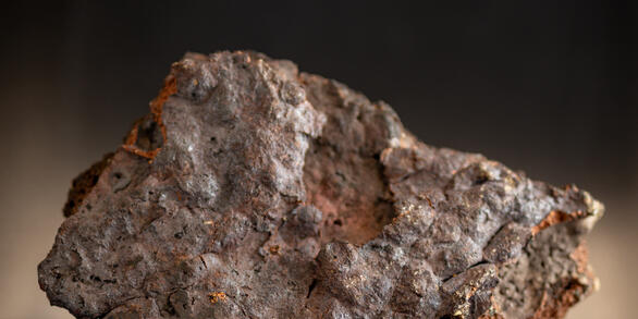
Critical mineral deposits of the United States (ver. 2.0, April 2024) Critical mineral deposits of the United States (ver. 2.0, April 2024)
A goal of the USGS Earth Mapping Resources Initiative (Earth MRI) program, which partners the USGS with State Geological Surveys, Federal agencies, and the private sector, is to collect new geological, geophysical, geochemical, and topographic (lidar) data in key areas of the U.S., with the purpose of stimulating domestic mineral exploration and production of critical minerals. As a...
Airborne magnetic and radiometric survey of the Wet Mountains and surrounding region, Custer and Fremont Counties, south-central Colorado, 2021 Airborne magnetic and radiometric survey of the Wet Mountains and surrounding region, Custer and Fremont Counties, south-central Colorado, 2021
This data release provides digital flight-line and gridded data for a high-resolution airborne magnetic and radiometric survey over the region surrounding the Wet Mountains of southern Colorado, including parts of Custer and Fremont Counties. Data for this survey were collected by Sander Geophysics Limited International (SGL) under contract with the USGS. The survey was flown in June and...
Airborne magnetic and radiometric survey, northwestern Minnesota, 2021 Airborne magnetic and radiometric survey, northwestern Minnesota, 2021
This data release provides digital flight line data for a high-resolution airborne magnetic and radiometric survey over parts of northwestern Minnesota near the town of Mentor. The airborne survey was funded by the Earth Mapping Resources Initiative and was designed to meet complementary needs related to geologic mapping and characterization of mineral resource potential. A total of 40...
Gravity data in the Wet Mountains area, southcentral Colorado, 2021 to 2022 Gravity data in the Wet Mountains area, southcentral Colorado, 2021 to 2022
The U.S. Geological Survey (USGS) collected gravity data in the Wet Mountains, CO from September 2021 to July 2022 to compliment newly collected airborne magnetic data for surface and subsurface geologic mapping. A total of 261 measurements were collected across two Ediacaran-Ordovician alkaline complexes (Gem Park and McClure Mountain) and gabbroic outcrops suspected Ediacaran...
Magnetic susceptibility measurements in the Wet Mountains, Colorado, 2021 to 2022 Magnetic susceptibility measurements in the Wet Mountains, Colorado, 2021 to 2022
The U.S. Geological Survey (USGS) collected rock magnetic susceptibility measurements to understand the causative sources of airborne magnetic survey anomalies in the Wet Mountains, Colorado. A total of 808 measurements were collected over 50 locations from August 2021 to June 2022 on rocks ranging from Paleoproterozoic to Oligocene age. These measurements aid the interpretation of newly...
Airborne magnetic and radiometric survey, Virginia and North Carolina Fall Zone, 2021 Airborne magnetic and radiometric survey, Virginia and North Carolina Fall Zone, 2021
This data release provides digital flight line data for a high-resolution airborne magnetic and radiometric survey over Virginia and North Carolina along and near the eastern U.S. 'Fall Zone', which represents the transitional area between Atlantic Coastal Plain sediments and Piedmont metamorphic and igneous rocks. The airborne data collection was funded by the U.S. Geological Survey...
GIS, supplemental data table, and references for focus areas of potential domestic resources of critical minerals and related commodities in the United States and Puerto Rico (ver. 2.0, April 2024) GIS, supplemental data table, and references for focus areas of potential domestic resources of critical minerals and related commodities in the United States and Puerto Rico (ver. 2.0, April 2024)
In response to Executive Order 13817 of December 20, 2017, the U.S. Geological Survey (USGS) coordinated with the Bureau of Land Management (BLM) to identify 36 nonfuel minerals or mineral materials considered critical to the economic and national security of the United States (U.S.) (https://pubs.usgs.gov/of/2018/1021/ofr20181021.pdf). Acquiring information on possible domestic sources...
Airborne magnetic and radiometric survey, Idaho Cobalt Belt, Central Idaho, 2021 - Magnetic and Radiometric Data Airborne magnetic and radiometric survey, Idaho Cobalt Belt, Central Idaho, 2021 - Magnetic and Radiometric Data
This publication provides digital flight line data for a high resolution magnetic and radiometric survey over an area of central Idaho, USA. The survey includes airborne geophysical data collected as part of the U.S. Geological Survey (USGS) Earth Mapping Resource Initiative (Earth MRI) effort (Day, 2019). Earth MRI is a cooperative effort between the USGS, the Association of American...
Airborne magnetic and radiometric survey, Munsungun region in northern Maine, 2021 Airborne magnetic and radiometric survey, Munsungun region in northern Maine, 2021
This data release provides digital flight line data for a high-resolution airborne magnetic and radiometric survey over parts of northern Maine. The airborne data collection was funded by the U.S. Geological Survey (USGS) Earth Mapping Resource Initiative (Earth MRI) with goals of better understanding volcanogenic massive sulfide mineral deposits, sediment hosted manganese deposits, and...