
Data
USGS Data release products in support of Earth MRI are listed below. New data releases collected under Earth MRI will be provided as they become available.

The GEMMA Dispatch
The GEMMA Dispatch
Get USGS Geology, Energy and Minerals data and news straight to your inbox.
Filter Total Items: 62
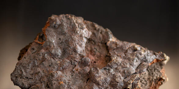
X-ray diffraction data and estimates of mineral abundances based on Rietveld refinement for mine wastes collected through the USGS Earth Mapping Resources Initiative (ver. 3.0, June 2026) X-ray diffraction data and estimates of mineral abundances based on Rietveld refinement for mine wastes collected through the USGS Earth Mapping Resources Initiative (ver. 3.0, June 2026)
Powder X-ray diffraction (XRD) data and estimates of mineral abundances determined using Rietveld refinement included in this data release were generated as part of the Earth Mapping Resources Initiative (Earth MRI; https://www.usgs.gov/special-topics/earth-mri). Earth MRI is a partnership between the U.S. Geological Survey (USGS) and State geological surveys and was developed by the...
Density and magnetic susceptibility measurements on Precambrian rocks in the central Upper Peninsula, Michigan, 2021-2022 Density and magnetic susceptibility measurements on Precambrian rocks in the central Upper Peninsula, Michigan, 2021-2022
The U.S. Geological Survey (USGS) collected rock physical property measurements to help understand causative sources of gravity and magnetic survey anomalies in the central Upper Peninsula of Michigan. A total of 1,460 measurements of magnetic susceptibility and density from 61 outcrops and 37 boreholes have been conducted on Precambrian rocks. The measurements aid in interpretation of...
Yukon-Tanana Upland airborne magnetic geophysical data merge, version 2025 (ver. 2.0, March 2026) Yukon-Tanana Upland airborne magnetic geophysical data merge, version 2025 (ver. 2.0, March 2026)
The Yukon-Tanana Upland - Kuskokwim airborne magnetic geophysical data merge provides a merged raster grid of magnetic data for the Yukon-Tanana Upland (YTU) into the Kuskokwim Mountains, Alaska. This dataset provides a regionally consistent magnetic grid while retaining as much detail as possible of the originating data by leveling all the region's magnetic grids to one another. This...
Airborne magnetic and radiometric survey, Medicine Bow Mountains, Wyoming, 2023 Airborne magnetic and radiometric survey, Medicine Bow Mountains, Wyoming, 2023
This data release provides digital flight line data for a high-resolution airborne magnetic and radiometric survey over the Medicine Bow Mountains in southern Wyoming. The airborne survey was jointly funded by the Earth Mapping Resources Initiative and the Wyoming State Geological Survey (WSGS). The survey was designed to meet complementary needs related to geologic mapping and...
Thin section images, automated mineralogy scans, lithogeochemistry, and Nd-Sr-Pb isotopic analysis of samples from a mostly buried layered mafic intrusion, Wet Mountains, Colorado 2022-2024 Thin section images, automated mineralogy scans, lithogeochemistry, and Nd-Sr-Pb isotopic analysis of samples from a mostly buried layered mafic intrusion, Wet Mountains, Colorado 2022-2024
This dataset includes thin section images, automated mineralogy mineral maps, whole-rock geochemical data, and whole-rock Nd-Sr-Pb isotopic analysis of samples collected from nine mafic-ultramafic outcrops in the Wet Mountains, southern Colorado, during the summer of 2022. These data will accompany an upcoming journal publication and are intended to supplement recently collected airborne...
Airborne Magnetic and Radiometric Survey, Colorado Mineral Belt, Southwest Block, 2023 Airborne Magnetic and Radiometric Survey, Colorado Mineral Belt, Southwest Block, 2023
This data release provides digital flight-line and gridded data for a high-resolution airborne magnetic and radiometric survey over the southwestern portion of the Colorado Mineral Belt, southwestern Colorado. The Colorado Mineral Belt is a broad, northeast-southwest trending alignment of historic mining districts that have produced multiple types of commodities, including critical...
Airborne electromagnetic and magnetic survey of the Alabama Graphite-Vanadium Belt and surrounding regions, 2023 Airborne electromagnetic and magnetic survey of the Alabama Graphite-Vanadium Belt and surrounding regions, 2023
Airborne electromagnetic (AEM) and magnetic survey data were collected during March and April 2023 over a distance of 9,000 line kilometers in east central Alabama. Data were acquired by SkyTEM Canada Inc. with the SkyTEM 306HPM time-domain helicopter-borne electromagnetic system together with a Geometrics G822A cesium vapor magnetometer. The survey was acquired at a nominal flight...
Magnetic susceptibility and density measurements in the Wet Mountains, Colorado, 2022 to 2023 Magnetic susceptibility and density measurements in the Wet Mountains, Colorado, 2022 to 2023
The U.S. Geological Survey (USGS) collected rock magnetic susceptibility and density measurements to understand the causative sources of airborne magnetic and ground gravity survey anomalies in the Wet Mountains, Colorado. A total of 609 magnetic susceptibility and 86 density measurements were collected from outcrops and hand samples, respectively, from July 2022 to June 2023. These...
Airborne magnetic and radiometric survey, Boulder Batholith region, Montana, 2022 Airborne magnetic and radiometric survey, Boulder Batholith region, Montana, 2022
This data release provides digital flight line data for a high-resolution airborne magnetic and radiometric survey over parts of Montana in the vicinity of the Boulder Batholith. The airborne survey was jointly funded by the Earth Mapping Resources Initiative and Kennecott Exploration Company. The survey was designed to meet complementary needs related to geologic mapping and...
Reflectance spectra collected August 21, 2022, at Black Rock Desert, Nevada, with an ASD FieldSpecⓇ 4 Hi-Res NG spectroradiometer for calibration/validation of imaging spectrometer data Reflectance spectra collected August 21, 2022, at Black Rock Desert, Nevada, with an ASD FieldSpecⓇ 4 Hi-Res NG spectroradiometer for calibration/validation of imaging spectrometer data
Reflectance data were collected using Malvern Panalytical ASD FieldSpec® 4 Hi-Res NG Spectroradiometers with custom VNIR gratings (hereafter referred to as ASD spectrometers) on August 21, 2022, at a field site on Black Rock Desert, Nevada, USA. A full description of all collection and processing steps is included in this data release as ‘BlackRockDesertNV_21aug2022_ProcessingSteps.pdf’...
High-resolution airborne magnetic and radiometric survey of the Republic Graben, Okanogan and Kettle metamorphic core complexes, Kootenay Arc and surrounding regions, Northeastern Washington High-resolution airborne magnetic and radiometric survey of the Republic Graben, Okanogan and Kettle metamorphic core complexes, Kootenay Arc and surrounding regions, Northeastern Washington
The Republic survey consists of high-resolution aeromagnetic and radiometric data designed to image the subsurface geology and structure of a large portion of northeastern Washington. These data are intended for rigorous modeling and interpretation of the geology and structure in this region and will be used to evaluate the potential for undiscovered resources and will contribute to USGS...
Airborne magnetic and radiometric survey, South Pass-Granite Mountains region, Wyoming, 2023 Airborne magnetic and radiometric survey, South Pass-Granite Mountains region, Wyoming, 2023
This data release provides digital flight line data for a high-resolution airborne magnetic and radiometric survey over the South Pass-Granite Mountains region in central Wyoming. The airborne survey was funded by the state of Wyoming, designed by the Wyoming State Geological Survey (WSGS), and contracted by the USGS. The survey is aligned with the Earth Mapping Resources Initiative and...