



Salt, brine shrimp, and brine larvae are picked up by a gust of wind at Lake Abert.
Multimedia
If you are unable to access or download a product, email SalineLakeEcosystemsIWAA@usgs.gov.
Images
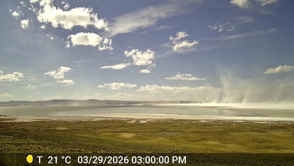
Salt blows in the wind at Lake Abert
Salt, brine shrimp, and brine larvae are picked up by a gust of wind at Lake Abert.
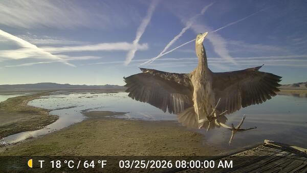
A Blue Heron at Carson Sink, Nevada
A majestic Great Blue Heron makes a dramatic front-facing landing at the Carson Sink wetlands in Nevada. This perfectly timed image was captured by a timelapse camera installed to observe changing water conditions for the Saline Lake Ecosystems Integrated Water Availability Assessment project.
A majestic Great Blue Heron makes a dramatic front-facing landing at the Carson Sink wetlands in Nevada. This perfectly timed image was captured by a timelapse camera installed to observe changing water conditions for the Saline Lake Ecosystems Integrated Water Availability Assessment project.
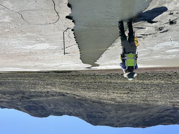
Lake Abert inflow measurement
Measuring a shallow spring fed channel at Lake Abert, Oregon. Lake Abert is one of the 20 plus terminal lakes identified by USGS partners as priority ecosystems for study by the Saline Lakes Ecosystems IWAA.
Measuring a shallow spring fed channel at Lake Abert, Oregon. Lake Abert is one of the 20 plus terminal lakes identified by USGS partners as priority ecosystems for study by the Saline Lakes Ecosystems IWAA.
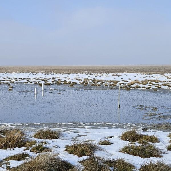
Temperature rod in the Great Salt Lake
A field photo from the Great Salt Lake. The yellow spike marks the installation point of a temperature rod (T‑rod) used to measure vertical temperature gradients in the water.
A field photo from the Great Salt Lake. The yellow spike marks the installation point of a temperature rod (T‑rod) used to measure vertical temperature gradients in the water.
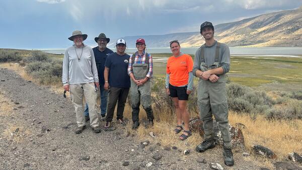
Saline Lake Ecosystems Integrated Water Availability Assessment researchers at Lake Abert
Saline Lake Ecosystems Integrated Water Availability Assessment researchers at Lake AbertSaline Lake Ecosystems Integrated Water Availability Assessment (IWAA) project researchers at Lake Abert.
From left to right:
Saline Lake Ecosystems Integrated Water Availability Assessment researchers at Lake Abert
Saline Lake Ecosystems Integrated Water Availability Assessment researchers at Lake AbertSaline Lake Ecosystems Integrated Water Availability Assessment (IWAA) project researchers at Lake Abert.
From left to right:

Continuous monitoring in Lake Abert
A USGS scientist wades into Lake Abert to service continuous water quality monitoring equipment.
A USGS scientist wades into Lake Abert to service continuous water quality monitoring equipment.
Videos
Owens Lake, California, DSWE Surface Water Proportions 1990-2025
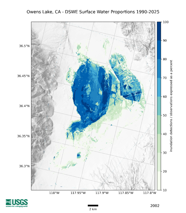
Owens Lake, California, DSWE Surface Water Proportions 1990-2025Annual variability of water levels in Owens Lake, California derived from USGS Dynamic Surface Water Extent (DSWE) data based on Landsat satellite imagery. Grey to white tones represent dry rough to flat terrain, respectively.
Owens Lake, California, DSWE Surface Water Proportions 1990-2025
Owens Lake, California, DSWE Surface Water Proportions 1990-2025Annual variability of water levels in Owens Lake, California derived from USGS Dynamic Surface Water Extent (DSWE) data based on Landsat satellite imagery. Grey to white tones represent dry rough to flat terrain, respectively.
Saline Lake Ecosystems IWAA Spring Seminar: Project Updates and 2026 Field Season Plans
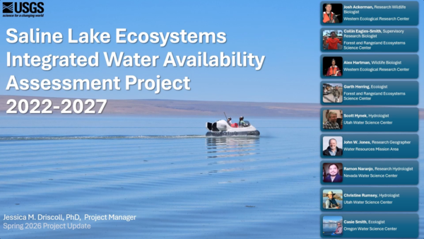
Saline Lake Ecosystems IWAA Spring Seminar: Project Updates and 2026 Field Season PlansThis video presents the Spring 2026 Saline Lake Ecosystems Integrated Water Availability Assessment Spring Seminar by the U.S. Geological Survey (USGS). Narrated by Lisa Hoaks, the seminar provides project updates, summer 2026 field season plans, and recently published products.
Saline Lake Ecosystems IWAA Spring Seminar: Project Updates and 2026 Field Season Plans
Saline Lake Ecosystems IWAA Spring Seminar: Project Updates and 2026 Field Season PlansThis video presents the Spring 2026 Saline Lake Ecosystems Integrated Water Availability Assessment Spring Seminar by the U.S. Geological Survey (USGS). Narrated by Lisa Hoaks, the seminar provides project updates, summer 2026 field season plans, and recently published products.

Saline Lake Ecosystems IWAA Spring Seminar: Project Updates and 2025 Field Season Plans
Saline Lake Ecosystems IWAA Spring Seminar: Project Updates and 2025 Field Season PlansThis video presents the Spring 2025 Saline Lake Ecosystems Integrated Water Availability Assessment Spring Seminar by the U.S. Geological Survey (USGS). Hosted by Allison Shipp, the seminar provides updates on how hydroclimatic changes and water management affect terminal lake ecosystems and waterbird populations.
Saline Lake Ecosystems IWAA Spring Seminar: Project Updates and 2025 Field Season Plans
Saline Lake Ecosystems IWAA Spring Seminar: Project Updates and 2025 Field Season PlansThis video presents the Spring 2025 Saline Lake Ecosystems Integrated Water Availability Assessment Spring Seminar by the U.S. Geological Survey (USGS). Hosted by Allison Shipp, the seminar provides updates on how hydroclimatic changes and water management affect terminal lake ecosystems and waterbird populations.

Saline Lakes IWAA Fall 2024 Webinar Series: Satellite Observations of Lake Surface Water Dynamics
Saline Lakes IWAA Fall 2024 Webinar Series: Satellite Observations of Lake Surface Water DynamicsThe sixth and final webinar in the Saline Lakes Ecosystems IWAA Fall 2024 Webinar Series is on satellite observations of lake surface water dynamics. John W. Jones of the USGS Hydrologic Remote Sensing Branch introduces the surface water and wetland remote sensing component of the Integrated Water Availability Assessment.
By
Ecosystems Mission Area, Water Resources Mission Area, Species Management Research Program, Water Availability and Use Science Program, Forest and Rangeland Ecosystem Science Center, Fort Collins Science Center, Nevada Water Science Center, Oregon Water Science Center, Utah Water Science Center, Western Ecological Research Center (WERC), Saline Lake Ecosystems Integrated Water Availability Assessment
Saline Lakes IWAA Fall 2024 Webinar Series: Satellite Observations of Lake Surface Water Dynamics
Saline Lakes IWAA Fall 2024 Webinar Series: Satellite Observations of Lake Surface Water DynamicsThe sixth and final webinar in the Saline Lakes Ecosystems IWAA Fall 2024 Webinar Series is on satellite observations of lake surface water dynamics. John W. Jones of the USGS Hydrologic Remote Sensing Branch introduces the surface water and wetland remote sensing component of the Integrated Water Availability Assessment.
By
Ecosystems Mission Area, Water Resources Mission Area, Species Management Research Program, Water Availability and Use Science Program, Forest and Rangeland Ecosystem Science Center, Fort Collins Science Center, Nevada Water Science Center, Oregon Water Science Center, Utah Water Science Center, Western Ecological Research Center (WERC), Saline Lake Ecosystems Integrated Water Availability Assessment

Saline Lakes IWAA Fall 2024 Webinar Series: Waterbird Prey Availability
Saline Lakes IWAA Fall 2024 Webinar Series: Waterbird Prey AvailabilityThe fifth webinar in the Saline Lakes Ecosystems IWAA Fall 2024 Webinar Series is on waterbird prey availability in Great Basin terminal lakes.
By
Ecosystems Mission Area, Water Resources Mission Area, Species Management Research Program, Water Availability and Use Science Program, Forest and Rangeland Ecosystem Science Center, Fort Collins Science Center, Nevada Water Science Center, Oregon Water Science Center, Utah Water Science Center, Western Ecological Research Center (WERC), Saline Lake Ecosystems Integrated Water Availability Assessment
Saline Lakes IWAA Fall 2024 Webinar Series: Waterbird Prey Availability
Saline Lakes IWAA Fall 2024 Webinar Series: Waterbird Prey AvailabilityThe fifth webinar in the Saline Lakes Ecosystems IWAA Fall 2024 Webinar Series is on waterbird prey availability in Great Basin terminal lakes.
By
Ecosystems Mission Area, Water Resources Mission Area, Species Management Research Program, Water Availability and Use Science Program, Forest and Rangeland Ecosystem Science Center, Fort Collins Science Center, Nevada Water Science Center, Oregon Water Science Center, Utah Water Science Center, Western Ecological Research Center (WERC), Saline Lake Ecosystems Integrated Water Availability Assessment

Saline Lakes Ecosystems IWAA Fall 2024 Webinar Series: Bird Movements
Saline Lakes Ecosystems IWAA Fall 2024 Webinar Series: Bird MovementsThe fourth webinar in the Saline Lakes Ecosystems IWAA Fall 2024 Webinar Series is on movement of bird species associated with Great Basin terminal lake ecosystems. Cory Overton of the Western Ecological Research Center gives an overview of the USGS bird movement monitoring strategy and presents results from the 2024 field season.
By
Ecosystems Mission Area, Water Resources Mission Area, Species Management Research Program, Water Availability and Use Science Program, Forest and Rangeland Ecosystem Science Center, Fort Collins Science Center, Nevada Water Science Center, Oregon Water Science Center, Utah Water Science Center, Western Ecological Research Center (WERC), Saline Lake Ecosystems Integrated Water Availability Assessment
Saline Lakes Ecosystems IWAA Fall 2024 Webinar Series: Bird Movements
Saline Lakes Ecosystems IWAA Fall 2024 Webinar Series: Bird MovementsThe fourth webinar in the Saline Lakes Ecosystems IWAA Fall 2024 Webinar Series is on movement of bird species associated with Great Basin terminal lake ecosystems. Cory Overton of the Western Ecological Research Center gives an overview of the USGS bird movement monitoring strategy and presents results from the 2024 field season.
By
Ecosystems Mission Area, Water Resources Mission Area, Species Management Research Program, Water Availability and Use Science Program, Forest and Rangeland Ecosystem Science Center, Fort Collins Science Center, Nevada Water Science Center, Oregon Water Science Center, Utah Water Science Center, Western Ecological Research Center (WERC), Saline Lake Ecosystems Integrated Water Availability Assessment