
Measuring a shallow spring fed channel at Lake Abert, Oregon. Lake Abert is one of the 20 plus terminal lakes identified by USGS partners as priority ecosystems for study by the Saline Lakes Ecosystems IWAA.
Images
If you are not able to access a product, contact salinelakesiwaas@usgs.gov
Filter Total Items: 84
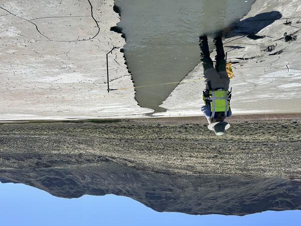
Lake Abert inflow measurement
Measuring a shallow spring fed channel at Lake Abert, Oregon. Lake Abert is one of the 20 plus terminal lakes identified by USGS partners as priority ecosystems for study by the Saline Lakes Ecosystems IWAA.
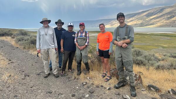
Saline Lake Ecosystems Integrated Water Availability Assessment researchers at Lake Abert
Saline Lake Ecosystems Integrated Water Availability Assessment researchers at Lake AbertSaline Lake Ecosystems Integrated Water Availability Assessment (IWAA) project researchers at Lake Abert.
From left to right:

Discrete monitoring in Summer Lake Wildlife Area
A USGS scientist walks in the marsh at Summer Lake Wildlife Area to collect discrete water quality monitoring measurements.
A USGS scientist walks in the marsh at Summer Lake Wildlife Area to collect discrete water quality monitoring measurements.

Measuring reflectance of a playa
A scientist's POV as they collect reflectance measurements of the Summer Lake playa. The reflectance measurements are used to test how well mud is distinguished from shallow surface water in satellite imagery.
A scientist's POV as they collect reflectance measurements of the Summer Lake playa. The reflectance measurements are used to test how well mud is distinguished from shallow surface water in satellite imagery.

Continuous monitoring in Lake Abert
A USGS scientist wades into Lake Abert to service continuous water quality monitoring equipment.
A USGS scientist wades into Lake Abert to service continuous water quality monitoring equipment.

American avocet gets GPS tag
An American avocet has an identification leg band attached to it. A soft sock is placed over the bird’s head to reduce stress and keep it calm during handling.
An American avocet has an identification leg band attached to it. A soft sock is placed over the bird’s head to reduce stress and keep it calm during handling.

Summer Lake field work
A USGS scientist, wearing a personal floatation device, or PFD, and hearing protection, conducts field research at Summer Lake, Oregon from an airboat. Airboats help USGS navigate shallow, muddy lakes and other challenging environments during critical studies.
A USGS scientist, wearing a personal floatation device, or PFD, and hearing protection, conducts field research at Summer Lake, Oregon from an airboat. Airboats help USGS navigate shallow, muddy lakes and other challenging environments during critical studies.

Water-quality measurements at Barnyard Spring
A multiparameter water-quality monitoring instrument is deployed in the clear, shallow waters of Barnyard Spring, which feeds into Harney Lake in Harney County, Oregon. This rugged device collects data on vital parameters such as pH, temperature, conductivity, dissolved oxygen, and turbidity, supporting ongoing research efforts.
A multiparameter water-quality monitoring instrument is deployed in the clear, shallow waters of Barnyard Spring, which feeds into Harney Lake in Harney County, Oregon. This rugged device collects data on vital parameters such as pH, temperature, conductivity, dissolved oxygen, and turbidity, supporting ongoing research efforts.
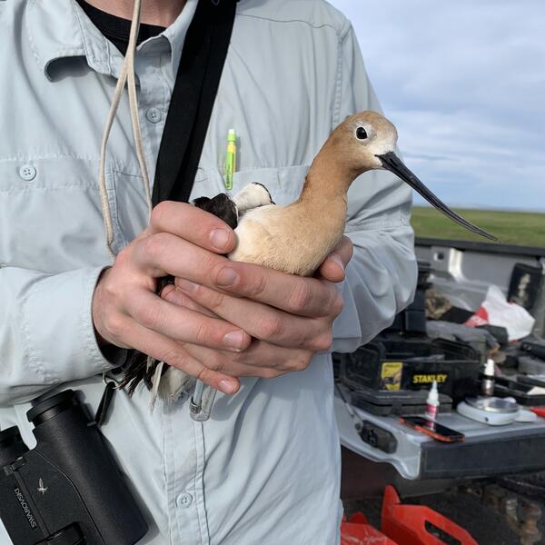
American avocet captured for research
A USGS scientist holds an American avocet that will have a GPS tag attached to it. The location data collected from this bird is used to track its movement and habitat use.
A USGS scientist holds an American avocet that will have a GPS tag attached to it. The location data collected from this bird is used to track its movement and habitat use.
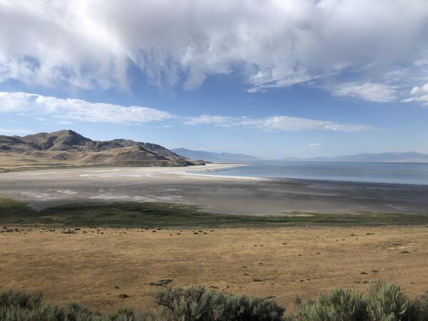
Looking south at the Great Salt Lake
A view from Antelope Island State Park in Utah shows the receding shoreline of the Great Salt Lake, highlighting extensive areas of exposed lakebed.
A view from Antelope Island State Park in Utah shows the receding shoreline of the Great Salt Lake, highlighting extensive areas of exposed lakebed.
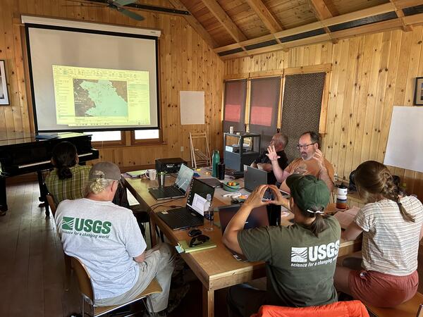
USGS scientists collaborate to advance Saline Lake ecosystems science
USGS scientists collaborate to advance Saline Lake ecosystems scienceSaline Lake researchers and field technicians gathered at Summer Lake to collaborate during a week-long workshop to integrate data and share expertise on Great Basin terminal lake ecosystems.
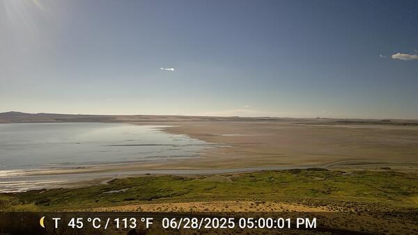
Lake Abert on June 28, 2025
The shoreline of Lake Abery shifted between June 27 and June 28, 2025. Seiche events, driven by strong winds, cause extreme fluctuations in the shoreline that can shift the lake water by miles in a single day.
The shoreline of Lake Abery shifted between June 27 and June 28, 2025. Seiche events, driven by strong winds, cause extreme fluctuations in the shoreline that can shift the lake water by miles in a single day.
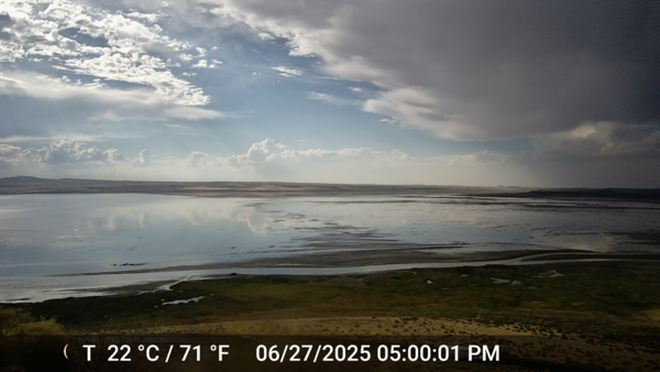
Lake Abert on June, 27, 2025
The water in Lake Abert stretches across the expanse of the camera view. Seiche events, driven by strong winds, cause extreme fluctuations in the shoreline that can shift the lake water by miles in a single day.
The water in Lake Abert stretches across the expanse of the camera view. Seiche events, driven by strong winds, cause extreme fluctuations in the shoreline that can shift the lake water by miles in a single day.

Researchers setting up water quality sensors
USGS scientists installing one of three wind and water quality instruments in Lake Abert. These instruments will record measurements throughout the year, allowing scientist to track changes to the water quality and wind speed and direction over time.
USGS scientists installing one of three wind and water quality instruments in Lake Abert. These instruments will record measurements throughout the year, allowing scientist to track changes to the water quality and wind speed and direction over time.

Researchers deploying sondes at Summer Lake
Researchers deploying sonde and wind sensors in Summer Lake. These sensors will gather continuous water quality data on pH, water temperature, dissolved oxygen, and specific conductance.
Researchers deploying sonde and wind sensors in Summer Lake. These sensors will gather continuous water quality data on pH, water temperature, dissolved oxygen, and specific conductance.

Tadpole shrimp in Summer Lake
Tadpole shrimp are also known as living fossils. This is because they have been around since the Devonian period, 350 million years ago!
Tadpole shrimp are also known as living fossils. This is because they have been around since the Devonian period, 350 million years ago!

Hydrologic inputs and outflow for water budgets
Diagram of hydrologic inputs and outflows (fluxes) for water budgets of terminal lakes and their watershed spatial extent. Understanding this process helps us to understand the ability of systems to support birds and ecosystems.
Diagram of hydrologic inputs and outflows (fluxes) for water budgets of terminal lakes and their watershed spatial extent. Understanding this process helps us to understand the ability of systems to support birds and ecosystems.
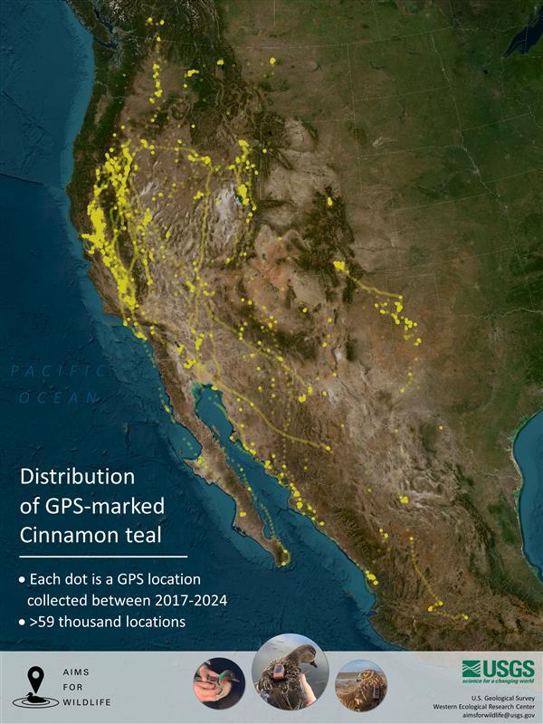
GPS-marked Cinnamon Teal Distribution
Distribution of GPS- marked Cinnamon teals. Marking data is from 2017-2024 with over 59,000 locations used.
Distribution of GPS- marked Cinnamon teals. Marking data is from 2017-2024 with over 59,000 locations used.

Water Boatmen Back
A Water Boatmen or Corixidae viewed through a microscope. They have a thin bubble of air trapped against their body, allowing them to stay underwater for long periods of time.
A Water Boatmen or Corixidae viewed through a microscope. They have a thin bubble of air trapped against their body, allowing them to stay underwater for long periods of time.
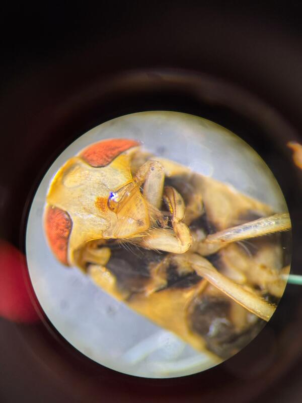
Water Boatmen Head
A water boatmen, scientific name Corixidae, is an aquatic insect that lives in both freshwater and saline ecosystems. They're commonly found as a source of prey for migratory birds across the Saline Lakes.
A water boatmen, scientific name Corixidae, is an aquatic insect that lives in both freshwater and saline ecosystems. They're commonly found as a source of prey for migratory birds across the Saline Lakes.

Cinnamon teal wearing a tracking backpack
Cinnamon teal with a GPS tracking backpack that weighs 10 grams, making it much more successful in staying on longer than heavier tracking devices.
Cinnamon teal with a GPS tracking backpack that weighs 10 grams, making it much more successful in staying on longer than heavier tracking devices.