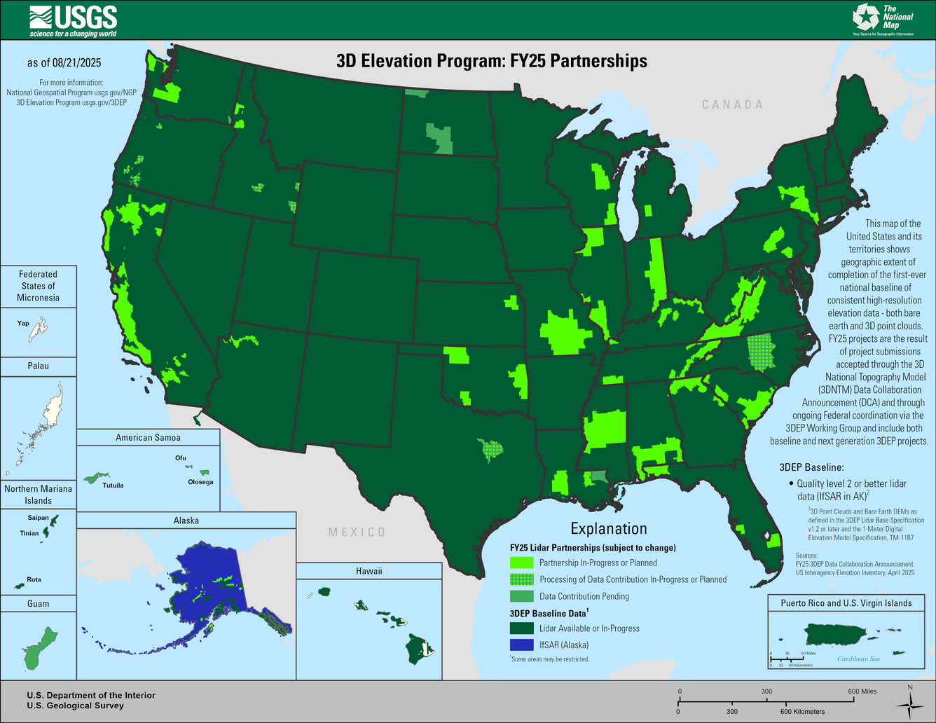
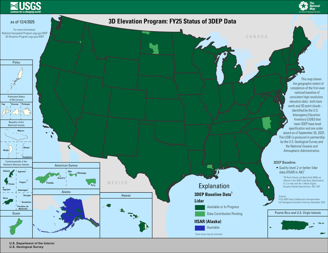
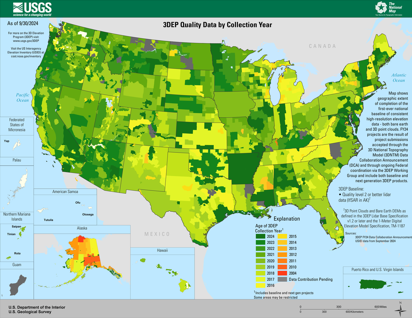
This map of the United States and its territories shows geographic extent of planned, existing, and in-progress 3DEP data acquisition projects.
3D Elevation Program
Science and Products
This map of the United States and its territories shows geographic extent of planned, existing, and in-progress 3DEP data acquisition projects.
This map of the United States and its territories shows the areal extent and quality level of planned, in-progress, and existing publicly available lidar (IfSAR in Alaska) data identified by the United States Interagency Elevation Inventory (USIEI) that meet 3DEP base level specification planned to be under award by September 30, 2023. 3DEP base level spec
This map of the United States and its territories shows geographic extent of planned, existing, and in-progress 3DEP data acquisition projects.
Map shows geographic extent of the first-ever national baseline of consistent high-resolution elevations – both bare earth and 3D point clouds. FY23 projects are the result of partnership projects awarded through the 3DEP Broad Agency Announcement (BAA) and through on-going Federal coordination via the 3DEP working group.
Image of a preliminary topobathymetric digital elevation model captured of the of the Santiam River, OR.
Map of the Potomac River topobathymetric lidar survey area in Virginia, Maryland, and West Virginia.
Topobathymetric digital elevation model of the confluence of the Potomac and Shenandoah Rivers at Harper’s Ferry, West Virginia.
This map of the United States and its territories shows the areal extent and quality level of planned, in-progress, and existing publicly available lidar (IfSAR in Alaska) data identified by the United States Interagency Elevation Inventory (USIEI) that meet 3DEP base level specification planned to be under award by September 30, 2022. 3DEP base level spec
Four Images created with 3DEP-quality lidar and IfSAR technology. Left to right, Clockwise: Digital Elevation Model of the Red River near Fargo, ND; IfSAR Digital Surface Model; Lidar point cloud image of Dulles Airport, VA; Lidar point cloud image of the transportation network in Denver, CO.
Lidar point cloud (lpc) rendering for the capitol building in Olympia, Washington
Top down view of lidar point cloud data showing elevation and intensity information of White Sands National Park (U.S. National Park Service). Colors highlight elevation changes within 3m range. USGS_LPC_NM_WhiteSandsNM_2020_D20_w3637n3633.laz
Simulation of a flood event in New Mexico near the confluence of the Rio Jemez and Rio Grande Rivers north of Albuquerque.
A 3DEP lidar point cloud illustrating dune progression with intensity and elevation information near White Sands National Park, New Mexico.
A 3D lidar point cloud rendering of the Rio Grande Gorge Bridge in Taos New Mexico.
3DEP lidar point cloud showing elevation and intensity over the Bisti/De-Na-Zin Wilderness near the Four Corners region of New Mexico.
3DEP lidar point cloud over the Very Large Array Radio Observatory, Socorro, NM. Motion of middle two antennas between flight lines was captured.
Colorized 3DEP lidar point cloud showing intensity and elevation of part of Kasha-Katuwe Tent Rocks National Monument, New Mexico
3DEP lidar rendering of Millsite Reservoir near Millsite State Park, Utah.
The USGS 3DEP DEM viewer may be accessed at: https://apps.nationalmap.gov/3depdem
Left to right:
Aspect
The USGS 3DEP DEM viewer may be accessed at: https://apps.nationalmap.gov/3depdem
Left to right:
Aspect
An oblique perspective of Alaska's Denali Mountain visualized by 3D Elevation Program lidar data.