
Inflation Reduction Act accelerates USGS effort to collect high-resolution data of landscapes across 25 states
Over $6 million in funding will support the USGS goal of nationwide high-resolution 3D data coverage.
RESTON, Va. — A U.S. Geological Survey effort to create a detailed three-dimensional, digital baseline map of the continental U.S. landscape using state-of-the-art high-definition laser modeling was significantly expanded thanks to an investment of more than $6 million from the Inflation Reduction Act (IRA).
The IRA funds awarded to the USGS last fiscal year for its 3D Elevation Program, known as 3DEP, were combined with other USGS funding and funds from federal agencies, states and other partners to facilitate the following:
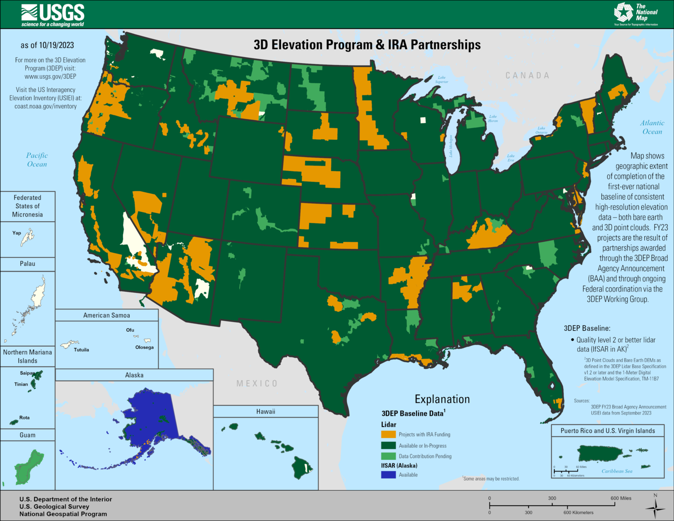
Mapping Landscapes through more than 97,000 square miles of new topographic lidar, a technology using lasers to create 3D maps of the Earth's surface. The new data, across 25 states, will be useful for supporting flood-risk management, precision agriculture, infrastructure projects, natural-resources management, and more.
- Mapping Riverbeds using a similar technology known as topobathymetric lidar, which provides 3D maps of submerged riverbed topography, the USGS will map the Santiam River, Oregon, and the Chehalis River, Washington, to support salmon habitat restoration, improved flood mapping, bridge- and road engineering studies and many other applications.
Advancing the 3D Nation Ecosystem project, a joint USGS-General Services Administration effort to connect elevation data collected from multiple sources across Federal agencies. The first pilot 3D Nation Ecosystem data system will be developed in collaboration with the National Oceanic and Atmospheric Administration.
- Modernizing data delivery using cloud-based infrastructure and associated tools for easier and faster access to 3DEP data.
“Our goal of providing a detailed 3D digital model of the U.S. landscape is a massive undertaking but an inspiring one that will have significant real-world benefits for our economy and ability to manage our lands effectively and sustainably. Investments from the Inflation Reduction Act in 2023 have been critical in moving us towards that goal,” said USGS Director Dave Applegate.
The resulting data and digital elevation models (DEMs) will be made available for public use on The National Map website and can be downloaded via the 3DEP LidarExplorer here.
Background
The goal of 3DEP is to complete the first-ever baseline topographic model of the conterminous U.S. using laser scanning technology called lidar (light detection and ranging). According to a comprehensive study, detailed elevation data provides \$690 million in new benefits each year through applications that span all economic sectors. The 3DEP program provides a critical new dimension to flood-risk, natural-resource and infrastructure management, conservation, energy development, agriculture, critical-minerals exploration, and a host of other nationally significant applications. 3DEP data helps to inform critical decisions made across our Nation every day that depend on elevation data, ranging from immediate safety of life, property, and environment to long term planning for infrastructure projects.
Lidar, short for light detection and ranging, is a type of data collected from aircraft that emit and then detect the reflections of a pulsed laser beam. The reflections are recorded as millions of individual points, collectively called a “point cloud,” that represent the three-dimensional positions of objects on the surface of the Earth. A slightly different technology called IfSAR, short for interferometric synthetic aperture radar, is used to collect data over Alaska due to its prevalent cloud cover, rugged terrain and remoteness.