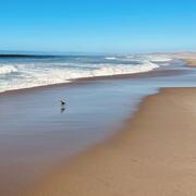
I have worked primarily on calculating shoreline position on sandy coasts usually from lidar data
Education and Certifications
Master's in Physical Oceanography from URI (1995)
Bachelor's in Physics from Denison University (1992)
Science and Products
Digital Shoreline Analysis System (DSAS)
Computer Software for Calculating Shoreline Change (or positional change of a boundary over time) The Digital Shoreline Analysis System (DSAS) v5 software is an add-in to Esri ArcGIS desktop (10.4-10.7+) that enables a user to calculate rate-of-change statistics from multiple historical shoreline positions. It provides an automated method for establishing measurement locations, performs rate...
USGS National Shoreline Change: A GIS compilation of Updated Vector Shorelines (1800s - 2010s) and Associated Shoreline Change Data for the Georgia and Florida Coasts.
During Hurricane Irma in September 2017, Florida and Georgia experienced significant impacts to beaches, dunes, barrier islands, and coral reefs. Extensive erosion and coral losses result in increased immediate and long-term hazards to shorelines that include densely populated regions. These hazards put critical infrastructure at risk to future flooding and erosion and may cause economic losses. T
Preliminary estimates of forecasted shoreline positions and associated uncertainties for Florida and Georgia
During Hurricane Irma, Florida and Georgia experienced substantial impacts to beaches, dunes, barrier islands, and coral reefs. Extensive erosion and coral losses from hurricanes result in increased vulnerability of coastal regions, including densely populated areas. Erosion may put critical infrastructure at risk of future flooding and may cause economic loss. The U.S. Geological Survey (USGS) Co
Massachusetts Shoreline Change Project, 2021 Update: A GIS Compilation of Shoreline Change Rates Calculated Using Digital Shoreline Analysis System Version 5.1, With Supplementary Intersects and Baselines for Massachusetts
The Massachusetts Office of Coastal Zone Management launched the Shoreline Change Project in 1989 to identify erosion-prone areas of the coast and support local land-use decisions. Trends of shoreline position over long and short-term timescales provide information to landowners, managers, and potential buyers about possible future impacts to coastal resources and infrastructure. In 2001, a 1994
Mean High Water Shorelines for the Outer Cape of Massachusetts from Nauset Inlet to Race Point (1998-2005)
This data release contains mean high water (MHW) shorelines for the Outer Cape of Cape Cod, Massachusetts, from Nauset Inlet to Race Point. From 1998-2005, the U.S. Geological Survey surveyed 45 kilometers of coastline 111 times using a ground-based system called Surveying Wide-Area Shorelines (SWASH). The SWASH system used a six-wheeled amphibious all-terrain vehicle as a platform for an array of
Massachusetts Shoreline Change Project, 2018 Update: A GIS Compilation of Shoreline Change Rates Calculated Using Digital Shoreline Analysis System Version 5.0, With Supplementary Intersects and Baselines for Massachusetts
The Massachusetts Office of Coastal Zone Management launched the Shoreline Change Project in 1989 to identify erosion-prone areas of the coast. The shoreline position and change rate are used to inform management decisions regarding the erosion of coastal resources. In 2001, a shoreline from 1994 was added to calculate both long- and short-term shoreline change rates along ocean-facing sections of
Marsh shorelines of the Massachusetts coast from 2013-14 topographic lidar data
The Massachusetts Office of Coastal Zone Management (CZM) launched the Shoreline Change Project in 1989 to identify erosion-prone areas of the Massachusetts coast. Seventy-six maps were produced in 1997 depicting a statistical analysis of shoreline change on ocean-facing shorelines from the mid-1800s to 1978 using multiple data sources. In 2001, a 1994 shoreline was added. More recently, in cooper
Digital Shoreline Analysis System (DSAS) version 5.1 user guide
The Digital Shoreline Analysis System version 5 software is an add-in to Esri ArcGIS Desktop version 10.4–10.7 that enables a user to calculate rate-of-change statistics from a time series of vector shoreline positions. The Digital Shoreline Analysis System provides an automated method for establishing measurement locations, performs rate calculations, provides the statistical data necessary to as
Identifying salt marsh shorelines from remotely sensed elevation data and imagery
Salt marshes are valuable ecosystems that are vulnerable to lateral erosion, submergence, and internal disintegration due to sea-level rise, storms, and sediment deficits. Because many salt marshes are losing area in response to these factors, it is important to monitor their lateral extent at high resolution over multiple timescales. In this study we describe two methods to calculate the location
Digital Shoreline Analysis System (DSAS) version 5.0 user guide
OverviewThe Digital Shoreline Analysis System (DSAS) is a freely available software application that works within the Esri Geographic Information System (ArcGIS) software. DSAS computes rate-of-change statistics for a time series of shoreline vector data. DSAS version 5.0 (v5.0) was released in December 2018 and has been tested for compatibility with ArcGIS versions 10.4 and 10.5. It is supported
Comparing methods used by the U.S. Geological Survey Coastal and Marine Geology Program for deriving shoreline position from lidar data
The U.S. Geological Survey Coastal and Marine Geology Program uses three methods to derive a datum-based, mean high water shoreline on open-ocean coasts from light detection and ranging (lidar) elevation surveys. This work compared the shorelines produced by the three methods for two different surveys: one survey with simple beach morphology, and one survey with complex beach morphology. For the s
UAS-SfM for coastal research: Geomorphic feature extraction and land cover classification from high-resolution elevation and optical imagery
The vulnerability of coastal systems to hazards such as storms and sea-level rise is typically characterized using a combination of ground and manned airborne systems that have limited spatial or temporal scales. Structure-from-motion (SfM) photogrammetry applied to imagery acquired by unmanned aerial systems (UAS) offers a rapid and inexpensive means to produce high-resolution topographic and vis
Using topographic lidar data to delineate the North Carolina Shoreline
In North Carolina, shoreline change rates are an important component of the state's coastal management program. To enhance methods of measuring shoreline change, the NC Division of Coastal Management (DCM) is considering using mean high water (MHW) shorelines extracted from lidar data together with traditional wet/dry shorelines digitized from aerial photography. To test their compatibility, a wet
Shoreline change as a proxy for subaerial beach volume change
It is difficult and expensive to calculate changes in sediment volume for large sections of sandy beaches. Shoreline change could be a useful proxy for volume change because it can be collected quickly and relatively easily over long distances. In this paper, we summarize several studies that find a high correlation between shoreline change and subaerial volume change. We also examine three new da
Reversing storm hotspots on sandy beaches: Spatial and temporal characteristics
Coastal erosion hotspots are defined as sections of coast that exhibit significantly higher rates of erosion than adjacent areas. This paper describes the spatial and temporal characteristics of a recently identified type of coastal erosion hotspot, which forms in response to storms on uninterrupted sandy coasts largely free from human intervention. These are referred to here as reversing storm ho
Bottom currents and sediment transport in Long Island Sound: A modeling study
A high resolution (300-400 m grid spacing), process oriented modeling study was undertaken to elucidate the physical processes affecting the characteristics and distribution of sea-floor sedimentary environments in Long Island Sound. Simulations using idealized forcing and high-resolution bathymetry were performed using a three-dimensional circulation model ECOM (Blumberg and Mellor, 1987) and a s
Large-scale shoreline response to storms and fair weather
No abstract available.
Digital Shoreline Analysis System
Digital Shoreline Analysis System version 5.0
Science and Products
- Science
Digital Shoreline Analysis System (DSAS)
Computer Software for Calculating Shoreline Change (or positional change of a boundary over time) The Digital Shoreline Analysis System (DSAS) v5 software is an add-in to Esri ArcGIS desktop (10.4-10.7+) that enables a user to calculate rate-of-change statistics from multiple historical shoreline positions. It provides an automated method for establishing measurement locations, performs rate... - Data
USGS National Shoreline Change: A GIS compilation of Updated Vector Shorelines (1800s - 2010s) and Associated Shoreline Change Data for the Georgia and Florida Coasts.
During Hurricane Irma in September 2017, Florida and Georgia experienced significant impacts to beaches, dunes, barrier islands, and coral reefs. Extensive erosion and coral losses result in increased immediate and long-term hazards to shorelines that include densely populated regions. These hazards put critical infrastructure at risk to future flooding and erosion and may cause economic losses. TPreliminary estimates of forecasted shoreline positions and associated uncertainties for Florida and Georgia
During Hurricane Irma, Florida and Georgia experienced substantial impacts to beaches, dunes, barrier islands, and coral reefs. Extensive erosion and coral losses from hurricanes result in increased vulnerability of coastal regions, including densely populated areas. Erosion may put critical infrastructure at risk of future flooding and may cause economic loss. The U.S. Geological Survey (USGS) CoMassachusetts Shoreline Change Project, 2021 Update: A GIS Compilation of Shoreline Change Rates Calculated Using Digital Shoreline Analysis System Version 5.1, With Supplementary Intersects and Baselines for Massachusetts
The Massachusetts Office of Coastal Zone Management launched the Shoreline Change Project in 1989 to identify erosion-prone areas of the coast and support local land-use decisions. Trends of shoreline position over long and short-term timescales provide information to landowners, managers, and potential buyers about possible future impacts to coastal resources and infrastructure. In 2001, a 1994Mean High Water Shorelines for the Outer Cape of Massachusetts from Nauset Inlet to Race Point (1998-2005)
This data release contains mean high water (MHW) shorelines for the Outer Cape of Cape Cod, Massachusetts, from Nauset Inlet to Race Point. From 1998-2005, the U.S. Geological Survey surveyed 45 kilometers of coastline 111 times using a ground-based system called Surveying Wide-Area Shorelines (SWASH). The SWASH system used a six-wheeled amphibious all-terrain vehicle as a platform for an array ofMassachusetts Shoreline Change Project, 2018 Update: A GIS Compilation of Shoreline Change Rates Calculated Using Digital Shoreline Analysis System Version 5.0, With Supplementary Intersects and Baselines for Massachusetts
The Massachusetts Office of Coastal Zone Management launched the Shoreline Change Project in 1989 to identify erosion-prone areas of the coast. The shoreline position and change rate are used to inform management decisions regarding the erosion of coastal resources. In 2001, a shoreline from 1994 was added to calculate both long- and short-term shoreline change rates along ocean-facing sections ofMarsh shorelines of the Massachusetts coast from 2013-14 topographic lidar data
The Massachusetts Office of Coastal Zone Management (CZM) launched the Shoreline Change Project in 1989 to identify erosion-prone areas of the Massachusetts coast. Seventy-six maps were produced in 1997 depicting a statistical analysis of shoreline change on ocean-facing shorelines from the mid-1800s to 1978 using multiple data sources. In 2001, a 1994 shoreline was added. More recently, in cooper - Publications
Digital Shoreline Analysis System (DSAS) version 5.1 user guide
The Digital Shoreline Analysis System version 5 software is an add-in to Esri ArcGIS Desktop version 10.4–10.7 that enables a user to calculate rate-of-change statistics from a time series of vector shoreline positions. The Digital Shoreline Analysis System provides an automated method for establishing measurement locations, performs rate calculations, provides the statistical data necessary to asIdentifying salt marsh shorelines from remotely sensed elevation data and imagery
Salt marshes are valuable ecosystems that are vulnerable to lateral erosion, submergence, and internal disintegration due to sea-level rise, storms, and sediment deficits. Because many salt marshes are losing area in response to these factors, it is important to monitor their lateral extent at high resolution over multiple timescales. In this study we describe two methods to calculate the locationDigital Shoreline Analysis System (DSAS) version 5.0 user guide
OverviewThe Digital Shoreline Analysis System (DSAS) is a freely available software application that works within the Esri Geographic Information System (ArcGIS) software. DSAS computes rate-of-change statistics for a time series of shoreline vector data. DSAS version 5.0 (v5.0) was released in December 2018 and has been tested for compatibility with ArcGIS versions 10.4 and 10.5. It is supportedComparing methods used by the U.S. Geological Survey Coastal and Marine Geology Program for deriving shoreline position from lidar data
The U.S. Geological Survey Coastal and Marine Geology Program uses three methods to derive a datum-based, mean high water shoreline on open-ocean coasts from light detection and ranging (lidar) elevation surveys. This work compared the shorelines produced by the three methods for two different surveys: one survey with simple beach morphology, and one survey with complex beach morphology. For the sUAS-SfM for coastal research: Geomorphic feature extraction and land cover classification from high-resolution elevation and optical imagery
The vulnerability of coastal systems to hazards such as storms and sea-level rise is typically characterized using a combination of ground and manned airborne systems that have limited spatial or temporal scales. Structure-from-motion (SfM) photogrammetry applied to imagery acquired by unmanned aerial systems (UAS) offers a rapid and inexpensive means to produce high-resolution topographic and visUsing topographic lidar data to delineate the North Carolina Shoreline
In North Carolina, shoreline change rates are an important component of the state's coastal management program. To enhance methods of measuring shoreline change, the NC Division of Coastal Management (DCM) is considering using mean high water (MHW) shorelines extracted from lidar data together with traditional wet/dry shorelines digitized from aerial photography. To test their compatibility, a wetShoreline change as a proxy for subaerial beach volume change
It is difficult and expensive to calculate changes in sediment volume for large sections of sandy beaches. Shoreline change could be a useful proxy for volume change because it can be collected quickly and relatively easily over long distances. In this paper, we summarize several studies that find a high correlation between shoreline change and subaerial volume change. We also examine three new daReversing storm hotspots on sandy beaches: Spatial and temporal characteristics
Coastal erosion hotspots are defined as sections of coast that exhibit significantly higher rates of erosion than adjacent areas. This paper describes the spatial and temporal characteristics of a recently identified type of coastal erosion hotspot, which forms in response to storms on uninterrupted sandy coasts largely free from human intervention. These are referred to here as reversing storm hoBottom currents and sediment transport in Long Island Sound: A modeling study
A high resolution (300-400 m grid spacing), process oriented modeling study was undertaken to elucidate the physical processes affecting the characteristics and distribution of sea-floor sedimentary environments in Long Island Sound. Simulations using idealized forcing and high-resolution bathymetry were performed using a three-dimensional circulation model ECOM (Blumberg and Mellor, 1987) and a sLarge-scale shoreline response to storms and fair weather
No abstract available. - Software
Digital Shoreline Analysis System
Digital Shoreline Analysis System version 5.0
- Multimedia