
USGS hydrologist, Erin Leahy, collects sediment samples at the upstream gage on Chicken Creek in the Tualatin River National Wildlife Refuge.
Erin Leahy
Erin Leahy is a Hydrologist and Code 4 Supervisor with the USGS Oregon Water Science Center.
Project management: Independently manage multiple projects with various associated tasks and goals. Interview, onboard and train new staff. Develop and manage budgets. Manage and coordinate 10+ staff members to ensure efficient workflow and workload. Plan and coordinate site construction including obtaining proper permitting and site design. Create project schedules and monitor status to ensure project goals are met. Plan and lead sampling teams. Review various long-term datasets to ensure high quality. Develop and maintain working relationships with federal, state and local government agencies along with non-profit organizations. Maintain consistent and clear communication with partners.
Hydrologic data: Metadata specialist for the ORWSC. Review and create metadata for various types of datasets and shepherd them through the data release process. Interpret patterns and trends in continuous datasets to better understand instream processes. Audit continuous water quality records to ensure the highest quality data.
Fieldwork: Operated multiple long-term, continuous water-quality sites. Responsibilities included maintaining and calibrating water-quality equipment, processing data to ensure high-quality standards. Coordinate and participate in suspended-sediment sampling efforts during storm-events for multiple projects. Manage and participate in temperature synoptics assessing spatial variability in surface-water temperature in urban ponds. Investigate spatial and temporal temperature and streamflow variation in beaver-effected stream reaches. Collect and process discrete water-quality data, including sampling for the National Water-Quality Assessment Program using parts-per-billion protocols. Install and maintain continuous surface water and groundwater gaging stations. Collect bathymetric and surface elevation data using both total station and real-time kinematic (RTK) instruments.
Communication: Accomplished at developing presentations for a variety of audiences. Successfully delivered over a dozen presentations. Coauthored multiple papers that will be published in 2025. Created numerous maps for publication.
Science and Products

City Beavers: Tualatin River Basin Beaver Study
Beavers and their dams are common sights along creeks in the Tualatin River basin. Beaver help create diverse habitats for many other animals, including birds, fish, and amphibians. The USGS studying the affect beaver activity has on the amount and quality of water in local streams, so that agencies in the basin can make strategic management and habitat restoration decisions based on science.
The “Super Monitor”: Tracking Willamette River water quality in Portland
Nicknamed the ‘Super Monitor,’ this site has measured key water-quality values every 15 minutes since 2009.

Tualatin River Basin Water Quality Assessment
In 1990, the USGS began assessing water-quality in the Tualatin River. More then 30 years later, we are still monitoring conditions in the basin and conducting investigations to better understand stream processes within the basin.

Evaluating sediment transport in Chicken Creek
The United States Geological Survey (USGS) is evaluating how the newly restored meandering channel on Chicken Creek affects sediment transport within the Tualatin River National Wildlife Refuge.

Fernhill Natural Treatment Wetlands
The amount and type of algae in the Tualatin River affect the river’s water quality and ecological health, as well as its value as a recreational resource. As a relatively new source of summertime flow to the upper Tualatin River, discharges from the Fernhill Natural Treatment System (NTS) have the potential to enhance or degrade downstream water quality. Discharges of low nutrient concentrations...

Johnson Creek Basin Hydrologic Monitoring Study
The USGS provides hydrologic data for the Johnson Creek Basin. Real-time surface-water, water-quality and groundwater data, as well as historic data and analyses, help to improve our understanding of the hydrology of the basin.
Filter Total Items: 22

Chicken Creek sediment sampling
USGS hydrologist, Erin Leahy, collects sediment samples at the upstream gage on Chicken Creek in the Tualatin River National Wildlife Refuge.

Data Collection at Chicken Creek
USGS hydrologist, Erin Leahy, collecting data in Chicken Creek in the Tualatin River National Wildlife Refuge. The USGS operates two water-quality monitors along Chicken Creek.
USGS hydrologist, Erin Leahy, collecting data in Chicken Creek in the Tualatin River National Wildlife Refuge. The USGS operates two water-quality monitors along Chicken Creek.

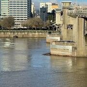
Tualatin at Boones Ferry
View of lake at Fernhill Natural Treatment Wetlands.
View of lake at Fernhill Natural Treatment Wetlands.

Fernhill Sample Site 7
View of lake at Fernhill Natural Treatment Wetlands.
View of lake at Fernhill Natural Treatment Wetlands.

Lake at Fernhill
View of lake at Fernhill Natural Treatment Wetlands.
View of lake at Fernhill Natural Treatment Wetlands.

Lake at Fernhill
View of lake at Fernhill Natural Treatment Wetlands.
View of lake at Fernhill Natural Treatment Wetlands.

Fernhill Sample Site 18
View of lake at Fernhill Natural Treatment Wetlands.
View of lake at Fernhill Natural Treatment Wetlands.

Fernhill Sample Point 1
View of lake at Fernhill Natural Treatment Wetlands.
View of lake at Fernhill Natural Treatment Wetlands.

After the Flames talk by Steven Sobieszczyk
USGS hydrologist, Steven Sobieszcyk, on stage at Alberta Rose Theater talking about the science behind the Eagle Creek Fire response.
USGS hydrologist, Steven Sobieszcyk, on stage at Alberta Rose Theater talking about the science behind the Eagle Creek Fire response.
2. Beaver Dam Inventory and Beaver Dam Capacity Estimates
2. Beaver Dam Inventory and Beaver Dam Capacity EstimatesBeavers and their dams can substantially change the storage and movement of water through a stream reach. The magnitude of this change is, in part, a function of the number and type of dams plus stream characteristics.
5. Effects of Beaver Dams on Sediment Transport
Beaver dams and associated ponding affect sediment transport and trapping by pushing water onto the floodplain and decreasing stream velocity, allowing for increased sediment deposition.
Beaver dams and associated ponding affect sediment transport and trapping by pushing water onto the floodplain and decreasing stream velocity, allowing for increased sediment deposition.
4. Effects of Beaver Activity on Water Quality
Beaver dams and ponds alter the movement and storage of water as well as the water quality in a stream reach. To date, little work has been done to quantify the effects of beaver activity on water quality in urban streams.
Beaver dams and ponds alter the movement and storage of water as well as the water quality in a stream reach. To date, little work has been done to quantify the effects of beaver activity on water quality in urban streams.
3. Hydraulic Effects of Beaver Dams
Beaver dams and ponds fundamentally alter how water moves through a stream reach. Semi-porous dams can impound water, leading to backwatering, floodplain inundation, and overall changes in wetted area, depth, and velocity.
For this part of the study, USGS:
Beaver dams and ponds fundamentally alter how water moves through a stream reach. Semi-porous dams can impound water, leading to backwatering, floodplain inundation, and overall changes in wetted area, depth, and velocity.
For this part of the study, USGS:
1. Overview of the Tualatin Urban Beaver Dam Study
1. Overview of the Tualatin Urban Beaver Dam StudyPopulations of North American beaver (Castor canadensis) have increased in recent years due to decreased trapping, habitat restoration, and recognition of their importance as a keystone species in stream ecosystems (Pollock and others, 2017).

Bob The Beaver
Meet Bob.
Bob is a beaver.
Meet Bob.
Bob is a beaver.

Adult and juvenile beaver near Windrose, Oregon
Adult and juvenile beaver near Windrose, Oregon
Adult and juvenile beaver near Windrose, Oregon

Beaver along bank of pond in Tualatin River Basin, OR
Beaver along bank of pond in Tualatin River Basin, ORBeaver along bank of pond in Tualatin River Basin, OR
Beaver along bank of pond in Tualatin River Basin, OR
Beaver along bank of pond in Tualatin River Basin, ORBeaver along bank of pond in Tualatin River Basin, OR

Cardinal Meadowhawk
This dragonfly is called a Cardinal Meadowhawk.
This dragonfly is called a Cardinal Meadowhawk.

Beaver at Summer Lake, Oregon
Beaver swimming in Summer Lake, Oregon.
Beaver swimming in Summer Lake, Oregon.

Beaver eating at Summer Lake, OR
Beaver eating at Summer Lake, OR
Beaver eating at Summer Lake, OR

Beaver swimming in Summer Lake, OR
Beaver swimming in Summer Lake, OR
Beaver swimming in Summer Lake, OR
Science and Products
City Beavers: Tualatin River Basin Beaver Study
Beavers and their dams are common sights along creeks in the Tualatin River basin. Beaver help create diverse habitats for many other animals, including birds, fish, and amphibians. The USGS studying the affect beaver activity has on the amount and quality of water in local streams, so that agencies in the basin can make strategic management and habitat restoration decisions based on science.
The “Super Monitor”: Tracking Willamette River water quality in Portland
Nicknamed the ‘Super Monitor,’ this site has measured key water-quality values every 15 minutes since 2009.
Tualatin River Basin Water Quality Assessment
In 1990, the USGS began assessing water-quality in the Tualatin River. More then 30 years later, we are still monitoring conditions in the basin and conducting investigations to better understand stream processes within the basin.
Evaluating sediment transport in Chicken Creek
The United States Geological Survey (USGS) is evaluating how the newly restored meandering channel on Chicken Creek affects sediment transport within the Tualatin River National Wildlife Refuge.
Fernhill Natural Treatment Wetlands
The amount and type of algae in the Tualatin River affect the river’s water quality and ecological health, as well as its value as a recreational resource. As a relatively new source of summertime flow to the upper Tualatin River, discharges from the Fernhill Natural Treatment System (NTS) have the potential to enhance or degrade downstream water quality. Discharges of low nutrient concentrations...
Johnson Creek Basin Hydrologic Monitoring Study
The USGS provides hydrologic data for the Johnson Creek Basin. Real-time surface-water, water-quality and groundwater data, as well as historic data and analyses, help to improve our understanding of the hydrology of the basin.
Filter Total Items: 22
Chicken Creek sediment sampling
USGS hydrologist, Erin Leahy, collects sediment samples at the upstream gage on Chicken Creek in the Tualatin River National Wildlife Refuge.
USGS hydrologist, Erin Leahy, collects sediment samples at the upstream gage on Chicken Creek in the Tualatin River National Wildlife Refuge.
Data Collection at Chicken Creek
USGS hydrologist, Erin Leahy, collecting data in Chicken Creek in the Tualatin River National Wildlife Refuge. The USGS operates two water-quality monitors along Chicken Creek.
USGS hydrologist, Erin Leahy, collecting data in Chicken Creek in the Tualatin River National Wildlife Refuge. The USGS operates two water-quality monitors along Chicken Creek.
Tualatin at Boones Ferry
View of lake at Fernhill Natural Treatment Wetlands.
View of lake at Fernhill Natural Treatment Wetlands.
Fernhill Sample Site 7
View of lake at Fernhill Natural Treatment Wetlands.
View of lake at Fernhill Natural Treatment Wetlands.
Lake at Fernhill
View of lake at Fernhill Natural Treatment Wetlands.
View of lake at Fernhill Natural Treatment Wetlands.
Lake at Fernhill
View of lake at Fernhill Natural Treatment Wetlands.
View of lake at Fernhill Natural Treatment Wetlands.
Fernhill Sample Site 18
View of lake at Fernhill Natural Treatment Wetlands.
View of lake at Fernhill Natural Treatment Wetlands.
Fernhill Sample Point 1
View of lake at Fernhill Natural Treatment Wetlands.
View of lake at Fernhill Natural Treatment Wetlands.
After the Flames talk by Steven Sobieszczyk
USGS hydrologist, Steven Sobieszcyk, on stage at Alberta Rose Theater talking about the science behind the Eagle Creek Fire response.
USGS hydrologist, Steven Sobieszcyk, on stage at Alberta Rose Theater talking about the science behind the Eagle Creek Fire response.
2. Beaver Dam Inventory and Beaver Dam Capacity Estimates
2. Beaver Dam Inventory and Beaver Dam Capacity EstimatesBeavers and their dams can substantially change the storage and movement of water through a stream reach. The magnitude of this change is, in part, a function of the number and type of dams plus stream characteristics.
2. Beaver Dam Inventory and Beaver Dam Capacity Estimates
2. Beaver Dam Inventory and Beaver Dam Capacity EstimatesBeavers and their dams can substantially change the storage and movement of water through a stream reach. The magnitude of this change is, in part, a function of the number and type of dams plus stream characteristics.
5. Effects of Beaver Dams on Sediment Transport
Beaver dams and associated ponding affect sediment transport and trapping by pushing water onto the floodplain and decreasing stream velocity, allowing for increased sediment deposition.
Beaver dams and associated ponding affect sediment transport and trapping by pushing water onto the floodplain and decreasing stream velocity, allowing for increased sediment deposition.
4. Effects of Beaver Activity on Water Quality
Beaver dams and ponds alter the movement and storage of water as well as the water quality in a stream reach. To date, little work has been done to quantify the effects of beaver activity on water quality in urban streams.
Beaver dams and ponds alter the movement and storage of water as well as the water quality in a stream reach. To date, little work has been done to quantify the effects of beaver activity on water quality in urban streams.
3. Hydraulic Effects of Beaver Dams
Beaver dams and ponds fundamentally alter how water moves through a stream reach. Semi-porous dams can impound water, leading to backwatering, floodplain inundation, and overall changes in wetted area, depth, and velocity.
For this part of the study, USGS:
Beaver dams and ponds fundamentally alter how water moves through a stream reach. Semi-porous dams can impound water, leading to backwatering, floodplain inundation, and overall changes in wetted area, depth, and velocity.
For this part of the study, USGS:
1. Overview of the Tualatin Urban Beaver Dam Study
1. Overview of the Tualatin Urban Beaver Dam StudyPopulations of North American beaver (Castor canadensis) have increased in recent years due to decreased trapping, habitat restoration, and recognition of their importance as a keystone species in stream ecosystems (Pollock and others, 2017).
1. Overview of the Tualatin Urban Beaver Dam Study
1. Overview of the Tualatin Urban Beaver Dam StudyPopulations of North American beaver (Castor canadensis) have increased in recent years due to decreased trapping, habitat restoration, and recognition of their importance as a keystone species in stream ecosystems (Pollock and others, 2017).
Bob The Beaver
Meet Bob.
Bob is a beaver.
Meet Bob.
Bob is a beaver.
Adult and juvenile beaver near Windrose, Oregon
Adult and juvenile beaver near Windrose, Oregon
Adult and juvenile beaver near Windrose, Oregon
Beaver along bank of pond in Tualatin River Basin, OR
Beaver along bank of pond in Tualatin River Basin, ORBeaver along bank of pond in Tualatin River Basin, OR
Beaver along bank of pond in Tualatin River Basin, OR
Beaver along bank of pond in Tualatin River Basin, ORBeaver along bank of pond in Tualatin River Basin, OR
Cardinal Meadowhawk
This dragonfly is called a Cardinal Meadowhawk.
This dragonfly is called a Cardinal Meadowhawk.
Beaver at Summer Lake, Oregon
Beaver swimming in Summer Lake, Oregon.
Beaver swimming in Summer Lake, Oregon.
Beaver eating at Summer Lake, OR
Beaver eating at Summer Lake, OR
Beaver eating at Summer Lake, OR
Beaver swimming in Summer Lake, OR
Beaver swimming in Summer Lake, OR
Beaver swimming in Summer Lake, OR