I have been a hydrologist with the U.S. Geological Survey (USGS) since 2020, where my work focuses on the intricate relationships among energy, water resources, and geospatial data. I am particularly passionate about integrating geospatial, geological, and hydrogeological datasets to address complex scientific challenges.
Currently, I lead or work on several projects aimed at investigating the connections between oil and gas activities and water resource extraction, developing tools and resources to support stakeholders (including the geothermal energy sector), identifying and predicting areas susceptible to landslides, mapping and modeling groundwater discharge zones and thermal habitats for cold-water fish species through advanced geospatial and hydrogeological modeling techniques, and mapping essential groundwater aquifers for effective resource management (among many other projects).
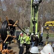
Before joining the USGS, I earned my master's degree from Pennsylvania State University, where I conducted environmental forensic studies on hydrocarbon and brine migration. During this time, I collaborated with a diverse group of scientists and volunteers to trace the origins of groundwater contaminants and predict the geochemical impacts along their flow paths.