



Lisa Hoaks (Former Employee)
Science and Products
I’ve helped draft and design numerous science project web pages to support public understanding of our work. I am not a researcher or the technical contact for these projects. Please see the project page for appropriate technical contacts.
Filter Total Items: 23

Identifying nitrate sources in the lower Crooked River
The U.S. Geological Survey (USGS) and the Crooked River Watershed Council (CRWC) are working together to identify sources of nitrate entering Lake Billy Chinook from the Crooked River Basin to help resource managers improve water quality.

Fern Ridge Geomorphology
The USGS, in cooperation with the U.S. Army Corps of Engineers (USACE), is conducting targeted research to better understand geomorphic conditions and processes within the reservoir at Fern Ridge Lake, near Eugene, Oregon, so that managers have the information to support dam operations and other actions that will aid in the preservation and management of cultural sites.

Understanding Water Quality Challenges at Bethany Lake: Monitoring Harmful Algal Blooms
The USGS is studying Bethany Lake to provide a comprehensive picture of how the lake’s water conditions and nutrient sources tie into potential algae blooms.

Monitoring sediment transport and aquatic macroinvertebrate communities in the Willamette River basin
The U.S. Geological Survey is listening to rivers to understand how flows transport bedload sediment, which is fundamental to ecosystem structure and health.

New gages for understanding surface water availability and spring Chinook salmon habitat in the Willamette Basin
Learn about our new streamgages in the Williamette River Basin.
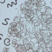
Willamette River plankton & water-quality updates
Plankton sampling results from the Willamette River in Portland, Oregon.

Surface-water extent in the Klamath Marsh
Satellite imagery and the interplay of climate and hydrologic data tell the story of surface-water decline in the Klamath Marsh.

Tracking Toxics in the Lower Columbia River
USGS scientists partnered with the Lower Columbia Estuary Partnership (LCEP) to assess toxic contaminant levels at 10 sites within the Lower Columbia River. Our strategy is to compare current toxic contaminant levels to the results collected previously at these sites to identify temporal changes.

Recharge to the Columbia River Basalt Groundwater System
Learn about the groundwater flow system within the Columbia River Basalt Group in the Umatilla River Basin.

Modeling the water-quality effects to the Klamath River from drain recirculation
What could happen to nutrient loads in the Klamath River if water from the Klamath Straits Drain is recirculated into the Ady Canal? USGS scientists investigate.

Multiscale comparison of hyperspectral reflectance from periphyton in three Oregon rivers used for municipal supply
In this study, USGS scientists from multiple centers used advanced hyperspectral imaging techniques to advance monitoring of attached benthic algae (periphyton) in Cascade Range rivers used for municipal water supply. Periphyton are naturally occurring, but excess growth can harm ecosystems and degrade raw and treated drinking water quality. In these rivers, periphyton contain cyanobacteria that...
Science and Products
I’ve helped draft and design numerous science project web pages to support public understanding of our work. I am not a researcher or the technical contact for these projects. Please see the project page for appropriate technical contacts.
Filter Total Items: 23
Identifying nitrate sources in the lower Crooked River
The U.S. Geological Survey (USGS) and the Crooked River Watershed Council (CRWC) are working together to identify sources of nitrate entering Lake Billy Chinook from the Crooked River Basin to help resource managers improve water quality.
Fern Ridge Geomorphology
The USGS, in cooperation with the U.S. Army Corps of Engineers (USACE), is conducting targeted research to better understand geomorphic conditions and processes within the reservoir at Fern Ridge Lake, near Eugene, Oregon, so that managers have the information to support dam operations and other actions that will aid in the preservation and management of cultural sites.
Understanding Water Quality Challenges at Bethany Lake: Monitoring Harmful Algal Blooms
The USGS is studying Bethany Lake to provide a comprehensive picture of how the lake’s water conditions and nutrient sources tie into potential algae blooms.
Monitoring sediment transport and aquatic macroinvertebrate communities in the Willamette River basin
The U.S. Geological Survey is listening to rivers to understand how flows transport bedload sediment, which is fundamental to ecosystem structure and health.
New gages for understanding surface water availability and spring Chinook salmon habitat in the Willamette Basin
Learn about our new streamgages in the Williamette River Basin.
Willamette River plankton & water-quality updates
Plankton sampling results from the Willamette River in Portland, Oregon.
Surface-water extent in the Klamath Marsh
Satellite imagery and the interplay of climate and hydrologic data tell the story of surface-water decline in the Klamath Marsh.
Tracking Toxics in the Lower Columbia River
USGS scientists partnered with the Lower Columbia Estuary Partnership (LCEP) to assess toxic contaminant levels at 10 sites within the Lower Columbia River. Our strategy is to compare current toxic contaminant levels to the results collected previously at these sites to identify temporal changes.
Recharge to the Columbia River Basalt Groundwater System
Learn about the groundwater flow system within the Columbia River Basalt Group in the Umatilla River Basin.
Modeling the water-quality effects to the Klamath River from drain recirculation
What could happen to nutrient loads in the Klamath River if water from the Klamath Straits Drain is recirculated into the Ady Canal? USGS scientists investigate.
Multiscale comparison of hyperspectral reflectance from periphyton in three Oregon rivers used for municipal supply
In this study, USGS scientists from multiple centers used advanced hyperspectral imaging techniques to advance monitoring of attached benthic algae (periphyton) in Cascade Range rivers used for municipal water supply. Periphyton are naturally occurring, but excess growth can harm ecosystems and degrade raw and treated drinking water quality. In these rivers, periphyton contain cyanobacteria that...