Monitoring equipment at Frio River at Concan, Tex.
Monitoring equipment at Frio River at Concan, Tex.Monitoring equipment at Frio River at Concan, Tex.

Official websites use .gov
A .gov website belongs to an official government organization in the United States.
Secure .gov websites use HTTPS
A lock () or https:// means you’ve safely connected to the .gov website. Share sensitive information only on official, secure websites.
Images from Region 6.
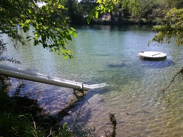
Monitoring equipment at Frio River at Concan, Tex.
Monitoring equipment at Frio River at Concan, Tex.

Back cover photo from

Back cover photo from

Back cover photo from

Cover background photo from
Cover background photo from

Back cover photo from

Photo from pages 8 and 9 of
Photo from pages 8 and 9 of

Photograph from page 19 of

A Crest Stage Gage
Here is a low-tech device made of solely of a metal pipe, a wooden pole, and crushed cork that is invaluable to providing a one-time measurement of the maximum height (stage) that a stream hits during a high-water event.
A Crest Stage Gage
Here is a low-tech device made of solely of a metal pipe, a wooden pole, and crushed cork that is invaluable to providing a one-time measurement of the maximum height (stage) that a stream hits during a high-water event.

USGS scientist Steve Hannes marks high water marks along the Colorado River after flooding from Harvey in Matagorda County, Texas.
USGS scientist Steve Hannes marks high water marks along the Colorado River after flooding from Harvey in Matagorda County, Texas.

USGS scientist Steve Hannes marks high water marks along the Colorado River after flooding from Hurricane Harvey in Wharton County, Texas.
USGS scientist Steve Hannes marks high water marks along the Colorado River after flooding from Hurricane Harvey in Wharton County, Texas.

USGS scientist Steve Hannes marks high water marks along the Colorado River after flooding from Hurricane Harvey in Wharton County, Texas.
USGS scientist Steve Hannes marks high water marks along the Colorado River after flooding from Hurricane Harvey in Wharton County, Texas.

USGS scientist Steve Hannes marks high water marks along the Colorado River after flooding from Hurricane Harvey in Wharton County, Texas.
USGS scientist Steve Hannes marks high water marks along the Colorado River after flooding from Hurricane Harvey in Wharton County, Texas.

USGS scientist David Rodriguez records high water marks from storm surge following Harvey near Corpus Christi, Texas.
USGS scientist David Rodriguez records high water marks from storm surge following Harvey near Corpus Christi, Texas.

USGS scientist David Rodriguez records high water marks from storm surge near Corpus Christi, Texas.
USGS scientist David Rodriguez records high water marks from storm surge near Corpus Christi, Texas.

USGS scientist Alec McDonald surveying high water marks from storm surge from Hurricane Harvey at Packery Channel near Corpus Christi, Texas.
USGS scientist Alec McDonald surveying high water marks from storm surge from Hurricane Harvey at Packery Channel near Corpus Christi, Texas.

USGS scientist Vidal Mendoza surveying high water marks from storm surge from Hurricane Harvey near Port Aransas, Texas.
USGS scientist Vidal Mendoza surveying high water marks from storm surge from Hurricane Harvey near Port Aransas, Texas.

Location 4. Sand dunes along this stretch of coast in Sargent, Texas, were overwashed by large waves during the storm. Sand from the beach and dunes is covering the roadway behind the dunes and which may be impassable. The predicted probability of overwash in this area was 94%.
Location 4. Sand dunes along this stretch of coast in Sargent, Texas, were overwashed by large waves during the storm. Sand from the beach and dunes is covering the roadway behind the dunes and which may be impassable. The predicted probability of overwash in this area was 94%.

A USGS field crew takes water-quality samples on Lake Houston following Harvey.
A USGS field crew takes water-quality samples on Lake Houston following Harvey.

A peek into a USGS planning meeting to coordinate water-quality sampling efforts in response to Harvey. This sampling effort is part of the federal government’s broad efforts to ensure public health and to support the state, tribal, and local response to the storm
A peek into a USGS planning meeting to coordinate water-quality sampling efforts in response to Harvey. This sampling effort is part of the federal government’s broad efforts to ensure public health and to support the state, tribal, and local response to the storm

USGS scientist Lisa Ashmore services a water-quality monitor on Lake Houston. These instruments stayed afloat and collected data throughout Harvey.
USGS scientist Lisa Ashmore services a water-quality monitor on Lake Houston. These instruments stayed afloat and collected data throughout Harvey.