U.S. flag

An official website of the United States government

Multimedia

Check out USGS images, video, and audio files from across Region 6. 

Images

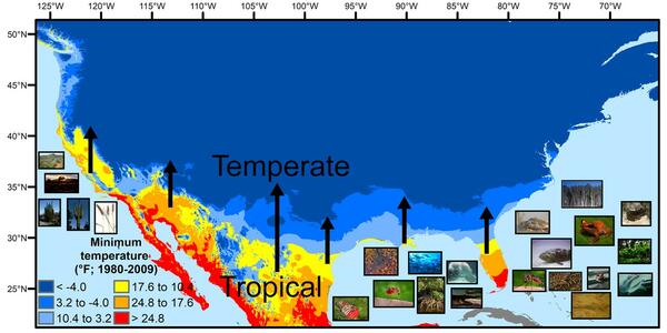
Map of U.S. mainland showing temperate, transitional and tropical temperature patterns
U.S. regions in the tropical-to-temperate transition

A map showing North America's tropical-to-temperate transition zone. Red, orange, and yellow depict the more tropical zones, and blues depict the more temperate zones, based on to the coldest recorded temperature for each area between 1980 and 2009.

A map showing North America's tropical-to-temperate transition zone. Red, orange, and yellow depict the more tropical zones, and blues depict the more temperate zones, based on to the coldest recorded temperature for each area between 1980 and 2009.

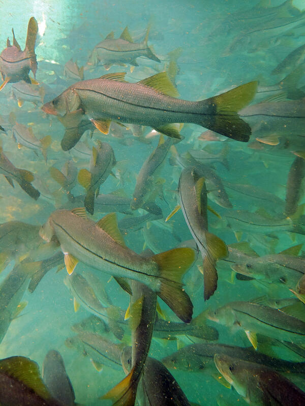
A school of snook, large subtropical game fish, in a Florida spring
Subtropical snook gather at a warm Florida springhead in winter

 Winter temperature extremes control the distributions of subtropical fishes. Common snook (Centropomus undecimalis), aggregate at a spring in northern Florida during winter. Snook are warm saltwater game fish, common in Florida, that have been moving further northward as extreme cold spells become less frequent and less intense.

 Winter temperature extremes control the distributions of subtropical fishes. Common snook (Centropomus undecimalis), aggregate at a spring in northern Florida during winter. Snook are warm saltwater game fish, common in Florida, that have been moving further northward as extreme cold spells become less frequent and less intense.

Map
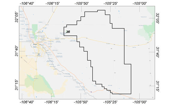
Flight area for Trans-Pecos aeromagnetic and radiometric survey

Map indicating flight area for Trans-Pecos aeromagnetic and radiometric survey. The survey area includes parts of El Paso and Hudspeth counties, Texas, and Otero County, New Mexico. Flights will begin in November 2020 and are expected to conclude in mid-January 2021. 

Map indicating flight area for Trans-Pecos aeromagnetic and radiometric survey. The survey area includes parts of El Paso and Hudspeth counties, Texas, and Otero County, New Mexico. Flights will begin in November 2020 and are expected to conclude in mid-January 2021. 

Image shows a rock core in a trough
Austin Chalk Core
Austin Chalk Core
Austin Chalk Core

Bedding features in the core from the USGS Gulf Coast #4 Bonham borehole, in the Eagle Ford Group mudstones from a depth of about 401 feet, Fannin County, Texas. The Eagle Ford Group lies underneath the Austin Chalk and serves as the source rock for much of the Austin Chalk's petroleum.

Bedding features in the core from the USGS Gulf Coast #4 Bonham borehole, in the Eagle Ford Group mudstones from a depth of about 401 feet, Fannin County, Texas. The Eagle Ford Group lies underneath the Austin Chalk and serves as the source rock for much of the Austin Chalk's petroleum.

Image shows three men in safety equipment standing next to a drill rig
USGS Technicians Prepare to Take a Core of the Austin Chalk in Texas

USGS technicians at the USGS Gulf Coast #4 Bonham borehole in preparation for geophysical logging of the Austin Chalk Group and the Eagle Ford Group mudstones, Fannin County, Texas.

USGS technicians at the USGS Gulf Coast #4 Bonham borehole in preparation for geophysical logging of the Austin Chalk Group and the Eagle Ford Group mudstones, Fannin County, Texas.

People wading in knee-high water
Dragonfly Mercury Project specimen collection in Glacier NP

Researchers instruct volunteers on how to collect dragonfly larvae in Glacier NP as a part of the Dragonfly Mercury Project.

Researchers instruct volunteers on how to collect dragonfly larvae in Glacier NP as a part of the Dragonfly Mercury Project.

Videos

Surveying Contracted-Opening Indirect Measurements

This video goes into detail about surveying high-water marks, various aspects of bridges, and cross sections for the contracted-opening method. 
 

This video goes into detail about surveying high-water marks, various aspects of bridges, and cross sections for the contracted-opening method. 
 

Requirements for the Contracted-Opening Method

This video discusses the general requirements that will be needed to accomplish a contracted-opening indirect discharge measurement. Approach section, contracted section, and necessary high-water mark locations are described along with scenarios where the method will not be successful. 
 

This video discusses the general requirements that will be needed to accomplish a contracted-opening indirect discharge measurement. Approach section, contracted section, and necessary high-water mark locations are described along with scenarios where the method will not be successful. 
 

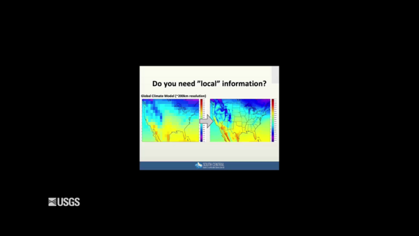
Climate Projections as a Way to Illustrate Future Possibilities

This video is a recording of the webinar “Climate Projections as a Way to Illustrate Future Possibilities" that is part of the USGS National Climate Adaptation Science Center (NCASC), in partnership with the National Conservation Training Center (NCTC), 2019 webinar series.

This video is a recording of the webinar “Climate Projections as a Way to Illustrate Future Possibilities" that is part of the USGS National Climate Adaptation Science Center (NCASC), in partnership with the National Conservation Training Center (NCTC), 2019 webinar series.

Image of the Week - Lake Meredith’s Return

Lake Meredith National Recreation Area takes its name from the water body it surrounds in the Texas Panhandle. The Amarillo-area lake sees more than a million visitors a year.


Lake Meredith National Recreation Area takes its name from the water body it surrounds in the Texas Panhandle. The Amarillo-area lake sees more than a million visitors a year.


Habitat Connectivity: Assessing Threats and IDing Conservation Actions

An important conservation strategy for climate change is to enhance and maintain regional habitat connectivity for the long-term viability of wildlife populations. Modeling habitat connectivity for wildlife species often results in a mapped network of linkages between habitat patches.

An important conservation strategy for climate change is to enhance and maintain regional habitat connectivity for the long-term viability of wildlife populations. Modeling habitat connectivity for wildlife species often results in a mapped network of linkages between habitat patches.

Waterfowl Seeking Submerged Aquatic Vegetation

Waterfowl populations in the northern Gulf of Mexico (NGOM) rely extensively on plants that grow under the surface in shallow waters, know as submerged aquatic vegetation (SAV), as a critical food resource in the winter season.

Waterfowl populations in the northern Gulf of Mexico (NGOM) rely extensively on plants that grow under the surface in shallow waters, know as submerged aquatic vegetation (SAV), as a critical food resource in the winter season.

Webcams

Illinois River Floatcam

The Illinois River Floatcam is located at USGS station 07196320 on the Illinois River near Moodys, OK (Combs Bridge), about 36 miles downstream from the Arkansas state line.

The Illinois River Floatcam is located at USGS station 07196320 on the Illinois River near Moodys, OK (Combs Bridge), about 36 miles downstream from the Arkansas state line.