
Download GNIS Data
The Geographic Names Information System (GNIS) Domestic Names Search Application
Learn about and download U.S. Board on Geographic Names data from the Geographic Names Information System (GNIS)
Download Names Data
The geographic names data provided here contain names for natural features, unincorporated populated places, canals, reservoirs, and more for the United States, its dependent areas, and Antarctica. All names data products are extracted from the Geographic Names Information System (GNIS), the Federal Government's repository of official geographic names.
Accessing Data Using the The National Map Staged Products Directory
All downloadable files are available at The National Map Staged Products Directory. The following table contains a description of the downloads available in each geographic names folder. Click the directory title to view the files. An in-depth look at the structure and attribution for each product type is provided in the GNIS data products document.
In addition to pipe-delimited text (TXT) files, names data is available in native Geographic Information System (GIS) formats (file geodatabase [GDB] and GeoPackage [GPKG]) for easier ingest into GIS software and applications. See 'FullModel' below. Each download is a .zip file that contains the data in one of the above-mentioned formats as well as download-specific metadata in an .xml file.
| Directory | File Formats | Description |
|---|---|---|
| Antarctica | TXT GDB GPKG | Names data for the continent of Antarctica approved by the Advisory Committee on Antarctic Names of the U.S. Board on Geographic Names. |
| Archive | TXT | Static legacy domestic and Antarctica names data last updated August 2021. This data will not be refreshed. Includes unmaintained administrative features no longer included in GNIS. |
| DomesticNames | TXT | Names data for the 50 States, the District of Columbia, Puerto Rico, the U.S. Virgin Islands, Guam, and the Northern Mariana Islands. These files are most similar to the legacy files previously available for domestic names. Available geographic extents are National, States, and AllStates (bundled States). |
| FederalCodes | TXT | Domestic names records that have assigned Census codes, Census class codes, General Services Administration (GSA) codes, or Office of Personnel Management (OPM) codes. Available geographic extents are National, States, and AllStates (bundled States). |
| FullModel | GDB GPKG | GIS-enabled names data for the 50 States, the District of Columbia, Puerto Rico, the U.S. Virgin Islands, Guam, and the Northern Mariana Islands. Available geographic extents are National and States. |
| Topical | TXT | Topical domestic names extracts of GNIS, such as populated places, features with description/history, historical features, and government units. Geographic extent is National. More information on these data products is below. |
Note about character display issues in text files: GNIS data is maintained in the character set AL32/UTF8 to accommodate native special characters. Names in any language in the Roman alphabet are supported. Some software might not display these characters correctly. Please see the Unicode Display Problems at the Unicode Consortium website for additional information concerning Unicode character display problems.
Other Ways to Explore GNIS Data
Data products are refreshed every other month. To see the latest domestic geographic names, please visit the GNIS Domestic Names Search Application. From the application, data on up to 2000 geographic features may be downloaded to a .csv file.
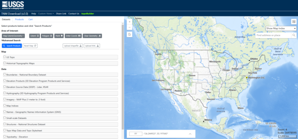
Geographic names downloads described in the table above are also available through The National Map Downloader, which provides a user-friendly map interface to help with the selection of your geographic area of interest and desired file format.
GNIS data is also provided as a National Map web service.
Topical Gazetteers
Topical extracts of GNIS are also available. These files are National in extent and provided in pipe-delimited .txt format. Please click the Gazetteer Type title to begin the download. Click here for an an in-depth look at the structure and attribution associated with each product listed below.
| Gazetteer Type | Description |
|---|---|
| Feature Description /History | Contains only records from the database that have the Description or History fields populated. This layer is meant to be related to the All Names, Populated Places, or Historical Features layers. |
| Government Units | Contains the names & alphabetic and numerical codes of country, State, and county/county-equivalent governmental units in the database. |
| Historical Features | Contains features identified as Historical. A designation of Historical indicates that the name is no longer in use, or the feature no longer serves the original purpose |
| Populated Places | Contains features classified as Populated Place in the database. |
| All Names | Contains official and variant names as well as source information for all features. Variant names are non-official names by which a feature is or was known. |
Questions
If you have any questions or download issues, please email tnm_help@usgs.gov.
Related

Lesson 14a - Searching for Domestic Names in the Geographic Names Information System
This lesson will show how to use the Domestic Names Search Application to find names of geographic features. By the end of this lesson, you will be introduced to the Geographic Names Information System, understand the search application for U.S. domestic geographic names, and see some search options and help features. Timestamps: 1:58 - Domestic Names Search Application Overview 2:22 - Conducting...
Related
Lesson 14a - Searching for Domestic Names in the Geographic Names Information System
This lesson will show how to use the Domestic Names Search Application to find names of geographic features. By the end of this lesson, you will be introduced to the Geographic Names Information System, understand the search application for U.S. domestic geographic names, and see some search options and help features. Timestamps: 1:58 - Domestic Names Search Application Overview 2:22 - Conducting...