U.S. flag

An official website of the United States government

January 19, 2022

An eruption at Kīlauea's summit began at approximately 3:20 p.m. HST on September 29, 2021. Lava activity is currently confined within Halema‘uma‘u crater, in the closed area of Hawai‘i Volcanoes National Park.

HVO scientists collect detailed data to assess hazards and understand how the eruption is evolving at Kīlauea's summit, all of which are shared with the National Park Service and emergency managers. Access to this hazardous area is by permission from, and in coordination with, Hawai‘i Volcanoes National Park.

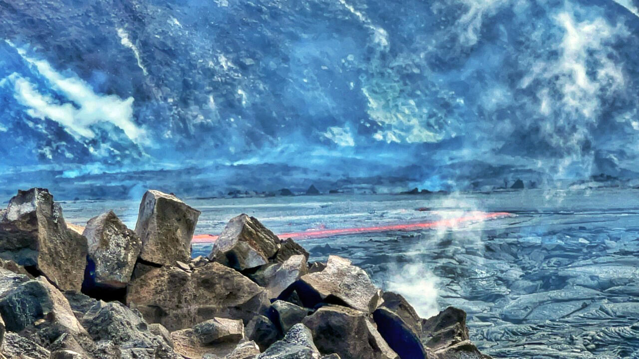
January 18, 2022 — Kīlauea summit eruption observations

Color photographs of lava lake
Hawaiian Volcano Observatory geologists arrived at the summit of Kīlauea shortly after the eruption in Halema‘uma‘u crater resumed on January 18, 2022. These photos compare the active portion of the lava lake shortly after the eruption re-started, when the lake level was lower (top) to a little more than an hour later, when lava had re-filled much of the active lake area (bottom). The white arrow points to approximately the same spot on both images, where the difference in lava-lake level (approximately one meter or three feet) is easily visible. USGS images by K. Mulliken
Color photograph of lava lake
The active lava lake surface in Halema‘uma‘u crater has lowered during the eruption pauses that have been occurring recently at the summit of Kīlauea. This zoomed-in photo, taken shortly after the eruption resumed on January 18, 2022, shows the difference in elevation of the most recently active lava lake surface on the left side of the image, compared to the broader lake surface on the right side of the image. HVO geologists arrived in the field shortly after the eruption resumed, and new lava can be seen encroaching in the left center portion of the image. USGS image by K. Mulliken.
Color photograph of lava pond
Telephoto view, from the south rim of the Halema‘uma‘u crater, of the upwelling lava pond cascading into the broader lava lake. This photo was taken approximately an hour and a half after the Kīlauea summit eruption resumed at approximately 11 a.m. HST on January 18, 2022. USGS image by K. Mulliken.
Color photograph of lava island in lava lake
The large island that formed in December 2020 remains visible within Halema‘uma‘u crater in this telephoto image. The lighter brown deposits of the island, formed during the initial hours of the previous eruption within Halema‘uma‘u crater that began the evening of December 20, 2020, are a stark contrast to the younger and darker-colored surrounding lava flows from the current eruption. USGS image by K. Mulliken.
Color photograph of volcanic vent
Telephoto view of the west vent in Halema‘uma‘u crater after it resumed erupting in the late morning of January 18, 2022. A lighter gray gray recent lava flow is visible emanating from the west vent, and active lava upwells from the lava pond adjacent to the west vent in the upper left part of the photo. Cascades from the lava pond are filling the active portion of the lava lake. USGS image by K. Mulliken. 

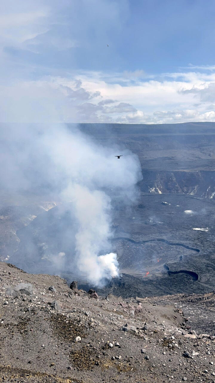
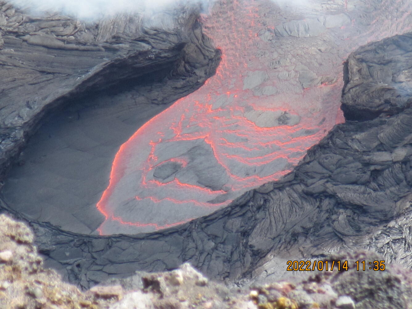
January 14, 2022 — Kīlauea

UAS mission at Kīlauea summit: On January 14, Hawaiian Volcano Observatory scientists conducted an Unoccupied Aircraft Systems (UAS) survey at Kīlauea summit. Imagery collected by the UAS will be used to generate a 3-dimensional model that will be used to evaluate the eruption within Halema‘uma‘u for changes. Volcanic gas samples analyses from the UAS will be used to study eruption dynamics.
Color photograph of instrument in field
An Unoccupied Aircraft System (UAS) unit surveys the eruption site at the summit of Kīlauea on January 14, 2022. UAS photos, data, and samples help scientists to understand ongoing volcanic processes and their associated hazards, and to detect changes that might indicate shifts in the character of activity. USGS has special use permits from the National Park Service to conduct official UAS missions as part of HVO's mission to monitor active volcanoes in Hawaii, assess their hazards, issue warnings, and advance scientific understanding to reduce impacts of volcanic eruptions. Launching, landing, or operating an unoccupied aircraft from or on lands and waters administered by the National Park Service within the boundaries of Hawai‘i Volcanoes National Park is prohibited under 36 CFR § 1.5 - Closures and public use limits. USGS image by M. Warren.
Color photograph of scientists adjusting instrument
Hawaiian Volcano Observatory scientists prepare an Unoccupied Aircraft Systems (UAS) unit for launch at Kīlauea summit on January 14, 2022. Imagery collected by the UAS will be used to generate a 3-dimensional model that will be used to evaluate the eruption within Halema‘uma‘u for changes. Volcanic gas samples analyses from the UAS will be used to study eruption dynamics. USGS has special use permits from the National Park Service to conduct official UAS missions as part of HVO's mission to monitor active volcanoes in Hawaii, assess their hazards, issue warnings, and advance scientific understanding to reduce impacts of volcanic eruptions. Launching, landing, or operating an unoccupied aircraft from or on lands and waters administered by the National Park Service within the boundaries of Hawai‘i Volcanoes National Park is prohibited under 36 CFR § 1.5 - Closures and public use limits. USGS image by M. Warren.
Color photograph of scientist adjusting instrument
In this photo, an HVO technician adjusts a volcanic gas analysis instrument that was specifically designed for this Unoccupied Aircraft System (UAS) unit, which carries three one-liter analysis bags. The instrument transmits gas concentration information in real-time during flight. USGS has special use permits from the National Park Service to conduct official UAS missions as part of HVO's mission to monitor active volcanoes in Hawaii, assess their hazards, issue warnings, and advance scientific understanding to reduce impacts of volcanic eruptions. Launching, landing, or operating an unoccupied aircraft from or on lands and waters administered by the National Park Service within the boundaries of Hawai‘i Volcanoes National Park is prohibited under 36 CFR § 1.5 - Closures and public use limits. USGS image by M. Warren.
Color photograph of lava flow
A telephoto lens captured this view of crustal plates forming on the lava lake surface within Halema‘uma‘u on January 14, 2022. The plates are being transported southeast (to the top of the photograph) into the larger lava lake at the summit of Kīlauea. USGS image by C. Parcheta.

January 13, 2022 — Kīlauea

Kīlauea summit down-dropped block: On January 13, 2022, Hawaiian Volcano Observatory (HVO) staff conducted a mission to rescue monitoring equipment that was being threatened by overflows from the active lava lake within Halema‘uma‘u at the summit of Kīlauea. With permission from Hawai‘i Volcanoes National Park, HVO technicians were flown via helicopter to the lowest remaining down-dropped block within Halema‘uma‘u crater to retrieve the equipment.
Color photograph of lava lake
On January 13, 2022, Hawaiian Volcano Observatory (HVO) staff conducted a mission to rescue monitoring equipment that was being threatened by overflows from the active lava lake within Halema‘uma‘u at the summit of Kīlauea. With permission from Hawai‘i Volcanoes National Park, HVO technicians—one of whom is visible in an orange flight suit near the center of this image—were flown via helicopter to the lowest remaining down-dropped block within Halema‘uma‘u crater to retrieve the equipment. This southward view is from the down-dropped block just north of the Halema‘uma‘u lava lake; islands in the lava lake are visible in the background of the image. USGS image by K. Kamibayashi.
Color photograph of monitoring equipment
This monitoring station partially survived the 2018 collapse events at the summit of Kīlauea. Located on one of the blocks that “down-dropped” during those events, the station was lowered in elevation by over 150 m (almost 500 ft) in 2018. Recent overflows from the lava lake within Halema‘uma‘u, visible in the background of the photo, began to encroach on the station and prompted HVO’s recovery mission on January 13, 2022. USGS image by K. Kamibayashi. 
Color photograph of lava flow
Close-up view of the margin of overflows from the active lava lake within Halema‘uma‘u crater at the summit of Kīlauea. These overflows are encroaching northwards onto the lowest of the down-dropped blocks that formed during Kīlauea's 2018 summit collapse events. USGS image by K. Kamibayashi.
Color photograph of lava lake at base of crater
Eruptions within Halema‘uma‘u crater over the past year have filled in the deepest part of Kīlauea caldera that collapsed during 2018. This image shows the young lava lake surface bounded by fault scarps that formed within the caldera during 2018. An HVO technician is visible in the left side of the photo, which was taken from the down-dropped block northeast of the recent eruption site within Kīlauea caldera. USGS image by K. Kamibayashi.
Color photograph of lava
Active lava in Halema‘uma‘u is visible in this image, with rubble from Kīlauea's 2018 collapse events prominent in the foreground. The background of the photo is framed by the fault scarps that formed within the caldera during the 2018 summit collapse events at Kīlauea. USGS image by M. Warren.

Get Our News

These items are in the RSS feed format (Really Simple Syndication) based on categories such as topics, locations, and more. You can install and RSS reader browser extension, software, or use a third-party service to receive immediate news updates depending on the feed that you have added. If you click the feed links below, they may look strange because they are simply XML code. An RSS reader can easily read this code and push out a notification to you when something new is posted to our site.