



What is a HUC?
What is a HUC??
A Hydrologic Unit Code (HUC) is a numerical ID that acts like a “zip code for your watershed.” It is part of a hierarchical system created by the U.S. Geological Survey (USGS) to classify land areas based on where water flows. Each hydrologic unit represents an area where all rainfall, snow, and surface water drains to a common outlet.
USGS organizes water regions by Hydrologic Unit Codes (HUCs),
Before understanding HUCs, it helps to know what a watershed is. A watershed is an area of land where all the water drains to the same place, such as:
- a creek
- a river
- a lake
- an estuary
- the ocean
When it rains or snow melts, that water flows downhill into streams, rivers, lakes,oceans or even groundwater. Eventually, all the water makes it way to the same outlet, leaving the watershed. You can think of this like your bathtub. If you pour water anywhere on the edges of the inside of the tub, it ends up eventually joining the rest of the water in your bath and leaving through the drain. If you pour water over the edge onto the bathroom floor, that water would belong to a different “watershed” - plus may make your parents angry!
Watersheds come in many sizes:
- Some are huge and cover many states.
- Some are small and might drain just a few square miles.
Every location in the United States is part of a watershed, even your backyard.
Basin vs watershed?
The word "watershed" is sometimes used interchangeably with drainage basin or catchment, but a basin is usually used to describe an area much larger than a watershed.
These three examples show large watersheds in 3D. Every drop of water that lands on one of these watersheds eventually makes its way to the same place. For example, in the Illinois River Basin, the water leaves the basin where the Illinois joins the Mississippi River near Grafton, Illinois. At that point, the water enters the Mississippi River basin.
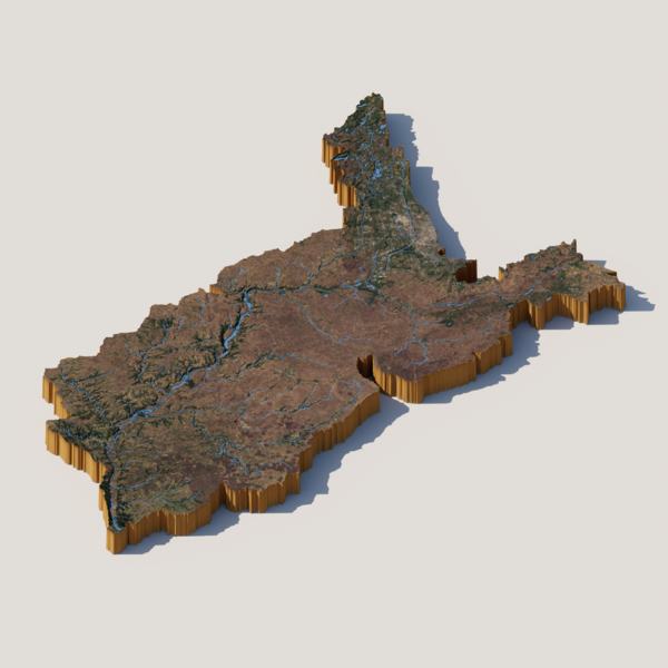
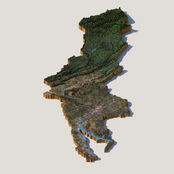
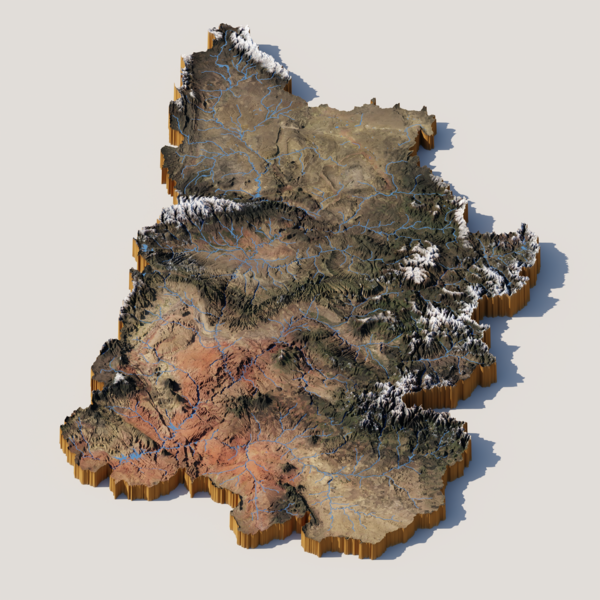
To learn more about watersheds visit our watersheds and drainage basins page.
What Is a HUC?
A Hydrologic Unit Code (HUC) is a special numeric code scientists use to label and organize watersheds using hydrologic units.
It works like a zip code for your watershed.
A hydrologic unit (HU) is an area of land where water drains into part of a stream system. It shows how surface water moves across the landscape toward one or more outlet points.
Instead of always covering the entire area that drains to a single point, a hydrologic unit might represent only part of that drainage area. That means you sometimes need more than one hydrologic unit to fully map all the land that sends water to the same outlet.
Hydrologic unit boundaries are drawn using natural landscape features, like hills, valleys, and water flow patterns, not political or administrative borders.
A HUC is the code that represents these hydrologic units.
Each HUC is made up of 2 to 12 digits. The more digits it has, the smaller the area is:
- 2 digits
- 4 digits
- 6 digits
- 8 digits
- 10 digits
- 12 digits
This nested code system helps scientists divide the entire United States into thousands of connected water‑based areas.

This system helps scientists divide the entire United States into thousands of connected water‑based areas.
Why are HUCs important?
Water doesn’t follow state lines or county borders.
A river may begin in one state, flow through several others, and eventually empty hundreds of miles away.
Scientists, water managers, emergency planners, and conservation organizations need a consistent way to describe watersheds regardless of political boundaries.
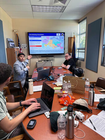
In addition, different questions require looking at different scales. A national drought assessment may examine large HUC-2 regions, whereas a restoration project for a local creek may focus on a HUC-12 . Scientists choose the HUC level that best matches the question they’re trying to answer.
Using HUCs allows people across different agencies and states to communicate about the exact same watershed.
HUCs are commonly used to:
- monitor water quality
- study floods and droughts
- manage drinking water resources
- restore rivers and wetlands
- track fish and wildlife habitat
- organize hydrologic data
- plan conservation projects
In addition, different questions require looking at different scales. A national drought assessment may examine large HUC-2 regions, whereas a restoration project for a local creek may focus on a HUC-12 . Scientists choose the HUC level that best matches the question they’re trying to answer.
How are HUCs organized?
HUCs are nested or “hierarchical,” meaning large watersheds are divided into progressively smaller watersheds.
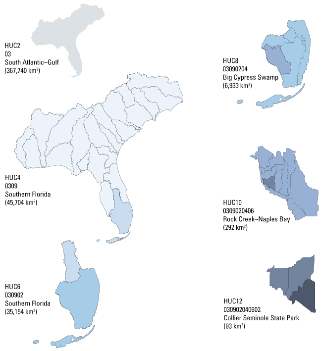
Each additional set of numbers identifies a smaller portion of the landscape: The more digits a HUC contains, the smaller the watershed boundary.
HUC Level | Digits | Average size range (acres) | Example |
2-digit Hydrologic unit | 2 |
| 03 – South Atlantic Gulf |
4-digit Hydrologic unit | 4 |
| 0309 - Southern Florida |
6-digit Hydrologic unit | 6 |
| 030902 – Southern Florida |
8-digit Hydrologic unit | 8 |
| 03090204 – Big Cypress Swamp |
10-digit Hydrologic unit | 10 | 40,000 – 250,000 | 0309020406 – Rock Creek –Naples Bay |
12-digit Hydrologic unit | 12 | 10,000 – 40,000 | 030902040602 – Collier Seminole State Park |
The more digits a HUC contains, the smaller and more specific the watershed.
Understanding a HUC
Imagine the HUC8 from the previous table: 03090204 – Big Cypress Swamp
This number isn’t random.
Each group of digits identifies where that watershed fits within progressively smaller drainage areas.
You can think of it like an outline:
HUC2 → HUC4 → HUC6→ HUC8
In this case, 03090204 is a HUC8, which corresponds to the Big Cypress Swamp in the Southern Florida River Basin, within the Southern Florida HUC6 in the larger South Atlantic Gulf Region.
HUCs are like nested folders
Another way to picture Hydrologic Unit Codes (HUCs) is to imagine a set of nesting dolls.
Each doll fits neatly inside a larger one, just like each HUC level fits inside the next.
HU2 (South Atlantic Gulf)
└── HU4 (Southern Florida)
└── HU6 (Southern Florida)
└── HU8 (Big Cypress Swamp)
└── HU10 (Rock Creek – Naples Bay)
└── HU12 (Collier Seminole State Park)
How are HUC boundaries determined?
Unlike county or city boundaries, HU boundaries are based on natural landscape features and often overlap with political boundaries like state lines. The main natural landscape feature that helps us determine watershed boundaries are high points in the landscape called drainage divides or ridgelines. These high points determine where water flows:
- Rain falling on one side of a divide drains into one watershed. Rain falling on the other side drains into a different watershed.
Remember the bathtub example from above. The edge of the bathtub works like the drainage divide or ridgeline between two watersheds.
HUCs: A national standard developed by the USGS and USDA
The Hydrologic Unit Code system was developed to provide a consistent national framework for identifying watersheds that is used by federal, state, Tribal, and local organizations across the U.S. The HUC system is maintained through a partnership between the U.S. Geological Survey (USGS) and the U.S. Department of Agriculture (USDA) Natural Resources Conservation Service (NRCS).
Did You Know?
- Every location in the United States belongs to a watershed.
- Every watershed has a Hydrologic Unit Code.
- Hydrologic Unit (HU) boundaries are based on natural drainage, not political boundaries.
- More digits mean a smaller, more specific watershed.
- Thousands of scientists use HUCs every day to organize water information.
How can I find a HUC?
The USGS maintains an interactive web map that allows you to view HUC codes for any place in the U.S. that allows you to view HUC codes for any place in the U.S.
You can also use the The National Map - 3D Viewer. This page allows you to search by address and not just zipcode to get your local HUC12 information.
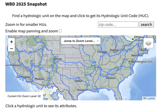
To look up a HUC on the Water Boundary Dataset Map:
Go to the Interactive Watershed Boundary Dataset (WBD) Web Map. Navigate to the WBD2025 Snapshot.
1. The map will open at the HUC 2 level. In this view, you can look at the U.S. map and use the blue outlines to identify your HUC 2 region.2. Enter the ZIP code for the location you want to look up.
3. Open the “Jump to Zoom Level” dropdown menu and select the HUC level you want (e.g., HUC 4, HUC 6, HUC 8).
4. Click on your location on the map to see the specific HUC for that area.
Additional Notes
- In the upper-right corner of the map, you can select “Control Map” to enable drag-and-move navigation.
- Below the map, you can change the map view (for example, switch from imagery to topo).