
Uncrewed Aerial Systems
Uncrewed Aerial Systems (UAS) allow for new opportunities for gathering data essential to land management and Earth science.
Three-dimensional (3D) data capture technologies continue to become more commonplace, as UAS have become available at affordable costs in recent years. The rationalization of regulations that sets guidelines for flying unmanned aircraft (e.g FAA Part 107), and open source or less expsensive data processing hardware and software have made UAS popular for many important uses.
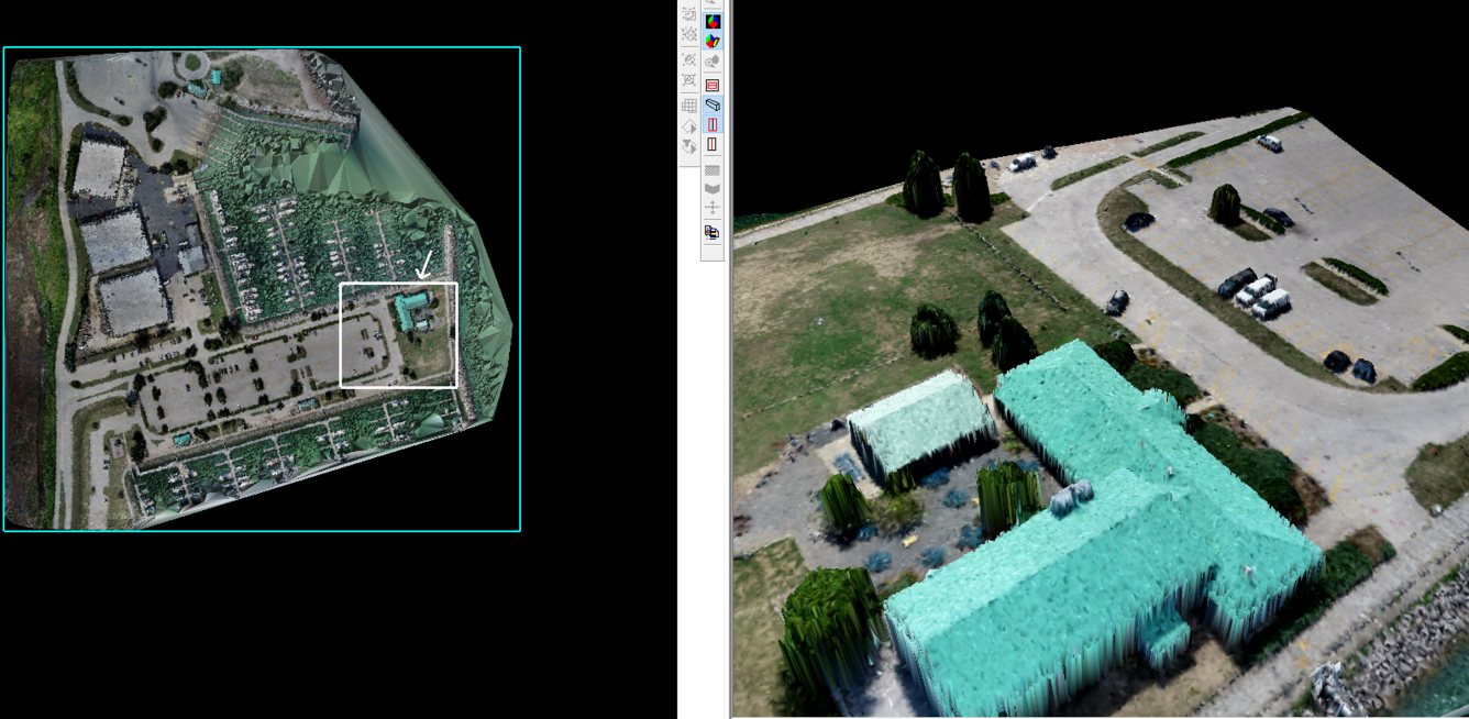
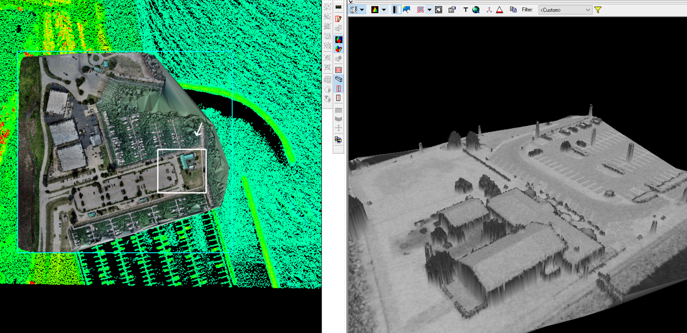
The images below show 3D data generated from images captured from a UAS. The data were processed in commercial software (Agisoft Photoscan, although free and open software are available for use). These software use a technique called Structure From Motion (SfM), which combines photogrammetric principles (of 3D measurement from 2D images), with computational methods of densely extracting feature correspondences.
Conjugate features are identified from multiple images and a robust 3D point cloud is generated. These images show a triangulated model generated from the point cloud and colorized using the spectral information available from the captured images.
From the perspective of scientific uses of remote sensing platforms, most remote sensing data used by the scientific community have been collected using expensive, stable and metric sensors, with data being processed using standard practices. The stablity of the established processes have ensured the data are generally consistent with each other and benefit a diverse group of users.
In the case of data acquired from UAS platforms, researchers often customize systems based on their requirements and payload capacity of the platforms. Researchers also tend to use ad-hoc processing steps to generate data. The value of UAS data to a researcher is often in the:
- Ability to customize sensors based on research requirements
- Ability to collect data at times as required by the researcher
Since these data are often produced by a wide array of sensors and processes, the potential of inconsistent comparisons with various UAS data is high — and unlike data collected from metric sensors, UAS data are designed to benefit only specific user groups.
However, this limitation may be mitigated by proper documentation and following best practices for data acquisition, processing and metadata requirements. Quality assurance and Calibration requirements are critical in ensuring that data are utilized to the maximum extent possible. Calibration parameters (as well as any uncertainties) must be included in the metadata to allow for easier data discovery and analytical filters.
UAS Data Available
UAS data produced by the USGS and distributed via Earth Explorer have proper documentation that allows the user to have complete knowledge of the processes that went into generating these data — this information helps each users decide whether the data is appropriate for the user's specific application.
To assit the US Geological Survey achieve this goal within the UAS community and provide USGS and EROS with the ability to acquire and distribute such data, the following are required:
- Recommendations for product evolution to meet key interoperability requirements:
- Geometric and spatial Calibration processes
- Radiometric Calibration processes
- Guidance for established practices which allow the user community to adapt and use multiple UAS data within single data streams.
- Metadata requirements for use in data discovery and as analytical filters.
USGS National Uncrewed information
-

National Uncrewed Systems Office
The U.S. Geological Survey (USGS) National Uncrewed Systems Office (NUSO) leads the research activities needed to make Uncrewed Aircraft Systems (UAS) data collection an efficient, safe, and cost-effective remote sensing tool for Department of the Interior (DOI) and USGS scientists.