Workshop area at CAWSC West Sacramento Projects Office
Workshop area at CAWSC West Sacramento Projects OfficeWorkshop area at CAWSC West Sacramento Projects Office

Official websites use .gov
A .gov website belongs to an official government organization in the United States.
Secure .gov websites use HTTPS
A lock () or https:// means you’ve safely connected to the .gov website. Share sensitive information only on official, secure websites.
Multimedia products allow us to distribute information to the public. The California Water Science Center has a variety of materials available, including webcasts, videos, and images.
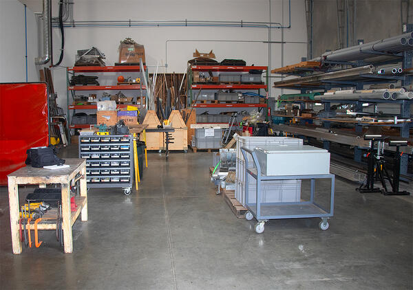
Workshop area at CAWSC West Sacramento Projects Office
Workshop area at CAWSC West Sacramento Projects Office
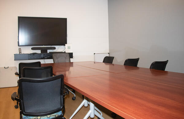
Training Room at CAWSC West Sacramento Projects Office
Training Room at CAWSC West Sacramento Projects Office
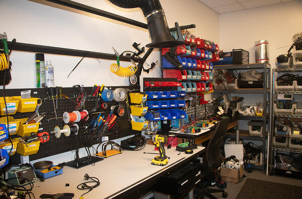
Shop adjacent to the boat warehouse where members of the Projects Office team discuss their workload.
Shop adjacent to the boat warehouse where members of the Projects Office team discuss their workload.
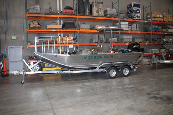
The Research Vessel (R/V) Wooldridge in the warehouse of the CAWSC West Sacramento Projects Office.
The Research Vessel (R/V) Wooldridge in the warehouse of the CAWSC West Sacramento Projects Office.
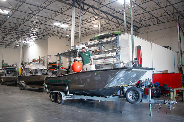
The Research Vessel (R/V) Dora Henry in the warehouse of the CAWSC West Sacramento Projects Office.
The Research Vessel (R/V) Dora Henry in the warehouse of the CAWSC West Sacramento Projects Office.
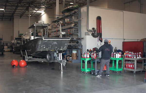
Team members at the CAWSC West Sacramento Projects Office check research vessel fire extinguishers.
Team members at the CAWSC West Sacramento Projects Office check research vessel fire extinguishers.

Mercury contamination from historic gold mining represents a potential risk to human health and the environment. There is a lack of public awareness of the history mercury use in gold mining and how it contributed to this situation, and also what the present concerns are. Specifically, the public is not aware of locations and levels of contamination.
Mercury contamination from historic gold mining represents a potential risk to human health and the environment. There is a lack of public awareness of the history mercury use in gold mining and how it contributed to this situation, and also what the present concerns are. Specifically, the public is not aware of locations and levels of contamination.

Heterosigma akashiwo collected from Seaplane Lagoon in San Francisco Bay on August 9, 2022. Video was taken with an ioLight 1mm microscope.
Heterosigma akashiwo collected from Seaplane Lagoon in San Francisco Bay on August 9, 2022. Video was taken with an ioLight 1mm microscope.

High flows at streamgage 11172945 (Alameda Creek above Div Dam near Sunol, California) were captured by USGS hydrologic technician Louis Cannarozzi on 12/31/2022. Heavy precipitation caused higher-than-normal streamflow in many areas as an atmospheric river moved through northern California.
High flows at streamgage 11172945 (Alameda Creek above Div Dam near Sunol, California) were captured by USGS hydrologic technician Louis Cannarozzi on 12/31/2022. Heavy precipitation caused higher-than-normal streamflow in many areas as an atmospheric river moved through northern California.

This video explains how streamgages are used to measure the height and flow, or speed, of streams. By monitoring the height and flow of streams, the people who manage water infrastructure can have advanced noted of when the water is rising and how fast it’s coming.
This video explains how streamgages are used to measure the height and flow, or speed, of streams. By monitoring the height and flow of streams, the people who manage water infrastructure can have advanced noted of when the water is rising and how fast it’s coming.

USGS scientists collect water quality samples in the San Francisco Bay. The samples have been collected at the same locations for >50 years and are part of one of the longest running datasets of its kind in the United States.
USGS scientists collect water quality samples in the San Francisco Bay. The samples have been collected at the same locations for >50 years and are part of one of the longest running datasets of its kind in the United States.

This video describes how to use the SAC conversion spreadsheet to convert data from a conventional level in angles and distances (polar coordinates) to Cartesian coordinates (northings and eastings).
This video describes how to use the SAC conversion spreadsheet to convert data from a conventional level in angles and distances (polar coordinates) to Cartesian coordinates (northings and eastings).
SGS hydrologist Dr. Claudia Faunt discusses her new study about Calfornia's vast central valley groundwater system and the new study findings.
SGS hydrologist Dr. Claudia Faunt discusses her new study about Calfornia's vast central valley groundwater system and the new study findings.
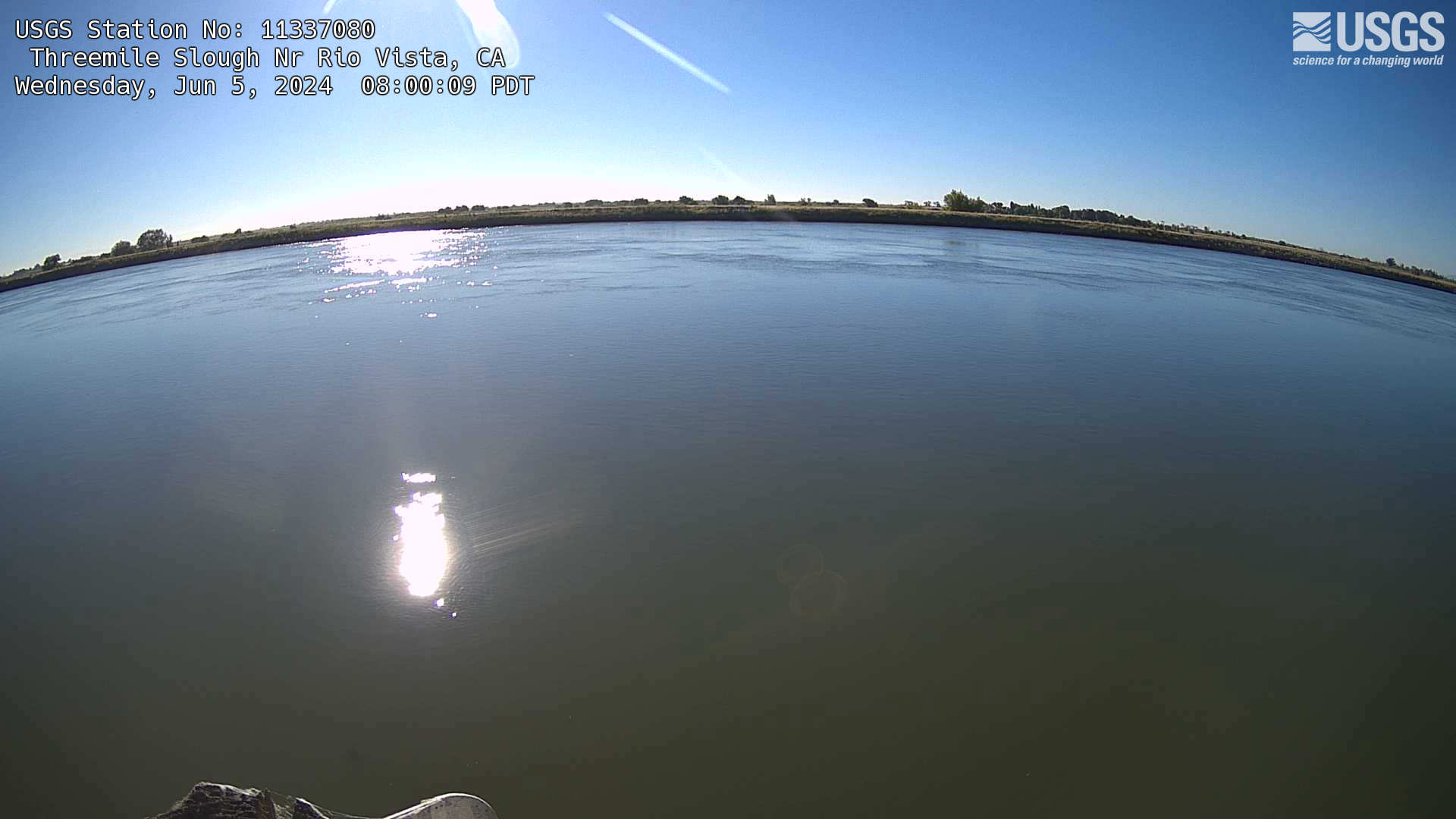
The name of this webcam is THREEMILE SLOUGH NR RIO VISTA. It is located in Rio Vista, CA. The timelapse length is 10 seconds (100 images) and the collection interval is every 15 minutes.
The name of this webcam is THREEMILE SLOUGH NR RIO VISTA. It is located in Rio Vista, CA. The timelapse length is 10 seconds (100 images) and the collection interval is every 15 minutes.

The name of this webcam is Topanga C A Hwy 1 Bridge nr Malibu. It is located in Malibu, CA. The timelapse length is 10 seconds (100 images) and the collection interval is every 15 minutes.
The name of this webcam is Topanga C A Hwy 1 Bridge nr Malibu. It is located in Malibu, CA. The timelapse length is 10 seconds (100 images) and the collection interval is every 15 minutes.
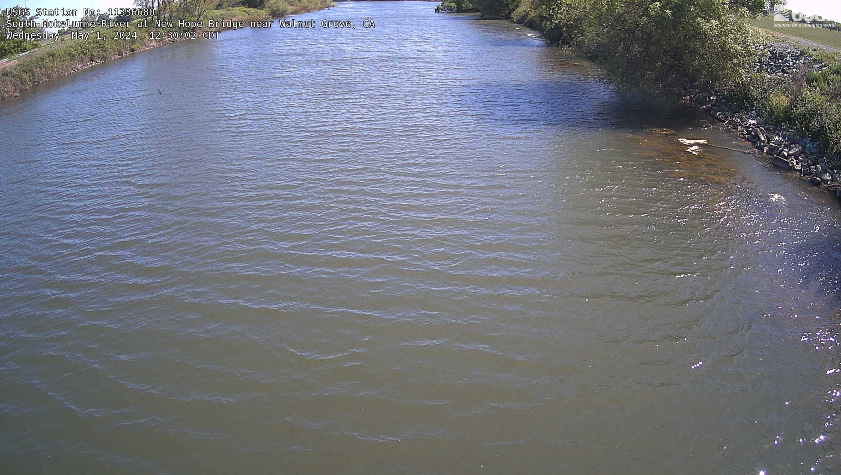
The name of this webcam is South Mokelumne River at New Hope Bridge near Walnut Grove. It is located at in Walnut Grove, CA. The timelapse length is 10 seconds (100 images) and the collection interval is every 15 minutes.
The name of this webcam is South Mokelumne River at New Hope Bridge near Walnut Grove. It is located at in Walnut Grove, CA. The timelapse length is 10 seconds (100 images) and the collection interval is every 15 minutes.
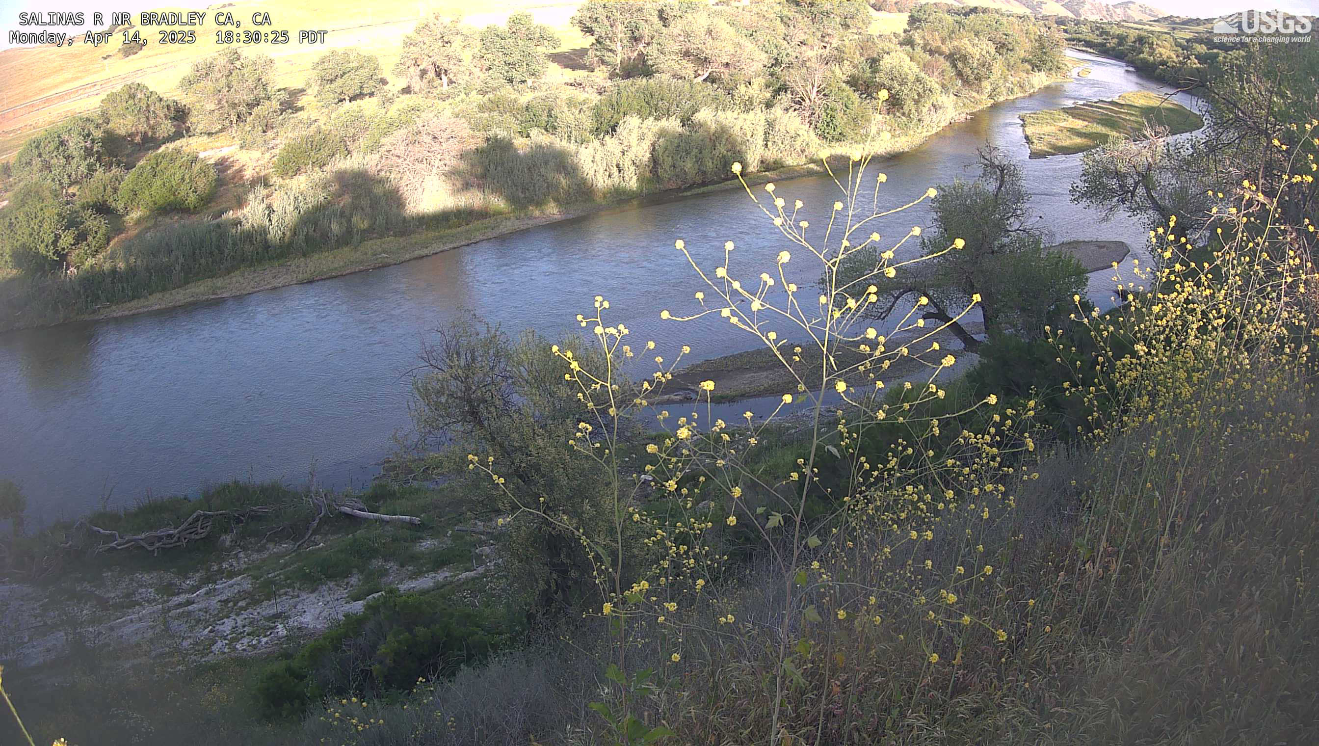
The name of this webcam is Salinas River at Bradley. It is located in Bradley, CA. The timelapse length is 10 seconds (100 images) and the collection interval is every 15 minutes.
The name of this webcam is Salinas River at Bradley. It is located in Bradley, CA. The timelapse length is 10 seconds (100 images) and the collection interval is every 15 minutes.

The name of this webcam is Truckee River at Boca Bridge near Truckee. It is located at in Truckee, CA. The timelapse length is 10 seconds (100 images) and the collection interval is every 15 minutes.
The name of this webcam is Truckee River at Boca Bridge near Truckee. It is located at in Truckee, CA. The timelapse length is 10 seconds (100 images) and the collection interval is every 15 minutes.
The name of this webcam is False River Near Oakley. It is located in Oakley, CA. The timelapse length is 10 seconds (100 images) and the collection interval is every 15 minutes.
The name of this webcam is False River Near Oakley. It is located in Oakley, CA. The timelapse length is 10 seconds (100 images) and the collection interval is every 15 minutes.
